All Activity
- Past hour
-
Showers are likely tomorrow into Thursday. An additional round of showers and thundershowers is possible on Saturday. Cooler than normal temperatures will prevail through the week. Meanwhile daily record and possible monthly record heat could develop for Friday and Saturday in such cities as Redding and Sacramento. June looks to be warmer than normal on the CFSv2. However, just as had been the case for May, the AI guidance is notably cooler than the conventional models. The ENSO Region 1+2 anomaly was +0.2°C and the Region 3.4 anomaly was -0.2°C for the week centered around May 21. For the past six weeks, the ENSO Region 1+2 anomaly has averaged +0.08°C and the ENSO Region 3.4 anomaly has averaged -0.08°C. Neutral ENSO conditions will likely continue through at least mid summer. Early indications are that summer 2025 will be warmer than normal in the New York City and Philadelphia areas. The potential exists for a much warmer than normal summer (more than 1° above normal). The SOI was +29.36 today. The preliminary Arctic Oscillation (AO) was +2.171 today. Based on sensitivity analysis applied to the latest guidance, there is an implied near 74% probability that New York City will have a cooler than normal May (1991-2020 normal). May will likely finish with a mean temperature near 62.7° (0.5° below normal).
-
The 11-15 day though is not a torch look. Appears to be AN though.
-
closer to average not the HHH some are calling for that's for sure
-
 Lulor184 joined the community
 -
Take the over on srfc Ts. That's 90ish BOS to HFD for sure for day or two.
-
That’s AOA normal
-
I'm excited that our forecast is rapidly changing to both hotter AND drier once June begins. I wouldn't mind it if it didn't rain again until September.
-
looks brutal at the end of the EPS run.. Stay safe!

-
It’s a furnace. It is coming to stay . One of the HHH summers on record! Many are calling for it
-
glad to hear it:)
-
The north trend commences...
-
The wife, huh? Okay. Sure.
-
We have a reporter working on a story today about the crops ruined by the dust storm across portions of North Central Indiana. Soybeans were already planted and now farmers are re-planting this week.
-
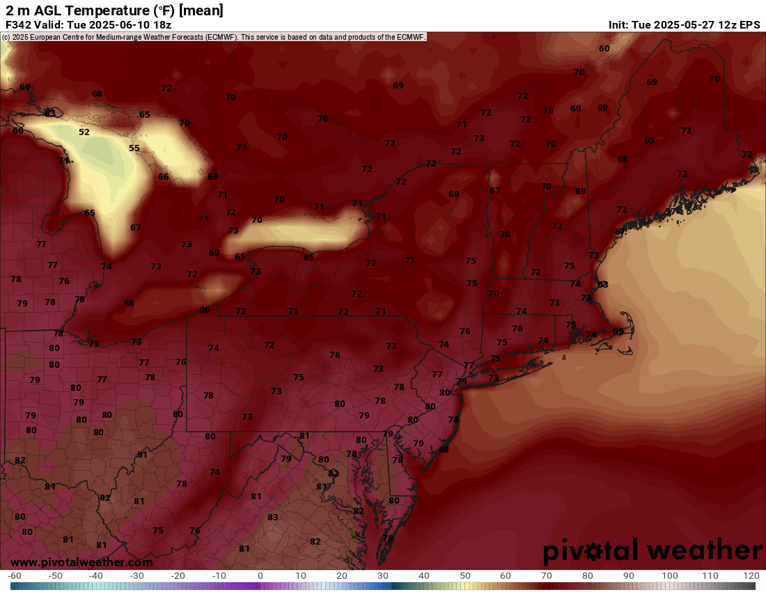
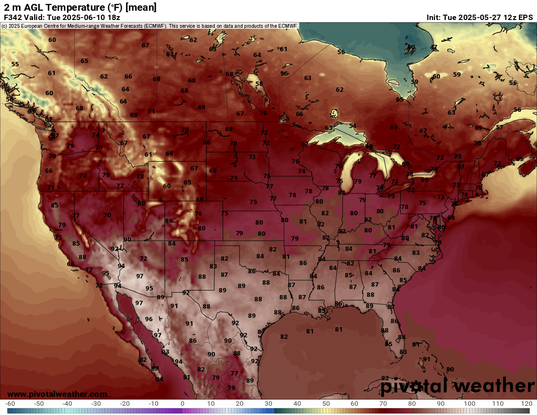
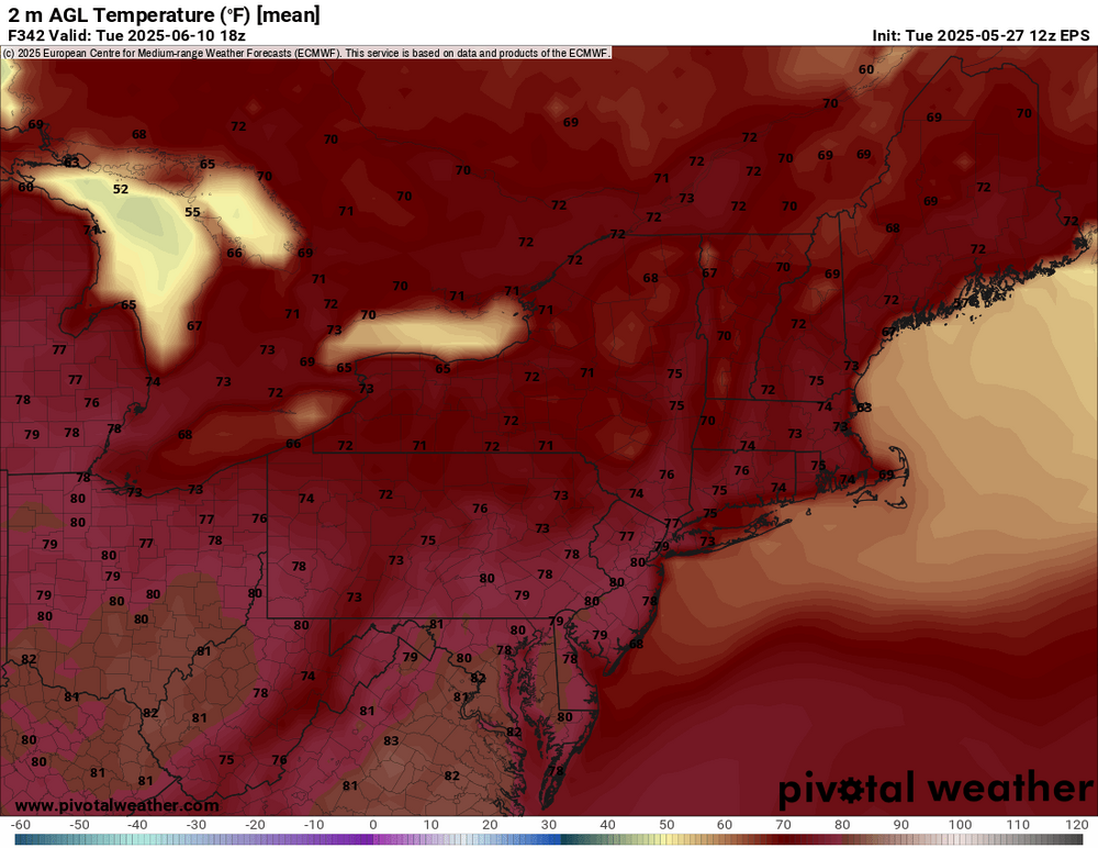
temps look close to average https://www.tropicaltidbits.com/analysis/models/?model=ecmwf®ion=us&pkg=T2m&runtime=2025052712&fh=360
-
Euro only has 80s for a few days and thats what has been mentioned the last few days..
-
0z showed that 12z was very meh until you get to day 10 and it only looked like one day of heat before the front came in
-
18z NAM is MUCH wetter for he tristate compared to 12z for the first round.
-
High of 71 after morning sun, rain just started. Down to 63
- Today
-
looks like my hoodie wearing may come to a abrupt end next week or maybe i will just leave the hoodie unzipped instead something to ponder on these next few days..
-
we'll get plenty of that to open up June. even the TV mets are banging the drums for a hot start to June now. the three month JJA forecast is out and it calls for hot weather on both the east and west coast with milder weather in the middle.
-
rain is so boring. the euro was wrong all winter so that trend would not be that hard to believe now either.
-
-
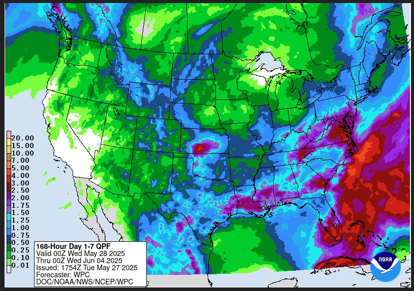
WPC has beefed up totals covering the next 7 days.
-
66/56, light rain. this weather is awesome.
-
For fucks sake. What a disaster.
-
This weather sucks