All Activity
- Past hour
-
6 minute downpour Aaaand its over
-

E PA/NJ/DE Summer 2026 Obs/Discussion
The Iceman replied to PhiEaglesfan712's topic in Philadelphia Region
Somehow got nothing but sprinkles from that cluster of storms. -
Looks like I am not going to be happy. Not bothering to water this year, if nature wants my lawn to be brown, so be it.
-
Same..very heavy rain
-
I didn't realize how much warmer it was south of here. That could help you guys out tremendously if it can hold together.
-

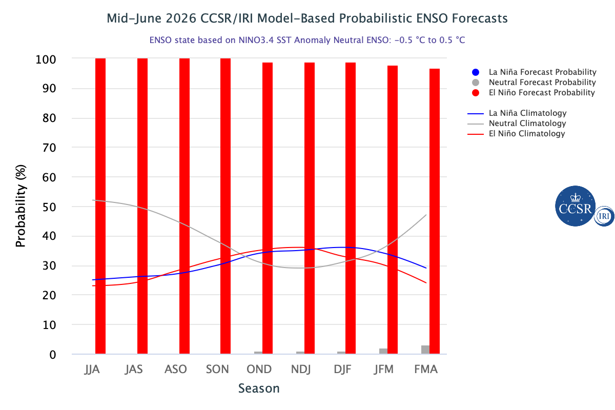
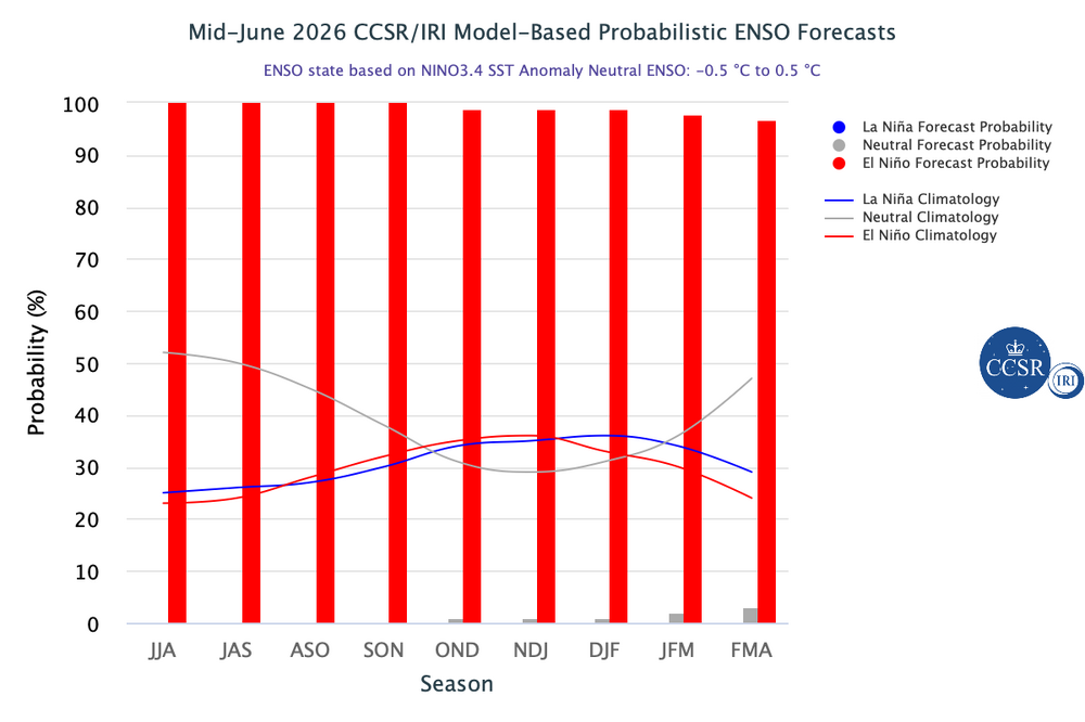
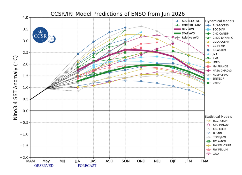
2026-2027 Super El Nino
PhiEaglesfan712 replied to Stormchaserchuck1's topic in Weather Forecasting and Discussion
-
you are right on the southern edge of the severe SVR from KOKX
-

Junorch obs and discussion 2026
Damage In Tolland replied to Damage In Tolland's topic in New England
Been raining since 10:30 .04 on the day dry under trees -
0.17" so far. Convective activity and severe will be more likely to the south when/if it develops. It's been running 61-65 here all morning and afternoon, even upper 50s in a few spots. Meanwhile, the Delmarva is in the 90s. It's actually quite a temperature difference over 100 miles.
-
Getting a heavy downpour now with strong winds.
-

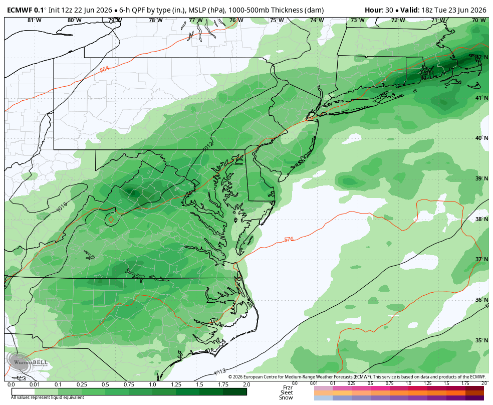
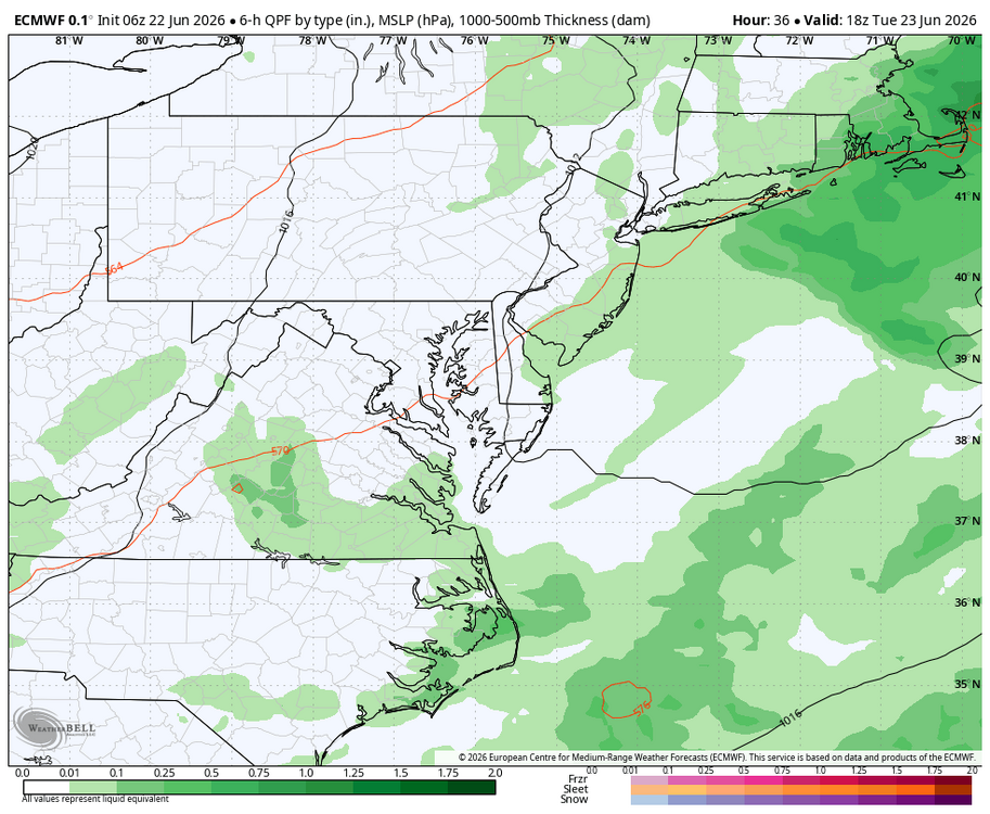
Wet late Monday 6/22 or another Fizzle?
Weather Will replied to Weather Will's topic in Mid Atlantic
WB 12Z EURO compared to 6Z. Dr. No is onboard for some rain!!!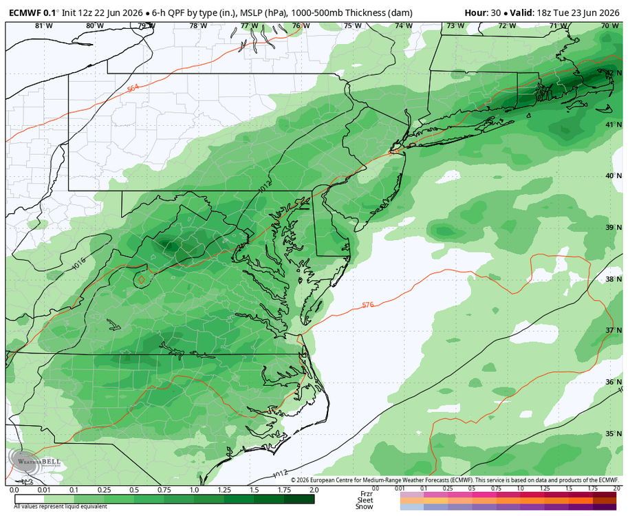
-
Just started and dumping. Love it. 63F +RA 0.17" 2.14"/hr
-
Yes the radar has greatly improved in the past 20 minutes
-
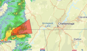
1:30 pm Central. I need that tornado warning back. Come on!
-
That storm that is severe warned in NJ looks a bit interesting
-
Very dark to the west/northwest
-
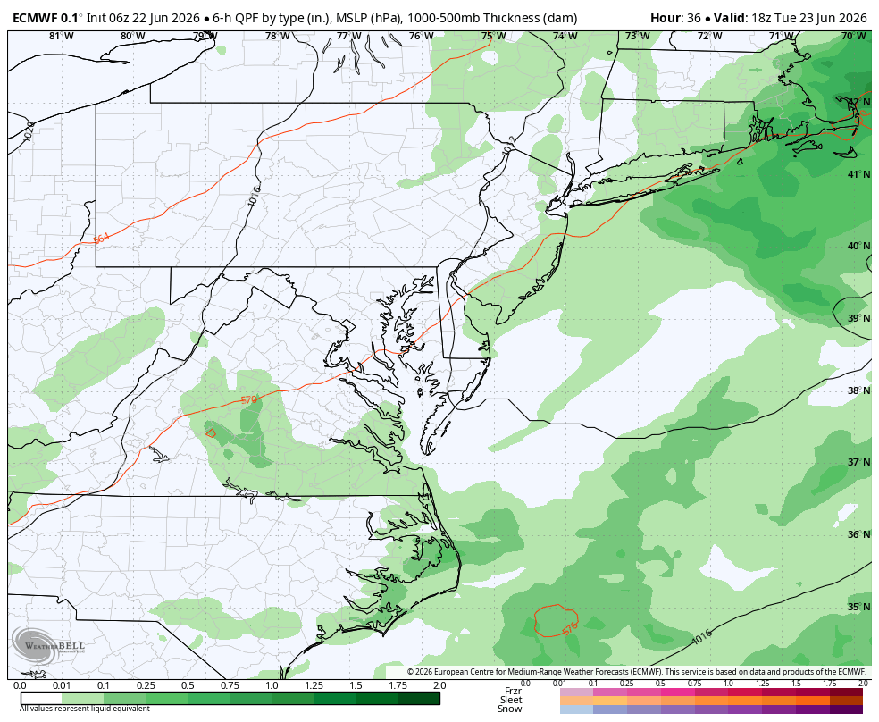
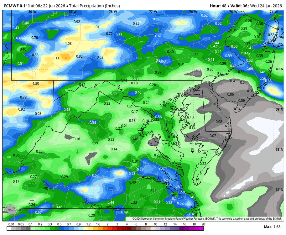
Wet late Monday 6/22 or another Fizzle?
Weather Will replied to Weather Will's topic in Mid Atlantic
WB 12Z EURO compared to 6Z. If this were winter, the site would crash!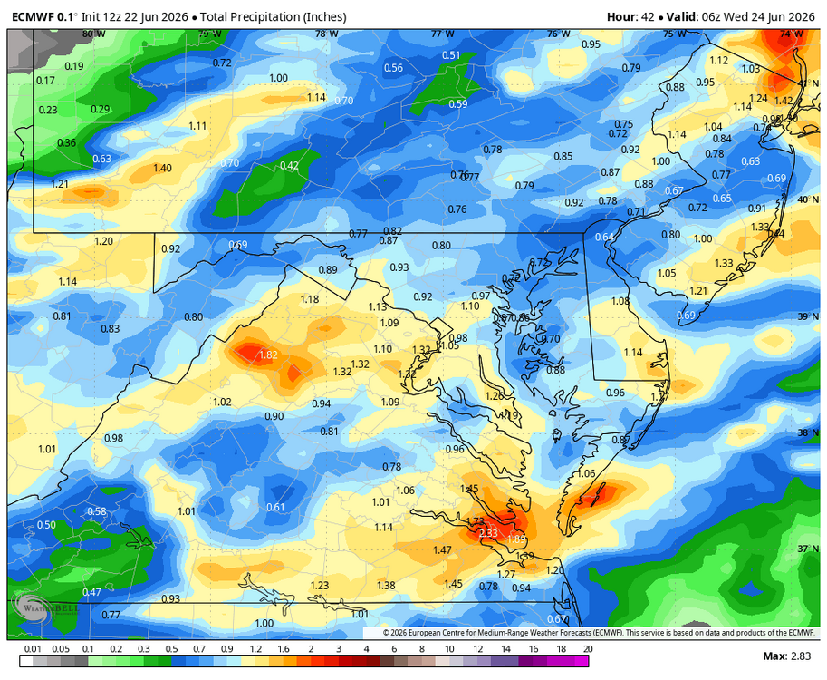
-
0.31” so far here imby
-

Central PA Summer 2026 Discussion/Obs Thread
canderson replied to Voyager's topic in Upstate New York/Pennsylvania
I am incredibly skeptical on why Dauphin is included. -
It's going to be close. I can see the dark clouds just to the north from the storms that have formed and are moving into Union and maybe extreme northern Middlesex. Then we have a couple downpours just to our southwest that are moving northeast. Hopefully going to get something shortly.
-

Central PA Summer 2026 Discussion/Obs Thread
Voyager replied to Voyager's topic in Upstate New York/Pennsylvania
I'm on the outside looking in. No watch for the Skook... -
We pour! About damn time!
-
Severe warnings Monmouth, Ocean, Mercer, Burlington Counties SVR from KPHI
-
Closely watching the Philly action. Trajectory looks good for western li .
-
Globals wet in the LR but we've seen that movie before