All Activity
- Past hour
-

Late February/Early March 2026 Mid-Long Range
Weather Will replied to WxUSAF's topic in Mid Atlantic
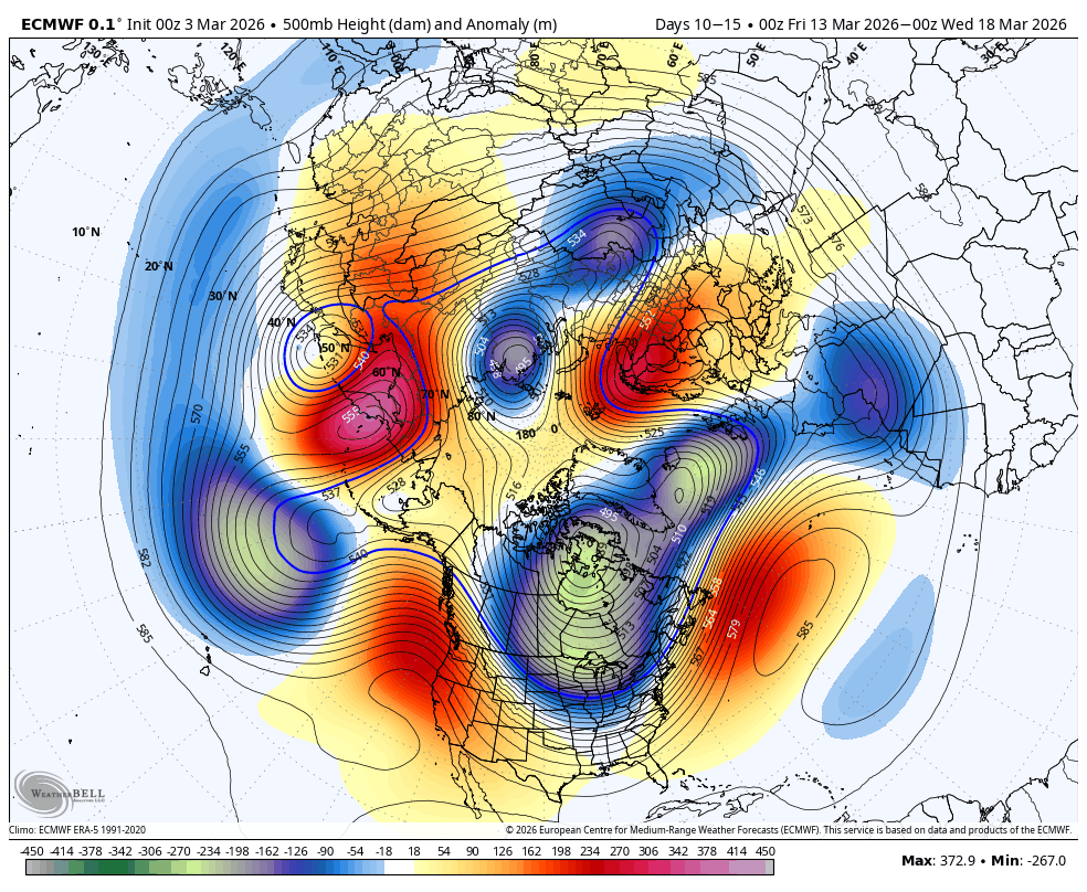
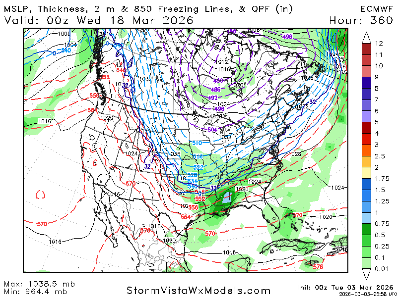
WB 0Z EURO gives us two waves of digital snow to watch. Only 13 days of tracking to go.....


-
Too bad its weenie land
-
30 here
-
-
Down to 10
-
I remember March 2016 we hit 81 on Mar 9th and then got a 4-6" snowstorm on Mar 21st and 2 more snow/ice storms in early April. It's a wild month.
-
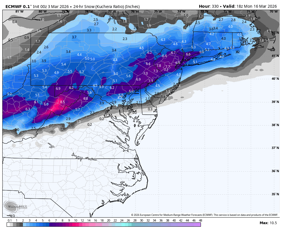
Seasonal snow to date: 14" 12/5: 1.75" 12/14: 1.0" 1/24-25: 8.5" 2/22-23: 2.0" 3/2: 0.75" I think I'm good for at least one more 0.5". Maybe a sloppy car topper on April 11th
- Today
-
each and all happy
-
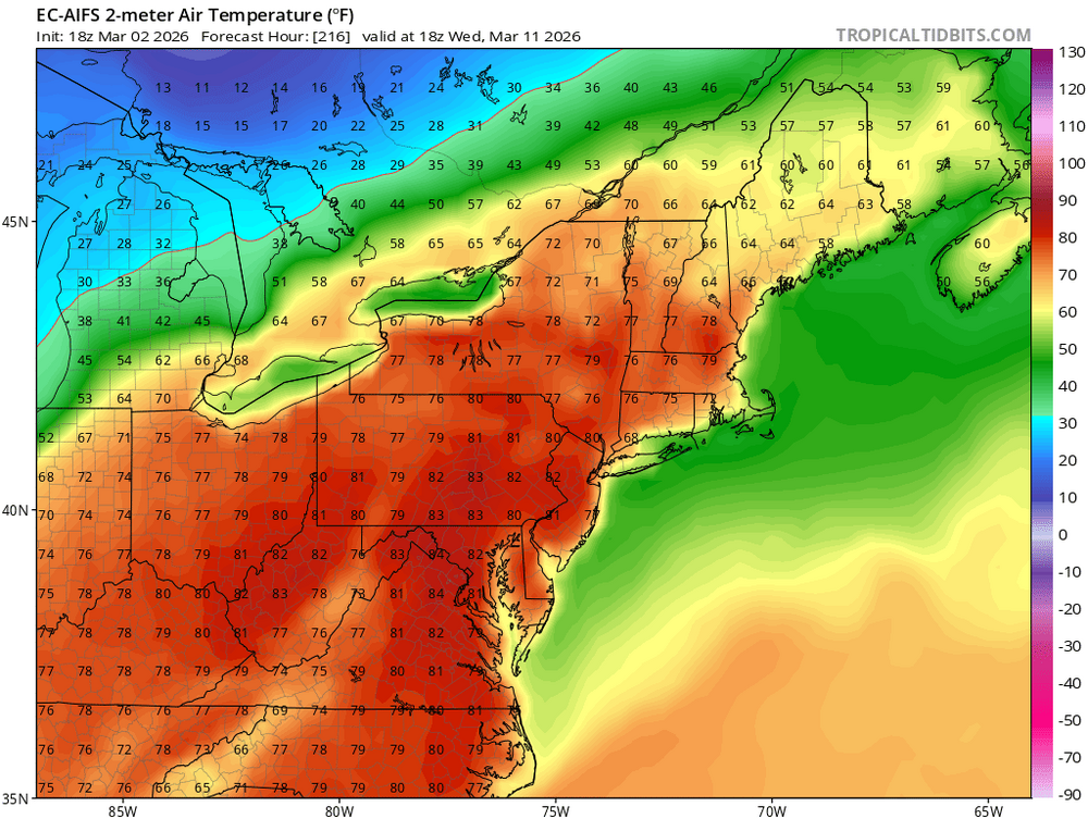
70's-80F to snow - LFG
-
=)
-

-

Central PA Winter 25/26 Discussion and Obs
Ruin replied to MAG5035's topic in Upstate New York/Pennsylvania
I kind of feel it was way colder then this -
Forecast calling for a high of 86 here next Tuesday 3/10. I don't know what the record for that day is in Atl. but I imagine 86 would destroy it if true.
-

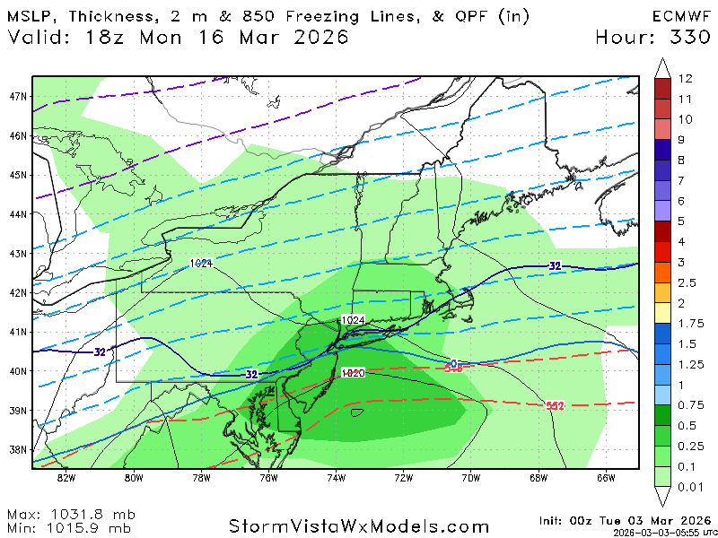
Outta gas and Outta Time: Early March Winter Storm finale
SnowenOutThere replied to Ji's topic in Mid Atlantic
Spoiler alert it’s freezing drizzle to my eyes -
I recently looked at the SREF on the SPC web site, like last week or something. There is a big thing that said the SREF will be discontinued later in 2026. After posting this on a different weather discussion forum, I've been informed that the NAM is going to be discontinued at some time. Here is a statement released in 2025. https://www.weather.gov/media/notification/pdf_2025/pns25-41_RRFS_legacy_model_cessation.pdf other information from 2025 https://www.weather.gov/media/notification/pdf_2025/pns25-73_Proposed_Termination_NAM_MOS.pdf I thought the NAM would keep going forever, as it has been known as the premiere mesoscale model for the USA. I was thinking that it feeds the 3-km NAM with boundary data and/or some other important data. Apparently not. I'm a little confused as to what convection-allowing model(s), other than the NAM, might disappear and appear in the PivotalWeather and other web sites. A little piece of me says, yeah when the GFS says of 500 J/kg of CAPE at the location of the next big severe weather outbreak, then you turn to a model that will actually calculate the CAPE. (Am I crazy?)
-
Low of 45, high of 54 and remained cloudy all day.
-
Well now it is the GFS, ICON, UK, and Euro all have the CAD signature, at least for my neck of the woods up here in Northern MD.
-
It appears by the end of this year, Rio de Janeiro will be made a TCAC for the South Atlantic Basin. https://x.com/frontierfcst/status/2028252178335310228 Now only if we could get a TCAC for the Mediterranean Sea, which clearly has shown that it has bona fide TCs, along w/ many subtropical cyclones. Geopolitical borders/areas are a construct of human society. The atmosphere does not care one bit about that. It does what it does regardless. This system is I think the strongest Mediterranean Sea TC on record - Ianos Sep 2020. https://en.wikipedia.org/wiki/Cyclone_Ianos tcac.pdf
-

Outta gas and Outta Time: Early March Winter Storm finale
87storms replied to Ji's topic in Mid Atlantic
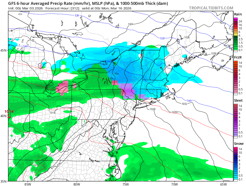
So basically I don’t know what form of precip the next round will be lol. -
80?
-
Outta gas and Outta Time: Early March Winter Storm finale
87storms replied to Ji's topic in Mid Atlantic
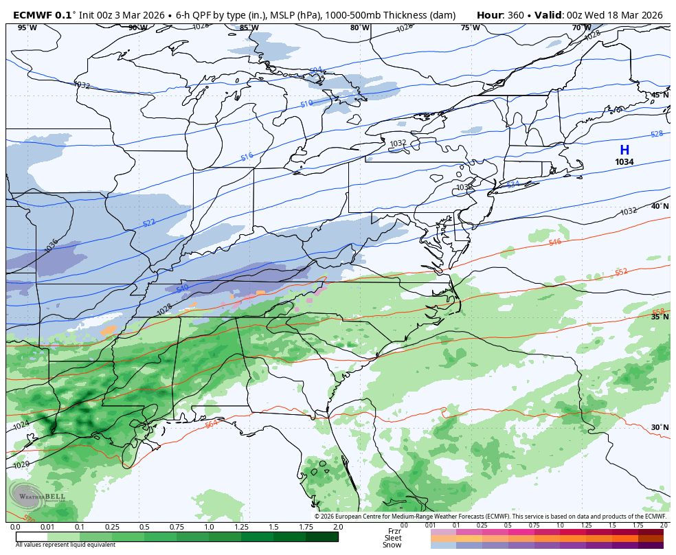
Still a 1036mb high overhead: https://www.wpc.ncep.noaa.gov/sfc/sfcobs/latestsfc.html -
Winter weather advisory for up to 1” of snow and ice out this way. Temp holding at 23 currently.
-
Sup with the hundredths values?
-

Outta gas and Outta Time: Early March Winter Storm finale
Stormchaserchuck1 replied to Ji's topic in Mid Atlantic
29F. I'm surprised Winter is holding on this strong, to be honest. And our last few temperature dips have coincided with precip, it's usually the other way around. -

Outta gas and Outta Time: Early March Winter Storm finale
Interstate replied to Ji's topic in Mid Atlantic
28.0/27.8