All Activity
- Past hour
-
 Total last 90? I could look on your station , but would rather not
 -
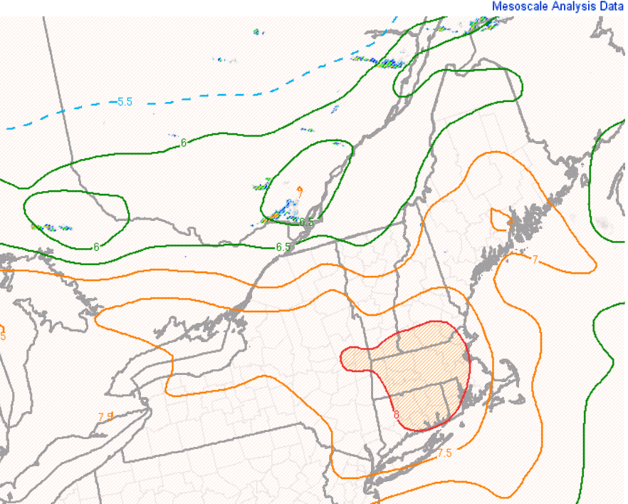
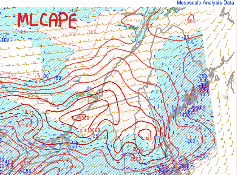
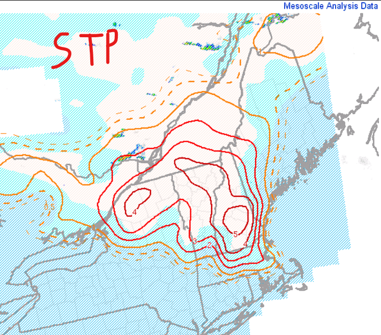
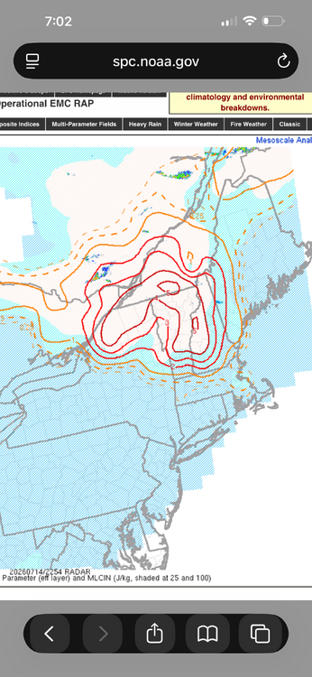
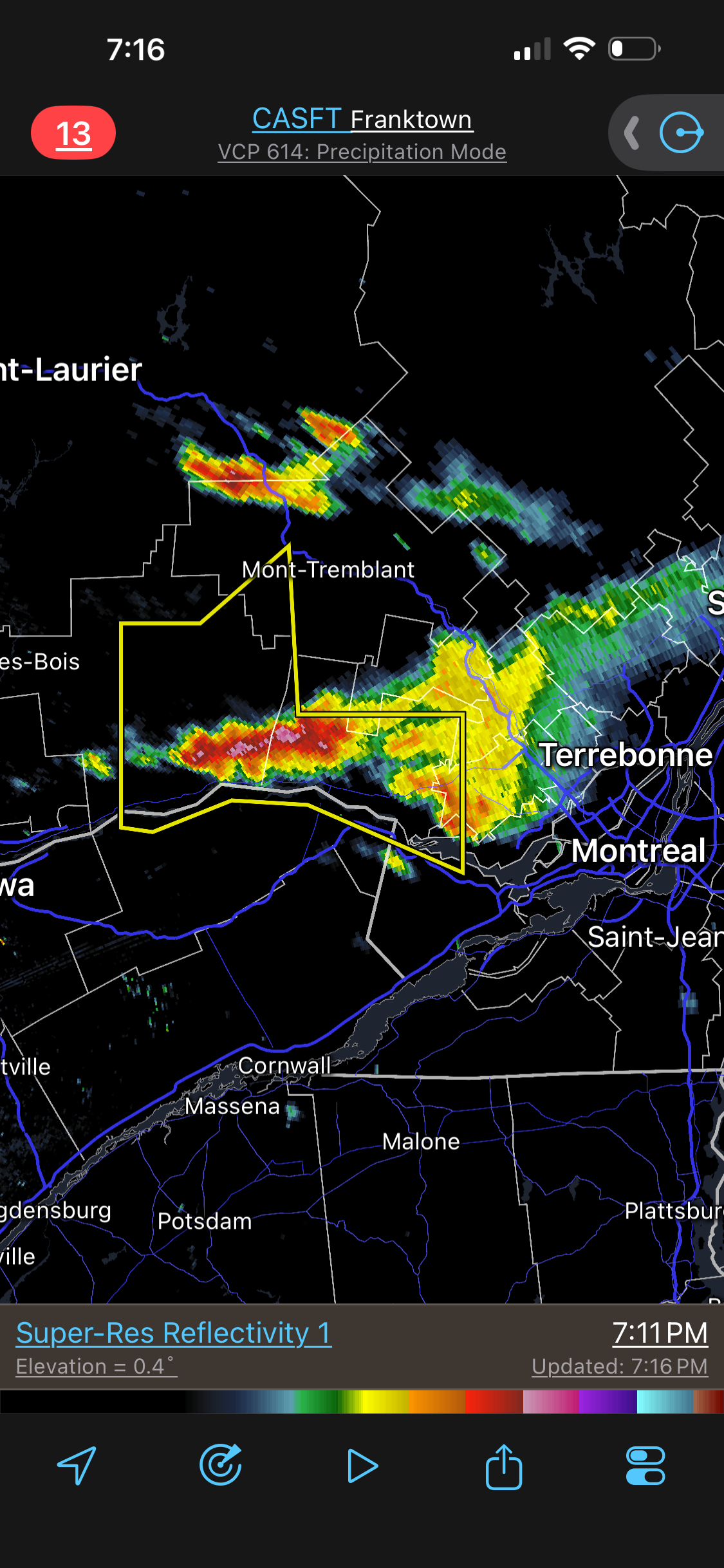
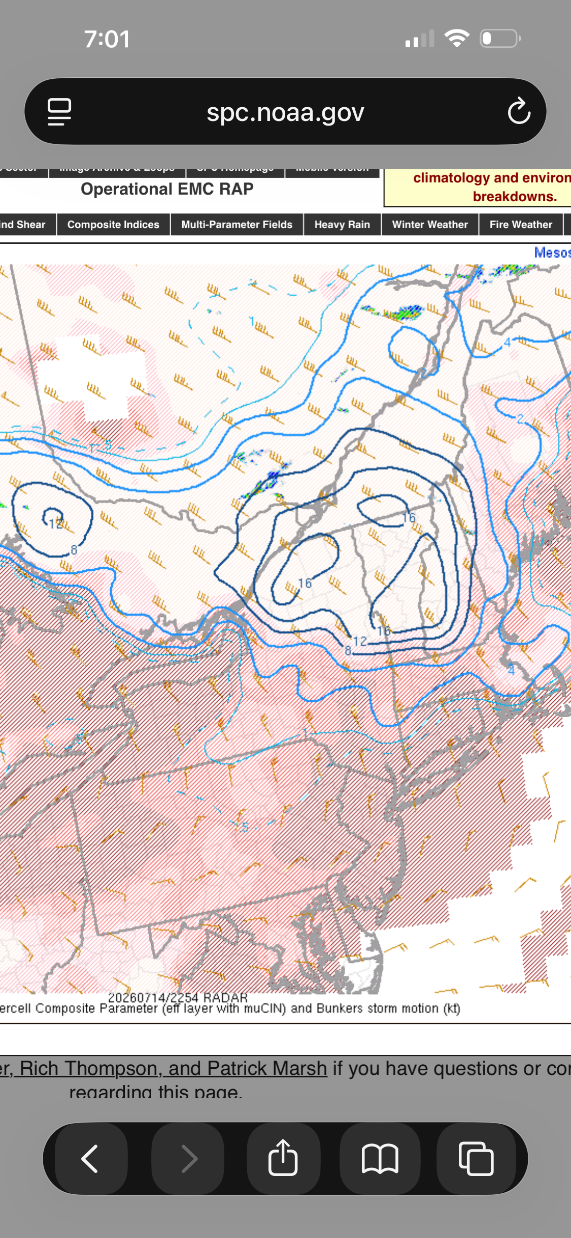
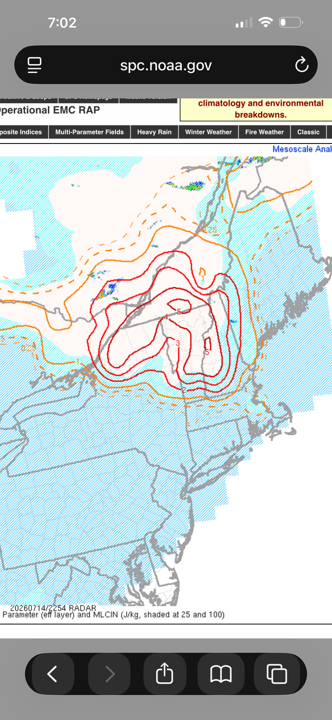
 Front/trough continue advancing south EML shunting south so cap up north so that will help weakening the capping MLCIN all but eroded with values >3000 J/KG Getting activity going...I would think things really begin taking off in the next couple hours. Don't see STP values like this here very often and these may be amongst the highest that would exist in a database if such one existed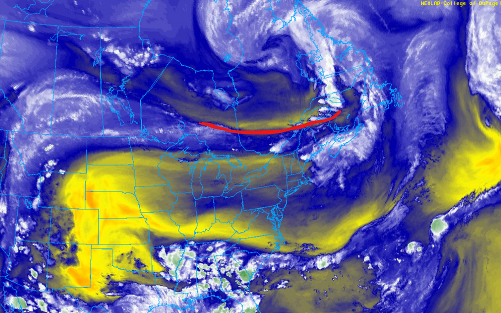
-
Got to 91. I imagine years ago, in the 60s and 70s, things would have been hotter if not for the thick smog and less days with actual clean, clear blue skies.
-
 Now finally storms w/ some meat!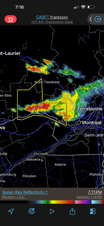
-
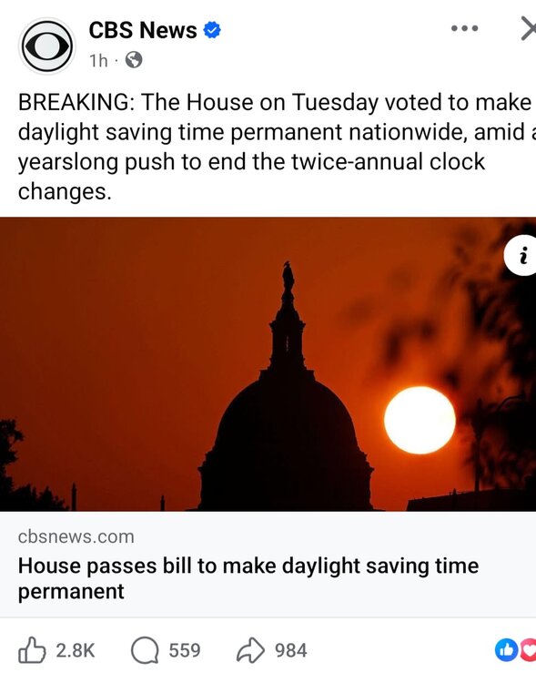
 Not kidding ..when the issue came up in 2022 the comments section in the Globe was filled people thinking there was going to be an extra hour of daylight lol
 -
 5.61” in June 0.00” in the last 12 days
 -
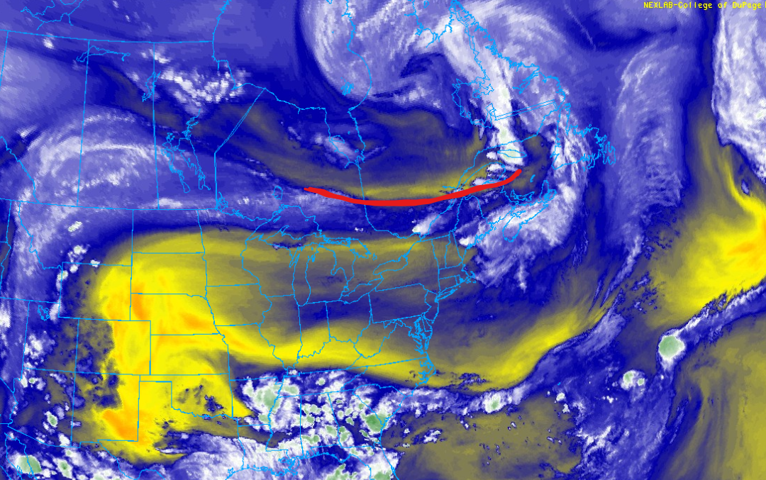
Never turn you back on an EML in the evening/overnight, esp. when storms fall during the day. This happens countless times in the Plains/Midwest. EML is an EML, doesn't matter where you are.
-
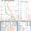 It's an EML event, and they tend to run later than our normal crappy svr up here. Somebody in VT or NH or ME or all three should get crushed badly later tonight.
 -
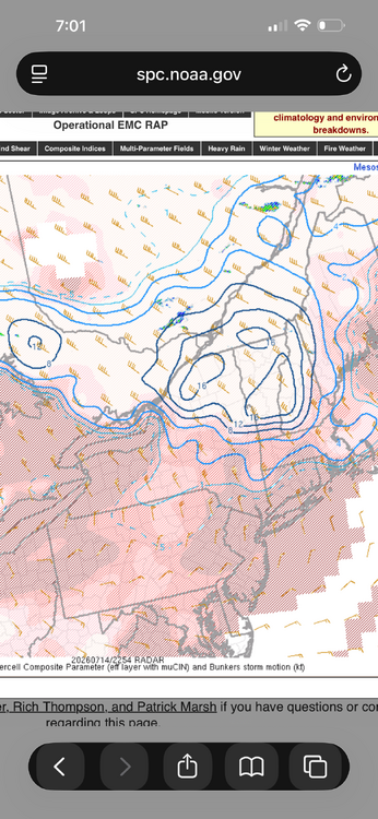
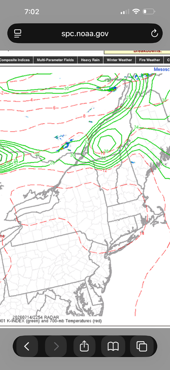
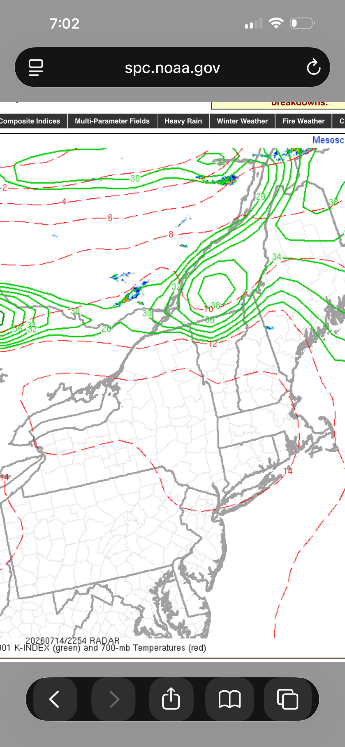
Yes. The thing is its not like there have been no storms at all in srn Quebec and NNE so far, so the convective temps has been reached. And those storms that did develop laid down boundaries to provide focus for other storms. I am just surprised the storms that developed have not been supercells b/c the enviroment is primed. Any updraft should rotate quickly, and then mesocyclone feedback makes the updraft stronger, and you get a solid supercell. Look at the SCP and SIGTOR values currently! And the K-index. There is a focused band of 850/700 moisture and obvious boundary near the border. Maybe nocturnal effects such as the strengthening LLJ and BL decoupling need to come into play here. The models clearly showing the 925 and 850 winds ramping up this evening. This happens a lot in the Plains/Midwest and you still get nasty tstms. Tor potential is typically limited though as MCS clusters/lines are more common.
-
Most . You also had 6-7 “ of rain in June when most had half or less of that . And you had a soaker May and out of drought status
-
I was out on the Allegany / Garrett county border today, the smoke was definitely noticeable between the ridges.
-

2026-2027 Super El Nino
csnavywx replied to Stormchaserchuck1's topic in Weather Forecasting and Discussion
'97 loses some steam from here over the next month and as you point out, there's another large KW on the way, so would expect these two events to swap positions with respect to max anomaly temps. -
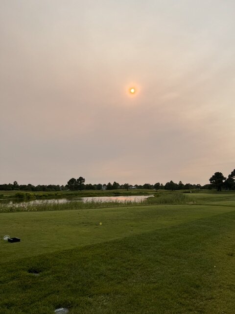
 Daughter just grabbed a photo of the sun. What the fuck…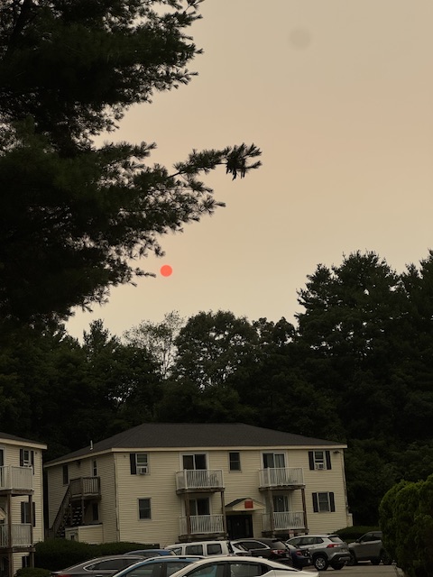
-
My uncle survived a widowmaker heart attack. Happened about 15yrs ago now. He was astute enough to realize something was going on and my aunt called the paramedics. While on trip to the hospital in the ambulance was when it occurred.
-
Looks like Thursday morning will be rough according to the HRRR. Interestingly it keeps west of the blue ridge/shenandoah shielded from the near surface smoke.
-
Amazing what a difference a week makes. Last week at this time we were all wrapping up 36-48 straight hours of rain with 2-3” for many and S coast double that. Then we go 7 straight days of hot, dry sunny weather and any gains we had for lawns, shrubs, gardens are gone . Everything burning and browning out all over again with little significant rain in sight . What Stein wants. Stein gets.
-
 What an incredible bust. Wildfire smoke for the loss.
 -
Seems it’ll be a part of our skies I’m some capacity thru early September at a minimum . These all exploded yesterday .
-
 Looks like the smoke will linger into Thursday too Been interesting following the HRRR simulations: https://www.pivotalweather.com/model.php?m=hrrr&p=smoke_viden&rh=2026071418&fh=loop&r=us_ne&dpdt=&mc=
 -
If the smoke gets as thick as it looks it may (rivaling 2023), that’ll definitely knock a few/several degrees off the temps. New England highs today were mostly under the forecast.
-
Milky white skies at 6PM just west of Bethany, DE.
-
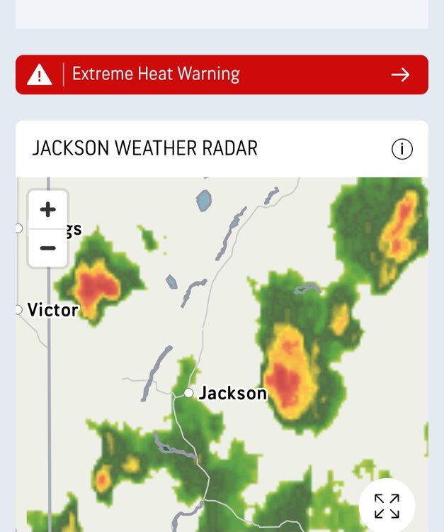
 Maybe something yet.
.thumb.jpg.a5182a9313623157ae06711ea2e5d43f.jpg)
.jpg.da623cff21d8254f12c33f454ac37698.jpg)
-
Now the Senate and Trump If passes , it will be later sunrises and later sunsets during the winter. Poor weather models during winter.
-







.jpg.99428d596ff60b2398e344d0827a7949.jpg)