All Activity
- Past hour
-
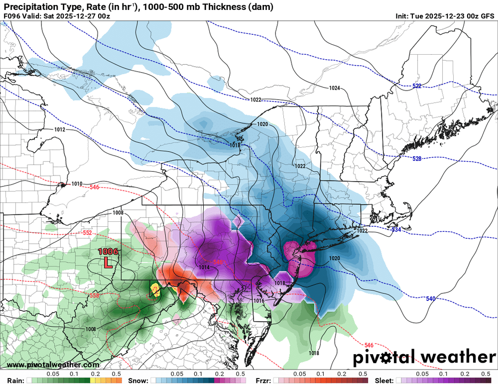
Heavy precip from Philly to NYC
-
.thumb.png.4150b06c63a21f61052e47a612bf1818.png)
White Christmas Miracle? December 23-24th
HIPPYVALLEY replied to Baroclinic Zone's topic in New England
Definitely some dry air to fight through. Currently 23/16 at mi casa. Counting on that initial burst to drop an inch here. -
Gfs is nasty icy for northern tier
-
Both GFS and GFS-AI ticked slightly further north vs. 18z. Still snowy (some ice SW) for most areas. Kind of the sweet spot right now.
-

E PA/NJ/DE Winter 2025-26 Obs/Discussion
CoolHandMike replied to LVblizzard's topic in Philadelphia Region
Anybody seeing any actual flakes tonight, or is it all just virga? -

White Christmas Miracle? December 23-24th
JKEisMan replied to Baroclinic Zone's topic in New England
HREF. Still going up north.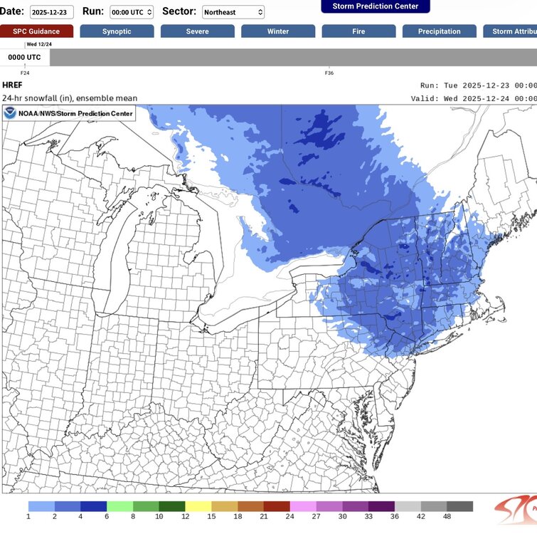
-
Gfs is a beauty
-
MECS? Anthony?
-
I just posted this in another thread but this one may be more appropriate… I’m looking to rent a cabin in the NC mountains for New Years Eve through the weekend - where’s the best chance for snow?
-
AI gfs
-
I’m looking to rent a cabin somewhere in the NC mountains for New Year’s Eve through the weekend… Where’s the best chance for snow? Or where’s the best place for me to ask this question? Lol
-
WSW hoisted
-
I haven’t seen any reports of overperforming coming out of PA where it’s currently snowing so I think the models might be onto something with the marginal temps and drier air
-

White Christmas Miracle? December 23-24th
bristolri_wx replied to Baroclinic Zone's topic in New England
-

White Christmas Miracle? December 23-24th
tunafish replied to Baroclinic Zone's topic in New England
IVT already showing up on radar over midcoast Maine?? -
Yep, and then it'll backdoor again in spring for weeks on end.
-

White Christmas Miracle? December 23-24th
Sey-Mour Snow replied to Baroclinic Zone's topic in New England
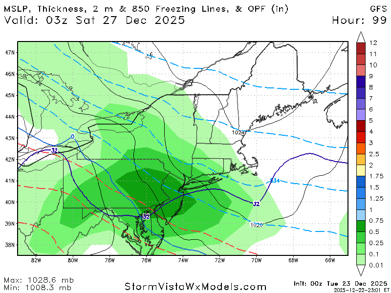
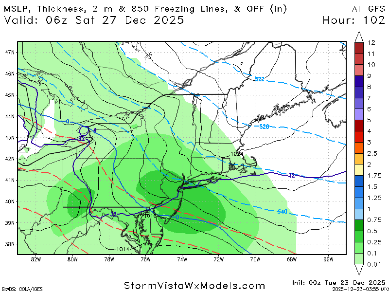
GFS another big cutback barely any precip in northeast half of CT -
Look familiar? This is Dec 1962, 1964, 1975, 2010 warmed up two degrees. Core heat Northwest, not Southwest. Core cold Lakes/Mid Atlatnic, not Northern Plains or New England. I just picked the best temp matches in the -PNA, -WPO, -NAO, -ENSO set. These are all warmed up by 2F - still supports my idea since Sep/Oct of cold eventually retrogressing to the West.
-
Icon is colder and icier
-
White Christmas Miracle? December 23-24th
Sey-Mour Snow replied to Baroclinic Zone's topic in New England
Radar not matching up with models at 10pm.. -

E PA/NJ/DE Winter 2025-26 Obs/Discussion
Birds~69 replied to LVblizzard's topic in Philadelphia Region
Looking ahead temp wise to the EOM we will be -2 to -3 for the month when all is said and done, right? I don't keep stats but just seems like a cold Dec.... -

Central PA Winter 25/26 Discussion and Obs
Ruin replied to MAG5035's topic in Upstate New York/Pennsylvania
hah -
White Christmas Miracle? December 23-24th
bristolri_wx replied to Baroclinic Zone's topic in New England
.thumb.png.9de9b9e4b9ab8edc6e7e67e8852fbe24.png)
-
By the way - this is the -ENSO (La Nina/near La Nina), -PNA, -WPO, -NAO composite for December since 1950. Its very similar to the pattern this month, but less extreme. The pattern this month has the cold/warm areas in the same place, just need to add at least 4-6F to both the cold (colder) and the warmth (warmer). In the composite, January is still pretty cold. But you do see the cold retrogress hard to the West - in March. February is not coherent - its all over the place. -NAO if it continues becomes a pretty strong cold signal further west later in the winter, particularly Jan 15 and on.
-

White Christmas Miracle? December 23-24th
ORH_wxman replied to Baroclinic Zone's topic in New England
NAM being so dry is starting to be a little bit of a red flag I don’t think I’d change anything though over interior. Still prob 1-3”. Maybe if GFS and Euro jump ship.


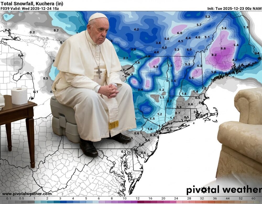
.png.f402cdcce900e1e843896d644c8bd048.png)