All Activity
- Past hour
-
(002).thumb.png.6e3d9d46bca5fe41aab7a74871dd8af8.png)
Central PA Summer 2026 Discussion/Obs Thread
ChescoWx replied to Voyager's topic in Upstate New York/Pennsylvania
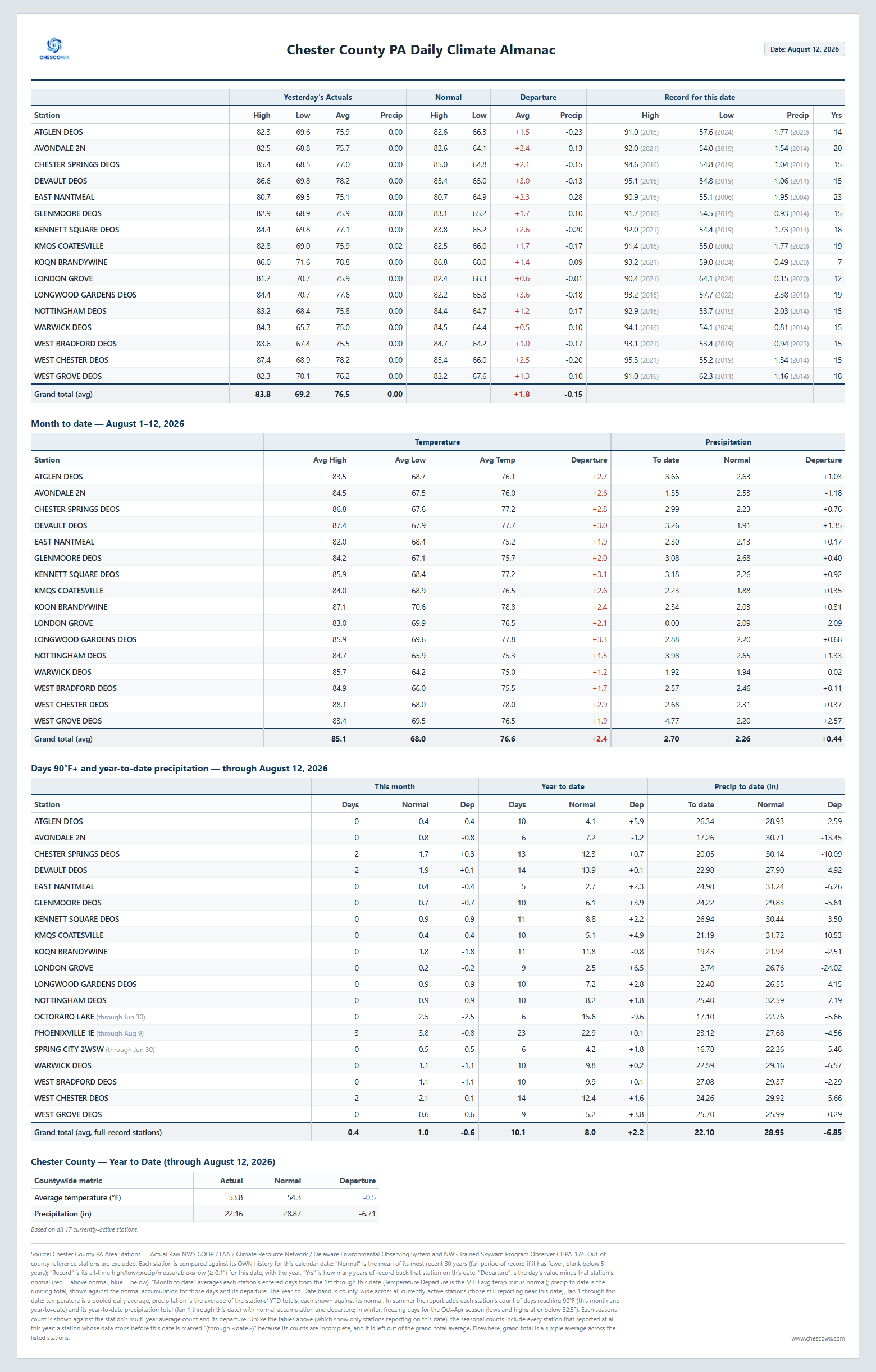
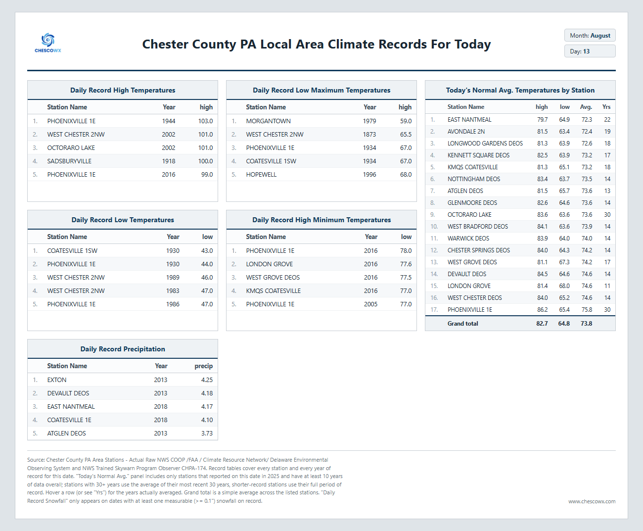
Today will be our last day with higher humidity. We should cooler weather both tomorrow and especially on Saturday. However, we turn more humid and wetter again by later Sunday into Monday. Drier and near normal temperatures arrive by next Tuesday.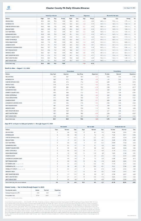
-
E PA/NJ/DE Summer 2026 Obs/Discussion
ChescoWx replied to PhiEaglesfan712's topic in Philadelphia Region
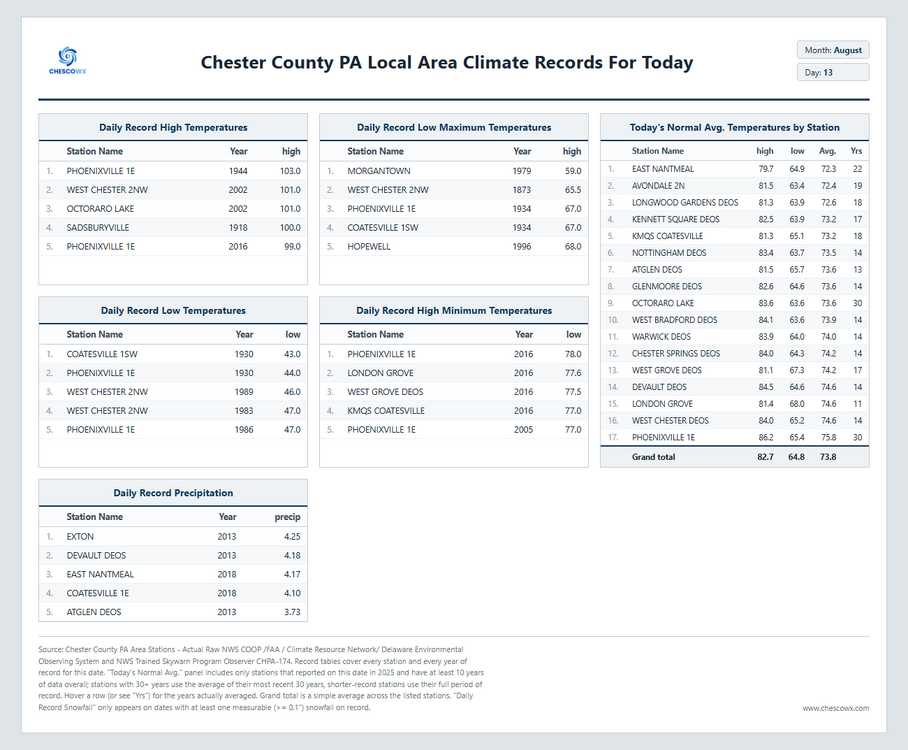
Today will be our last day with higher humidity. We should cooler weather both tomorrow and especially on Saturday. However, we turn more humid and wetter again by later Sunday into Monday. Drier and near normal temperatures arrive by next Tuesday.
-
Jamstec
-

2026-2027 Record-breaking El Nino
GaWx replied to Stormchaserchuck1's topic in Weather Forecasting and Discussion
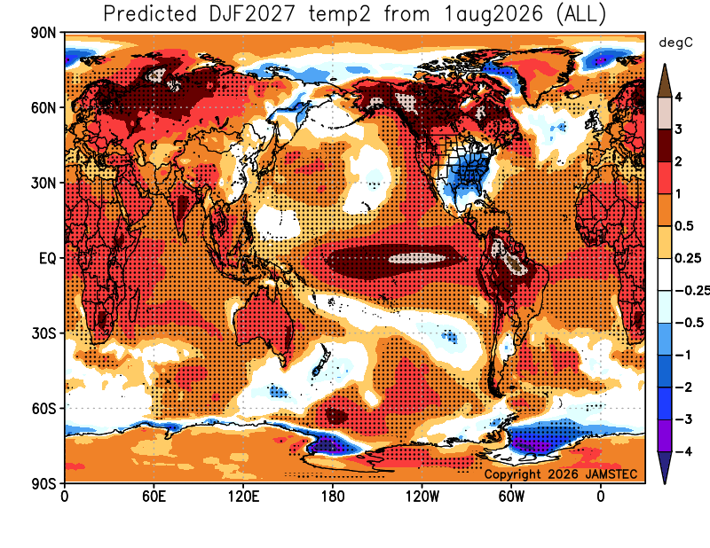
The Aug ‘23 Jamstec was actually slightly colder than the prior two months. But to be fair, Sep and moreso Oct were colder than the Aug run before Nov warmed back up to no BN. However, even the Oct 23 run, which a number of us including me were understandably salivating over, wasn’t nearly as cold as the current run (also note how much colder is the Arctic vs 23-4): Current run (Aug):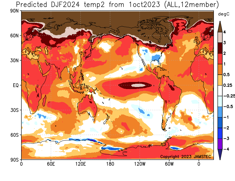
-
why not? lol
-

2026-2027 Record-breaking El Nino
PhiEaglesfan712 replied to Stormchaserchuck1's topic in Weather Forecasting and Discussion
At least by this point, the cold signal was gone. (This was the case in 2015-16.) By the time you went into the fall runs, those regions were showing above average temperatures for DJF on almost all models. By the time you got to October and November in 2015 and 2023, it should have been apparent that December was going to torch. The cold signal still being there has to bring hope to those want cold and snow. I always keep coming back to the point that the last strong el nino that showed a cold signal this deep into the season produced the coldest CONUS winter in the 21st century. -

Augdewst 2026: Summer's Last Stand
weatherwiz replied to Prismshine Productions's topic in New England
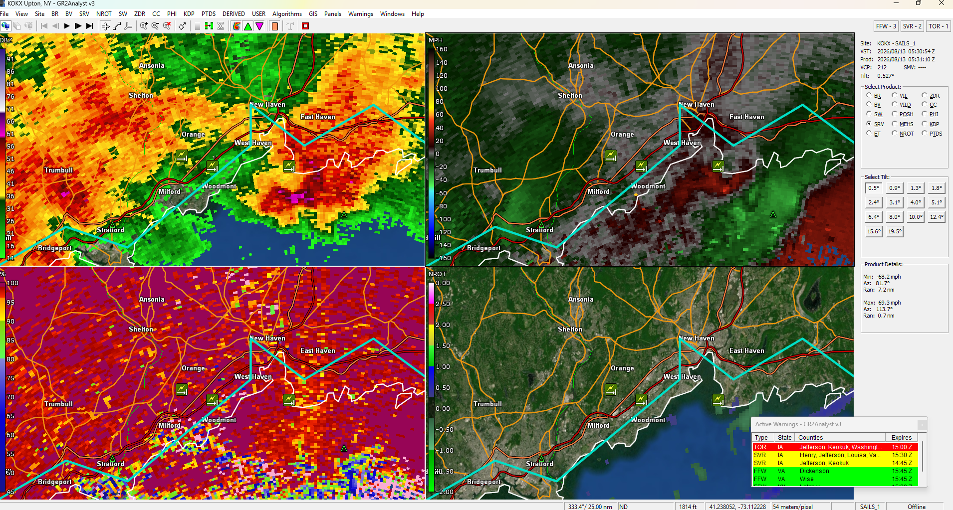
Here's a scan 5 minutes after what I posted. Definitely interesting around there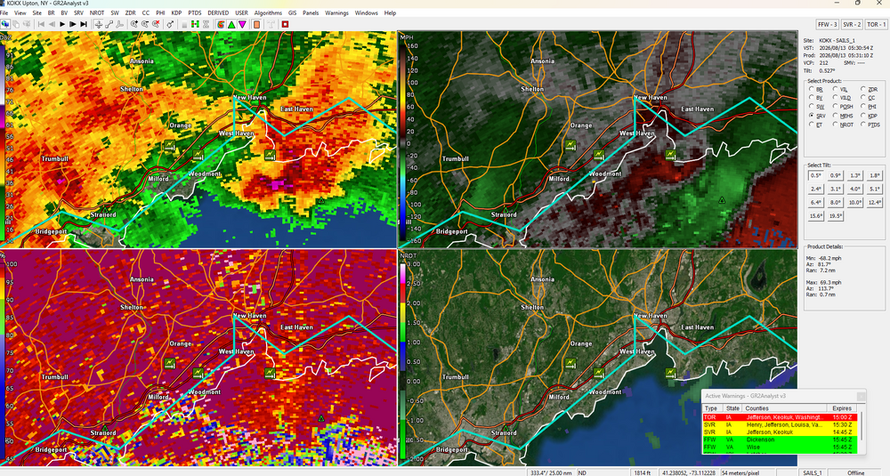
-

Augdewst 2026: Summer's Last Stand
Typhoon Tip replied to Prismshine Productions's topic in New England
It had a 'micro bow' on the base reflectivity structure as it passed through NH fwiw - ... probably a cycling micro burster -
A good fall outbreak and this happens. I honestly expect it at this point.
-
No worries, thanks for sharing. That's impressive!
-
Shocker
-

Augdewst 2026: Summer's Last Stand
dendrite replied to Prismshine Productions's topic in New England
86mph at a home site just east of the lighthouse. https://www.wunderground.com/dashboard/pws/KCTEASTH275 -
Augdewst 2026: Summer's Last Stand
weatherwiz replied to Prismshine Productions's topic in New England
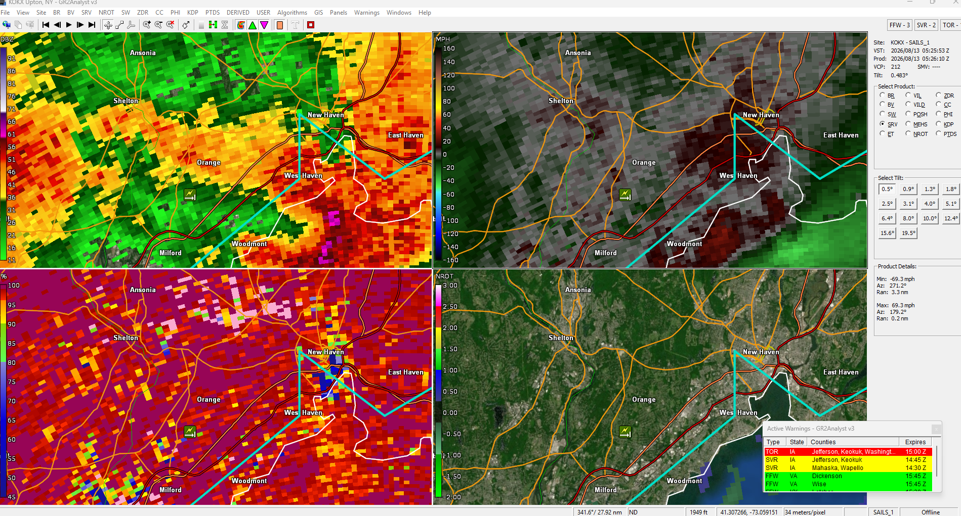
must have been a super localized gust. Actually further looking at the radar, I wonder if there may have been a brief TOR? -
Augdewst 2026: Summer's Last Stand
dendrite replied to Prismshine Productions's topic in New England
Around 130 EDT Only 37mph at HVN right next door. -
Augdewst 2026: Summer's Last Stand
weatherwiz replied to Prismshine Productions's topic in New England
yeah I just edited my post for the time. Meant to convert from Z but forgot -

Augdewst 2026: Summer's Last Stand
OrangeCTWX replied to Prismshine Productions's topic in New England
Think the worst of it was from 1-2am no? Another storm came through at 5ish but I thought that one was weaker. At least I was able to sleep through that one lol -
Apologies if it's just outside of this region, but some pretty impressive hail reports yesterday in Binghamton. Several reports up to 3". Mark Tarello - WOW! Golfball to egg size hail from severe... | Facebook
-
Augdewst 2026: Summer's Last Stand
weatherwiz replied to Prismshine Productions's topic in New England
wonder what time that was. This is a scan from 1:25 AM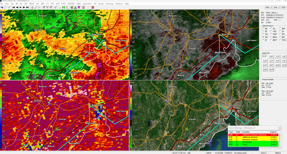
-
Eastern tip of Long Island got quite a bit of rain last night. Reminds me of that one snowstorm last winter where they got like 10” out there with barely a flurry in babylon
-
Augdewst 2026: Summer's Last Stand
weatherwiz replied to Prismshine Productions's topic in New England
HOLY SHIT. -
Augdewst 2026: Summer's Last Stand
dendrite replied to Prismshine Productions's topic in New England
Gotta get you some rain up there. -
Augdewst 2026: Summer's Last Stand
OrangeCTWX replied to Prismshine Productions's topic in New England
103 mile per hour wind gust in New Haven! https://x.com/ryanhanrahan/status/2087905696947884069?s=46 - Today
-

Augdewst 2026: Summer's Last Stand
tamarack replied to Prismshine Productions's topic in New England
Some echoes passed overhead but nothing reached the ground. 1.83" this month so far, a bit AN. -

2026-2027 Record-breaking El Nino
mitchnick replied to Stormchaserchuck1's topic in Weather Forecasting and Discussion
Since I'm always optimistic as there's nothing to lose enjoying the hobby, I'll remain in the open instead of ducking for cover. Lol -

2026-2027 Record-breaking El Nino
40/70 Benchmark replied to Stormchaserchuck1's topic in Weather Forecasting and Discussion
It's coming lol I'm telling you, he's going to shred this optimism like a ninja with absolute surgical precision.