Search the Community
Showing results for tags 'snow'.
-

First Cape Cod MA snow? - After December 4th??????
USCAPEWEATHERAF posted a blog entry in Once a legend always a legend
The forecast for snow and cold looks dim the next 10 days, however beyond that time period, looks to the first real chance at a snowy and cold regime over New England and at least as far south as the 38N latitude line. Anyone south of that latitude needs to wait until further into January time frame, but for those of us north of that latitude, the pattern change is being seen by most of the guidance after day 7-9 time frame, it looks like after December 4th an arctic front swings through the Northeastern USA states and brings a return of true arctic air and snow could be a possibility. Stay tuned! Right now it looks like a 60% chance at seeing at least 2 snowstorms, while a 40% chance exists that we see suppression depression. -
SO the models are showing frigid air entering the northern Plains sometime in the next ten days and that cold air filters into the eastern US by day 13-16, which is the 27th and beyond of October. We could be seeing a change to much colder air eventually as winter gets closer. Most of our storms this winter will be from the Oh Valley to the Mid Atlantic coastal storm tracks, signifying that miller Bs and not Miller As will be the normalcy this winter.
-
Here is a snowfall map that I created using reports from various sources. Many of the reports came from this forum and the National Weather Service. Only social media reports that passed through quality control were considered. All reports gathered were carefully considered and compared before being included. Light rain developed during the morning hours on November 26th and mixed with some sleet inland. Wet snow initially confined to the far northwestern corner of the state. As steadier precipitation moved in, a slight southeast shift of the snow/sleet line was observed with some modest evaporational cooling. However, much of coastal and southeastern Connecticut stayed predominantly rain. The main reason for the mixed precipitation and sleet was a warm layer in the atmosphere around 700mb. As precipitation became heavy, sleet fell across much of central Connecticut. Wet snow continued across northwestern Connecticut and rain moved as far northwest as Meriden and Hartford with some warming aloft nudging into the valleys. Even in those areas, the 2-meter temperature hovered around 34 degrees for much of the event, which did not allow for significant amounts of snow to accumulate. Precipitation tapered off to scattered snow showers by early evening. As cooler air gradually funneled in, a light additional accumulation of snow was reported in many areas. A few broken, but locally enhanced bands of snow continued into the early morning hours on the 27th. The greatest snowfall totals were in the range of 6 to 10 inches across northwestern Connecticut. Totals dropped off fairly quickly to the south and east. A narrow area of 3 to 6 inches was observed near and just northwest of I-84. Just southeast of there, 1 to 3 inches was reported and the southeastern third of the state generally saw less than one inch of snow. Where the snow did accumulate, it had a very high water content, especially those areas that battled between a mixture of snow, sleet and rain.
-
Here is a snowfall map that I created using reports from various sources. Many of the reports came from this forum and the National Weather Service. Only social media reports that passed through quality control were considered. All reports gathered were carefully considered and compared before being included. Light rain, with light snow across the higher elevations, developed across Connecticut during the evening hours of November 13th. The steadiest and heaviest snow fell around midnight and tapered off during the pre-dawn hours on November 14th. Most locations eventually changed to snow, with the exception being the immediate shoreline and urban coastal corridor from New Haven down toward the New York border. On average, the hills saw anywhere from 1 to 3 inches of snow, with generally an inch or less across the valleys and shoreline. The highest amounts around and just over 3 inches were reported in Litchfield County.
-
 Actually, this is more of a test image. Just checking out the system, timing, ease of use, etc.
© Stormitecture, Jason Foster
-
While still being a day 5ish event, it is not to early to start looking at some of the possible implications of various models. At this juncture, we generally have the GFS and the Euro book-ending a possibilities window that includes a cutter to Chicago and a more suppressed system that goes East of Hatteras For the most part been consistently left of the GFS ... with its ensembles a tad to the right of the operational Euro (but no where near the GFS). The 12z GFS Ensembles cut the difference with somewhat of a middle ground ... bringing the primary low into Ohio, with a coastal transfer. Depending on the amount of moisture return that is achieved in the warm sector, the operational GFS could be a notable severe weather event. And would keep QPF amounts across the DC/NOVA area on the light side with little possibilities for winter weather. The transfer with this solution simply happens too late to provide the lift for precipitation and wraparound of cold air. Then we have the Euro with it's more southern solution. It would mean a smaller spatial window for severe weather possibilities and a better chance for wintry weather for the area (especially west ... like we saw with the early March event). Given the time range and the placement of the the ensembles in the middle of the operationals I would expect to see some compromise towards the middle in terms of track over the next 1-3 days ... rather than an extreme on either side verifying. If I had to pick a solution verbatim from this mornings 12z suite for the heck of it, it would be the GEFS.
-
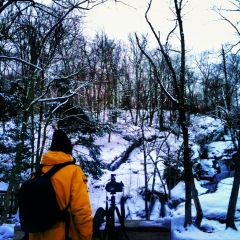
From the album: Stuff
© Ian Livingston
-
From the album: First snow


