Gravity Wave
-
Posts
1,169 -
Joined
-
Last visited
Content Type
Profiles
Blogs
Forums
American Weather
Media Demo
Store
Gallery
Everything posted by Gravity Wave
-
 The Euro and CMC closed off the system on Friday IIRC, interesting to see that potential re-emerge.
- 3,762 replies
-
- 1
-

-
- heavy snow
- heavy rain
- (and 3 more)
-
2009-2010 had several storm that did that, December 18-19, February 5-6 and February 10-11 all had brutal northern cutoffs, although the cutoff line moved north each time.
- 3,762 replies
-
- 1
-
-
- heavy snow
- heavy rain
- (and 3 more)
-
If the final solution splits the difference between the GFS, Euro and CMC then the City should do extremely well.
-
Nothing to see here, just the UKIE dropping 2" of liquid equivalent for the City and the coast:
- 3,762 replies
-
- 2
-

-
-
- heavy snow
- heavy rain
- (and 3 more)
-
The source airmass is fantastic, most of SE Canada is below 0 degrees at the height of the storm. If we can get this to close off and deepen a la CMC, hence drawing in even more of that cold air, we could get an incredible result.
- 3,762 replies
-
- 1
-
-
- heavy snow
- heavy rain
- (and 3 more)
-
GEFS has improved from 0z. Remember the 2 camps I talked about? The eastern, weaker, progressive camp has shrunk significantly and is now a small minority while the stronger, west, amped camp has grown: The great high in Canada is preventing the amped solution from being too warm for the City and much of the coast.
-
GEFS is split into 2 camps: the cold, weaker, progressive camp of the OP and the warmer (for coastal areas) amped bomb camp of the CMC/Euro, with the latter group being larger. Could be the difference between an SECS for I-95 and the coast and a glancing blow for the interior on one hand and an MECS for the interior and a mixed bag on the coast with I-95 on a knife's edge. Hopefully the confluence continues to build which could allow colder solutions for marginal areas even in the case of an amped system. Edit: Here are the GEFS snowmaps. Some great hits in here:
- 3,762 replies
-
- 2
-

-
- heavy snow
- heavy rain
- (and 3 more)
-
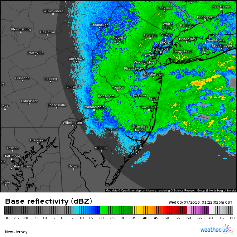
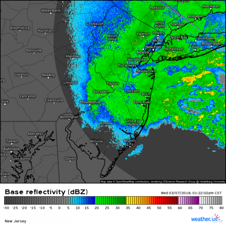
The March 7, 2018 nor'easter (the first of that month's trio) is an underrated bust for NYC proper, IMO. WSW upgraded to 8-12" for the City the morning of the event, short range models going bonkers, the first wave of snow comes in like a wall... and then the tap just shuts off around noon. IIRC the storm got tucked a little closer to the coast than expected and the CCB tracked west across the city and set up over NNJ, resulting in on-and-off light to borderline moderate snow for the rest of the day. This radar shot from 1:30 that afternoon is pretty representative of most of the event, note the subsidence over the city from the NNJ band and the developing bands over the ocean that would briefly increase snowfall rates before merging with the main band: The low rates we got for most of the afternoon just couldn't overcome the marginal boundary temps, which hovered around 34 as soon as the dynamic cooling from the CCB ended. The mini garden in front of my building in Chelsea ended up with 1.5-2" of slush but when I left my office in Midtown you would never have known it had been snowing most of the day. Meanwhile NNJ and the LHV got crushed. Definitely the worst bust since I moved here in 2017, at least. Behold the suck:
- 373 replies
-
- 1
-
-
- heavy rain
- wind event
- (and 2 more)
-
I remember before other models started catching on the GGEM was the progressive/east outlier and thinking that was a red flag since it's usually the opposite. Still, the Euro/NAM combo was seen as unbeatable then.
-
IIRC there was a secondary band that set up over Nassau and far eastern Queens that helped limit the damage in those areas to "regular bust" rather than "historic forecasting disaster" like it was for the rest of the City, NENJ, LHV and western CT. I was living upstate at the time but vividly remember the insane runs and the shock of realizing what was actually happening.
-
The last storm that was good at all in the city was March 21, 2018, or January 4, 2018 depending on how you feel about temps.
-
October 2020 General Discussions & Observations Thread
Gravity Wave replied to uofmiami's topic in New York City Metro
My parents are driving to Pittsburgh today and reported 81 degrees in Altoona. Crazy stuff. -
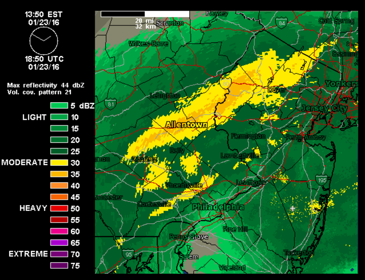
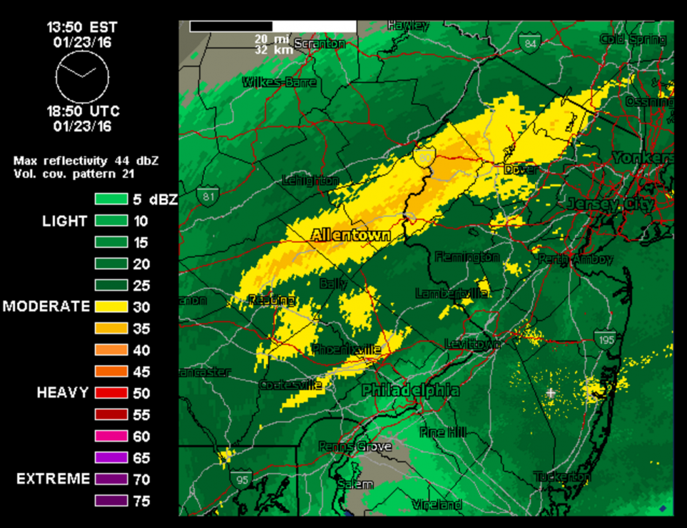
BDB was for me what January 2015 was for most people on this forum, albeit a slightly smaller bust. I was home in Allentown from my freshman year of college and had given up on the storm until the Christmas eve model runs pulled me back in. The modeled gradient on the western side of the storm was fairly sharp but no models consistently had far eastern PA out of the 6-10" range, and some were higher. We got a WSW for 10-16", IIRC the NWS was aggressive because the storm was overperforming to the south. Of course, the storm deepened more quickly and profoundly than expected, and the heavy banding hit a wall around I-287. With this result: 2" of pixie dust and the most painful radar images of my life, at least until I watched the Blizzard of 2016 drop 30 inches of snow at my house from cloudy Ithaca 36 hours after leaving home for spring semester.
-
It would be amazing to have a September that felt more like September than August for once.
-
Tropical connection NYC forum area Fri-Sun 8/28-30/20
Gravity Wave replied to wdrag's topic in New York City Metro
I'm glad the rain is staying south, any missed weekend night for outdoor dining is devastating for a lot of restaurants. -
SVR potential late Wed-Thu August 26-27 NYC metro
Gravity Wave replied to wdrag's topic in New York City Metro
Loud thunder here as the rain begins. -
These power outages are the first things that are making me happy to be in the city since March.
- 1,530 replies
-
- 1
-
-
- heavy rain
- rip current
- (and 1 more)
-
Heavy rain on the UES, it began very suddenly.
-
The Delaware and Lehigh Valleys and the Poconos got slammed as well. Up to 20" of rain in parts of NEPA with Diane. The river flooding was historic but the flash flooding on the smaller tributaries was even worse.
-
Frequent lightning and loud cracks of thunder, probably be the best storm from that perspective in the 3 years I've been here.
-
Heavy rain and some thunder and lightning from the lead cell here in Manhattan, the main show should be interesting.
-
July 2020 General Discussions & Observations Thread
Gravity Wave replied to Rtd208's topic in New York City Metro
Let's hope this is as accurate as 9 day temp forecasts usually are. -
Svr potential Monday July 6 2P-10P NY metro
Gravity Wave replied to wdrag's topic in New York City Metro
Wow, that storm over the Bronx just exploded out of nowhere. -
Svr potential Monday July 6 2P-10P NY metro
Gravity Wave replied to wdrag's topic in New York City Metro
Heavy rain with some thunder and lightning here. Very dark. -
Svr potential Monday July 6 2P-10P NY metro
Gravity Wave replied to wdrag's topic in New York City Metro
Is Manhattan going to see hail for the second time in a week?