andyhb
-
Posts
20,454 -
Joined
-
Last visited
Content Type
Profiles
Blogs
Forums
American Weather
Media Demo
Store
Gallery
Everything posted by andyhb
-
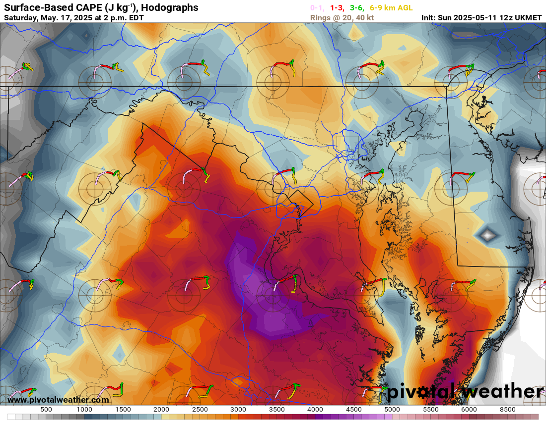
 Friday (5/16) should be added to this thread. Think it has more potential to become a widespread severe episode than Thursday, which may be a bit more localized pending moisture quality.
 -
Friday could also be a problem for areas further south into the Ohio and Tennessee Valleys. Shortwaves with zonal flow down there can be quite prolific.
-
Synoptics here are pretty favorable for a significant event including almost all of the sub-forum. Big EML with steep lapse rates, plenty of moisture, a trough that looks to swing negative tilt at a pretty ideal time of the day, and the LLJ responding to that. Will need to watch out how much areas further south mix out especially since convection should probably hold off until later in the day. Could definitely see the Madison/MKE and Chicago areas get in on this, and perhaps N IN/S MI later on. The pre-frontal wind shift is very obvious on most guidance.
-
The 12z UK is a must check for shits and giggles for this region.

- 1,378 replies
-
- 5
-

-

-
- severe
- thunderstorms
- (and 2 more)
-
This is going to be a major event for the region.
-
Warning has that line moving E at 75 mph. Widespread wind damage likely in the Pittsburgh metro. Also TPIT is down.
-
Significant severe wx event is possible tomorrow across much of MO. Very strong shear and favorable boundary orientation for semi discrete supercells should instability be sufficient. CAMs are in strong agreement.
-
Spring 2025 Medium/Long Range Discussion
andyhb replied to Chicago Storm's topic in Lakes/Ohio Valley
Potentially significant severe event setting up for MO/W IL on Sunday with instability/moisture being the main question. Potent, negatively tilted wave quickly ejects across the S Plains during the afternoon and a 50+ kt LLJ provides very strong low level shear ahead of the Pacific front most of the day. -
Violent tornado with that Byhalia MS cell. 80 kt VROT, huge TDS.
-
Large tornado moving directly into Selmer TN, pop nearly 4500, this could be bad.
-
And another strong tornado near Senatobia MS.
-
Strong tornado in progress near Middleton TN currently, perfectly discrete supercell.
-
Warehouse collapsed with people trapped near Brownsburg IN (west side of Indy) from the tornado earlier.
-
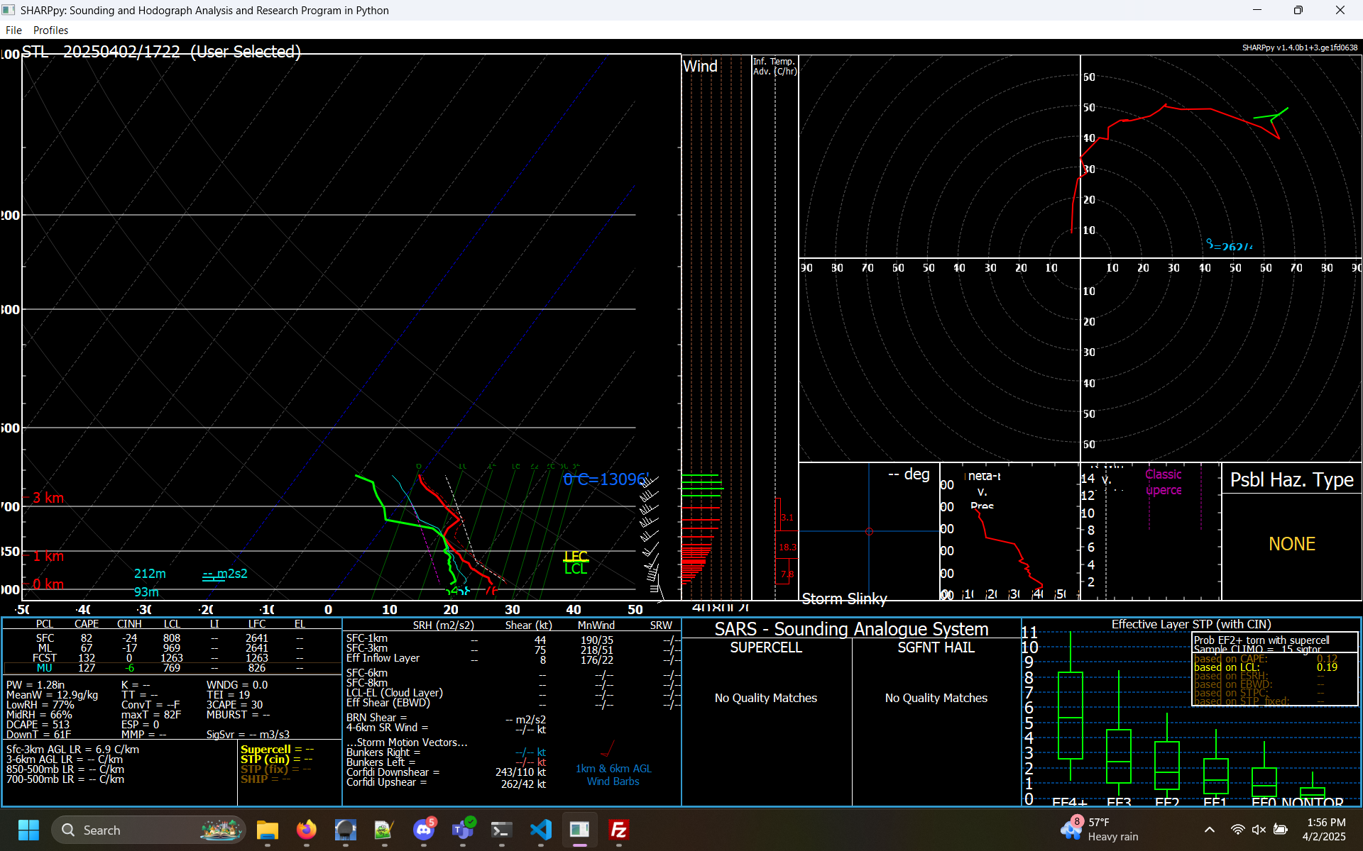
This ACARS profile from St. Louis is bad news from E MO/central IL should any storms get loose ahead of the line. Extremely favorable hodograph for tornadic supercells and a weakening cap.

-
IN/W OH may have some issues later.
-
Plains States Observations and Discussion Thread
andyhb replied to lookingnorth's topic in Central/Western States
Tomorrow could be a very serious severe weather event across KS and southward into OK, particularly in the evening. Incredible shear profiles will overlap with rapidly returning moisture along a 50-70 kt LLJ and weak CIN ahead of a rather potent dryline. -
Spring 2025 Medium/Long Range Discussion
andyhb replied to Chicago Storm's topic in Lakes/Ohio Valley
12z Euro is also a major event. Very volatile parameter space across a very large area with relatively subtle forcing for ascent and a weak cap is a recipe for trouble. -
Spring 2025 Medium/Long Range Discussion
andyhb replied to Chicago Storm's topic in Lakes/Ohio Valley
Really, really need a thread for 4/2-3 here soon. Major outbreak on the 12z GFS from IL/IN all the way southward to central MS. -
Could be a pretty nasty nocturnal threat with this one especially closer to the Ohio River.
-
Spring 2025 Medium/Long Range Discussion
andyhb replied to Chicago Storm's topic in Lakes/Ohio Valley
Volatile, potential widespread severe setup on the 12z Euro/EPS/AIFS next week around 4/2 @RCNYILWX. Have seen that synoptic pattern before and it's consistent with significant GL/Midwest/OV severe events. This has been showing up for several runs now while the GFS is off in la-la land. -
Moisture is mixing out too much, temperatures getting too warm.
-
2025 Short Range Severe Weather Discussion
andyhb replied to Chicago Storm's topic in Lakes/Ohio Valley
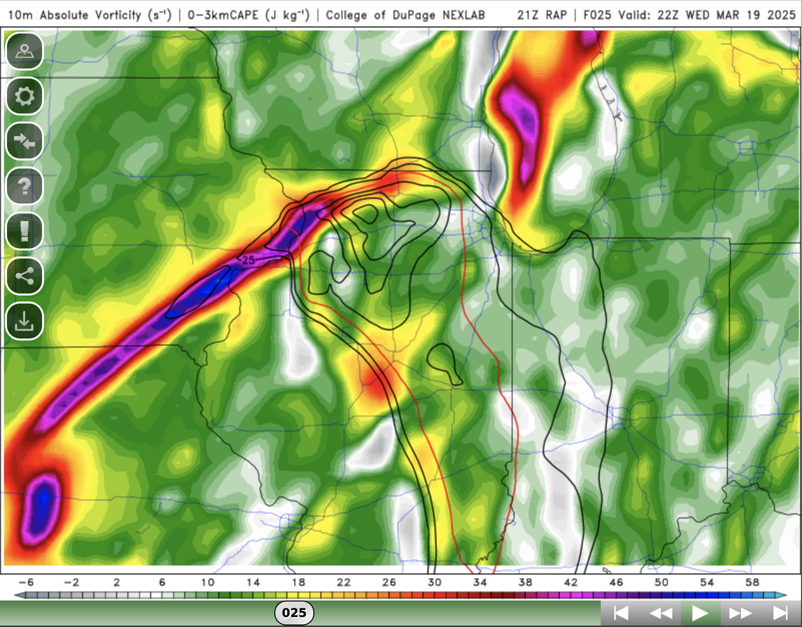
Pretty much a no-brainer on the 21z RAP. There's enough columnar CAPE for robust updrafts as well.
-
2025 Short Range Severe Weather Discussion
andyhb replied to Chicago Storm's topic in Lakes/Ohio Valley
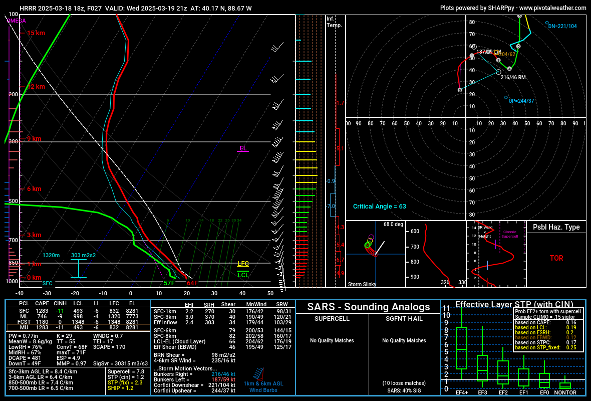
The LCLs on the 15z RAP and 18z HRRR are plenty workable for some tornadoes should the thermodynamics verify this way.
-
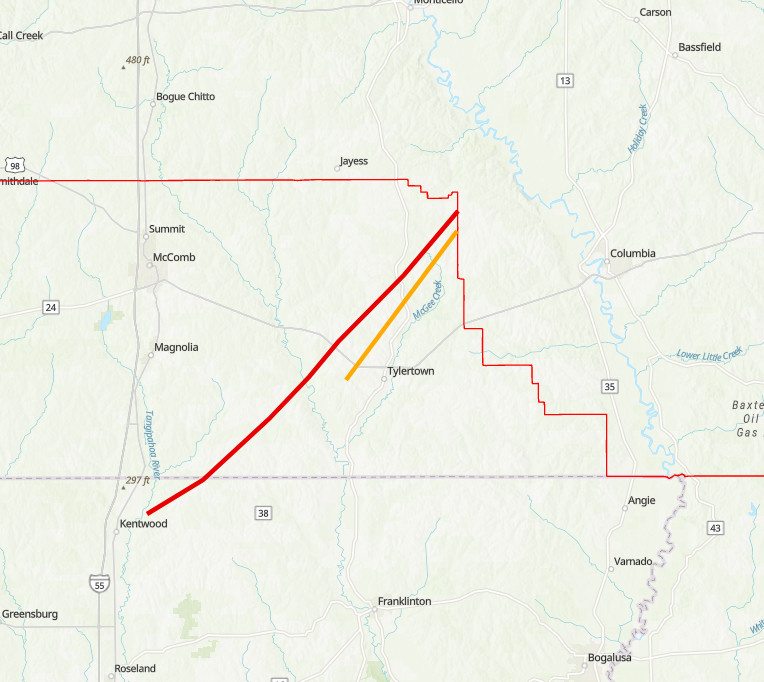
Another EF4 tornado confirmed near Tylertown MS on 3/15. First outbreak to have 3+ violent tornadoes since 4/12-13/2020.
-
High end EF4 tornado confirmed in Diaz AR from 3/14 with 190 mph winds. First violent tornado of the year. https://mesonet.agron.iastate.edu/lsr/#LZK/202503150423/202503150423/111010