andyhb
-
Posts
20,454 -
Joined
-
Last visited
Content Type
Profiles
Blogs
Forums
American Weather
Media Demo
Store
Gallery
Everything posted by andyhb
-

1/24-1/25 Major Winter Storm - S. IL, IN, and OH
andyhb replied to A-L-E-K's topic in Lakes/Ohio Valley
Looks like Ohio’s biggest storm in quite awhile. Notable banding setting up initially north of Cincinnati right now extending all the way back through S IN and IL. -
Y’all are going to win 2015 style on this one.
-
Good lord…
-
That second GFS storm is an absolute titan, Cat 5 NESIS/RSI type stuff.
-
MO/KS/AR/OK 2025-2026 Winter Discussion
andyhb replied to stormdragonwx's topic in Central/Western States
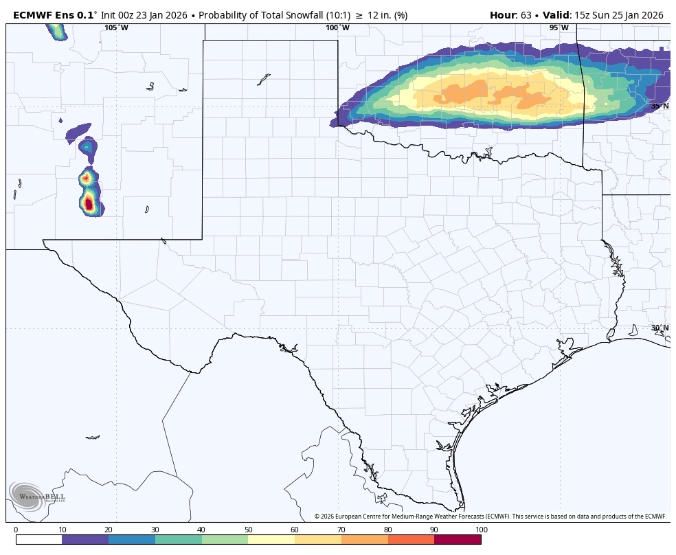
The Euro/EPS really do seem to want to lay the smackdown on Oklahoma. 60-80% chance of a foot or more at 10:1 ratios on the 00z run. Reminder that the greatest snowfall in OKC's history is GHD 2011 with ~14", so we're talking easily in historic territory if most of this stays snow/avoiding dryslots/etc.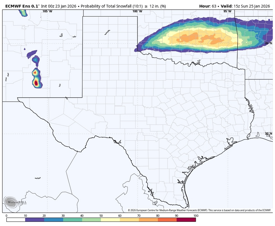
-
MO/KS/AR/OK 2025-2026 Winter Discussion
andyhb replied to stormdragonwx's topic in Central/Western States
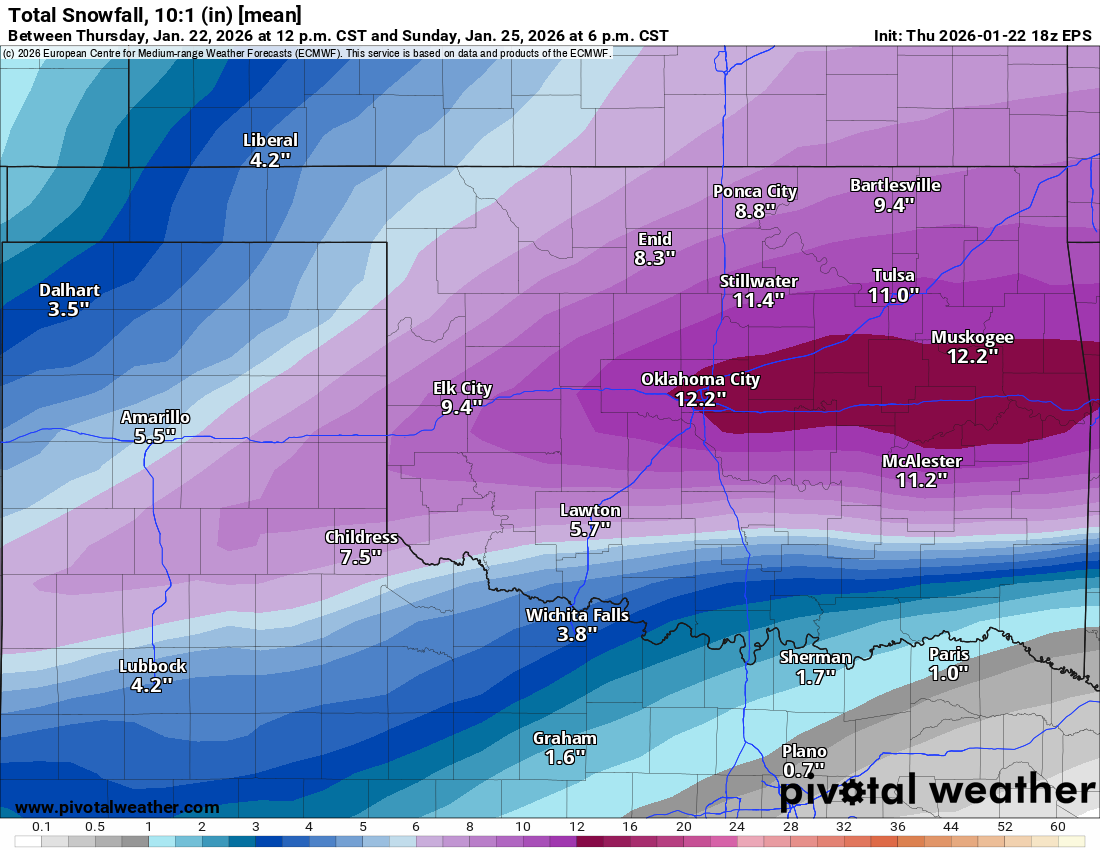
Monstrous storm for OK on the 18z Euro, particularly the I-44 corridor. 1.2-1.5" liquid for both metros with temps in the single digits on the backside. 18z EPS is also extremely impressive.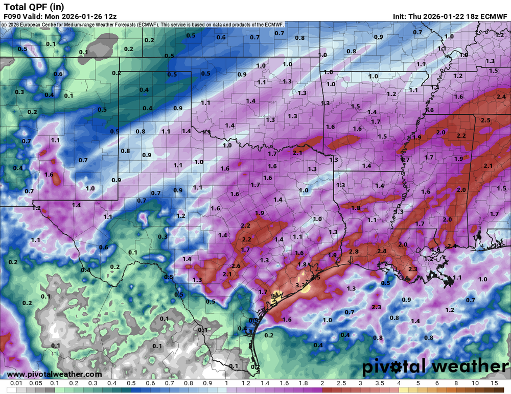

-
12z Euro essentially stalls the coastal as the primary ascent from the jet results in redevelopment closer to the coast, long period of high ratio fluff results and gets the entire region above 1" QPF/15" on Kuchera.
-
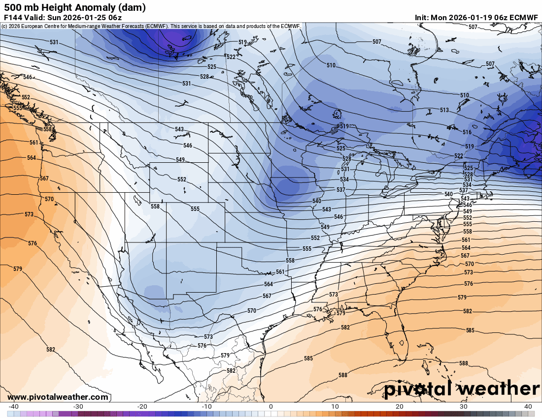
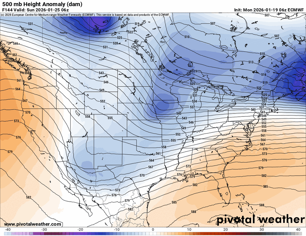
Doesn’t get much more favorable than that tbh from a large scale pattern standpoint. That blocking is incredible.
-
1/24-1/25 Major Winter Storm - S. IL, IN, and OH
andyhb replied to A-L-E-K's topic in Lakes/Ohio Valley
Per MA sub-forum lol. The synoptics here don't lie. -
Winter 2025-26 Medium/Long Range Discussion
andyhb replied to michsnowfreak's topic in Lakes/Ohio Valley
-
That is the same picture.
-
Winter 2025-26 Medium/Long Range Discussion
andyhb replied to michsnowfreak's topic in Lakes/Ohio Valley
Yeah you're all going to want to watch out if that phasing trend continues in the west with this weekend system. Potential for a major short range bust in the positive direction and a major winter storm for the sub-forum. -
As someone living in OK, holy shit at that 00z GFS. Also as someone watching the potential for the Mid Atlantic, holy shit at the 00z GFS.
-
MO/KS/AR/OK 2025-2026 Winter Discussion
andyhb replied to stormdragonwx's topic in Central/Western States
Massive storm for pretty much all of OK on the 00z GFS. Even at 10:1 that's approaching record-breaking territory. -
The PDII comparisons starting to flash into the picture.
-
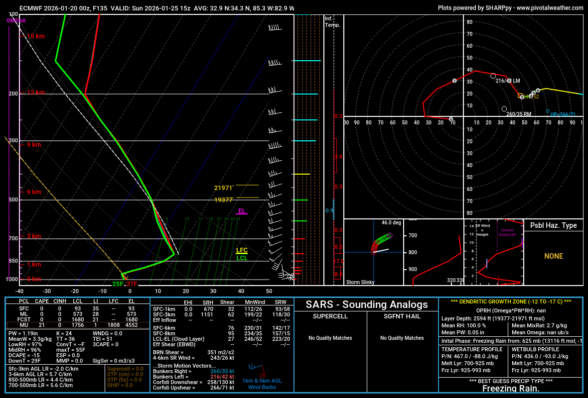
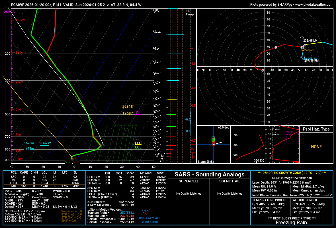
I do think there's a logical limit to how far north the mixing is based on how strong the Arctic high is initially. Someone is going to get absolutely hammered with ice though if the SE ridge amplifies significantly.
-
If the dynamics get super charged by that northern stream wave, it increases the chances of a 2'+ jackpot for someone, if you want it in real weenie speak.
-
That northern stream wave/lobe of the PV continues to get stronger with each passing Euro run. Not sure if that continues, but it absolutely raises the ceiling on this if it phases. I should probably add that it also may induce more mixing concerns for areas further south, as it would lead to SE ridge amplification and WAA aloft.
-
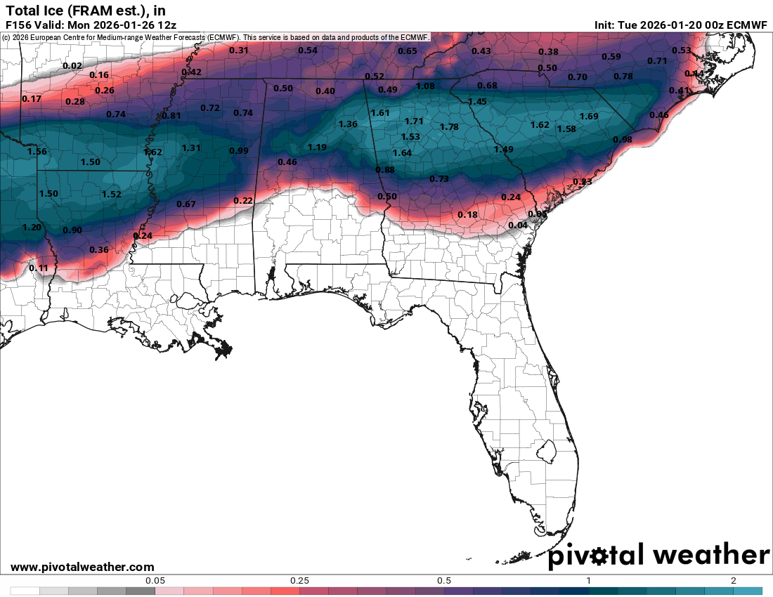
That run is an absolute disaster for the Carolinas ice wise, particularly upstate SC, Charlotte, and most of the Triad/Research Triangle metros.
-
GFS is very heavily suppressed. That's the number one failure mode with this storm by far with a near record strength Arctic high to the north.
-
I'm telling you all what you don't want with this storm, and it's this centered over the Atlanta metro via the 00z Euro. Do not be in the ZR swath with this thing.
-
That is absolutely not sleet via the 00z Euro in the Atlanta metro during the peak of the event.

-
1.5+" of ice for much of the Atlanta metro/N GA thanks to an extremely strong CAD wedge. This is a nightmare.

-
Absolutely historic, devastating ice storm on that 00z Euro run for a wide swath of the Southeast. You do not want that verifying.
-
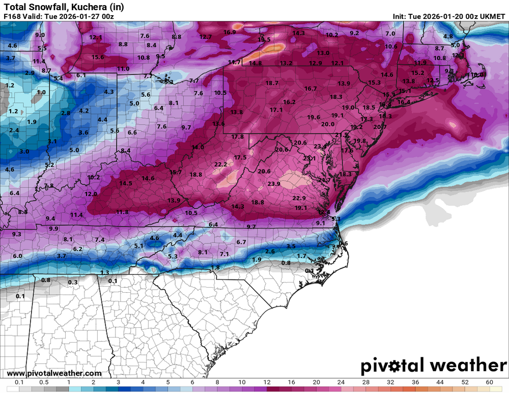
Yeah, that UK is pretty damn ridiculous on the Kuchera.