

LongBeachSurfFreak
-
Posts
9,524 -
Joined
-
Last visited
Content Type
Profiles
Blogs
Forums
American Weather
Media Demo
Store
Gallery
Everything posted by LongBeachSurfFreak
-
I was just checking the area likely to get the largest surge on google maps. This has to be the least developed coastal area on the entire east/gulf coast. For once we get to watch a storm explode and not feel that back of the mind guilt about loss of life. Even inland it’s going to pass between Tallahassee and Gainesville. It wouldn’t surprise me if monetary losses are larger in the Carolina’s then Florida with this one.
-
Very true, this setup in July would have meant a long lasting heat wave with shots at 100.
-
Yeah I was really surprised to see the amounts removed from the forecast today. Meaning, we will be lucky to get a few showers.
-
Based on its relatively small size that should solidly put it at 160, though based on NHC forecasting 155, I bet they go with 155mph.
-
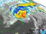
Looks like a low end cat 5 to me. Hopefully recon gets there in time before a EWR happens. That’s about text book right there, nice stadium effect.
-
Surf at area beaches will be pretty large Wednesday and Thursday from Franklin. If you want to witness the power of the ocean and some washovers and beach erosion it’s worth heading to the beach those days! Franklin now forecast to 155mph while sitting due south of us. One of the strongest storms ever to pass between Bermuda and NC.
-
Exactly, fetch is very important. Though with the track being north for a two day period there will be captured fetch in the eastern quadrant that will affect south facing beaches in the north east.
-
Franklin had that text book look right now. Despite its smallish size, it will produce the largest, most dangerous August swell for the east coast since Bill 08. Beach erosion, wash overs and deadly rip currents likely up and down the east coast.
-
Fantastic wave generating storm. The amazing thing is, just as the Franklin swell fades away we are going to get another burst of swell from Idalia.
-
Yeah Franklin is a small storm. That will limit swell production despite a great track for NE waves. It will still be a solid swell but peaking in the 8-10’ range rather then 12-18 in the greats like Bill august 08.
-
 Exactly. I think I stomped over 1000 today alone on the uws. They are here we are stuck with them. Bring on the waves from Franklin.
 -
Still sheared to the south, agreed, though once out of the shear it’s bombs away. Just need to get a solid core to form
-
Congrats on the move. Your definitely still part of this forum and will always be appreciated!
-
Makes allot of sense, lots of effective shear. meanwhile poring sheet drizzle on the uws put an end to my day working outside.
-
Pretty cool if you look at the current radar, lower level returns from the south passing through upper level returns from the north west
-
Roll the dice enough times. I think some of the pre 1850 storms my have been misclassified as hurricanes. Things like derechos and hybrid/nor’easters. Not all but some. The real reoccurrence rate of a landfalling hurricane in the north east may be a little bit lower than what’s currently suggested. Still, there were some that were obviously majors like the great colonial, 1815 and of course 38. That’s the one I think we are really do for. Not as much weakening inducing cooler water protecting Long Island and New England anymore. So it’s just a matter of when. meanwhile, Franklin is looking excellent for a medium to large swell for early next week. That period where it’s moving north will produce some captured fetch.
-
Incredible! Watching an eyeball form live on radar. Probably a decent but stronger than the estimated 50mph 998 official landfall. Probably more like 65mph 992.
-
That’s just the way we like them, close enough to limit swell decay but not so close that we get into the circulation and end up with winds too strong. I’ll never forget Gustav 9/11/02. 10-12’ swells on Long Island in the morning with light winds turned to 50-60mph offshore winds by mid morning and poof the swell was gone. Extreme example but shows what happens when you get too close.
-
2023 Atlantic Hurricane season
LongBeachSurfFreak replied to Stormchaserchuck1's topic in Tropical Headquarters
If the shear does relax and the Atmosphere looses that SAL, then yeah, it’s game time. Right in time for peak climo, so with OHC at record highs basin wide…. Watch out -
2023 Atlantic Hurricane season
LongBeachSurfFreak replied to Stormchaserchuck1's topic in Tropical Headquarters
Pretty interesting that Gert is still named because it has a couple thunderstorms hanging on well east of a mess of a low level swirl. Yet Emily has a textbook low level swirl and lost its name. For all intents and purposes Emily is a better defined low and would have been a major hurricane if it weren’t for strong shear. -
2023 Atlantic Hurricane season
LongBeachSurfFreak replied to Stormchaserchuck1's topic in Tropical Headquarters
I wouldn’t write off Franklin for a major. Plenty of warm water in its later life, and that area loves to produce majors historically -
Exactly, I feel like there is too much focus on winds and the structure of the storm. None of that matters when you’re pushing precipitable water values near 3” over serious mountains. There really aren’t any historical precedents for this. Except maybe some typhoons in places like the Philippines. There are going to be incredible videos of arroyos turning into raging torrents
-
.00” at the wantagh meso. Impressive how tight the gradient was right along the south shore. meanwhile it took me an extra hour to get to work on the uws, driving through a flooded out cross island
-
Similar. Except the area of cold water (buffer) is much larger and significantly colder. Speaking of which we are losing our buffer and will eventually (by the end of the century likely) be prime major hurricane coastline. Without the need for fast speed out of the Gulf Stream to limit weakening.
-
You would need a cat 5 at the latitude of Cabo, that gets sling shot north north east at, at least 40knots to get anything resembling a real cane. It’s possible but extremely unlikely. Low end trop storm is generally about the strongest possible given the hundreds of miles of cool water along the Baja, which is often even colder than in socal itself.


