LongBeachSurfFreak
-
Posts
9,479 -
Joined
-
Last visited
Content Type
Profiles
Blogs
Forums
American Weather
Media Demo
Store
Gallery
Everything posted by LongBeachSurfFreak
-

2025 Atlantic Hurricane Season
LongBeachSurfFreak replied to BarryStantonGBP's topic in Tropical Headquarters
This image really puts things in perspective of how small this tropical storm is in comparison with the Epac system. Atlantic really struggling to produce anything meaningful while adding named storms.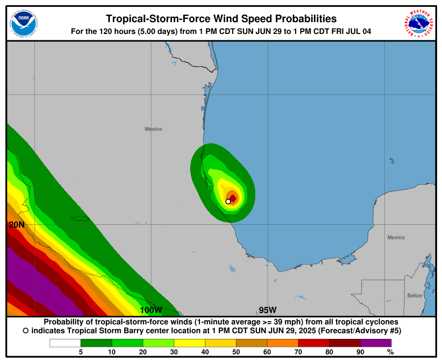
-
2025 Atlantic Hurricane Season
LongBeachSurfFreak replied to BarryStantonGBP's topic in Tropical Headquarters
Exactly. This has major real world implications. Especially in the age of marine heatwaves and unprecedented RI. The way people react to a cat 2 and a cat 5 might mean not evacuating and potentially deaths. -
June 2025 discussion-obs: Summerlike
LongBeachSurfFreak replied to wdrag's topic in New York City Metro
So we should abandon cities and destroy rural areas and turn them into endless suburbs. The reality from the perspective of the planet is the EXACT OPPOSITE. We want more people in tightly packed cities and less McMansions on quarter acre lots. Upstate NY reforesting over the last century is a great example of what we want to see. -
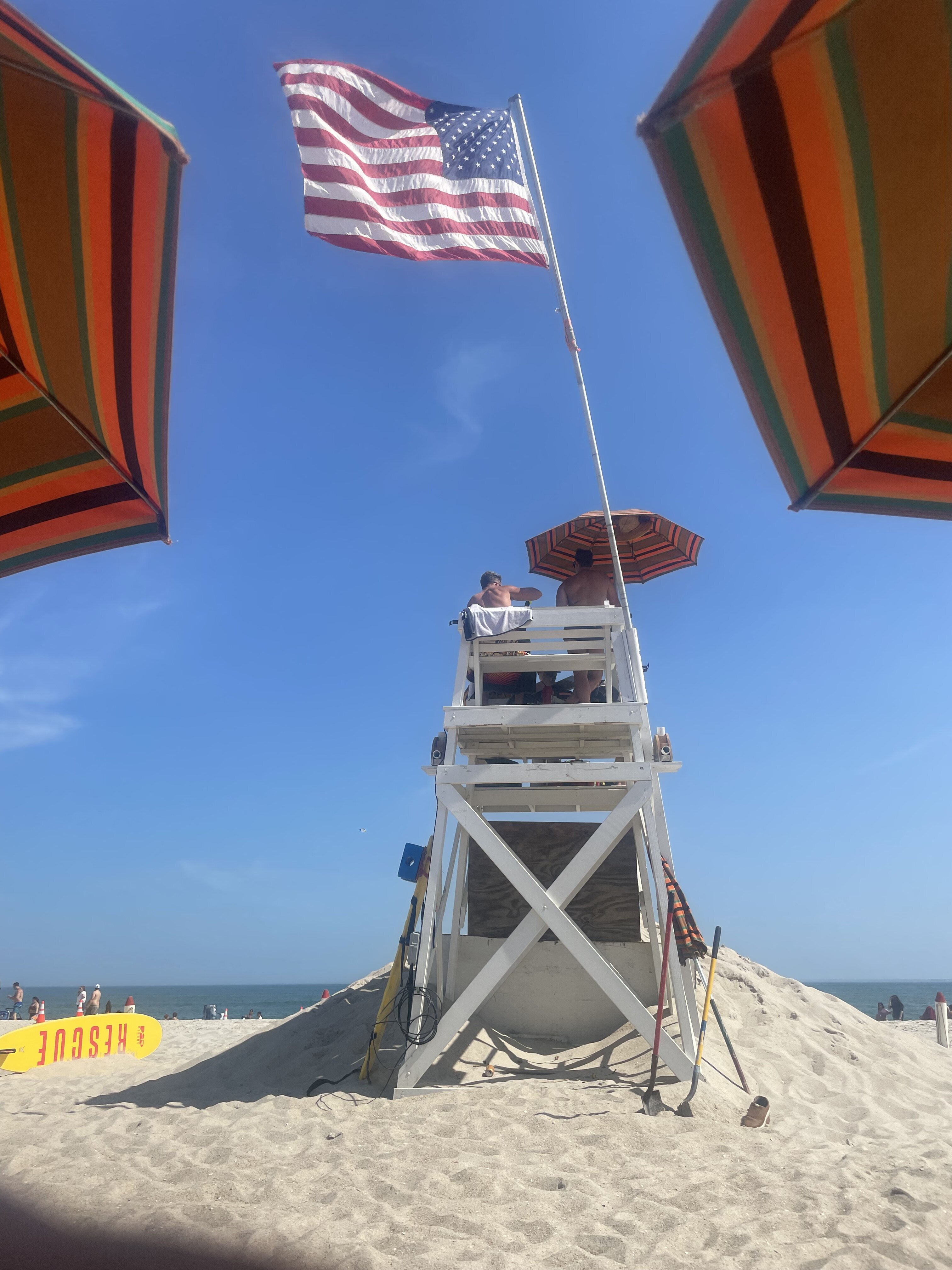
Missed jones to the east and west. We had a possible shark attack today I’m sure it’s all over the media
-
Really starting to drop off at JB. Should swing around shortly and the temp will shoot up from mid 80s to mid 90s right on the ocean. Tonight’s going be a steam bath.
-
There it is, fully kicking in now. Only a matter of time before it gets there.

-
Awesome thank you for that! It obviously has allot to do with the fact that it’s just in a green space.
-
Park 91 is a joke as usual. winds WSW now at jones beach. Just enough onshore component to make it bearable here
-
97 on the southern state just now on the truck thermometer.
-
Park and EWR look to have matched yesterdays lows.
-
June 2025 discussion-obs: Summerlike
LongBeachSurfFreak replied to wdrag's topic in New York City Metro
Yep, without an offshore wind it’s fine. It’s next to impossible to maintain an offshore flow the entire day when the water temp is in the 60s. -
June 2025 discussion-obs: Summerlike
LongBeachSurfFreak replied to wdrag's topic in New York City Metro
Yeah it’s honestly not that bad on the south shore right now. Tomorrow morning while the wind is NW should be the worst for the coast. -
Today’s not the day for record heat on the island. It’s always been about Tuesday.
-
Sea breeze is officially here at jones beach. Was dead calm 45 minutes ago. Temps already coming down
-
June 2025 discussion-obs: Summerlike
LongBeachSurfFreak replied to wdrag's topic in New York City Metro
It’s all going to come down to wind direction for the coast today. EWR is a lock for 100 coming of a low of 82. -
NYC 95 and EWR 110.
-
JFK has the best shot of setting an all time June record Tuesday. With compressional downslope heating. I’m not looking forward to 10000000 degree sand at the beach, it can get hot enough to cause 1st degree burns fast.
-
June 2025 discussion-obs: Summerlike
LongBeachSurfFreak replied to wdrag's topic in New York City Metro
Where climate change is a factor is in the strength and staying power of the ridge. If we hit 600dm that likely is directly attributable to CC. We can break that record and still not break temp records. JFK needs a wind vector of WNW to NW, for a daily record. The Park needs surrounding stations to be 105 to hit 100. So lots of little intricacies on a local level. -
Central & Eastern Pacific Thread
LongBeachSurfFreak replied to Windspeed's topic in Tropical Headquarters
Would have really gone to town if it had more time after the EWRC. -
June 2025 discussion-obs: Summerlike
LongBeachSurfFreak replied to wdrag's topic in New York City Metro
It was sub severe here. But close, gusts definitely at least in the 40s with small branches down. Best storm of the year for sure. -
June 2025 discussion-obs: Summerlike
LongBeachSurfFreak replied to wdrag's topic in New York City Metro
That bow coming up from central Jersey may be the real deal for the south shore -
June 2025 discussion-obs: Summerlike
LongBeachSurfFreak replied to wdrag's topic in New York City Metro
Just closed the beach for lighting at jones. Meanwhile it’s sunny and will not rain a drop. South Jersey severe looks primed and ready with the line in PA. -
June 2025 discussion-obs: Summerlike
LongBeachSurfFreak replied to wdrag's topic in New York City Metro
The PHL radar was in clear air mode and it looked like stationary yellows and reds over the city. The Upton radar was down at the time. I watch the radars all the time and have never seen incorrect returns like that. -
June 2025 discussion-obs: Summerlike
LongBeachSurfFreak replied to wdrag's topic in New York City Metro
Flash flood event building over the city and western Long Island right now. Stationary convection firing. Could seed the atmosphere for later today. Might actually be a radar issue. -
Central & Eastern Pacific Thread
LongBeachSurfFreak replied to Windspeed's topic in Tropical Headquarters
Pin hole eyes can really produce some high end winds relative to pressure. Also the cdo is rather small too.