donsutherland1
-
Posts
24,194 -
Joined
Content Type
Profiles
Blogs
Forums
American Weather
Media Demo
Store
Gallery
Everything posted by donsutherland1
-
Ophelia will bring a significant rainfall to the region late tonight into Sunday. Eastern sections will be in line for the heaviest rainfall. A general 1"-3" of rainfall is likely. Local amounts of 4" are possible. Gusty winds and rough surf will impact the Jersey Shore, Connecticut Shore, and Long Island. Coastal flooding is likely at high tide. Temperatures will hold mainly in the upper 50s and lower 60s tomorrow and lower to middle 60s on Sunday. In the wake of the storm, cooler than normal weather will continue through much of the remainder of the month. As a result, September now looks to wind up somewhat warmer than normal, but noticeably cooler than had been the case on the guidance even a few days ago. In the medium and longer range, a warmer than normal pattern could still develop in eastern North America as September concludes and October begins. The ENSO Region 1+2 anomaly was +2.9°C and the Region 3.4 anomaly was +1.6°C for the week centered around September 6. For the past six weeks, the ENSO Region 1+2 anomaly has averaged +3.20°C and the ENSO Region 3.4 anomaly has averaged +1.38°C. El Niño conditions will likely continue to strengthen into the fall with the current East-based event transitioning to a basinwide El Niño for the upcoming winter. The SOI was -19.37 today. The preliminary Arctic Oscillation (AO) was -0.223 today. Based on sensitivity analysis applied to the latest guidance, there is an implied 63% probability that New York City will have a warmer than normal September (1991-2020 normal). September will likely finish with a mean temperature near 69.9° (0.7° above normal).
-
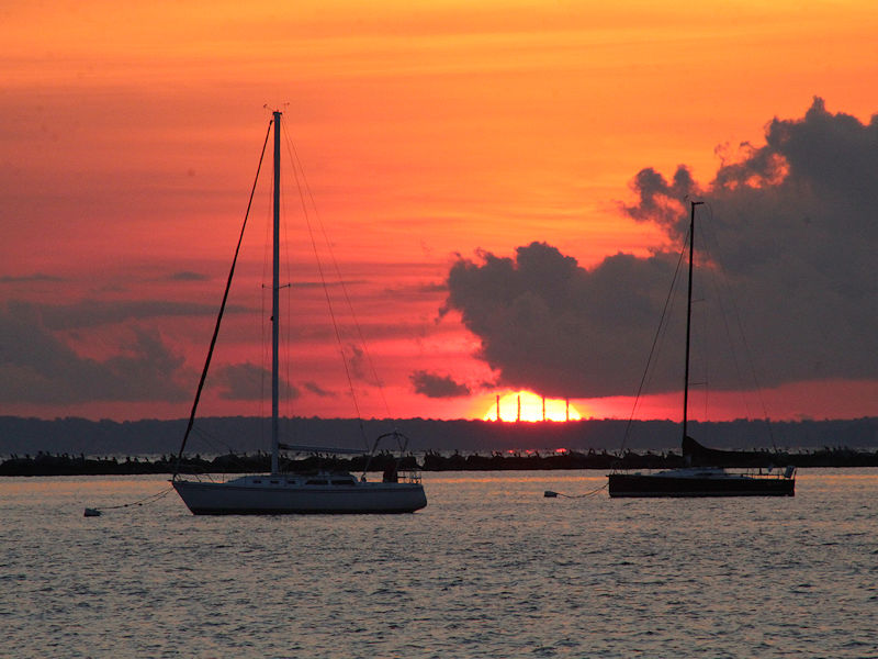
Three photos of this morning’s sunrise.


-
It is. It illustrates how dramatically things can change.
-
Dry weather will prevail through tomorrow. Temperatures will generally top out in the upper 60s and lower 70s in much of the region tomorrow, as clouds begin to increase. A storm, likely subtropical in nature, will likely bring a significant rainfall to the region late Friday night into Sunday. Eastern sections will be in line for the heaviest rainfall. A general 1"-3" of rain is likely. Gusty winds and some coastal flooding will impact the Jersey Shore, Connecticut Shore, and Long Island. Temperatures will hold mainly in the upper 50s and lower 60s during the weekend. In the wake of the storm, a period of cooler than normal weather will continue through much of the remainder of the month. As a result, September now looks to wind up somewhat warmer than normal, but noticeably cooler than had been the case on the guidance even a few days ago. In the medium and longer range, a warmer than normal pattern could still develop in eastern North America as September concludes or October begins. The ENSO Region 1+2 anomaly was +2.9°C and the Region 3.4 anomaly was +1.6°C for the week centered around September 6. For the past six weeks, the ENSO Region 1+2 anomaly has averaged +3.20°C and the ENSO Region 3.4 anomaly has averaged +1.38°C. El Niño conditions will likely continue to strengthen into the fall with the current East-based event transitioning to a basinwide El Niño for the upcoming winter. The SOI was -26.14 today. The preliminary Arctic Oscillation (AO) was -0.122 today. Based on sensitivity analysis applied to the latest guidance, there is an implied 64% probability that New York City will have a warmer than normal September (1991-2020 normal). September will likely finish with a mean temperature near 70.0° (0.8° above normal).
-
Dry weather will prevail through the remainder of the week. Temperatures will generally top out in the lower 70s in much of the region. Nights will see readings in the 50s in New York City, Newark, and Philadelphia with 40s possible in some of the colder suburbs. Another storm will likely bring a significant rainfall to the region late Friday night into Sunday. Gusty winds and some coastal flooding are likely along the Jersey Shore, Connecticut Shore, and Long Island. In the medium and longer range, a warmer than normal pattern could develop in eastern North America as September concludes. The ENSO Region 1+2 anomaly was +2.9°C and the Region 3.4 anomaly was +1.6°C for the week centered around September 6. For the past six weeks, the ENSO Region 1+2 anomaly has averaged +3.20°C and the ENSO Region 3.4 anomaly has averaged +1.38°C. El Niño conditions will likely continue to strengthen into the fall with the current East-based event transitioning to a basinwide El Niño for the upcoming winter. The SOI was -26.14 today. The preliminary Arctic Oscillation (AO) was +0.121 today. On September 18 the MJO was not available. The September 17-adjusted amplitude was 1.591 (RMM). Based on sensitivity analysis applied to the latest guidance, there is an implied 74% probability that New York City will have a warmer than normal September (1991-2020 normal). September will likely finish with a mean temperature near 70.7° (1.5° above normal).
-
Dry weather will prevail through the remainder of the week. Temperatures will generally top out in the lower and middle 70s in much of the region. Nights will see readings in the 50s in New York City, Newark, and Philadelphia with 40s possible in some of the colder suburbs. Another storm could bring a significant rainfall to the region Saturday night into Sunday. In the medium and longer range, a warmer than normal pattern could develop in eastern North America as September concludes. The ENSO Region 1+2 anomaly was +2.9°C and the Region 3.4 anomaly was +1.6°C for the week centered around September 6. For the past six weeks, the ENSO Region 1+2 anomaly has averaged +3.20°C and the ENSO Region 3.4 anomaly has averaged +1.38°C. El Niño conditions will likely continue to strengthen into the fall with the current East-based event transitioning to a basinwide El Niño for the upcoming winter. The SOI was -25.67 today. The preliminary Arctic Oscillation (AO) was +0.206 today. On September 17 the MJO was in Phase 3 at an amplitude of 1.591 (RMM). The September 16-adjusted amplitude was 1.646 (RMM). Based on sensitivity analysis applied to the latest guidance, there is an implied 81% probability that New York City will have a warmer than normal September (1991-2020 normal). September will likely finish with a mean temperature near 71.0° (1.8° above normal).
-
A storm brought a soaking rain to the region late yesterday and today. Rainfall totals included: Bridgeport: 1.19" Islip: 1.32" New Haven: 0.93" New York City: 1.57" Newark: 1.35" Philadelphia: 1.11" Poughkeepsie: 2.08" Dry weather will prevail through the remainder of the week. Temperatures will generally top out in the middle 70s in much of the region. Another storm could bring a significant rainfall to the region Saturday night into Sunday. In the medium and longer range, a warmer than normal pattern could develop in eastern North America as September concludes. The ENSO Region 1+2 anomaly was +2.9°C and the Region 3.4 anomaly was +1.6°C for the week centered around September 6. For the past six weeks, the ENSO Region 1+2 anomaly has averaged +3.20°C and the ENSO Region 3.4 anomaly has averaged +1.38°C. El Niño conditions will likely continue to strengthen into the fall with the current East-based event transitioning to a basinwide El Niño for the upcoming winter. The SOI was -19.79 today. The preliminary Arctic Oscillation (AO) was -0.331 today. On September 16 the MJO was in Phase 3 at an amplitude of 1.591 (RMM). The September 15-adjusted amplitude was 1.474 (RMM). Based on sensitivity analysis applied to the latest guidance, there is an implied 83% probability that New York City will have a warmer than normal September (1991-2020 normal). September will likely finish with a mean temperature near 71.3° (2.1° above normal).
-
Occasional Thoughts on Climate Change
donsutherland1 replied to donsutherland1's topic in Climate Change
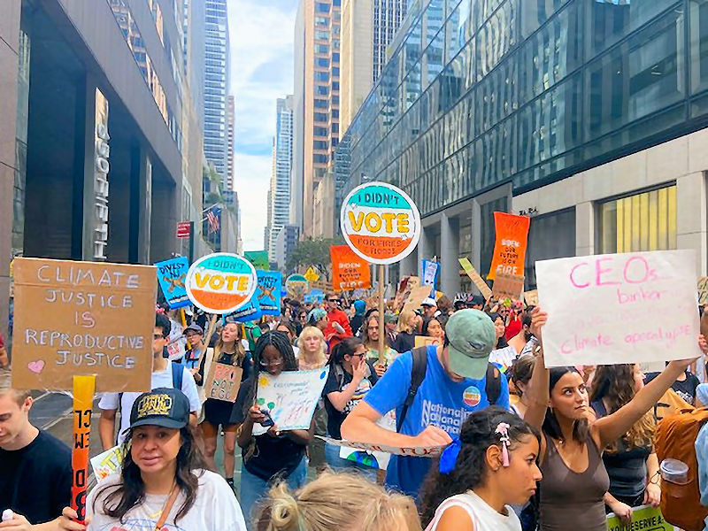
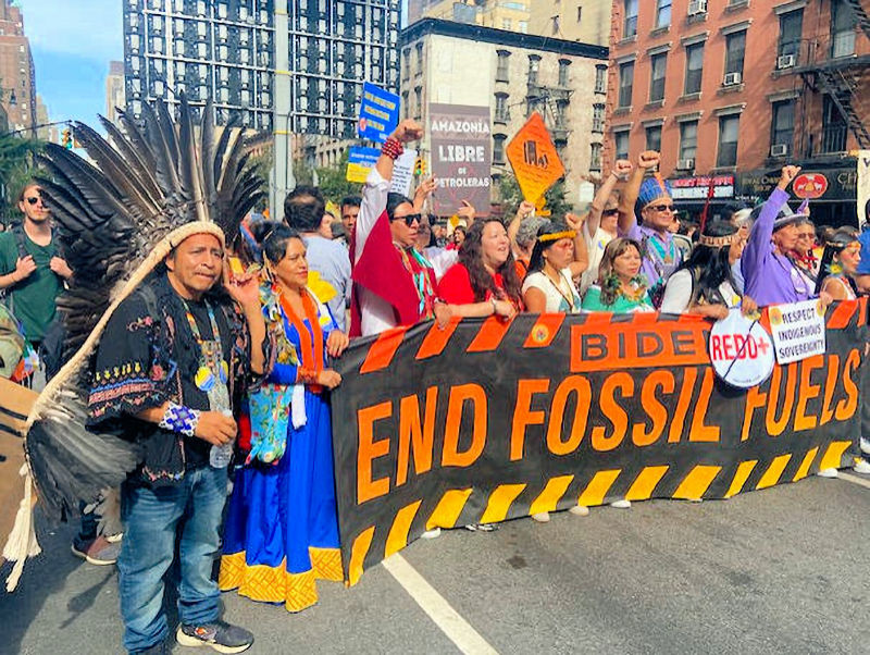
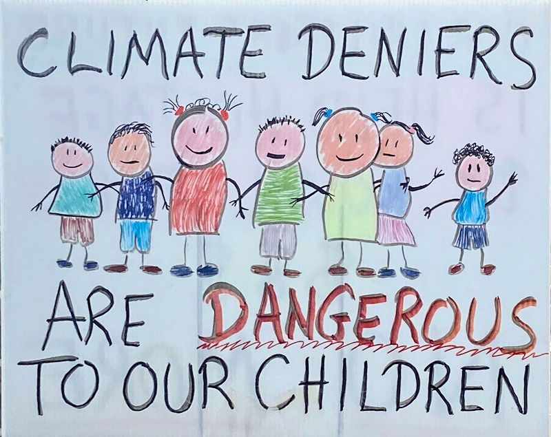
Four photos from the September 17, 2023 climate change march in New York City.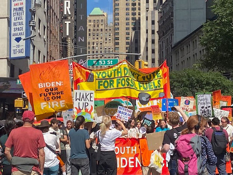
-
Rain will arrive tonight and continue through tomorrow. A general 0.50"-1.50" of rain is likely. Eastern sections will likely see the heaviest rain. In the medium and longer range, a warmer than normal pattern could develop in eastern North America. The ENSO Region 1+2 anomaly was +2.9°C and the Region 3.4 anomaly was +1.6°C for the week centered around September 6. For the past six weeks, the ENSO Region 1+2 anomaly has averaged +3.20°C and the ENSO Region 3.4 anomaly has averaged +1.38°C. El Niño conditions will likely continue to strengthen into the fall with the current East-based event transitioning to a basinwide El Niño for the upcoming winter. The SOI was -13.65 today. The preliminary Arctic Oscillation (AO) was -0.387 today. On September 14 the MJO was in Phase 3 at an amplitude of 1.527 (RMM). The September 13-adjusted amplitude was 1.663 (RMM). Based on sensitivity analysis applied to the latest guidance, there is an implied 80% probability that New York City will have a warmer than normal September (1991-2020 normal). September will likely finish with a mean temperature near 71.4° (2.2° above normal).
-
Wow. Those were probably the same clouds from another location.
-
Tomorrow will be fair and pleasant. However, rain will arrive on Monday and continue into Tuesday. A general 0.50"-1.50" of rain is likely. In the medium and longer range, a warmer than normal pattern could develop in eastern North America. The ENSO Region 1+2 anomaly was +2.9°C and the Region 3.4 anomaly was +1.6°C for the week centered around September 6. For the past six weeks, the ENSO Region 1+2 anomaly has averaged +3.20°C and the ENSO Region 3.4 anomaly has averaged +1.38°C. El Niño conditions will likely continue to strengthen into the fall with the current East-based event transitioning to a basinwide El Niño for the upcoming winter. The SOI was -13.19 today. The preliminary Arctic Oscillation (AO) was -0.786 today. On September 13 the MJO was in Phase 4 at an amplitude of 1.663 (RMM). The September 12-adjusted amplitude was 1.721 (RMM). Based on sensitivity analysis applied to the latest guidance, there is an implied 81% probability that New York City will have a warmer than normal September (1991-2020 normal). September will likely finish with a mean temperature near 71.5° (2.3° above normal).
-
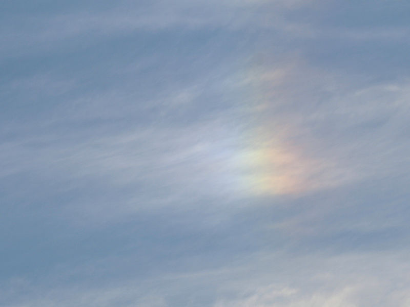
Cirrus clouds on the fringes of Post-Tropical Storm Lee.


-
After a chilly start, temperatures rose into the upper 60s and lower 70s across much of the region. Tomorrow will then be fair and continued cool. Much of the region will likely see temperatures top out in the lower to middle 70s. In the medium and longer range, a warmer than normal pattern could develop in eastern North America. The ENSO Region 1+2 anomaly was +2.9°C and the Region 3.4 anomaly was +1.6°C for the week centered around September 6. For the past six weeks, the ENSO Region 1+2 anomaly has averaged +3.20°C and the ENSO Region 3.4 anomaly has averaged +1.38°C. El Niño conditions will likely continue to strengthen into the fall with the current East-based event transitioning to a basinwide El Niño for the upcoming winter. The SOI was -16.99 today. The preliminary Arctic Oscillation (AO) was -0.613 today. On September 12 the MJO was in Phase 4 at an amplitude of 1.721 (RMM). The September 11-adjusted amplitude was 2.188 (RMM). Based on sensitivity analysis applied to the latest guidance, there is an implied 80% probability that New York City will have a warmer than normal September (1991-2020 normal). September will likely finish with a mean temperature near 71.5° (2.3° above normal).
-
Tonight could be the coolest night so far in many areas in the northern Mid-Atlantic area. Readings in New York City could dip below 60° for the first time this fall. Temperatures in the suburbs will fall into the lower and middle 50s. Some of the more distant or colder suburbs could see temperatures drop into the 40s. Tomorrow will then be fair but unseasonably cool. Much of the region will likely see temperatures top out in the upper 60s and lower 70s. Hurricane Lee will streadily move toward North American landfall. The guidance favors landfall in New Brunswick, but landfall along the Maine or Nova Scotia coast cannot be ruled out. Eastern Long Island and eastern New England could some periods of heavy rain and gusty winds as Lee passes offshore. The ENSO Region 1+2 anomaly was +2.9°C and the Region 3.4 anomaly was +1.6°C for the week centered around September 6. For the past six weeks, the ENSO Region 1+2 anomaly has averaged +3.20°C and the ENSO Region 3.4 anomaly has averaged +1.38°C. El Niño conditions will likely continue to strengthen into the fall with the current East-based event transitioning to a basinwide El Niño for the upcoming winter. The SOI was -13.37 today. The preliminary Arctic Oscillation (AO) was +0.113 today. On September 12 the MJO was not available. The September 11-adjusted amplitude was 2.188 (RMM). Based on sensitivity analysis applied to the latest guidance, there is an implied 81% probability that New York City will have a warmer than normal September (1991-2020 normal). September will likely finish with a mean temperature near 71.6° (2.4° above normal).
-
In the wake of a cold frontal passage, some of the coolest temperatures so far this fall are likely. Most areas outside of New York City and Philadelphia will see lows in the 50s and highs in the 70s through Friday. New York City could even experience its first sub-60° low temperature of this fall. Hurricane Lee will remain a powerful storm over the next several days. The guidance favors landfall in New Brunswick, but landfall along the Maine or Nova Scotia coast cannot be ruled out. Eastern Long Island and eastern New England could some periods of heavy rain and gusty winds as Lee passes offshore. The ENSO Region 1+2 anomaly was +2.9°C and the Region 3.4 anomaly was +1.6°C for the week centered around September 6. For the past six weeks, the ENSO Region 1+2 anomaly has averaged +3.20°C and the ENSO Region 3.4 anomaly has averaged +1.38°C. El Niño conditions will likely continue to strengthen into the fall with the current East-based event transitioning to a basinwide El Niño for the upcoming winter. The SOI was -15.63 today. The preliminary Arctic Oscillation (AO) was +0.502 today. On September 11 the MJO was in Phase 4 at an amplitude of 2.188 (RMM). The September 10-adjusted amplitude was 2.213 (RMM). Based on sensitivity analysis applied to the latest guidance, there is an implied 77% probability that New York City will have a warmer than normal September (1991-2020 normal). September will likely finish with a mean temperature near 71.5° (2.3° above normal).
-
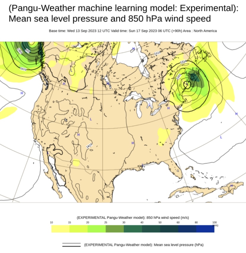
Here’s the latest (Pangu):

-
A strong cold front will cross the region tomorrow with some heavy thunderstorms. Parts of the region could experience street and highway flooding as excessive rainfall amounts are possible. Behind the front, some of the coolest temperatures so far this fall are likely. Hurricane Lee will remain a powerful storm over the next several days. Atlantic Canada faces the highest risk of landfall, but New England landfall still cannot completely be ruled out. The ECMWF offers the farthest west track on the operational guidance. Eastern Long Island and eastern New England could experience heavy rains and high winds as Lee passes offshore. The ENSO Region 1+2 anomaly was +2.9°C and the Region 3.4 anomaly was +1.6°C for the week centered around September 6. For the past six weeks, the ENSO Region 1+2 anomaly has averaged +3.20°C and the ENSO Region 3.4 anomaly has averaged +1.38°C. El Niño conditions will likely continue to strengthen into the fall with the current East-based event transitioning to a basinwide El Niño for the upcoming winter. The SOI was -24.06 today. The preliminary Arctic Oscillation (AO) was +0.438 today. On September 10 the MJO was in Phase 4 at an amplitude of 2.211 (RMM). The September 9-adjusted amplitude was 2.506 (RMM). Based on sensitivity analysis applied to the latest guidance, there is an implied 78% probability that New York City will have a warmer than normal September (1991-2020 normal). September will likely finish with a mean temperature near 71.5° (2.3° above normal).
-
Slow-moving thunderstorms brought torrential downpours to parts of the region producing flash flooding. Greenwich, NJ picked up 5.00" of rain this afternoon. Tomorrow will be a quieter day. It will be partly to mostly sunny and pleasant. Only a few isolated showers or thundershowers are possible. Most of the region should be dry. A strong cold front will cross the region on Wednesday with some heavy thunderstorms. Some street and highway flooding is possible. Behind it, parts of the region could see their coolest temperatures so far this fall. Hurricane Lee will remain a powerful storm over the next several days. Atlantic Canada faces the highest risk of landfall, but New England landfall still cannot completely be ruled out. Moreover, parts of eastern New England could experience heavy rains and high winds as Lee passes offshore. The ENSO Region 1+2 anomaly was +2.9°C and the Region 3.4 anomaly was +1.6°C for the week centered around September 6. For the past six weeks, the ENSO Region 1+2 anomaly has averaged +3.20°C and the ENSO Region 3.4 anomaly has averaged +1.38°C. El Niño conditions will likely continue to strengthen into the fall with the current East-based event transitioning to a basinwide El Niño for the upcoming winter. The SOI was -27.45 today. The preliminary Arctic Oscillation (AO) was +0.320 today. On September 9 the MJO was in Phase 4 at an amplitude of 2.507 (RMM). The September 8-adjusted amplitude was 2.511 (RMM). Based on sensitivity analysis applied to the latest guidance, there is an implied 77% probability that New York City will have a warmer than normal September (1991-2020 normal). September will likely finish with a mean temperature near 71.5° (2.3° above normal).
-
A heavy thunderstorm is ongoing in the Bronx.
-
Occasional Thoughts on Climate Change
donsutherland1 replied to donsutherland1's topic in Climate Change
Yes. Unfortunately, some of those earlier records likely overstate the high temperatures. And yet, those records are now being surpassed. -
Some showers and thundershowers will be possible tomorrow. Readings will top out in the upper 70s to perhaps low 80s. A strong cold front will cross the region on Wednesday with some thunderstorms. Behind it, parts of the region could see their coolest temperatures so far this fall. Hurricane Lee will remain a powerful storm over the next several days. Atlantic Canada faces the highest risk of landfall, but New England landfall still cannot completely be ruled out. The picture will clear in coming days. The ECMWF weeklies had forecast temperatures to average above to much above normal across the region for the September 4-11 period. That forecast is verifying with the ongoing heatwave. September has increasingly become an extension of summer in parts of the Northeast. Since 2000, almost half of all years (48%) have had a monthly mean temperature of 70° or above in New York City. Prior to 2000, just 20% of Septembers had mean temperatures of 70° or above. The ENSO Region 1+2 anomaly was +3.2°C and the Region 3.4 anomaly was +1.6°C for the week centered around August 30. For the past six weeks, the ENSO Region 1+2 anomaly has averaged +3.22°C and the ENSO Region 3.4 anomaly has averaged +1.32°C. El Niño conditions will likely continue to strengthen into the fall with the current East-based event transitioning to a basinwide El Niño for the upcoming winter. The SOI was -21.57 today. The preliminary Arctic Oscillation (AO) was +0.283 today. On September 8 the MJO was in Phase 3 at an amplitude of 2.509 (RMM). The September 7-adjusted amplitude was 2.666 (RMM). Based on sensitivity analysis applied to the latest guidance, there is an implied 74% probability that New York City will have a warmer than normal September (1991-2020 normal). September will likely finish with a mean temperature near 71.5° (2.3° above normal).
-
A cooling trend got underway today. Nevertheless, Philadelphia topped out at 91°. That was its 7th consecutive 90° or above day. That set a new September record. The previous record was set during Septembr 5-10, 1884 and tied on September 1-6, 1898 and September 9-14, 1931. The cooling trend will continue into early next week. In addition, showers and thundershowers will be possible tomorrow and Monday. Hurricane Lee will remain a powerful storm. The ensembles favor recurvature, but the outcome is not yet cast in stone. An area running from eastern New England to Atlantic Canada could face the highest risk of landfall should Lee fail to recurve away from the North American continent. The picture should begin to clear in coming days. The ECMWF weeklies had forecast temperatures to average above to much above normal across the region for the September 4-11 period. That forecast is verifying with the ongoing heatwave. September has increasingly become an extension of summer in parts of the Northeast. Since 2000, almost half of all years (48%) have had a monthly mean temperature of 70° or above in New York City. Prior to 2000, just 20% of Septembers had mean temperatures of 70° or above. The ENSO Region 1+2 anomaly was +3.2°C and the Region 3.4 anomaly was +1.6°C for the week centered around August 30. For the past six weeks, the ENSO Region 1+2 anomaly has averaged +3.22°C and the ENSO Region 3.4 anomaly has averaged +1.32°C. El Niño conditions will likely continue to strengthen into the fall with the current East-based event transitioning to a basinwide El Niño for the upcoming winter. The SOI was -19.67 today. The preliminary Arctic Oscillation (AO) was +0.527 today. On September 7 the MJO was in Phase 3 at an amplitude of 2.665 (RMM). The September 6-djusted amplitude was 2.560 (RMM). Based on sensitivity analysis applied to the latest guidance, there is an implied 76% probability that New York City will have a warmer than normal September (1991-2020 normal). September will likely finish with a mean temperature near 71.6° (2.4° above normal).
-
Parts of the region, including New York City, reached 90° today. However, cooler weather will be moving into the region. That cooling trend will continue through the weekend and into early next week. In addition, showers and thundershowers will be possible tomorrow and Sunday. Hurricane Lee will remain a powerful storm. The ensembles favor recurvature, but the outcome is not yet cast in stone. An area running from eastern New England to Atlantic Canada could face the highest risk of landfall should Lee fail to recurve away from the North American continent. The picture should begin to clear during the weekend into early next week. The ECMWF weeklies had forecast temperatures to average above to much above normal across the region for the September 4-11 period. That forecast is verifying with the ongoing heatwave. September has increasingly become an extension of summer in parts of the Northeast. Since 2000, almost half of all years (48%) have had a monthly mean temperature of 70° or above in New York City. Prior to 2000, just 20% of Septembers had mean temperatures of 70° or above. The ENSO Region 1+2 anomaly was +3.2°C and the Region 3.4 anomaly was +1.6°C for the week centered around August 30. For the past six weeks, the ENSO Region 1+2 anomaly has averaged +3.22°C and the ENSO Region 3.4 anomaly has averaged +1.32°C. El Niño conditions will likely continue to strengthen into the fall with the current East-based event transitioning to a basinwide El Niño for the upcoming winter. The SOI was -3.03 today. The preliminary Arctic Oscillation (AO) was +0.934 today. On September 6 the MJO was in Phase 3 at an amplitude of 2.602 (RMM). The September 5-djusted amplitude was 2.200 (RMM). Based on sensitivity analysis applied to the latest guidance, there is an implied 76% probability that New York City will have a warmer than normal September (1991-2020 normal). September will likely finish with a mean temperature near 71.6° (2.4° above normal).
-
Today was another day of extreme heat in parts of the East. Highs included: Albany: 93° Allentown: 92° (old record: 91°, 1985, 2015 and 2016) Atlantic City: 93° Baltimore: 98° (first September heatwave with 5 or more 98° days) Boston: 93° Bridgeport: 92° (old record: 91°, 1983) Concord: 93° Harrisburg: 94° Hartford: 95° (old record: 93°, 2007 and 2015) Islip: 92° (tied record set in 1998) New Haven: 95° (old record: 85°, 2015) ***New September Record*** New York City-Central Park: 93° New York City-JFK Airport: 92° New York City-LaGuardia Airport: 96° (old record: 90°, 1945 and 2015) Norfolk: 96° Philadelphia: 97° Providence: 92° Richmond: 100° ***2nd 100° high this month for the first time since 1954*** Sterling, VA: 97° (old record: 95°, 1983 and 1985) Washington, DC: 98° Wilmington, DE: 93° Worcester: 90° (tied record set in 1901 and tied in 1945) A cooling trend should commence tomorrow and continue through the weekend. Dangerous Hurricane Lee will likely grow into a Category 5 storm tonight or tomorrow. The ensembles favor recurvature, but the outcome is not yet cast in stone. An area running from eastern New England to Atlantic Canada could face the highest risk of landfall should Lee fail to recurve away from the North American continent. The ECMWF weeklies had forecast temperatures to average above to much above normal across the region for the September 4-11 period. That forecast is verifying with the ongoing heatwave. September has increasingly become an extension of summer in parts of the Northeast. Since 2000, almost half of all years (48%) have had a monthly mean temperature of 70° or above in New York City. Prior to 2000, just 20% of Septembers had mean temperatures of 70° or above. The ENSO Region 1+2 anomaly was +3.2°C and the Region 3.4 anomaly was +1.6°C for the week centered around August 30. For the past six weeks, the ENSO Region 1+2 anomaly has averaged +3.22°C and the ENSO Region 3.4 anomaly has averaged +1.32°C. El Niño conditions will likely continue to strengthen into the fall with the current East-based event transitioning to a basinwide El Niño for the upcoming winter. The SOI was -3.03 today. The preliminary Arctic Oscillation (AO) was +0.706 today. On September 4 he MJO was in Phase 3 at an amplitude of 1.585 (RMM). The September 3-djusted amplitude was 1.091 (RMM). Based on sensitivity analysis applied to the latest guidance, there is an implied 73% probability that New York City will have a warmer than normal September (1991-2020 normal). September will likely finish with a mean temperature near 71.5° (2.3° above normal).
-
This morning's low temperature at LaGuardia Airport was 80°. If that low holds, it would be the latest 80° or above low on record for the New York City area (Central Park, JFK Airport, or LaGuardia Airport). The record is September 4, 2018 at LaGuardia Airport.