donsutherland1
-
Posts
24,194 -
Joined
Content Type
Profiles
Blogs
Forums
American Weather
Media Demo
Store
Gallery
Everything posted by donsutherland1
-
The first half of December looks relatively dry. It could be tough to get to 55”.
-
A cold front will move across the region tomorrow after a storm brings a general 1.00"-2.00" rainfall with some locally higher amounts overnight. Ahead of the frontal passage, temperatures will likely soar into the middle and upper 50s. A few places will likely exceed 60°. New York City's annual precipitation, which stood at 49.18" as of 8:39 pm, will surge past 50.00". Years with 50.00" or precipitation have increased dramatically since the City's climate became abruptly wetter in 1972. The frequency of 50.00" or above years is as follows: 1869-1971: Once every 7.9 years 1972-2023*: Once every 2.3 years Since 2000*: Once every 1.8 years *Includes 2023 as a 50.00" year. 2023 currently has 49.70". No year had less than 0.30" from November 19-December 31. The record least precipitation during that timeframe was 0.67" in 1955. Following the storm and frontal passage, somewhat colder air will arrive. Thanksgiving Day will be blustery and cooler, but not harsh. Highs should reach the upper 40s and lower 50s. An even colder air mass should arrive late in the week. Friday night or Saturday morning will likely see New York City experience its first freeze of the season. The remainder of November will likely be generally cooler than normal. However, no Arctic blasts appear likely. The ENSO Region 1+2 anomaly was +2.0°C and the Region 3.4 anomaly was +1.9°C for the week centered around November 15. For the past six weeks, the ENSO Region 1+2 anomaly has averaged +2.27°C and the ENSO Region 3.4 anomaly has averaged +1.70°C. El Niño conditions will likely continue to strengthen into the early winter as the current East-based event completes its evolution into a basinwide El Niño. Currently, 2023 is in uncharted territory as far as the ENSO Region 3.4 anomaly and PDO are concerned. The October ENSO Region 3.4 anomaly was +1.59°C while the PDO was -1.71. Prior to 2023, the lowest October PDO when the ENSO Region 3.4 anomaly was +1.00°C or above was -0.36 in 1965. Should the ENSO Region 1+2 and 3.4 anomalies remain at or above +1.00°C in December, which is likely, and should the PDO remain negative, there is a single past case (1950-2022) with similar conditions: December 1972. The SOI was -18.07 today. The preliminary Arctic Oscillation (AO) was +0.535 today. On November 19 the MJO was in Phase 8 at an amplitude of 1.564 (RMM). The November 18-adjusted amplitude was 1.507 (RMM). Based on sensitivity analysis applied to the latest guidance, there is an implied 87% probability that New York City will have a cooler than normal November (1991-2020 normal). November will likely finish with a mean temperature near 46.2° (1.8° below normal). That would be New York City's coldest November since November 2019.
-
Tomorrow will be increasingly cloudy and somewhat milder. Showers could arrive late in the day or during the evening. Temperatures will generally top out in the upper 40s and lower 50s. A strong cold front will move across the region Tuesday night into Wednesday. A storm along the front will bring a general 1.00"-2.00" rainfall with some locally higher amounts. New York City's annual precipitation will surge past 50.00". Years with 50.00" or precipitation have increased dramatically since the City's climate became abruptly wetter in 1972. The frequency of 50.00" or above years is as follows: 1869-1971: Once every 7.9 years 1972-2023*: Once every 2.3 years Since 2000*: Once every 1.8 years *Includes 2023 as a 50.00" year. 2023 currently has 49.70". No year had less than 0.30" from November 19-December 31. The record least precipitation during that timeframe was 0.67" in 1955. Following the storm and frontal passage, a renewed shot of cold air will arrive. However, the latest guidance is warmer than it had been previously. Thanksgiving Day will be blustery and cooler. Some additional showers are possible Friday into Saturday. The remainder of November will likely be generally cooler than normal. However, no Arctic blasts appear likely. The ENSO Region 1+2 anomaly was +2.0°C and the Region 3.4 anomaly was +1.9°C for the week centered around November 15. For the past six weeks, the ENSO Region 1+2 anomaly has averaged +2.27°C and the ENSO Region 3.4 anomaly has averaged +1.70°C. El Niño conditions will likely continue to strengthen into the early winter as the current East-based event completes its evolution into a basinwide El Niño. Currently, 2023 is in uncharted territory as far as the ENSO Region 3.4 anomaly and PDO are concerned. The October ENSO Region 3.4 anomaly was +1.59°C while the PDO was -1.71. Prior to 2023, the lowest October PDO when the ENSO Region 3.4 anomaly was +1.00°C or above was -0.36 in 1965. Should the ENSO Region 1+2 and 3.4 anomalies remain at or above +1.00°C in December, which is likely, and should the PDO remain negative, there is a single past case (1950-2022) with similar conditions: December 1972. The SOI was not available today. The preliminary Arctic Oscillation (AO) was +1.003 today. On November 18 the MJO was in Phase 8 at an amplitude of 1.507 (RMM). The November 17-adjusted amplitude was 1.535 (RMM). Based on sensitivity analysis applied to the latest guidance, there is an implied 80% probability that New York City will have a cooler than normal November (1991-2020 normal). November will likely finish with a mean temperature near 46.4° (1.6° below normal). That would be New York City's coldest November since November 2019.
-
Tomorrow will be partly cloudy and chilly with temperatures reaching the middle and upper 40s in much of the region. The cool weather will continue through Tuesday. Afterward, a strong cold front will move across the region during the middle of the week. A storm will move along the front bringing a significant rainfall to the region. A general 1.00"-2.00" with locally higher amounts is likely. New York City's annual precipitation will surge past 50.00". Years with 50.00" or precipitation have increased dramatically since the City's climate became abruptly wetter in 1972. The frequency of 50.00" or above years is as follows: 1869-1971: Once every 7.9 years 1972-2023*: Once every 2.3 years Since 2000*: Once every 1.8 years *Includes 2023 as a 50.00" year. 2023 currently has 49.70". No year had less than 0.30" from November 19-December 31. The record least precipitation during that timeframe was 0.67" in 1955. Following the storm and frontal passage, a renewed shot of cold air will arrive. Thanksgiving Day will be blustery and cold. Another system could bring at least some precipitation to the region on Friday into Saturday. Generally cooler than normal conditions will likely persist through the remainder of November. The ENSO Region 1+2 anomaly was +2.2°C and the Region 3.4 anomaly was +1.8°C for the week centered around November 8. For the past six weeks, the ENSO Region 1+2 anomaly has averaged +2.37°C and the ENSO Region 3.4 anomaly has averaged +1.63°C. El Niño conditions will likely continue to strengthen into the early winter with the current East-based event continuing to evolve into a basinwide El Niño. Currently, 2023 is in uncharted territory as far as the ENSO Region 3.4 anomaly and PDO are concerned. The October ENSO Region 3.4 anomaly was +1.59°C while the PDO was -1.71. Prior to 2023, the lowest October PDO when the ENSO Region 3.4 anomaly was +1.00°C or above was -0.36 in 1965. Should the ENSO Region 1+2 and 3.4 anomalies remain at or above +1.00°C in December, which is likely, and should the PDO remain negative, there is a single past case (1950-2022) with similar conditions: December 1972. The SOI was +1.65 today. The preliminary Arctic Oscillation (AO) was +1.003 today. On November 17 the MJO was in Phase 8 at an amplitude of 1.535 (RMM). The November 16-adjusted amplitude was 1.563 (RMM). Based on sensitivity analysis applied to the latest guidance, there is an implied 83% probability that New York City will have a cooler than normal November (1991-2020 normal). November will likely finish with a mean temperature near 46.1° (1.9° below normal). That would be New York City's coldest November since November 2019.
-
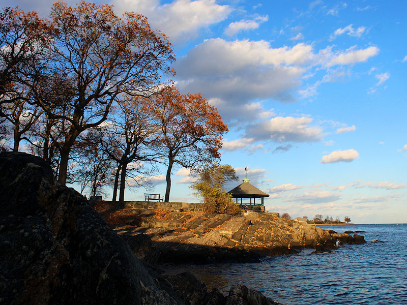
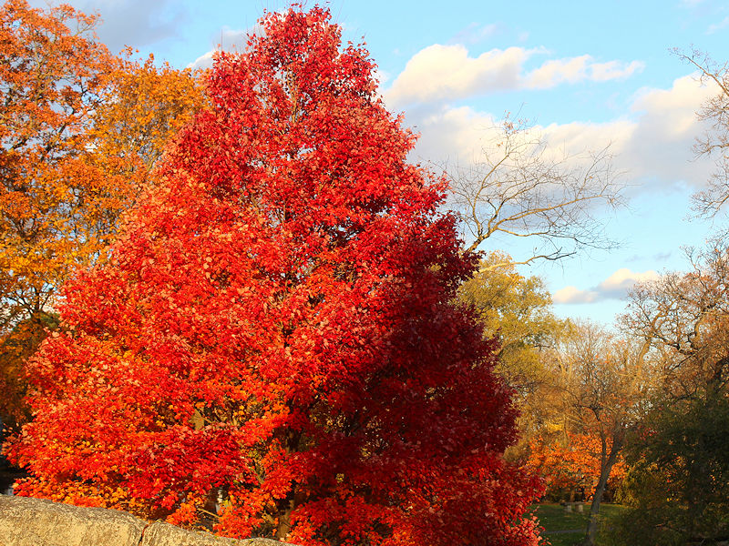
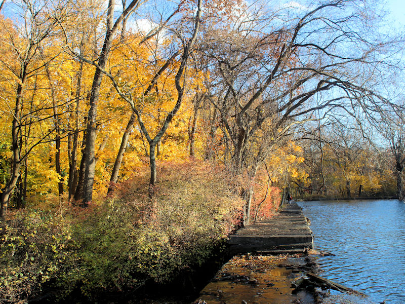
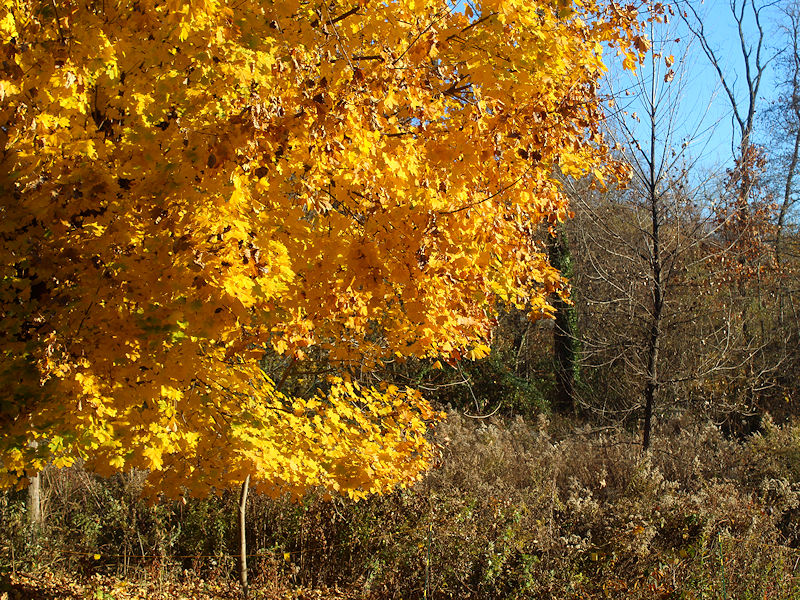
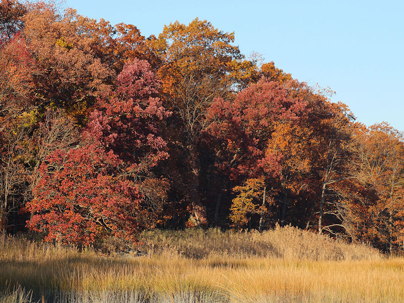
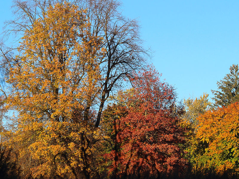
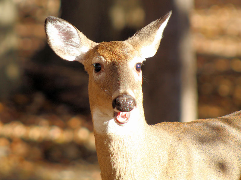
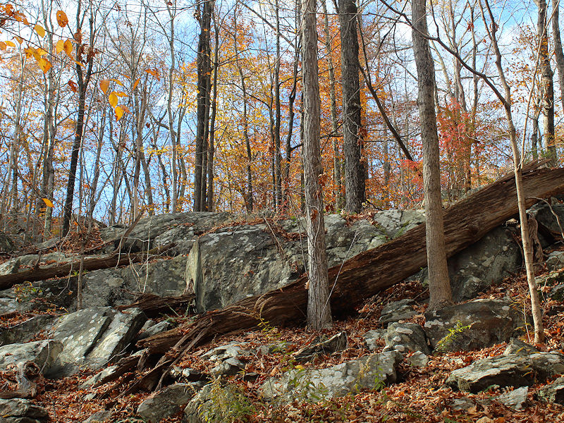
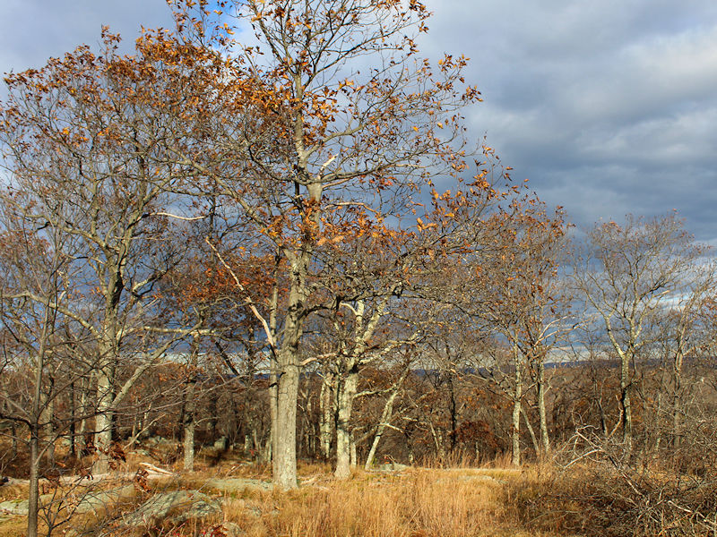
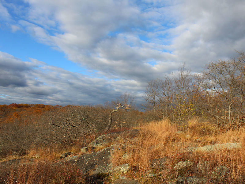
Today was another fine fall day with bright sunshine and pleasant, if not mild temperatures. Four photos before all the leaves come down.
-
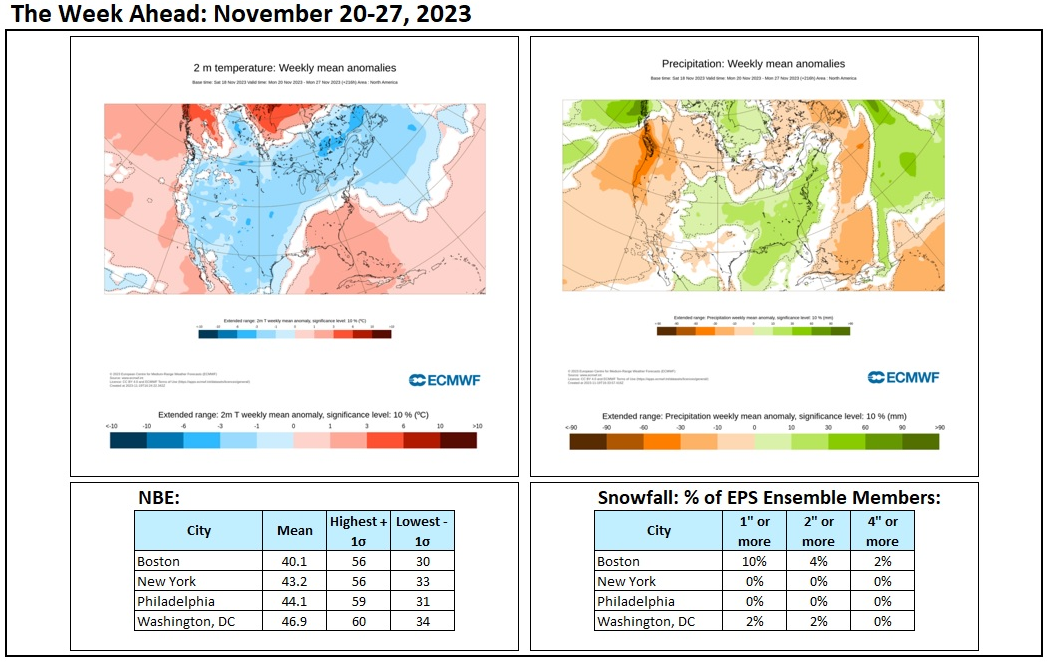
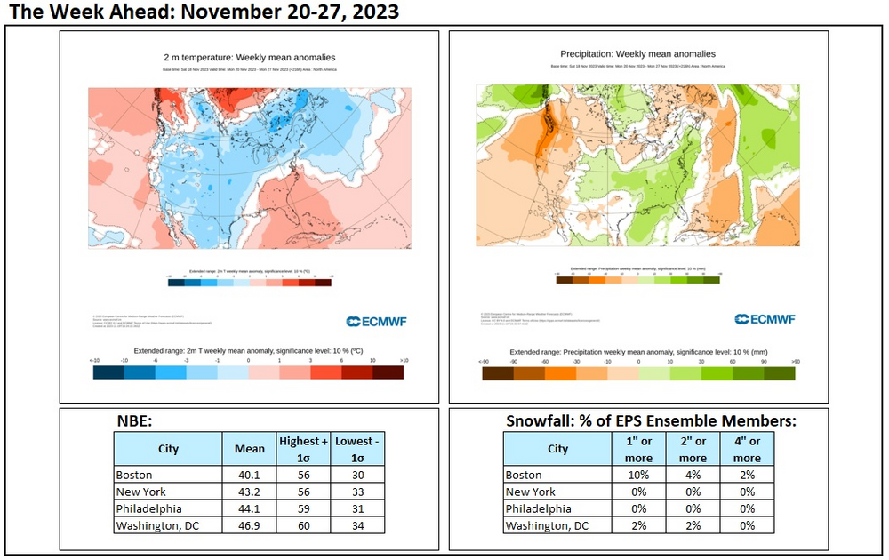
The week ahead is looking somewhat cooler than normal and wetter than normal. Snowfall for the big cities of the Northeast is unlikely. A low percentage of EPS ensemble members shows some snow for Boston.
-
Tomorrow will be fair and cooler. Monday will be chilly with temperatures reaching the middle and upper 40s in much of the region. The cool weather will continue through Tuesday. Afterward, a strong cold front will move across the region during the middle of the week. A storm will move along the front bringing a significant rainfall to the region. A general 1.00"-2.00" with locally higher amounts appears likely. New York City's annual precipitation will surge past 50.00". Years with 50.00" or precipitation have increased dramatically since the City's climate became abruptly wetter in 1972. The frequency of 50.00" or above years is as follows: 1869-1971: Once every 7.9 years 1972-2023*: Once every 2.3 years Since 2000*: Once every 1.8 years *Includes 2023 as a 50.00" year. 2023 currently has 49.70". No year had less than 0.30" from November 19-December 31. The record least precipitation during that timeframe was 0.67" in 1955. Afterward, the coldest air of the season will arrive. Thanksgiving Day could be blustery and very cold for the season with the temperature struggling into the lower 40s in New York City and perhaps Philadelphia. Temperatures will slowly moderate afterward. The ENSO Region 1+2 anomaly was +2.2°C and the Region 3.4 anomaly was +1.8°C for the week centered around November 8. For the past six weeks, the ENSO Region 1+2 anomaly has averaged +2.37°C and the ENSO Region 3.4 anomaly has averaged +1.63°C. El Niño conditions will likely continue to strengthen into the early winter with the current East-based event continuing to evolve into a basinwide El Niño. Currently, 2023 is in uncharted territory as far as the ENSO Region 3.4 anomaly and PDO are concerned. The October ENSO Region 3.4 anomaly was +1.59°C while the PDO was -1.71. Prior to 2023, the lowest October PDO when the ENSO Region 3.4 anomaly was +1.00°C or above was -0.36 in 1965. Should the ENSO Region 1+2 and 3.4 anomalies remain at or above +1.00°C in December, which is likely, and should the PDO remain negative, there is a single past case (1950-2022) with similar conditions: December 1972. The SOI was +3.05 today. The preliminary Arctic Oscillation (AO) was +1.123 today. On November 16 the MJO was in Phase 7 at an amplitude of 1.563 (RMM). The November 15-adjusted amplitude was 1.637 (RMM). Based on sensitivity analysis applied to the latest guidance, there is an implied 80% probability that New York City will have a cooler than normal November (1991-2020 normal). November will likely finish with a mean temperature near 46.1° (1.9° below normal). That would be New York City's coldest November since November 2019.
-
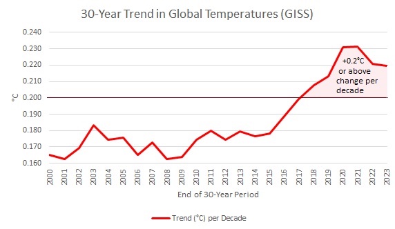
I agree that there’s more to the story than ENSO. It’s worth noting that since 2018, the 30-year trend has been warming at or above 0.2C per decade. It’s unclear what role this acceleration in the warming rate plays and whether it will persist. Dr. Hansen expects further acceleration. The acceleration coincides with the increase in the Earth Energy Imbalance documented by NASA.
-
Temperatures soared into the middle and upper 60s in advance of an approaching cold front. Meanwhile, Anchorage saw its November snowfall reach 39.1". That broke the November record of 38.8" from 1994 and is the 5th highest monthly figure on record. November 1994 saw an El Niño with a strongly negative PDO. The warmth will soon be a memory. A cold front will cross the region tonight bringing scattered showers. In its wake, temperatures will hold nearly steady tomorrow morning and then fall during the afternoon. Cool weather will continue through Tuesday. Afterward, a strong cold front will move across the region during the middle of the week. A moderate to significant rainfall is likely. Afterward, the coldest air of the season will arrive. Thanksgiving Day could be blustery and very cold for the season with the temperature struggling to reach the lower 40s in New York City and Philadelphia. Temperatures will slowly moderate afterward. The ENSO Region 1+2 anomaly was +2.2°C and the Region 3.4 anomaly was +1.8°C for the week centered around November 8. For the past six weeks, the ENSO Region 1+2 anomaly has averaged +2.37°C and the ENSO Region 3.4 anomaly has averaged +1.63°C. El Niño conditions will likely continue to strengthen into the early winter with the current East-based event transitioning to a basinwide El Niño. That transition continues. Currently, 2023 is in uncharted territory as far as the ENSO Region 3.4 anomaly and PDO are concerned. The October ENSO Region 3.4 anomaly was +1.59°C while the PDO was -1.71. Prior to 2023, the lowest October PDO when the ENSO Region 3.4 anomaly was +1.00°C or above was -0.36 in 1965. Should the ENSO Region 1+2 and 3.4 anomalies remain at or above +1.00°C in December, which is likely, and should the PDO remain negative, there is a single past case (1950-2022) with similar conditions: December 1972. The SOI was -0.07 today. The preliminary Arctic Oscillation (AO) was +1.539 today. On November 15 the MJO was in Phase 7 at an amplitude of 1.637 (RMM). The November 14-adjusted amplitude was 1.666 (RMM). Based on sensitivity analysis applied to the latest guidance, there is an implied 84% probability that New York City will have a cooler than normal November (1991-2020 normal). November will likely finish with a mean temperature near 46.0° (2.0° below normal). That would be New York City's coldest November since November 2019.
-
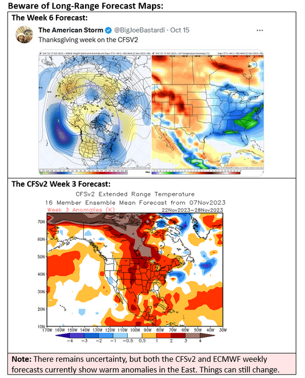
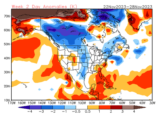
Continuing the illustration of how extended range models can fluctuate a lot over long timeframes, below is the latest CFSv2 forecast for November 22-28. Last week, it featured widespread warmth (a reversal from earlier). This week it features cool anomalies in much of Canada, parts of the Plains States, and the northeastern U.S.:
-
E PA/NJ/DE Fall 2023 OBS/Discussion Thread
donsutherland1 replied to Rtd208's topic in Philadelphia Region
Typically, that would indicate an enhanced prospect for snow, but there are exceptions. -
Tomorrow will be another very mild day. Highs will reach the middle and upper 60s. A few locations could reach 70°. However, a cold front will move across the region Friday night into Saturday bringing some showers. Generally rainfall amounts should be light (less than 0.25"). The long-range guidance has shifted. It now shows cooler air overspreading the region near or during the Thanksgiving Day holiday. The responsible cold front could bring a moderate to significant rainfall to the region. The colder conditions could last through the remainder of November. The shift in the guidance reaffirms the limitations of guidance beyond Week 2 and the reality that such outlooks are low-skill in nature. The ENSO Region 1+2 anomaly was +2.2°C and the Region 3.4 anomaly was +1.8°C for the week centered around November 8. For the past six weeks, the ENSO Region 1+2 anomaly has averaged +2.37°C and the ENSO Region 3.4 anomaly has averaged +1.63°C. El Niño conditions will likely continue to strengthen into the early winter with the current East-based event transitioning to a basinwide El Niño. That transition continues. Currently, 2023 is in uncharted territory as far as the ENSO Region 3.4 anomaly and PDO are concerned. The October ENSO Region 3.4 anomaly was +1.59°C while the PDO was -1.71. Prior to 2023, the lowest October PDO when the ENSO Region 3.4 anomaly was +1.00°C or above was -0.36 in 1965. The SOI was -10.25 today. The preliminary Arctic Oscillation (AO) was +1.417 today. On November 15 the MJO was in Phase 7 at an amplitude of 1.637 (RMM). The November 14-adjusted amplitude was 1.666 (RMM). Based on sensitivity analysis applied to the latest guidance, there is an implied 82% probability that New York City will have a cooler than normal November (1991-2020 normal). November will likely finish with a mean temperature near 46.1° (1.9° below normal). That would be New York City's coldest November since November 2019.
-
Tomorrow will be noticeably milder. Readings will likely reach the lower and perhaps middle 60s. Friday will be another very mild day. However, a cold front will move across the region Friday night into Saturday bringing some showers. An offshore storm could bring a soaking rain to eastern New England. The long-range guidance has shifted. It now shows cooler air overspreading the region near or during the Thanksgiving Day holiday. The colder conditions could last through the remainder of November. The shift in the guidance reaffirms the limitations of guidance beyond Week 2 and the reality that such outlooks are low-skill in nature. The ENSO Region 1+2 anomaly was +2.2°C and the Region 3.4 anomaly was +1.8°C for the week centered around November 8. For the past six weeks, the ENSO Region 1+2 anomaly has averaged +2.37°C and the ENSO Region 3.4 anomaly has averaged +1.63°C. El Niño conditions will likely continue to strengthen into the early winter with the current East-based event transitioning to a basinwide El Niño. That transition continues. Currently, 2023 is in uncharted territory as far as the ENSO Region 3.4 anomaly and PDO are concerned. The October ENSO Region 3.4 anomaly was +1.59°C while the PDO was -1.71. Prior to 2023, the lowest October PDO when the ENSO Region 3.4 anomaly was +1.00°C or above was -0.36 in 1965. The SOI was -15.53 today. The preliminary Arctic Oscillation (AO) was +1.092 today. On November 14 the MJO was in Phase 7 at an amplitude of 1.666 (RMM). The November 13-adjusted amplitude was 1.628 (RMM). Based on sensitivity analysis applied to the latest guidance, there is an implied 75% probability that New York City will have a cooler than normal November (1991-2020 normal). November will likely finish with a mean temperature near 46.5° (1.5° below normal).
-
After a frosty start, readings should become slightly milder tomorrow. The warmup will likely peak Thursday and Friday. Dry conditions could continue until late in the week before showers or periods of rain could move into the region Friday night into Saturday. The ENSO Region 1+2 anomaly was +2.2°C and the Region 3.4 anomaly was +1.8°C for the week centered around November 8. For the past six weeks, the ENSO Region 1+2 anomaly has averaged +2.37°C and the ENSO Region 3.4 anomaly has averaged +1.63°C. El Niño conditions will likely continue to strengthen into the early winter with the current East-based event transitioning to a basinwide El Niño. That transition continues. Currently, 2023 is in uncharted territory as far as the ENSO Region 3.4 anomaly and PDO are concerned. The October ENSO Region 3.4 anomaly was +1.59°C while the PDO was -1.71. Prior to 2023, the lowest October PDO when the ENSO Region 3.4 anomaly was +1.00°C or above was -0.36 in 1965. The SOI was -21.13 today. The preliminary Arctic Oscillation (AO) was +1.462 today. On November 13 the MJO was in Phase 6 at an amplitude of 1628 (RMM). The November 12-adjusted amplitude was 1.739 (RMM). Based on sensitivity analysis applied to the latest guidance, there is an implied 70% probability that New York City will have a cooler than normal November (1991-2020 normal). November will likely finish with a mean temperature near 46.9° (1.3° below normal).
-
After a frosty start, readings should become slightly milder tomorrow. The warmup will likely peak Thursday and Friday. Dry conditions could continue until late in the week before showers or periods of rain could move into the region Friday night into Saturday. The ENSO Region 1+2 anomaly was +2.6°C and the Region 3.4 anomaly was +1.6°C for the week centered around November 1. For the past six weeks, the ENSO Region 1+2 anomaly has averaged +2.47°C and the ENSO Region 3.4 anomaly has averaged +1.58°C. El Niño conditions will likely continue to strengthen into the early winter with the current East-based event transitioning to a basinwide El Niño. That transition continues. Currently, 2023 is in uncharted territory as far as the ENSO Region 3.4 anomaly and PDO are concerned. The October ENSO Region 3.4 anomaly was +1.59°C while the PDO was -1.71. Prior to 2023, the lowest October PDO when the ENSO Region 3.4 anomaly was +1.00°C or above was -0.36 in 1965. The SOI was -32.77 today. The preliminary Arctic Oscillation (AO) was +0.764 today. On November 11 the MJO was in Phase 6 at an amplitude of 1.755 (RMM). The November 10-adjusted amplitude was 1.696 (RMM). Based on sensitivity analysis applied to the latest guidance, there is an implied 60% probability that New York City will have a cooler than normal November (1991-2020 normal). November will likely finish with a mean temperature near 47.4° (0.8° below normal).
-
Tonight will again be mainly fair and cold. Readings outside New York City and Philadelphia will again dip below freezing. A warmup will commence early in the week. Dry conditions could continue until late in the week before showers or periods of rain could move into the region Friday night into Saturday. The long-range guidance suggests that the second half of November could be generally warmer than normal with the possibility of some shorter cool shots. Whether that will set the stage for a mild Thanksgiving week remains to be seen. The final week of te month could turn cooler for a time. The ENSO Region 1+2 anomaly was +2.6°C and the Region 3.4 anomaly was +1.6°C for the week centered around November 1. For the past six weeks, the ENSO Region 1+2 anomaly has averaged +2.47°C and the ENSO Region 3.4 anomaly has averaged +1.58°C. El Niño conditions will likely continue to strengthen into the early winter with the current East-based event transitioning to a basinwide El Niño. That transition continues. Currently, 2023 is in uncharted territory as far as the ENSO Region 3.4 anomaly and PDO are concerned. The October ENSO Region 3.4 anomaly was +1.59°C while the PDO was -1.71. Prior to 2023, the lowest October PDO when the ENSO Region 3.4 anomaly was +1.00°C or above was -0.36 in 1965. The SOI was not available today. The preliminary Arctic Oscillation (AO) was +0.237 today. On November 9 the MJO was in Phase 6 at an amplitude of 1.342 (RMM). The November 8-adjusted amplitude was 1.456 (RMM). Based on sensitivity analysis applied to the latest guidance, there is an implied 56% probability that New York City will have a cooler than normal November (1991-2020 normal). November will likely finish with a mean temperature near 47.6° (0.4° below normal).
-
No. Rye’s Marshlands Conservancy.
-
More late fall photos. The high was just 44 despite bright sunshine.

-
A reinforcing shot of cold air is overspreading the region. That will likely be the coldest air mass so far this season, but the cold will be short-lived. Central Park will likely remain several degrees above freezing. During 1961-1990, Central Park's mean first freeze fell on November 11. Under the latest 1991-2020 base period, its first freeze typically occurs on November 20. A warmup will commence early next week. Dry conditions could continue until late in the week before showers could move into the region. The long-range guidance suggests that the second half of November could be generally warmer than normal with the possibility of some shorter cool shots. Whether that will set the stage for a mild Thanksgiving week remains to be seen. The ENSO Region 1+2 anomaly was +2.6°C and the Region 3.4 anomaly was +1.6°C for the week centered around November 1. For the past six weeks, the ENSO Region 1+2 anomaly has averaged +2.47°C and the ENSO Region 3.4 anomaly has averaged +1.58°C. El Niño conditions will likely continue to strengthen into the early winter with the current East-based event transitioning to a basinwide El Niño. That transition continues. Currently, 2023 is in uncharted territory as far as the ENSO Region 3.4 anomaly and PDO are concerned. The October ENSO Region 3.4 anomaly was +1.59°C while the PDO was -1.71. Prior to 2023, the lowest October PDO when the ENSO Region 3.4 anomaly was +1.00°C or above was -0.36 in 1965. The SOI was -20.62 today. The preliminary Arctic Oscillation (AO) was +0.140 today. On November 7 the MJO was in Phase 5 at an amplitude of 0.924 (RMM). The November 6-adjusted amplitude was 0.385 (RMM). Based on sensitivity analysis applied to the latest guidance, there is an implied 52% probability that New York City will have a cooler than normal November (1991-2020 normal). November will likely finish with a mean temperature near 47.8° (0.2° below normal).
-
Some late autumn photos from Turkey Mountain Nature Preserve (Yorktown Heights, New York). Temperatures were around 50F.
-
If research by Jessica Tierney et al., is accurate, cloud feedbacks associated with rising greenhouse gas concentrations will amplify the warming. She observed: In addition, while the PETM-DA shows that the biggest changes in low cloud cover occur over the subtropical (upwelling zone) regions, clouds also decreased by 10 to 15% over the Southern Ocean and the Northern Hemisphere midlatitudes, and likely contributed to the elevated warming. A strong shortwave cloud feedback is a feature of the Community Earth System Model (CESM) simulations that was previously shown to contribute to mid- to high-latitude warming, as both cloud cover and opacity decline nonlinearly with increasing CO2. https://www.pnas.org/doi/full/10.1073/pnas.2205326119
-
Cooler air will begin to advance into the region tomorrow. A reinforcing shot of cold air will arrive Saturday night or Sunday. That will likely be the coldest air mass so far this season, but the cold will be short-lived. A warmup will commence early next week. The long-range guidance is continuing to move into consensus that the second half of November could be generally warmer than normal. Whether that will set the stage for a mild Thanksgiving week remains to be seen. The ENSO Region 1+2 anomaly was +2.6°C and the Region 3.4 anomaly was +1.6°C for the week centered around November 1. For the past six weeks, the ENSO Region 1+2 anomaly has averaged +2.47°C and the ENSO Region 3.4 anomaly has averaged +1.58°C. El Niño conditions will likely continue to strengthen into the early winter with the current East-based event transitioning to a basinwide El Niño. That transition continues. Currently, 2023 is in uncharted territory as far as the ENSO Region 3.4 anomaly and PDO are concerned. The October ENSO Region 3.4 anomaly was +1.59°C while the PDO was -1.71. Prior to 2023, the lowest October PDO when the ENSO Region 3.4 anomaly was +1.00°C or above was -0.36 in 1965. The SOI was -11.96 today. The preliminary Arctic Oscillation (AO) was -0.133 today. On November 6 the MJO was in Phase 6 at an amplitude of 0.385 (RMM). The November 5-adjusted amplitude was 0.041 (RMM). Based on sensitivity analysis applied to the latest guidance, there is an implied 51% probability that New York City will have a cooler than normal November (1991-2020 normal). November will likely finish with a mean temperature near 47.9° (0.1° below normal).
-
Personally, I think it will wind up on the warmer side of normal. The GFS still tends to cool things down around 240 hours. I suspect the warmer look on the GEFS and EPS is more likely to verify.
-
Cooler air will begin to advance into the region tomorrow. A reinformcing shot of cold air will arrive Saturday night or Sunday. That will likely be the coldest air mass so far this season, but the cold will be short-lived. A warmup will commence early next week. The long-range guidance is continuing to move into consensus that the second half of November could be generally warmer than normal. Whether that will set the stage for a mild Thanksgiving week remains to be seen. The ENSO Region 1+2 anomaly was +2.6°C and the Region 3.4 anomaly was +1.6°C for the week centered around November 1. For the past six weeks, the ENSO Region 1+2 anomaly has averaged +2.47°C and the ENSO Region 3.4 anomaly has averaged +1.58°C. El Niño conditions will likely continue to strengthen into the fall with the current East-based event transitioning to a basinwide El Niño for the upcoming winter. That transition is currently underway. The SOI was -12.03 today. The preliminary Arctic Oscillation (AO) was -0.020 today. On November 6 the MJO was in Phase 6 at an amplitude of 0.385 (RMM). The November 5-adjusted amplitude was 0.041 (RMM). Based on sensitivity analysis applied to the latest guidance, there is an implied 52% probability that New York City will have a cooler than normal November (1991-2020 normal). November will likely finish with a mean temperature near 47.8° (0.2° below normal).
-
Annual public service announcement: Beware of long-range maps (especially those calling for cold and snow) and proclamations of imminent sudden or major stratospheric warming events on social media. Beyond two weeks, the maps have little skill. Beyond 7-10 days, forecasts for stratospheric warming events also have low skill.