WxUSAF
-
Posts
28,700 -
Joined
-
Last visited
Content Type
Profiles
Blogs
Forums
American Weather
Media Demo
Store
Gallery
Everything posted by WxUSAF
-
Hopefully we can score something small when the RELOAD starts to RELAX before we get our annual Xmas torch
-
^enjoy! Too bad Notre Dame is still closed, but hopefully you can see lots of sights and have some amazing food.
-
Whoa, apologies for not announcing this before. With DCA reaching freezing on 11/18, that actually gave @yoda and @MN Transplant a tie with 17 days total departure. @GramaxRefugee comes in 3rd with 18 days. But @MN Transplanthit the tiebreaker of 81F exactly right and thus is the winner! Congrats!
-
Last year we started getting teased in late Nov/early Dec and the can got kicked into early January. I wouldn’t be surprised in the least if the can gets kicked 4-7 days here or maybe more. This really good pattern has only been teased for ~2 days so far also, so not exactly a lock yet.
-
@leesburg 04?
-
The NAO signal has been there off and on for awhile. But the -EPO has really grown on the D10+ progs over the last 48 hours.
-
@ORH_wxman posted 12z EPS in the NE sub. Looks like 6z GEFS. Pants tent
- 735 replies
-
- 10
-

-

-

-
Yup. And that ridge bridge with a trop PV underneath could supply some legit cold air. Pretty much. Had some snow in 2017 and 2020 too, but 2013 was last real winter month December.
-
Yup. End of the 12z Op GFS is illustrative of what could happen with such a look. Successive waves beat down the SE ridge and supply cold air and then we get a wave to move toward us with a conducive environment. This is a very normal way we get snow. It’s a ways off so need to see how stable this look is…but man oh man, it’s pretty.
-
EPO-NAO ridge bridge??? Pinch me. Anyone who gets antsy seeing the SE ridge should chillax… That will get beat down and you want something keeping the storm track nearby in that look.
- 735 replies
-
- 14
-
-
ALEET ALEET Digital Blue Fix at 12z ALEET ALEET
-
D12-15 on the 6z GEFS = wooo baby
- 735 replies
-
- 10
-
-
-
Maybe a squirrel is farting on my PWS, but it has not gotten as cold as nearby stations the last couple days. 34F now verbatim while my neighbor is 30 and BWI is in the 20s.
-
Ok soccer fans…what does a draw mean for their chances here? Assuming a win against Iran and loss against England, it may come down to goals for/against?
-
Hi Chuck
- 735 replies
-
- 19
-
-
-

-

-
Yup! And IAD had 3 days +20 or more!
-
Temp departures from normal yesterday: BWI: -15.4 IAD: -12.6 DCA: -12.8 RIC: -11.6
-
^straight up RELOADED there! That’s a nice look. Hope that holds more or less.
-
20.5 for the low so far IMBY. BWI and IAD have both gotten at least to 19, so ok @CAPE, that’s a solid November low temp.
-
Dropping like a rock now. 24.8F on my PWS
-
Record low max of 38F tied at BWI
-
Sharp defense, but offense was flat and sloppy.
-
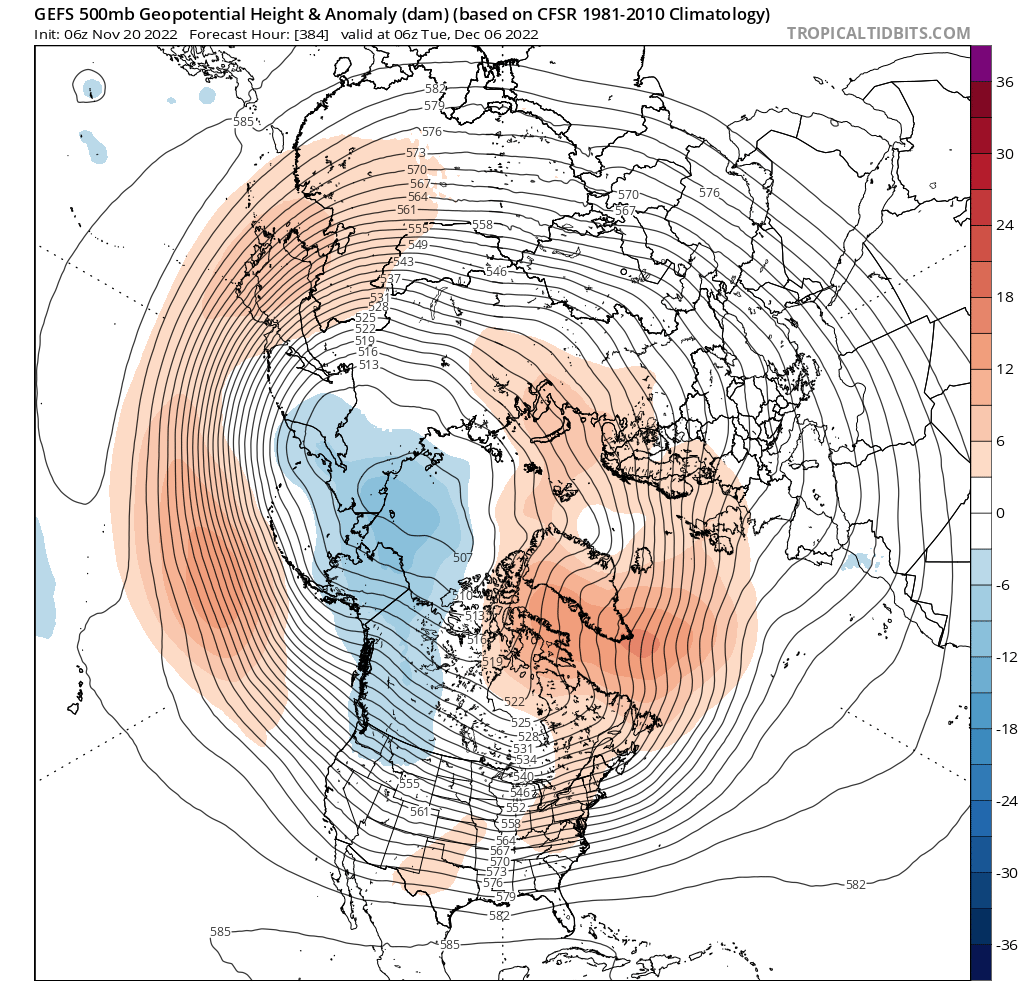
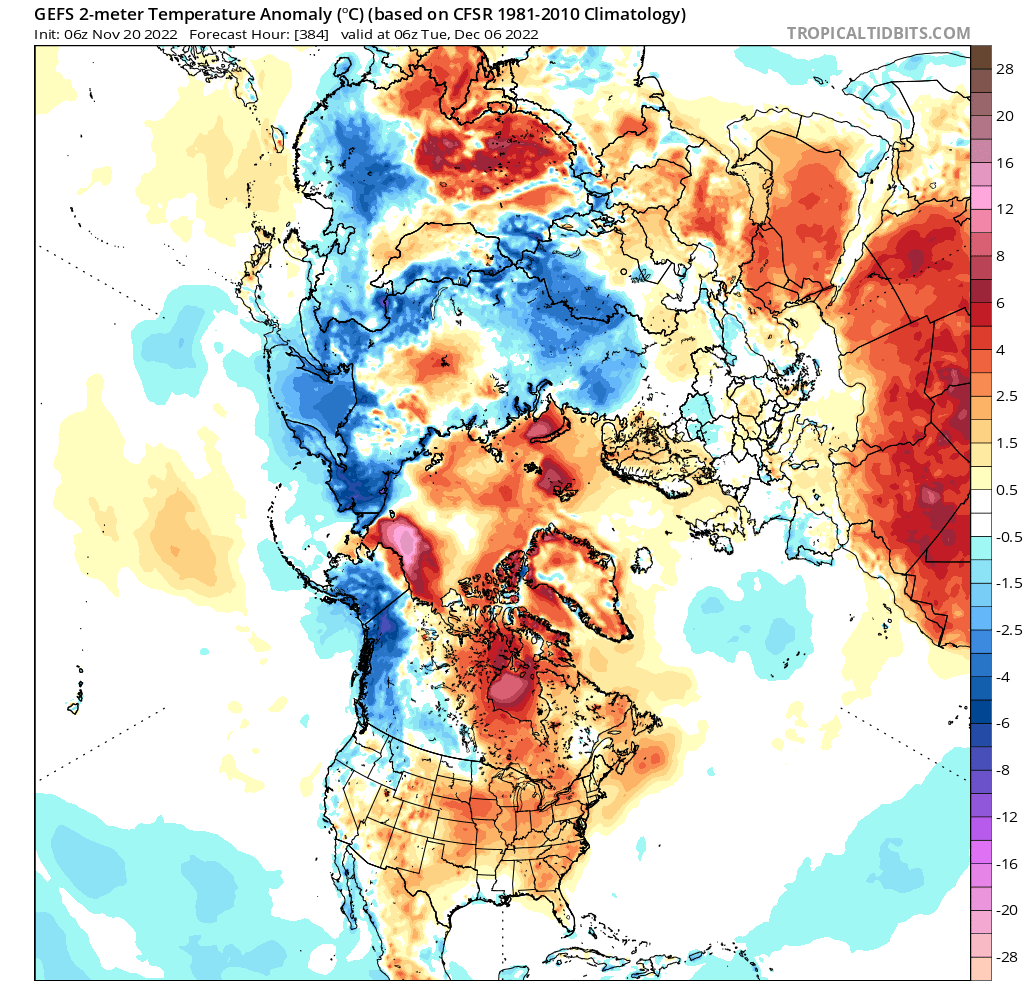
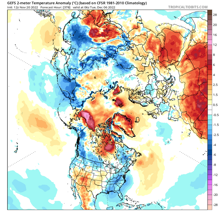
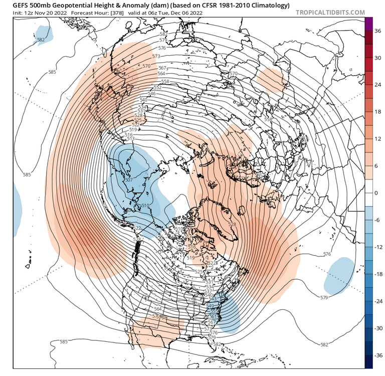
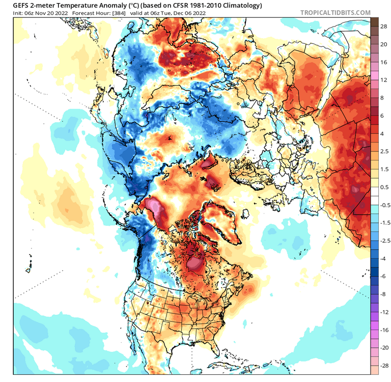
To emphasize how subtle differences in the Siberian/Arctic PV could change how the RELAX looks, check the 12z vs 6z GEFS. 12z: farther south in Siberia and less organized. -NAO looks worse actually relative to 6z, but without a pig PV setting up north of AK, we’re actually able to get some BN temps verbatim. 6z: -NAO looking nice with ridging into Greenland and Davis straights, but the PV is stronger and more consolidated, driving a -PNA and floods the conus with PAC air. Given that, I wouldn’t put much stock in anything after the 28th or so. @CoastalWx mentioned this could be due to weak tropical forcing and hence the models bouncing around a lot. Makes sense, but with that PV, it could bounce between torch ahead of a cutter, but then a good cold push behind it with a transient -EPO.

-
Racking up our cold wind seasonal totals already!!
-
I raked yesterday. With this wind, you probably won’t notice by noon today.