WxUSAF
-
Posts
28,700 -
Joined
-
Last visited
Content Type
Profiles
Blogs
Forums
American Weather
Media Demo
Store
Gallery
Everything posted by WxUSAF
-
Seems like the Sunday-Tuesday period is going to score for BWI and RIC. DCA maybe not a lock yet, but euro and GGEM both have widespread 20s for lows which would probably be a sufficient airmass for DCA too.
-
Hour less sunlight doesn’t seem to be holding temps down
-
I watched the end of that. Brutal.
-
Talk about a pattern change. 6z gfs goes from this torch to not hitting 50F after next Saturday morning through the end of the run.
-
Fantastic thread from @griteater this morning about 3 dominant Niña patterns and where this winter may fall in that mix. Spoiler alert, probably not in the least conducive pattern for mid-Atlantic snowfall.
-
A low temp more typical for late June.
-
Must be UHI
-
I’m guessing JB is going with a 89-90/95-96 blend as a forecast? December 89 and Jan-Feb 96?
-
That’s the timing when we could take advantage of a good pattern with climo becoming supportive of snow events. Dry would always be a risk with that look in a Niña, but need some cold air in December to have any chance. Fingers crossed.
-
Oh look, a casual 3 days with +20F departures on morning lows
-
That part seems like a lock. But they’re still waffling on whether it couples with a +PNA and hence how chilly we get.
-
I’m encouraged you think we’ll have legit threats this year and will join if such a miracle occurs
- 18 replies
-
- 12
-

-

-
@mattie gis a dork and he’s talking about lord of the rings
-
I’d wager with how anomalous these first 10 days are, that seals the deal for a AN month. As we know, we drop >=+10F departures like Steph Curry shooting 3s, while we’ll eke out a couple -5F departures on our “cold” days.
-
First 10 days of the month are a total torch, but ensembles are in agreement for now that it flips to a BN pattern after mid-month.
-
Not even 0.1”. Have a hard time seeing those ~0.5” forecasts verifying.
-
This is always the dilemma with good patterns in late November and early December. It’s still more apt to produce cold rain due to climo. I like seeing a good pattern arrive closer to mid December. We often get a can-kick with pattern changes as models rush it, so if we torch for 10-14 days, then maybe we have some level of transition for another 2 weeks, maybe we can get something good to start December.
-
I guess if they’ve forgotten how to draft well since EDC took over, at least they’re trading well!
-
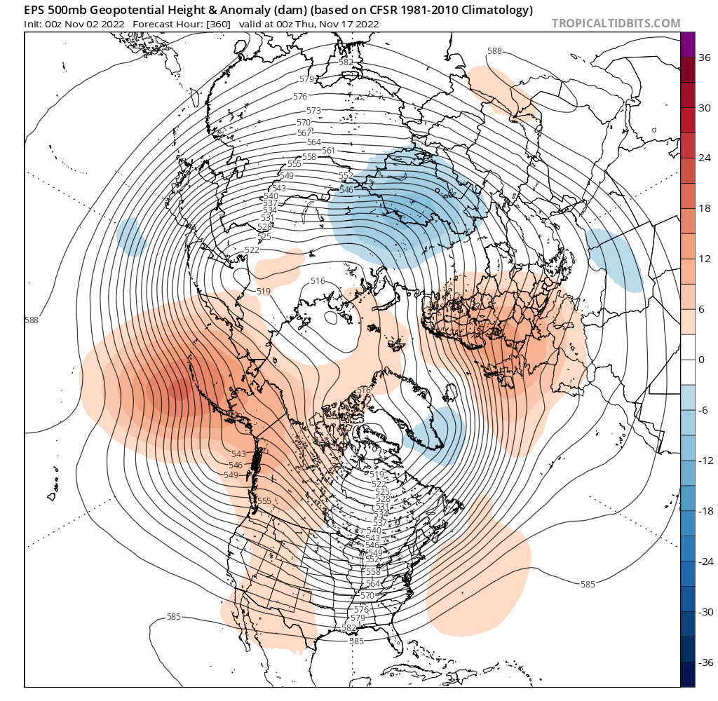
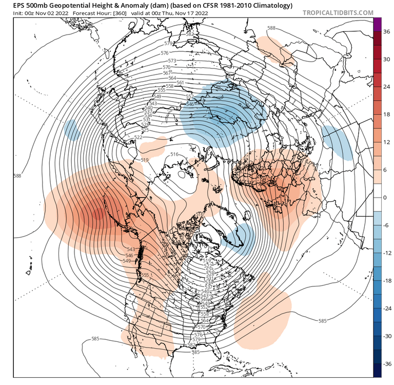
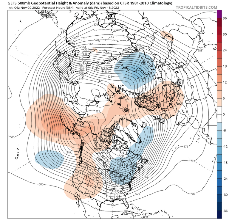
Getting more consistent on Ops and ensembles that our torchvember will start relaxing a bit around Veterans Day. Looks like we finally get a cold front or two with some oomph and the eastern ridge starts to weaken.
-
Lots of leaves falling now. If we get a good windy day, going to be a blizzard out there with drifts 1-2’ deep.
-
36.5 for the low
-