WxUSAF
-
Posts
28,779 -
Joined
-
Last visited
Content Type
Profiles
Blogs
Forums
American Weather
Media Demo
Store
Gallery
Everything posted by WxUSAF
-
This. Things look ripe after this big storm passes. Plenty of cold air and continuing energy moving into the southwest. Very Nino-like. Just a matter of how things time up and where they are located.
-
To somehow stay majority frozen for us we want that coastal capture by upper level energy as far south and east as we can get it. That capture will yank the low NW like the GFS shows. Combine a Midwest primary with a warm ocean and it’s really hard to keep the column below freezing.
-
Kaiser says NEIN although probably some eis if I can interpret from TT charts. Dat storm after the storm tho…
-

-
Of course if somehow those gaudy snow totals DO shift south, can I rent a car and drive home…
-
But Harrisburg is getting 24”!! If the storm tucks a little more or closes off 13mi farther south, it could be us!!
-
Next week has “tragedy for many” written all over it lol. People should be setting hopes at “first flakes” or “first small accumulation” and not imagine some gaudy inland PA/NY snow totals shifted south 150 miles. But I know that’s not how we roll. I am getting increasingly concerned about flying home next Thursday evening…
-
I’m still looking beyond next week’s weird ass thing. I see you EPS.

-
It’s a needle threader though to get JUST enough ULL strength in the Plains and JUST enough spacing with the 50-50 so the coastal can turn the corner but stay offshore. But that’s the 6z solution I guess so it’s possible. Just hard.
-
Strangest MECS in history or this is a BUsT!1!!11!!1
-
Life comes at ya fast in mid-Atlantic La Niña winters
-
Miller notgonnaBsnowinginthemidatlantic
-
Ha. I was thinking that if there weren’t some NSFW worthy EPS members today than they need to unplug ECMWF and plug it back in.
-
-
Yes true. Big jump south and weaker with the ULL. Just nowhere near as dramatic as GFS.
-
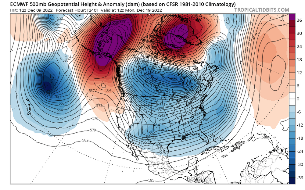
Euro keeps the primary low and ULL much stronger than gfs or even the GGEM. That has to weaken if we want any frozen precip.
-
Great pull @Cobalt
-
If you want to play that game, a GGEM/GFS blend would be [cousin Eddie voice] really nice [/cousin Eddie voice].
-
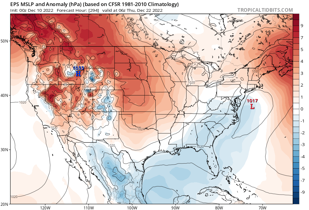
It’s more a function of having a -PNA with monster Atlantic side blocking. Storm is jacked coming out of the Rockies and then starts to get sheared and shredded by the Atlantic blocking. Gets pushed south and then a coastal redevelopment of some kind happens. A zillion moving parts here so expect very little consistency.
-
Blocking giveth and blocking taketh away
-
Primary in Iowa and snow to the NC line. Insanity.
-
GFS colder than 6z through 120… can’t believe I’m doing PBP of this
-
The farther south you are the more you’ll rely on some west coast ridging (+PNA) to force cold air and the storm track south. I think for all of us, better wintry precip chances probably come after next weeks storm. And any specific threat will be highly contingent on what happens to next weeks storm, so can’t diagnose more than that now. I’ll remain skeptical of any major frozen event from next week’s storm for awhile, but if I was north of NYC, I’d be getting excited.
-
Weaker ULL and redonkulous blocking produces a very unusual solution. It can happen, but wonky for obvious reasons. I’d like to see that solution after this New England weekend storm gets blown up offshore.
-
Well I’ll say this…I feel confident we haven’t seen the final solution yet for that storm. And crazy things happen with the kind of blocking advertised for next week.