John1122
-
Posts
10,752 -
Joined
-
Last visited
Content Type
Profiles
Blogs
Forums
American Weather
Media Demo
Store
Gallery
Everything posted by John1122
-
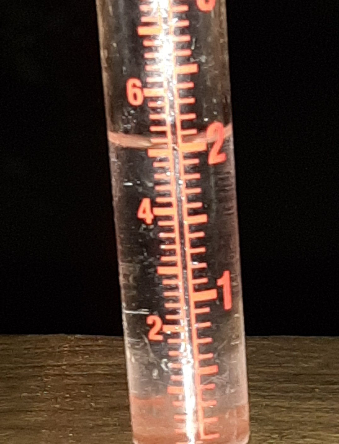
Ended up with .50 for the day. 1.85 through the first 5 days of August.
- 186 replies
-
- 1
-

-
- tennessee river valley
- wind
- (and 4 more)
-
I feel more like Forrest Gump when he said "and one day it started raining.."
- 186 replies
-
- 4
-
-
- tennessee river valley
- wind
- (and 4 more)
-
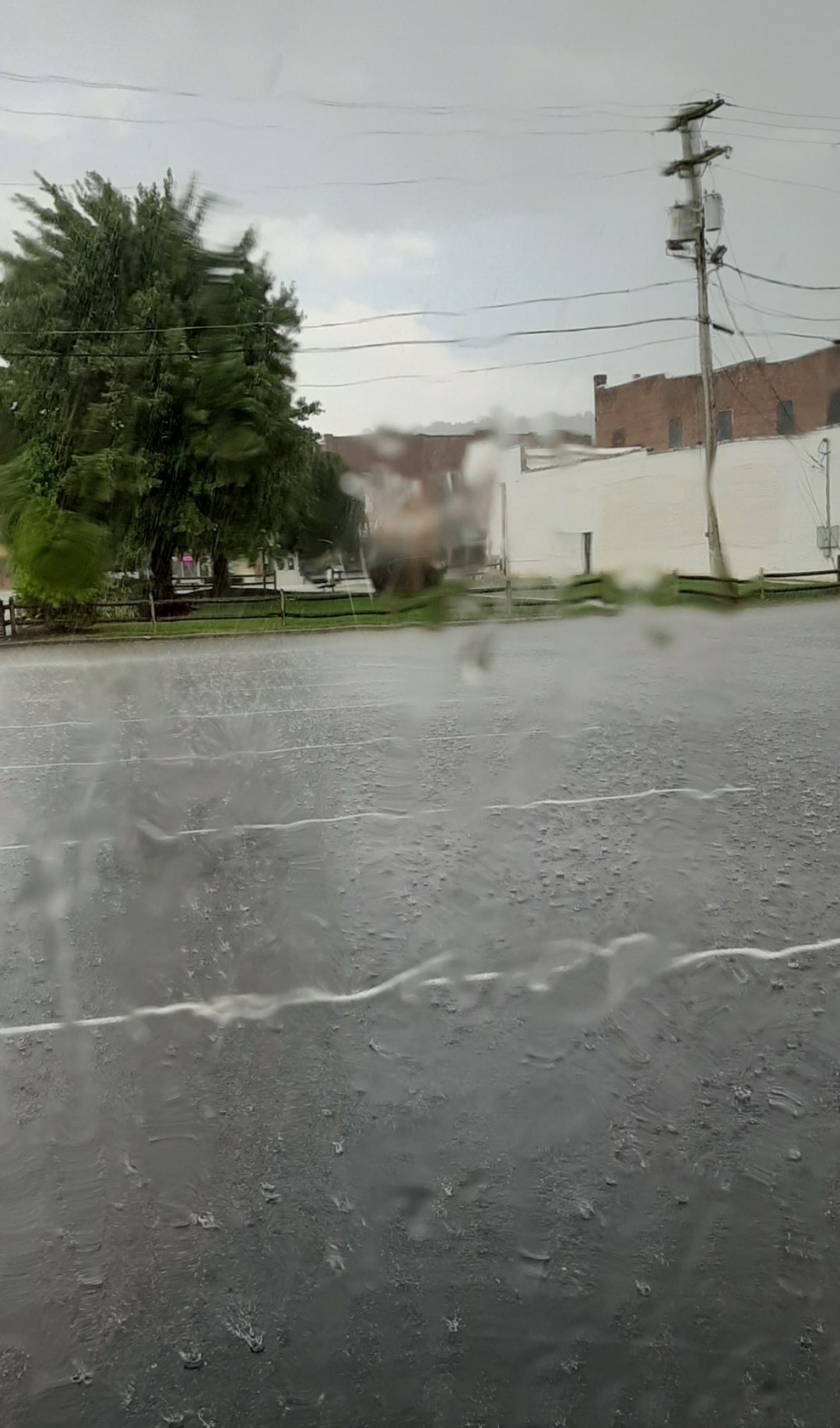
Currently in my second rain event of the day. .40 from the first. Not as heavy this round. But it's ridiculous that it has rained almost every day for two weeks now.
-
Ran through some very heavy showers around Loudon/Lenoir City and an extremely heavy one that had me going 30 on the interstate around the 640/75 split. Upon getting back home a few minutes ago, my ran gauge had .97 in it from today's rain here.
-
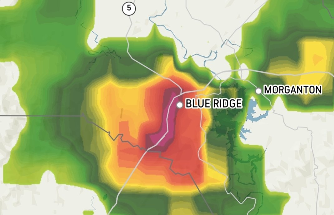
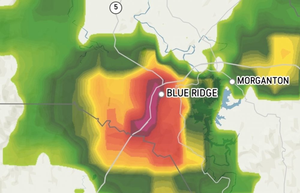
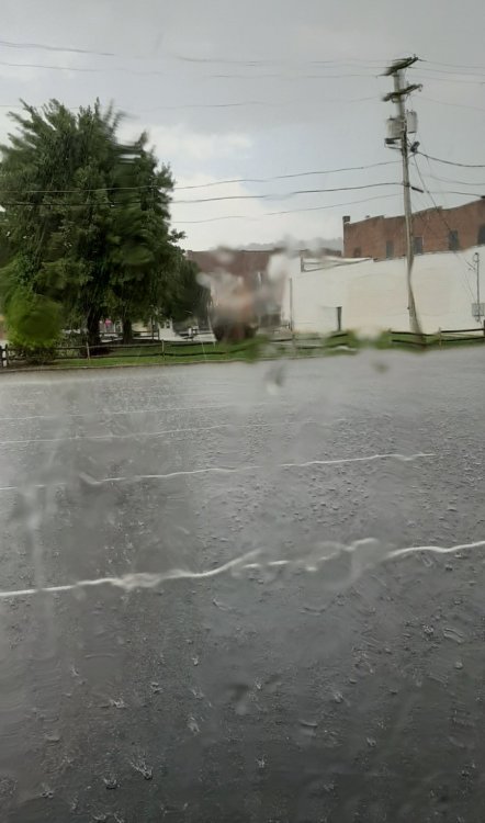
Went to Blue Ridge, GA today to help a friend load some stuff from outdoor storage into a UHaul. Needless to say, if you need a drought busted, I'm your guy.
-
.38 from the rain yesterday evening. I am in Blue Ridge Georgia today but see that it's been pouring up my way today too. Sticky and hot here.
-
One tiny shower in East Tennessee? You can guess who its following.
- 186 replies
-
- 3
-

-
- tennessee river valley
- wind
- (and 4 more)
-
Over 3 inch rainfall total to start July and a 3.5 inch deluge on the final day, ended up with over 12 inches of rain for the month. It's been mostly cloudy to completely cloudy for about 2 straight weeks now. I was honestly shocked to see it was a top 10 warm July around East Tennessee. it simply wasn't here. We had a few hot days and lots of humidity but the clouds and rain kept the temperatures in check. I think I got above 90 two or three times. Looks like TYS and Nooga dodged rain like nobody's business. I believe TYS was under 3 inches for the month. Granted in Campbell County alone the Coop station in Newcomb, which is in a deep valley in far NW CC somehow only recorded 2.88 inches of rainfall but areas 5-10 miles away show up in the 10-15 inch range on the AHPS site. I even remember flooding within 2 miles of there at the beginning of the month but looking at coop obs from the first of the month shows the site getting something like .09 inches of rain. I received 3.17 that same day about 10 or 12 miles from there.
-
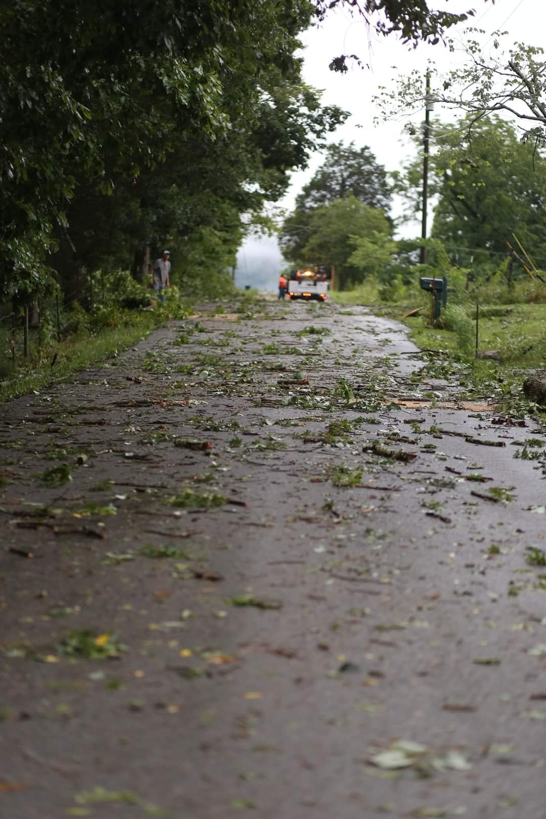
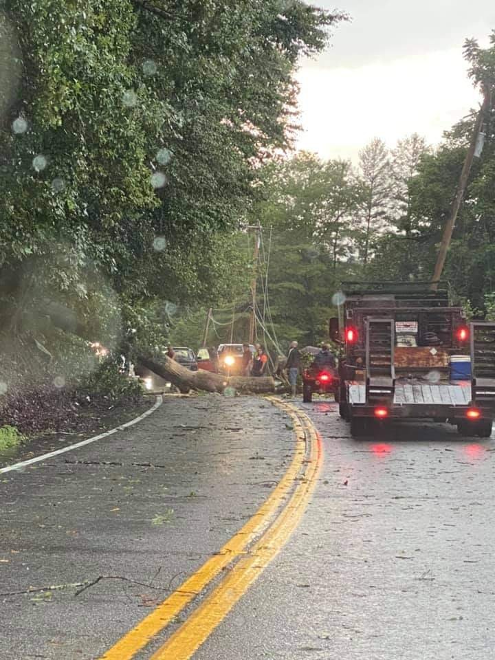
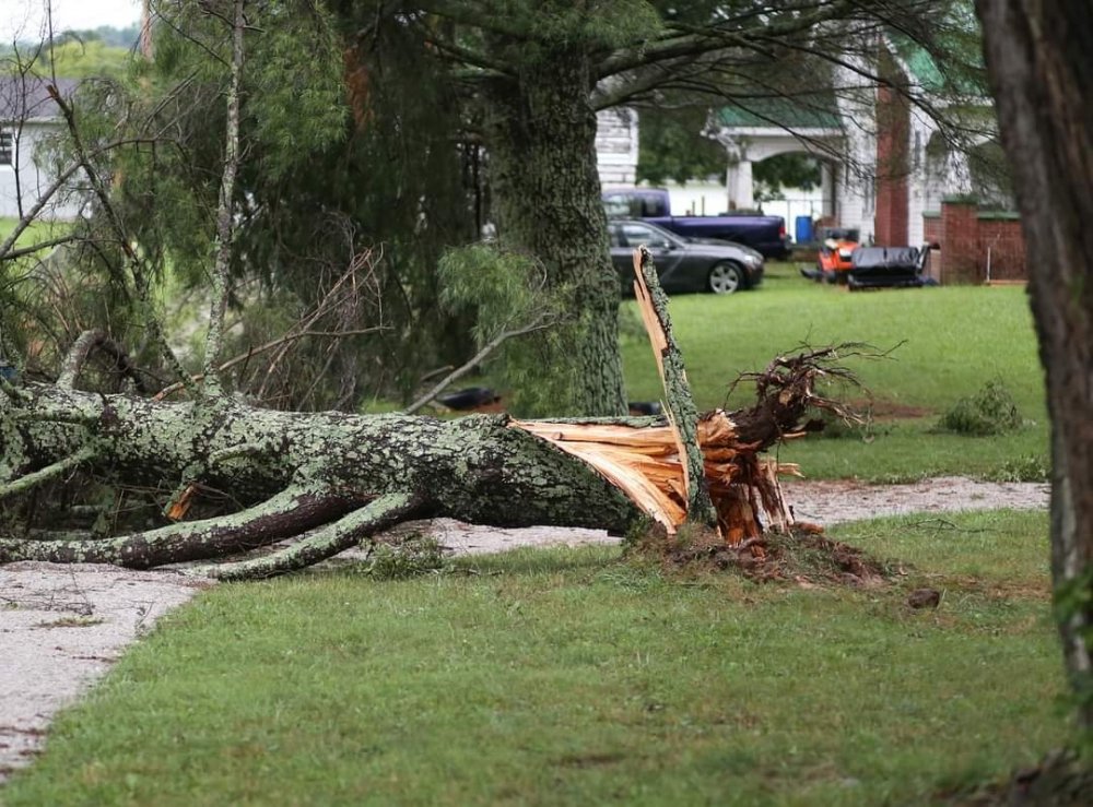
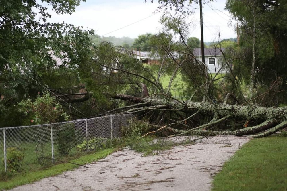
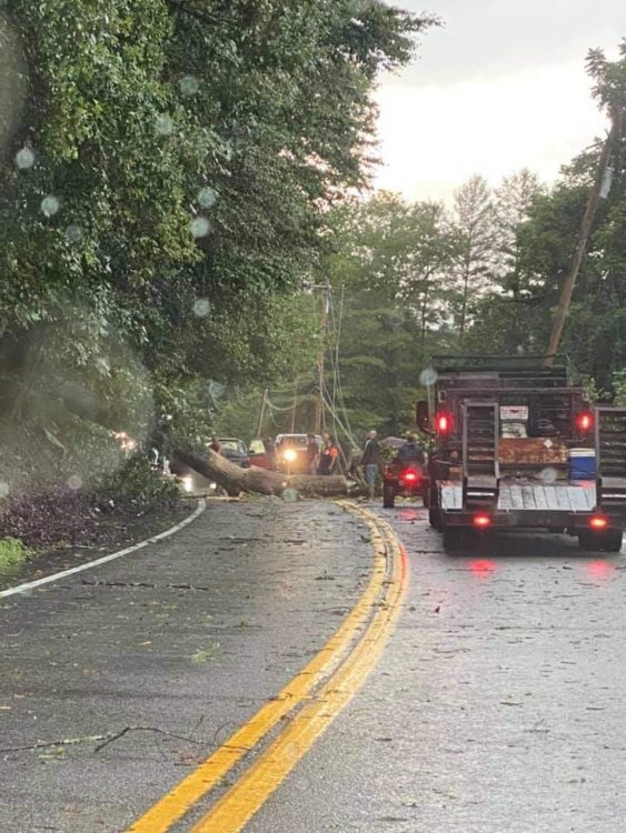
A few storm damage shots from CC from today. This was common across the county and there's a 25 mile long 15 mile wide swath of power outages.

- 186 replies
-
- 4
-
-

-
- tennessee river valley
- wind
- (and 4 more)
-
Huge storm rolled through, knocked down trees all over the county. Power is out for thousands. Destroyed my best tomato plant. It was nearly 10 feet tall with about 40 nice sized green tomatoes on it. Yesterday a deer got three of the tomatoes and today the storm broke out its branches and flattened it, pulled the stakes out of the ground and pulled the cage up. Storm also dropped 1.5 more inches of rain.
- 186 replies
-
- 1
-
-
- tennessee river valley
- wind
- (and 4 more)
-
Slightly over 2 inches out of that. Has drifted south of here for now but looks like more developing just to the West of my area.
- 186 replies
-
- 3
-
-
- tennessee river valley
- wind
- (and 4 more)
-
Still pouring 2 hours into it. Frequent lightning as well. Flood advisory issued by NWS. Why can't a snow shower ever develop and expand and then train overhead like this!
-
Thought this was going to be a small shower but it has been at it for an hour now. The rain kind of elongated from a small shower into one that back built and is now training from west of the Plateau all the way across my area. If it doesn't die out or drift north or south I'll probably get 2 or 3 hours of heavy rain from this one.
-
Spoke too soon, it started pouring at 11:55.
-
Had a much more brief shower today and only picked up .12 inches. Looks like another shower will arrive just after midnight. Even though it was dry, it was of course extremely cloudy all evening.
-
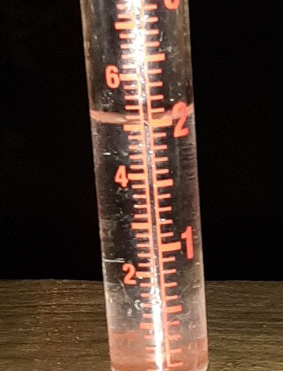
.58 so far today after a small storm just sat overhead pouring. 9.25 inches for July. Areas in far western CC and Eastern Scott are at well over 10 inches this month already due to that big soaker last Sunday that went right down the border along Cross Mtn.
- 186 replies
-
- 1
-
-
- tennessee river valley
- wind
- (and 4 more)
-
I'm a few miles East of I-75.
-
.35 inches today in a storm. Another cloudy evening preventing any comet visuals. That's 9 cloudy evenings in a row.
- 186 replies
-
- 1
-

-
- tennessee river valley
- wind
- (and 4 more)
-
.68 in a very heavy shower earlier today. Had another just barely miss me to the west that had a great looking shelf cloud.
-
1.7 inches of rain today, 3.8 inches this week. 7.64 inches for the month so far.
- 186 replies
-
- 1
-
-
- tennessee river valley
- wind
- (and 4 more)
-
More extremely heavy rains today. After getting 3.6 inches of rain the first few days of July we had a dry two weeks. Not so this week. Looks like we may make another run at a double digit month now.
- 186 replies
-
- 1
-
-
- tennessee river valley
- wind
- (and 4 more)
-
It's been cloudy/rainy here every evening this week. What timing!
-
Extremely heavy rains again this afternoon. Long, window rattling thunder too. It had looked like July might finish BN on rain, then this week happened and it's raining every day seemingly.
-
I don't know exactly how the drought monitor works, but I'm on the edge of abnormally dry and I'm sitting at about 20 inches above normal for rainfall this year. The creeks are at probably 125 percent of their normal flow for this time of year. Even with a drier July than previous months, its stretching it pretty thin to start placing my area anything close to abnormally dry.
-
I'm surprised you hadn't seen rain today, Stove. It's been raining here for a few hours. It's also stormed or been cloudy here every evening this week as I try to get comet photos.