LP08
-
Posts
3,709 -
Joined
-
Last visited
Content Type
Profiles
Blogs
Forums
American Weather
Media Demo
Store
Gallery
Everything posted by LP08
-
Maybe a positive to the amped solutions is we absolutely get the meat of the overunning before any change over occurs.
-
NAM very amped with much more interaction out west than 6z.
-
I’ve lived here way too long. Even through the clown maps say over a foot. That is a front ender of 3-6 to sleet.
-
Damn…it’s all the way in west Va lol edit. Pittsburgh
-
Aigfs a tick north again.
-
That is a wow run of the ICON
-
Aigfs with a nice bump north
-
Through 42…maybe a couple ticks better so far on the gfs.
-
It’s comes out on both, difference is the stream interaction
-
Icon leaves some of the southern vort behind, still should be good
-
Ukie is a hecs lol
-
And its trying to tuck, may just be a hair north with it.
-
Ukie still a beat down
-
UKIE maybe a tad slower and south to bring out the Baja closed low but its coming out.
-
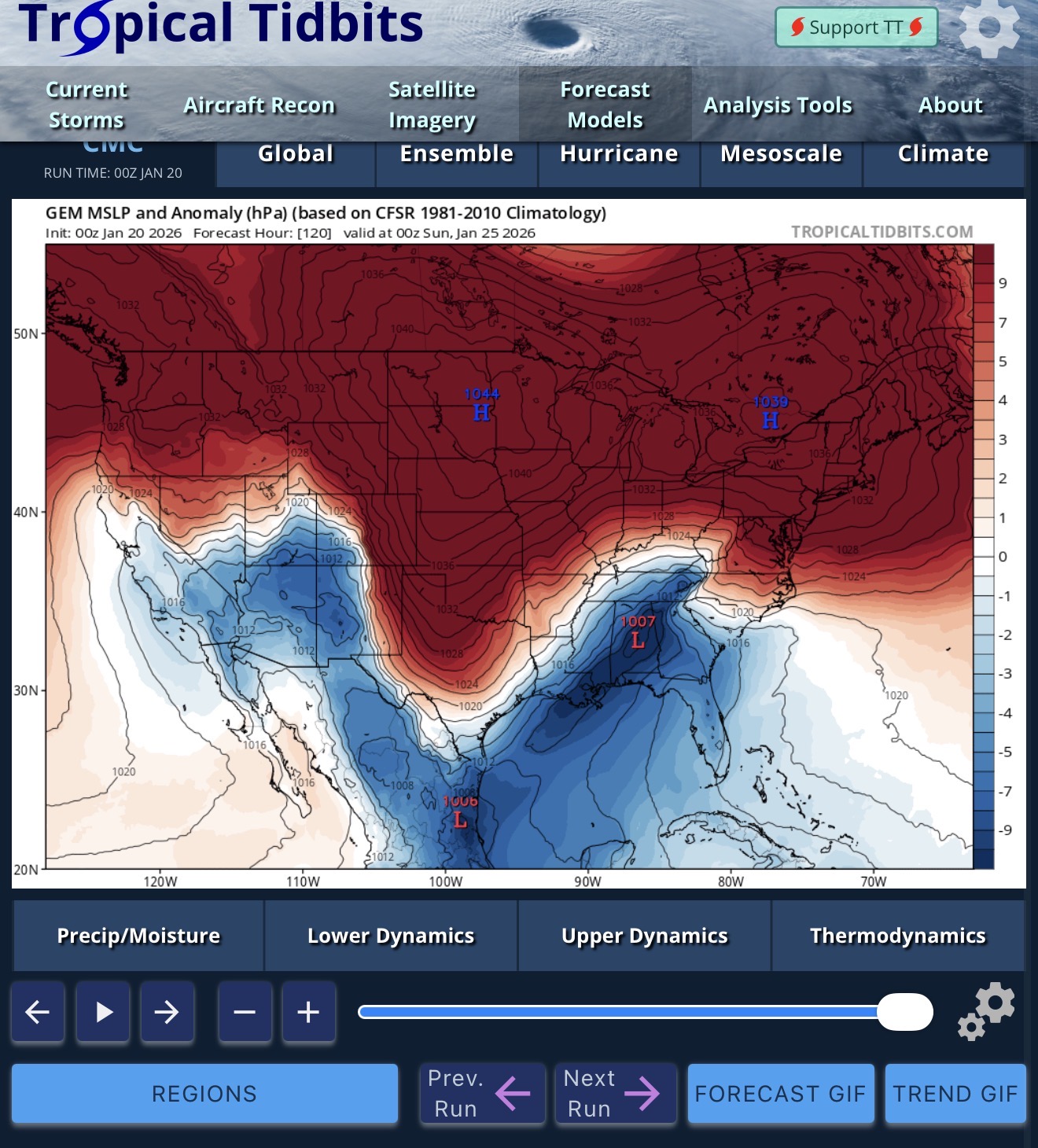
To give an idea to those not watching the models. 20 in charlotte NC, 10 or so in richmond. Basically a whiff north of DC.
-
GFS dragging its heels out west. Less interaction with the NS.
-
Don't think I have ever seen the ICON print that much snow. 12-17 EZF north. 6-10 in Rich with some mixing
-
Just let the Southern SW escape a bit NE. Full phase might get it slow down and tuck in.
-
ICON trying to full phase. 126 SLP off the coast. Mix getting close to Richmond
-
Yeah the ICON is looking nice through 102
-
Yeah…wish we had the dgex to finish that run hah
-
WAA snows are not the best ratio producers even into super cold air masses until the favored zones. Been here too long to rely on anything above 10 or 11-1. Best ratios as always are in a CCB or ULL pass. Stick with 10-1 and adjust higher if needed.
-
What an image.
-
At 84…some positives in the ICON. Less suppressive over the NE and maybe a bit more interaction out west with the Cali Sw and the NS S/W
-
Wasn’t even looking there lol. Just watching the interaction out west. Might need the PV to stay there if the Baja comes out and phases out west.