CT Rain
-
Posts
26,253 -
Joined
-
Last visited
Content Type
Profiles
Blogs
Forums
American Weather
Media Demo
Store
Gallery
Everything posted by CT Rain
-
Phil here, 33 and rain for Woody?
-
Looked pretty nasty near here.
-
Certainly a wintry appeal this weekend on the GFS.
-
Enjoy your rain!
-
 But isn’t the storm basically over by 9z? lots of hand wringing about a dry slot when most expectations are for 6” lol
 -
lol I forgot about that. also why are we complaining about the NAM with this look?

-
Yeah it looks fine to me as well. Maybe some snow grains/sleet pellets once we dry out in the SGZ but the good stuff is probably over by 6z/7z for HVN and OXC.
-
Man, you've ruined your kids lol
-
Scott will be excited.
-
We NAM (at least the 12km)
-
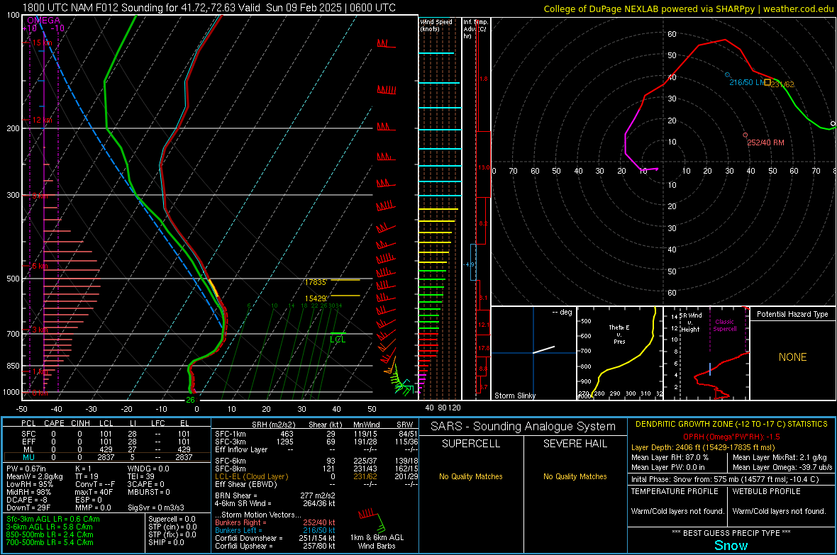
Snow growth looks fantastic down here for a couple hours Saturday evening. I bet we rip 2"/hour rates for two-ish hours and then nickel and dime our way through the remainder of the overnight when the snow growth zone dries out for a bit. The good stuff probably like 10 or 11p for Hartford/New Haven.
-
If we're not going to ice... might as well watch you melt while your pack melts.
-
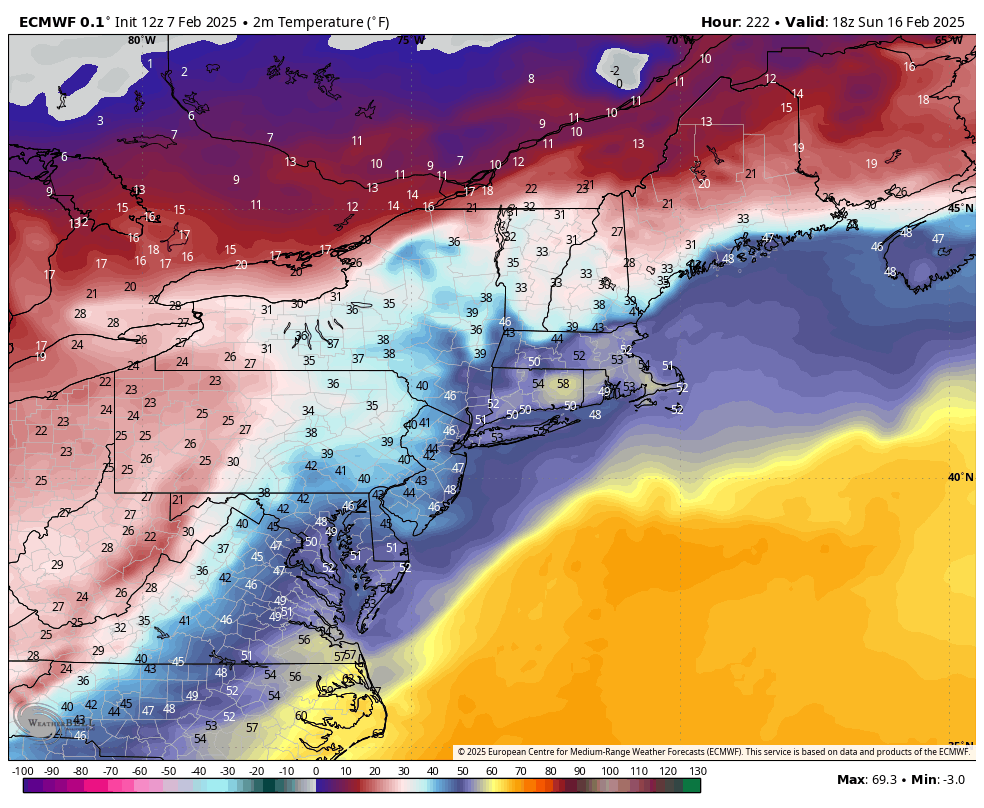
Next weekend too comes close on the Euro with that high anchored over QC.
-
Love the 60F for Tolland next weekend. lol
-
My favorite kind of storm!
-
Obscene run.
-
Can't believe it's been that long!
-
Triple bunner right there
-
Will we ever get a good winter?
-
KMSY 211603Z 01017G25KT 1/8SM +SN FZFG VV006 M03/M03 A3058 RMK AO2 P0001 T10281033 RVRNO $
-
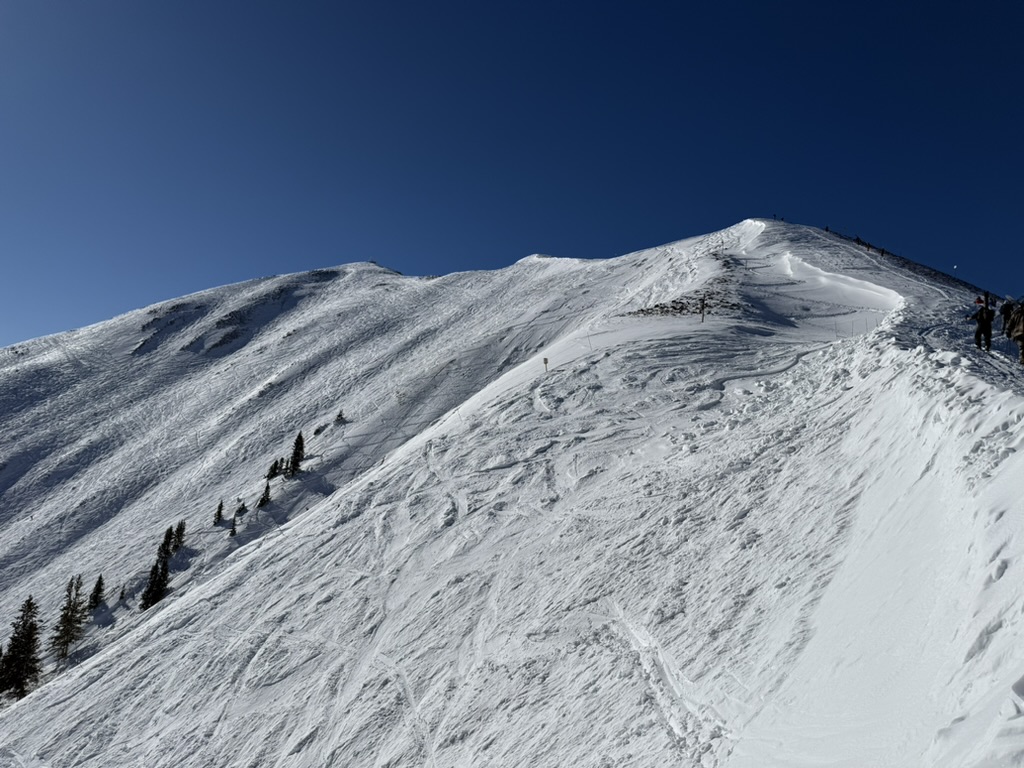
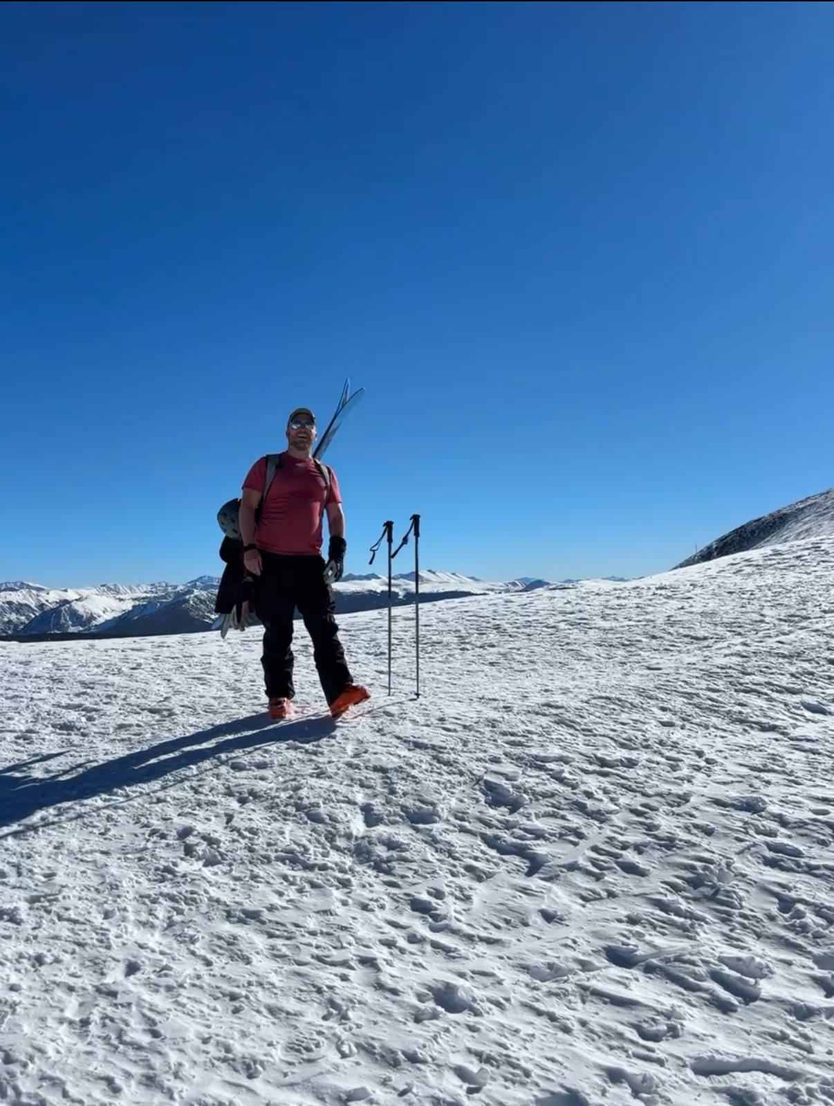
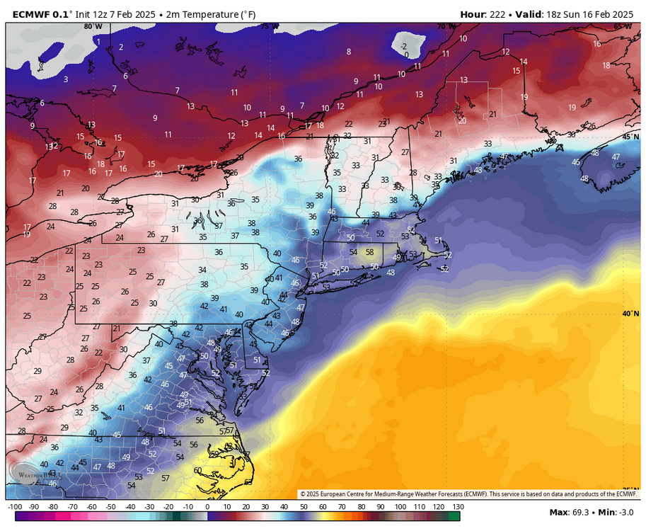
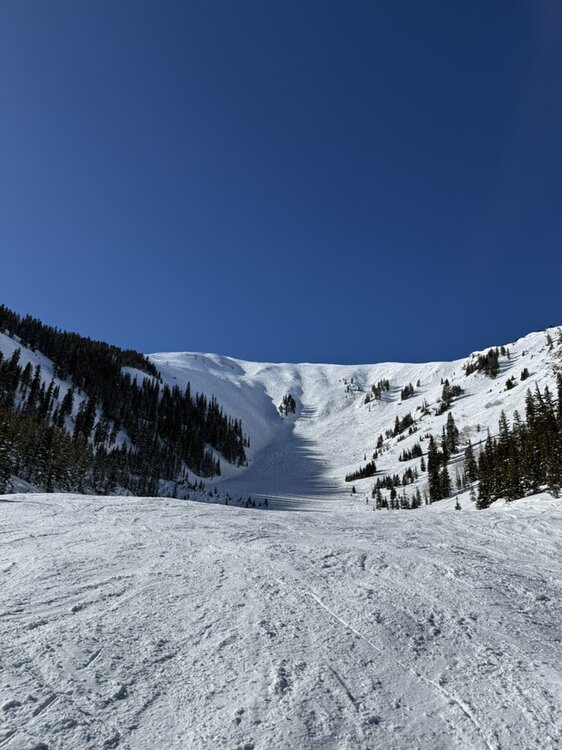
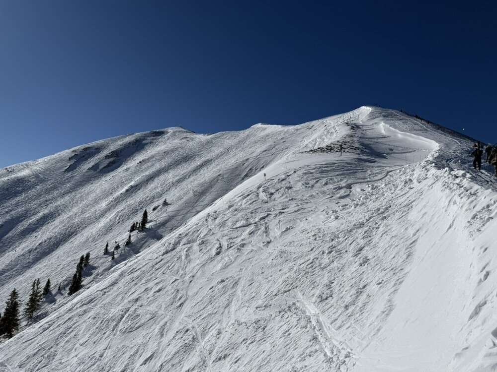
I was in Aspen last week and had an absolutely phenomenal time. The snow was amazing. The highlight was definitely hiking Highlands Bowl at Aspen Highlands. It hadn't snowed in a few days but the powder stashes were still quite good. Can't wait to go back one day.

-
Snowing quite hard here at BDL. Nice little bonus.
-
No - but the GFS solution has always sort of been a thread-the-needle kind of deal. Worth watching for sure but I definitely a step in the wrong direction. We'll see what the ensembles do... the op GFS has always been a significant outlier compared to the GFS/Euro/Canadian ensemble suite.
-
Well that went to hell. Way more progressive with less phasing. Looks like a more op Euro-esque solution.
-
Love the weenie energy in this thread!