CT Rain
-
Posts
26,264 -
Joined
-
Last visited
Content Type
Profiles
Blogs
Forums
American Weather
Media Demo
Store
Gallery
Everything posted by CT Rain
-
This hobby sucks.
-
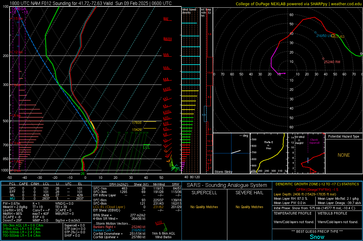
Ice could be significant in parts of NW CT and Farmington Valley tomorrow. That's a lot of QPF on the way.
-
2" here with decent snow growth continuing.
-
18z HRRR is pretty cold for tomorrow too. Quite a bit of ZR around here and points NW.
-
We pray
-
Yeah looks like 6-9 hours of light overrunning as we slot. Good for accretion rates I guess.
-
Still looks icy for many I think. 2m temps are really cold.
-
Still quite cold in the low levels.
-
NAM brings the primary to practically Detroit lol
-
And <0.5" of flat ice accretion isn't going to cause any widespread issues.
-
GFS is colder at 00z.
-
Phil here, 33 and rain for Woody?
-
Looked pretty nasty near here.
-
Certainly a wintry appeal this weekend on the GFS.
-
Enjoy your rain!
-
 But isn’t the storm basically over by 9z? lots of hand wringing about a dry slot when most expectations are for 6” lol
 -
lol I forgot about that. also why are we complaining about the NAM with this look?

-
Yeah it looks fine to me as well. Maybe some snow grains/sleet pellets once we dry out in the SGZ but the good stuff is probably over by 6z/7z for HVN and OXC.
-
Man, you've ruined your kids lol
-
Scott will be excited.
-
We NAM (at least the 12km)
-
Snow growth looks fantastic down here for a couple hours Saturday evening. I bet we rip 2"/hour rates for two-ish hours and then nickel and dime our way through the remainder of the overnight when the snow growth zone dries out for a bit. The good stuff probably like 10 or 11p for Hartford/New Haven.
-
If we're not going to ice... might as well watch you melt while your pack melts.
-
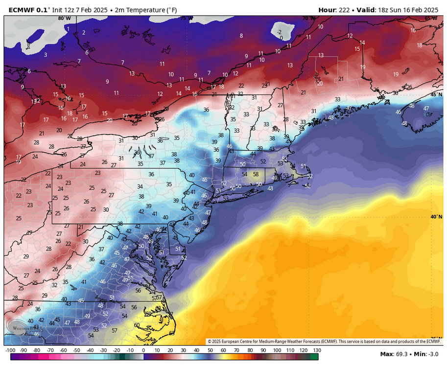
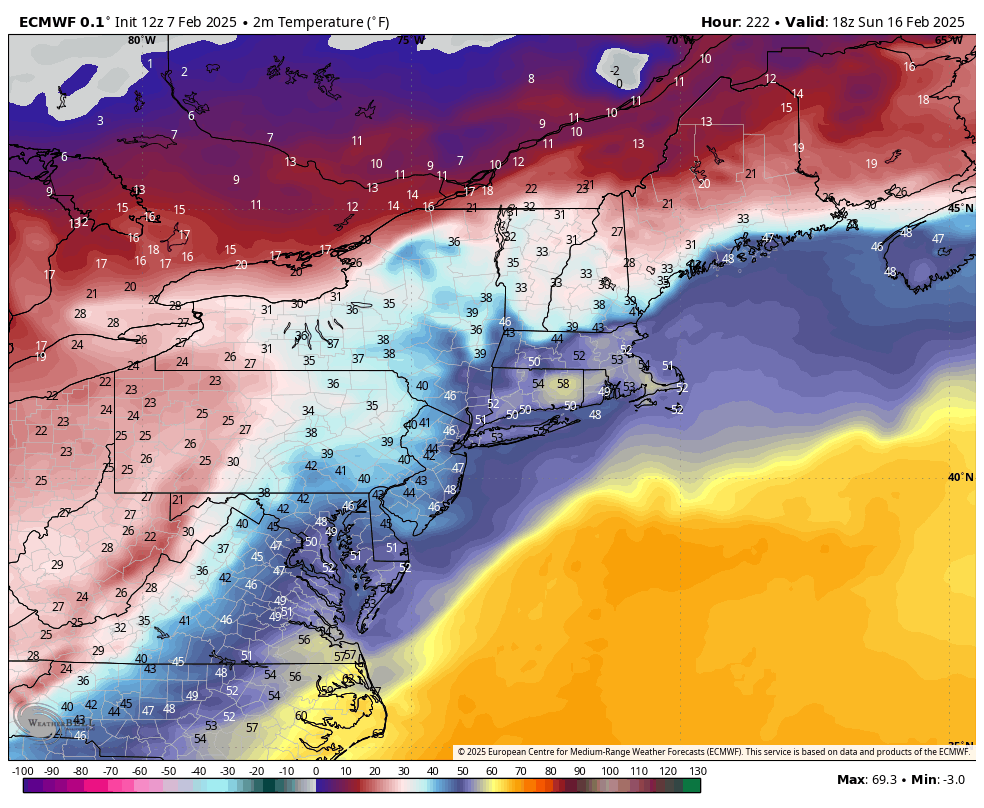
Next weekend too comes close on the Euro with that high anchored over QC.
-
Love the 60F for Tolland next weekend. lol