CT Rain
-
Posts
26,269 -
Joined
-
Last visited
Content Type
Profiles
Blogs
Forums
American Weather
Media Demo
Store
Gallery
Everything posted by CT Rain
-
 We NAM (at least the 12km)
 -
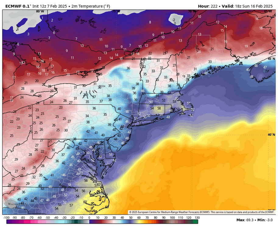
Snow growth looks fantastic down here for a couple hours Saturday evening. I bet we rip 2"/hour rates for two-ish hours and then nickel and dime our way through the remainder of the overnight when the snow growth zone dries out for a bit. The good stuff probably like 10 or 11p for Hartford/New Haven.
-
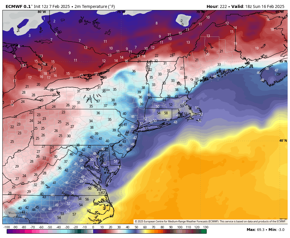
If we're not going to ice... might as well watch you melt while your pack melts.
-
Next weekend too comes close on the Euro with that high anchored over QC.
-
Love the 60F for Tolland next weekend. lol
-
My favorite kind of storm!
-
Obscene run.
-
Can't believe it's been that long!
-
Triple bunner right there
-
Will we ever get a good winter?
-
KMSY 211603Z 01017G25KT 1/8SM +SN FZFG VV006 M03/M03 A3058 RMK AO2 P0001 T10281033 RVRNO $
-
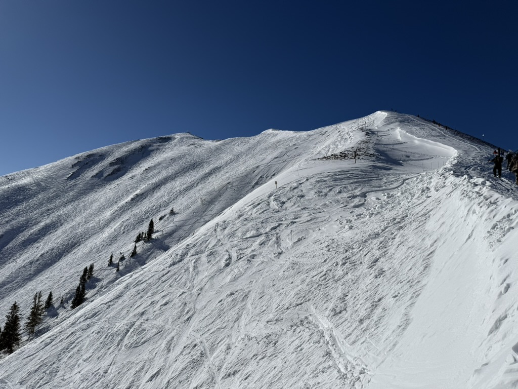
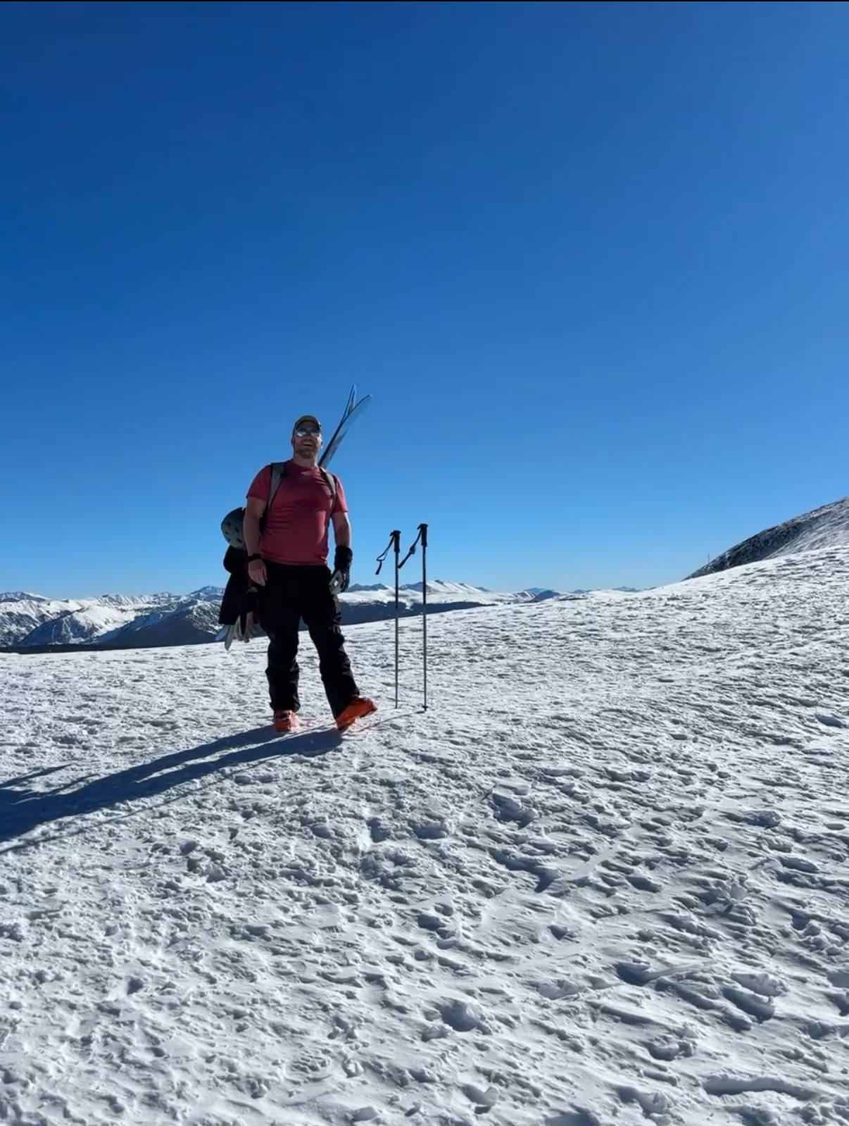
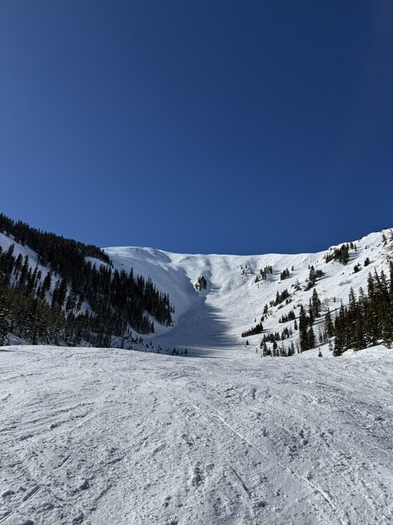
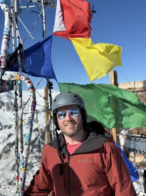
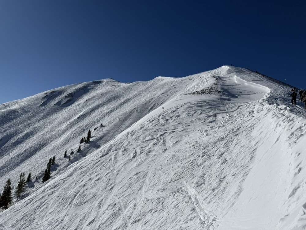
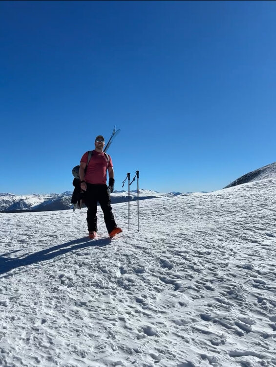
I was in Aspen last week and had an absolutely phenomenal time. The snow was amazing. The highlight was definitely hiking Highlands Bowl at Aspen Highlands. It hadn't snowed in a few days but the powder stashes were still quite good. Can't wait to go back one day.
-
Snowing quite hard here at BDL. Nice little bonus.
-
No - but the GFS solution has always sort of been a thread-the-needle kind of deal. Worth watching for sure but I definitely a step in the wrong direction. We'll see what the ensembles do... the op GFS has always been a significant outlier compared to the GFS/Euro/Canadian ensemble suite.
-
Well that went to hell. Way more progressive with less phasing. Looks like a more op Euro-esque solution.
-
Love the weenie energy in this thread!
-
Better... but still a ways to go.

-
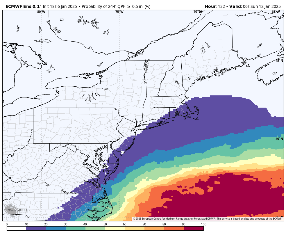
lol I mean it is what it is. FWIW, there's pretty much no change from 12z to 18z GEFS with QPF probs for Connecticut. Mean is getting skewed by some giant hits in there. Definitely interested in the storm... has some high end potential. We'll know more soon enough.
-
The 18z GEFS still with a lot of misses/scrapers. Odds of >0.5" QPF still relatively low.
-
Seems high
-
There's been NOTHING to talk about.
-
A good omen!
-
December 2024 - Best look to an early December pattern in many a year!
CT Rain replied to FXWX's topic in New England
Impressive change for both runs. Let's keep it going! -
Turkey Day Birch Bender Snow Storm/Observation Thread 11/28/-11/29
CT Rain replied to dryslot's topic in New England
Nice! Enjoy it, Will.