CT Rain
-
Posts
26,269 -
Joined
-
Last visited
Content Type
Profiles
Blogs
Forums
American Weather
Media Demo
Store
Gallery
Everything posted by CT Rain
-
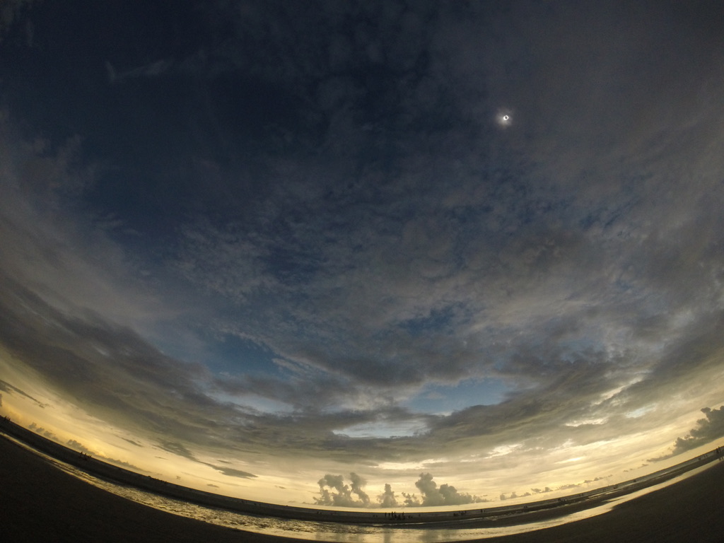
My parents drove to Danville, VT to a brewery I found online. I told them to leave right after totality and they managed to hit no traffic at all coming down 91. Made it back to New Haven in like 4 hours. In Dallas there was no traffic either… seems like everyone who worked downtown stayed home. No rush hour and just the coolest of vibes.
-
What a day. it also seemed better than 2017 to me!
- 821 replies
-
- 11
-

-

-
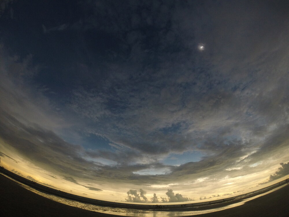
Completely cleared out in Dallas for totality. The cu field went poof and miraculously had no cirrus! Just an absolutely exceptional experience.
- 821 replies
-
- 14
-
-
-
I have no idea how my flight tomorrow is going to take off given the severe weather expected!
-
My parents are driving up to St. J this morning. I told them to get on 91 as soon as it’s over. Hopefully they don’t get stuck forever coming back to CT!
-
This was my view in 2017 in Sullivan's Island, SC.
-
New moon goon!
-
Someone who gets excited for a 940mb low on satellite off Newfoundland finds viewing a total eclipse in person as boring.
-
Looks like a decent cirrus deck there. Hopefully we get some breaks but who knows how that will shake out until the day of. I'll be happily surprised!
-
The difference between 99.5% and 100% is enormous. It's like night and day. Looking pretty cloudy for me but maybe I'll get lucky. Who knows lol
-
1970 was only a total solar eclipse on Nantucket. I saw 2017 in person in South Carolina on Sullivan's Island. I was excited for it but the experience completely blew me away. I used to think the people that called it a spiritual experience were overly dramatic but it truly was.
-
You haven't been in totality then.
-
Yeah liftline was fogged in and misty but Lord and those other blues on the side were completely sunny. Was nice to get some sun.
-
Today turned into an awesome day at Stowe with a really cool undercast and soft snow. Could have used some wax on my skis lol
-

It was a Flop... February 2024 Disco. Thread
CT Rain replied to Prismshine Productions's topic in New England
I'm heading up to Stowe on Friday 3/1. Hopefully the Wed rainstorm isn't too painful! -
Same here. Was in Charleston in 2017 and heading to Dallas this time. Can't wait.
-
It's amazing how quickly things tend to decrease once you get east of Guilford. My parents had 7.5" in Guilford only 2 miles from the Sound.
-
We take everything about this map
-
BDL had 7.1" as of 18z.
-
I thought this was an interesting way to visualize this forecasting cluster.
-
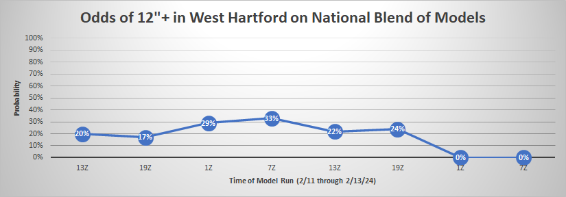
Just about 1" of liquid here so 15.7" in West Hartford comes to about 16:1. Love a good deform band!
-
15.2" in West Hartford here at the station. Nuts.
-
GFS is south a bit but still good for the south coast. Seems like a bit of an outlier at the moment.
-
The problem is half the ensemble members are time lagged so you're getting 50% of that mean coming from 12z runs and 50% from 00z runs. When there's a dramatic shift the utility of the HREF is definitely more limited.