CT Rain
-
Posts
26,302 -
Joined
-
Last visited
Content Type
Profiles
Blogs
Forums
American Weather
Media Demo
Store
Gallery
Everything posted by CT Rain
-
Another 2" here...
-
We had mostly cloudy for the day.
-
KJFK 262151Z 02026G48KT 10SM -RA OVC023 16/12 A2971 RMK AO2 PK WND 01048/2145 SLP061 P0000 T01560122 $ Not bad
-
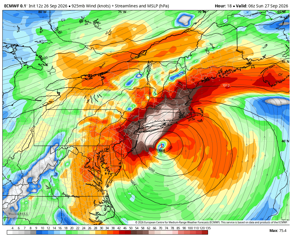
If the Euro is right with the evolution of the LLJ we should see a notable uptick in winds across LI/CT between now and 8p. Worth watching that.
-
You never disappoint!
-
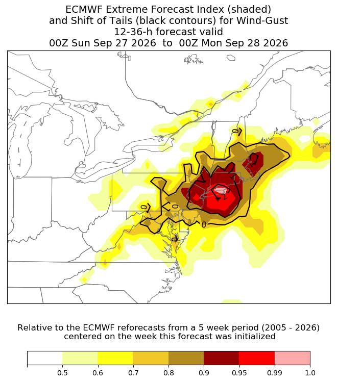
It's pretty cool. Basically how many of the ensemble members are in the 90th percentile of MClimate... and then how far are those beyond the 99th percentile. The shaded area is the confidence in an extreme event and then the black lines are basically how extreme the extreme is.
-
-
Yeah in November the trees would barely be swaying.
-
One of the more impressive looking daytime wind/rainstorms I can remember around here. Leaves on the trees helps a lot!
-
-
Would certainly argue for 60 barring some kind of sharp inversion.
-
-
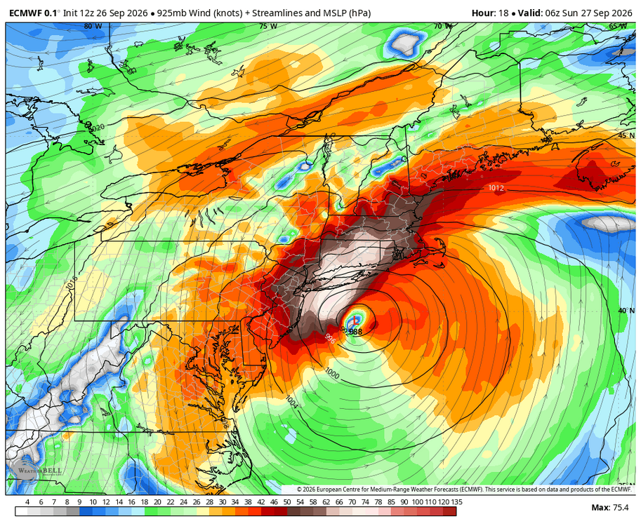
Not to sound like Kevin but the Euro is a ripper for CT/LI around 6z.
-
Becoming more of a warm seclusion. Has definitely had fronts for its life so far and is getting most of its energy through synoptic scale forcing with the digging trough. Not really a hybrid/subtropical storm but definitely a warm seclusion.
-
I'm curious what people would like us to do. For example, look at the call to action on the NWS coastal flood warnings and high wind warnings. Probably more "panicky" than anything a met said on air. Our forecast will turn out to be pretty much perfect in terms of wind gusts, impacts (scattered outages), and coastal flooding (minor to barely moderate).
-
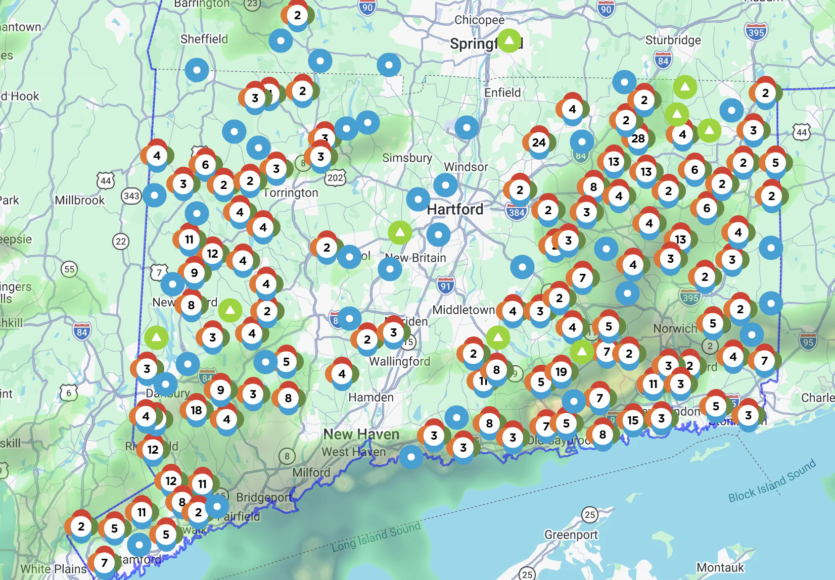
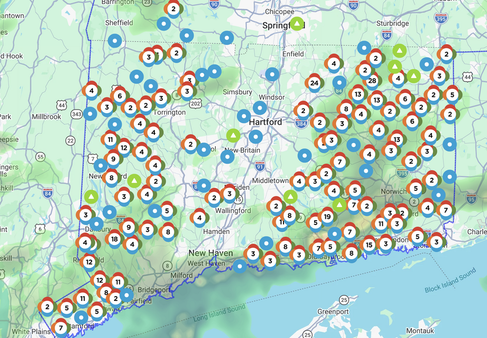
Eversource up to 20k out in CT. The distribution is pretty cool with nothing at all in t he valley.
-
Yup helping out this morning. Not sure how the day shakes out. Models look a bit less impressive with mixing but the Euro is still impressive with that LLJ.
-
FRG at 53 knots. Maybe OKX will issue the high wind warning now?
-
Yeah just odd. LIke did they look at a bufkit sounding? lol This is what happens when you're tied to model blends and WPC grids.
-
Really bizarre behavior by them. No coastal flood watches yesterday either around here. Strange.
-
That's a lot of wind on the Euro.
-
I had 50-60 at the coast.
-
What’s the deal with OKX not issuing high wind warnings?
-
When did you transition from every storm missing and bermuda blues and a spot shower to destructive windswept rainstorm for days? The equinox?
-
Why am I not surprised this is turning out to be a snooze. Just enough to ruin another weekend too!