Disc
-
Posts
4,052 -
Joined
-
Last visited
Content Type
Profiles
Blogs
Forums
American Weather
Media Demo
Store
Gallery
Everything posted by Disc
-
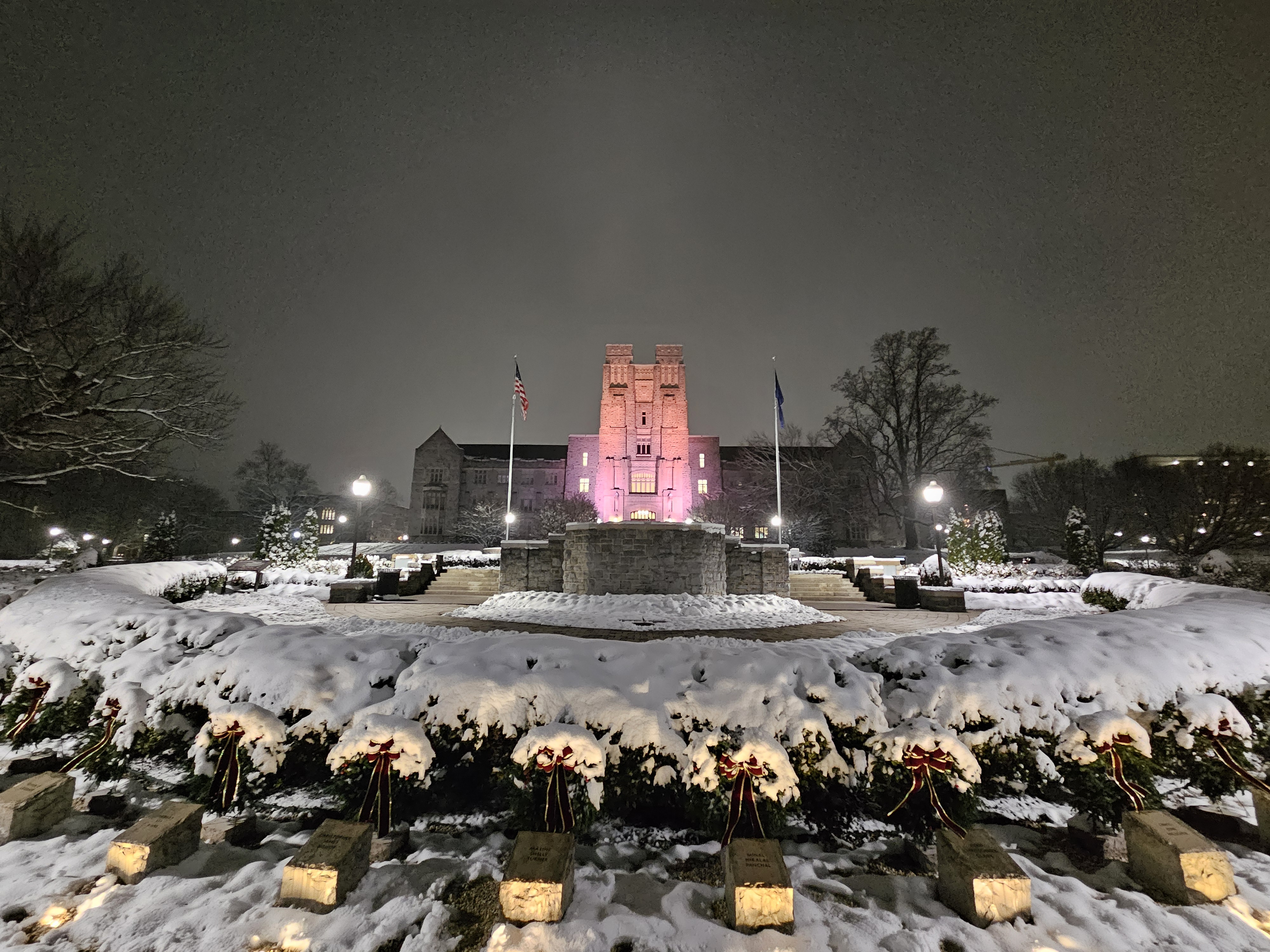
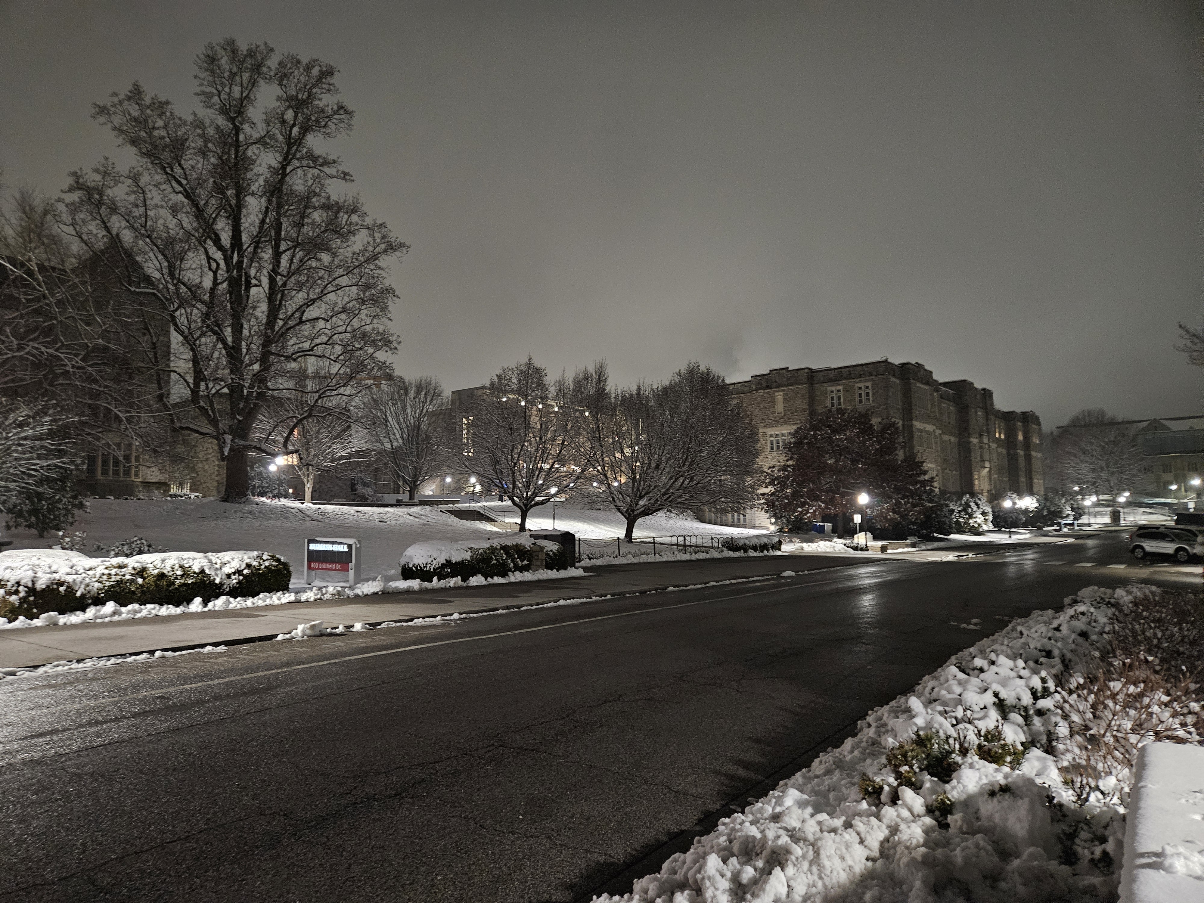
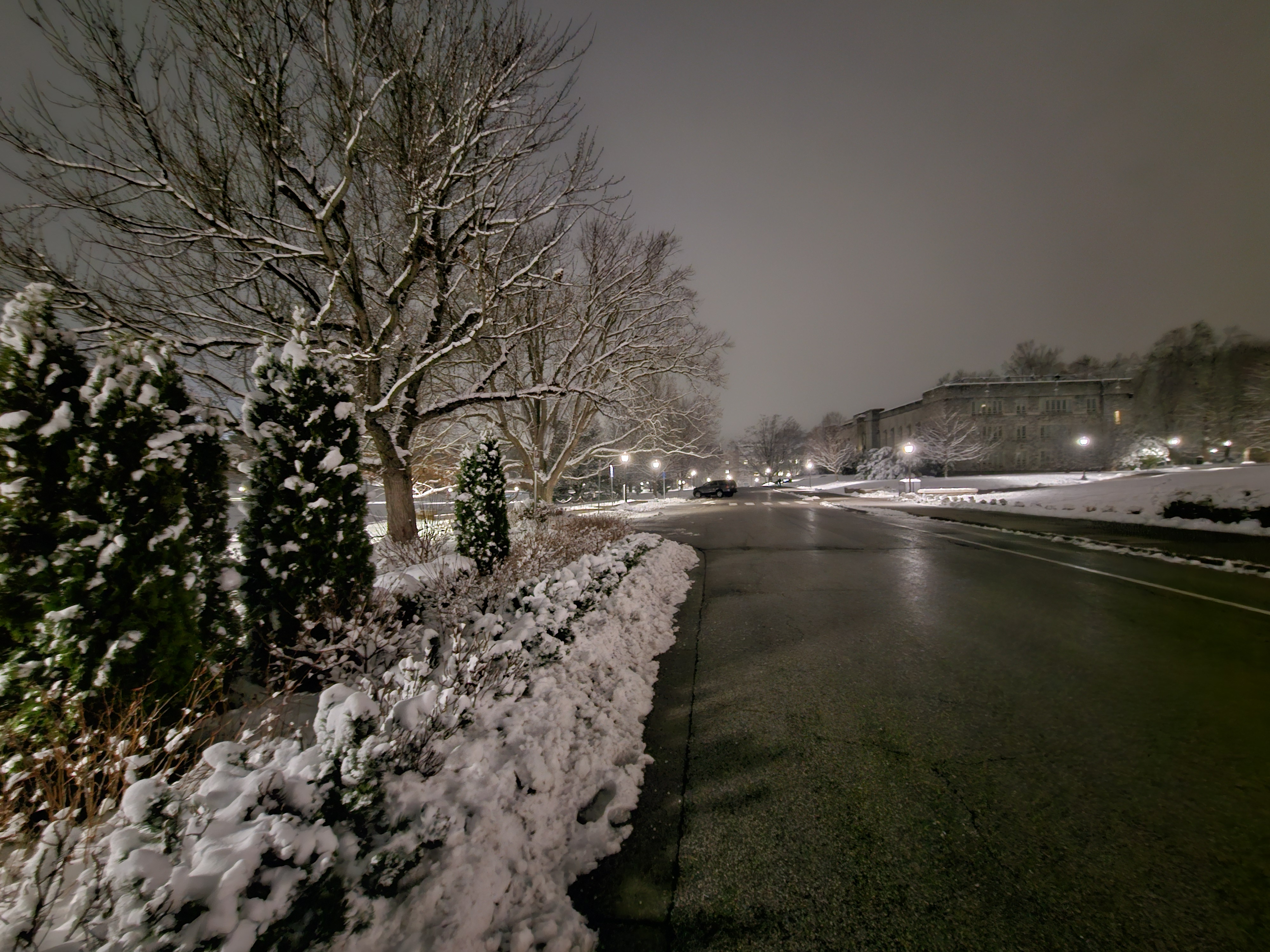
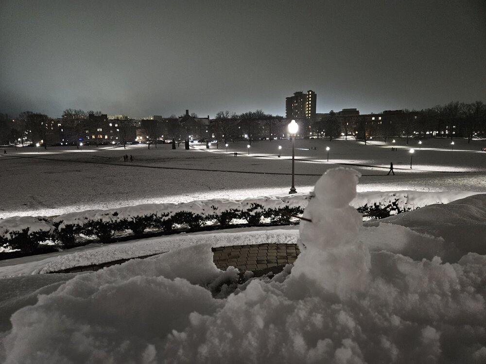
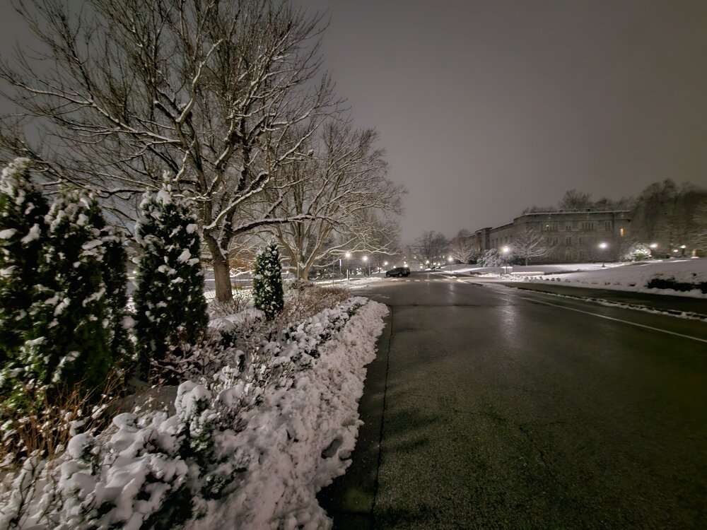
Some photos from Virginia Tech this evening. Never broke 32F today. Back down to 27F with some freezing fog setting in.


-
1 1/2sm vsby. 30F
-
A few flakes falling now. (Blacksburg, VA)
-
Snow cam is ready to go!
-
Yep! Very icy over this way. Had to "shuffle" to move across the parking lot.
-
A lil slick down here at the office. Currently 26F.
-
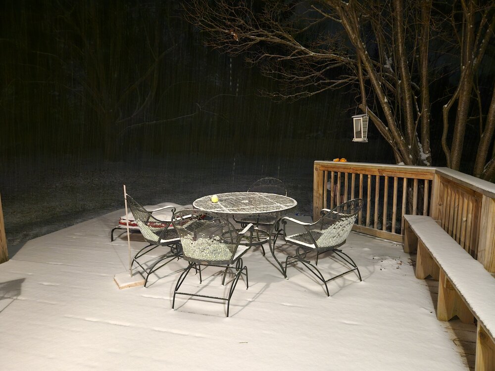
Steady snow in Blacksburg. Secondary roads and all sidewalks covered. Intensity has just really picked up. Down to 24.5F and dropping fast.
-
Power has been flickering here now.. but still on as of now. Gusting mid 40mph range.
-
Whoa! https://www.resortcams.com/webcams/king-street-boone/
-
Already getting gusts in Ashe and Watauga Counties in the 50mph range at higher peaks.
-
I hope everyone here and everyone in general stays safe. This is a significant event unfolding. We can't stress enough how serious this event could be as the main circulation comes through in the morning.
-
Still a lot of cloud cover and drizzle across much of Virginia leading to a lot of uncertainty. If we can start to break out of the clouds, I think this has a decently high ceiling considering the parameter space in place. CAMs are rather impressive with discrete cells forming in NC around 21z and then moving into Virginia and congealing more into a broken line as they progress into Central and Northern VA by 00z - 03z. Some impressive helicity tracks are noted moving into Southern Virginia, but wane a bit as they move north of I64, where I'd say this becomes more of just a wind threat. The new RRFS has been the most robust with this advertising multiple discrete cells, but the HRRR and NSSL/WRF models have a similar idea. I believe the WoFS will be run starting at 17z which has proven to be quiet skillful in the near term.
- 1,696 replies
-
- 3
-

-

-
- severe
- thunderstorms
- (and 5 more)
-
Light snow for about an hour or so.
-
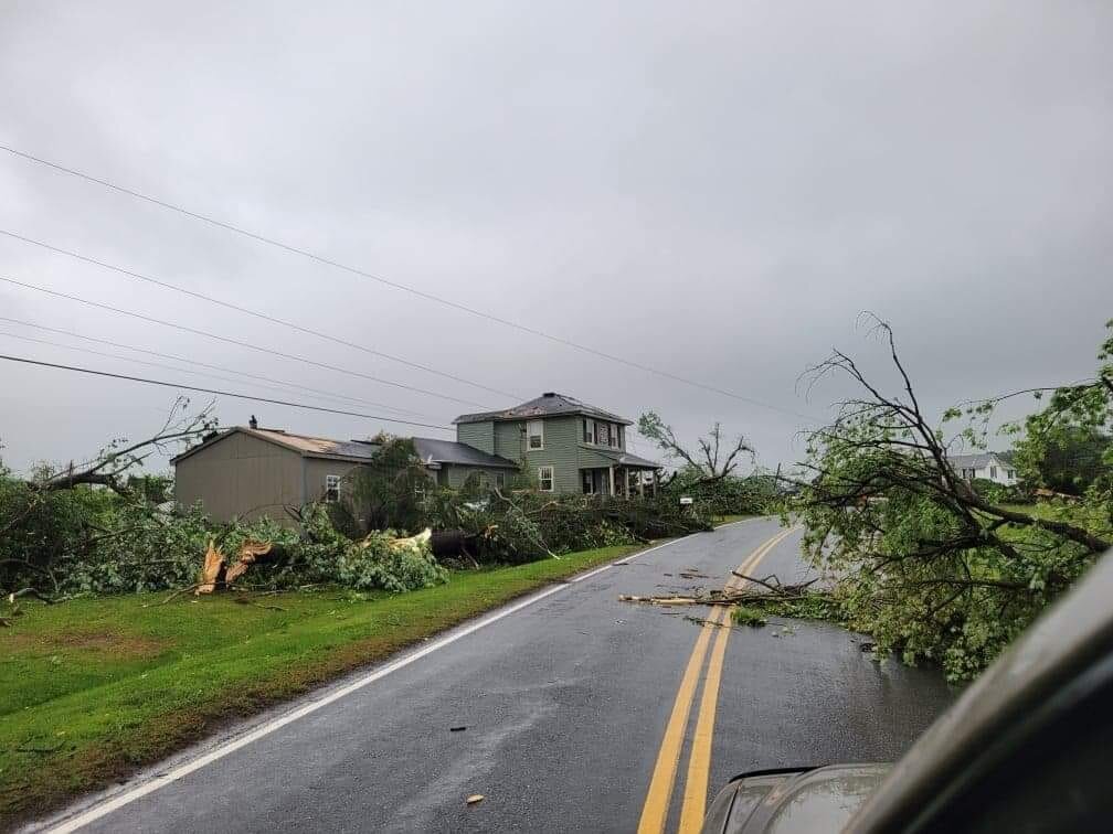
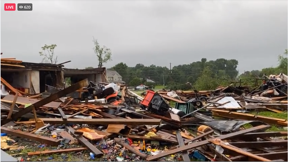
Large debris fallout in correlation coefficient. A significant tornado likely occurred. Hearing reports of people trapped in Nash County.
-

2023 Mid-Atlantic Severe Wx Thread (General Discussion)
Disc replied to Kmlwx's topic in Mid Atlantic
Lots of golf ball and even a tennis ball size hail from the storms in C VA today.- 2,785 replies
-
- 2
-
-
- severe
- thunderstorms
- (and 3 more)
-
All sleet in Blacksburg, VA. edit: and now just rain.
-
Here and watching. Our best chance at snow all winter. ULLs can do some crazy stuff, so this will be a wild ride the next few days.
-
Think of the NBM as a cycle or two behind the deterministic guidance. The 18z NBM has the 12z GFS/GEFS, but still has the 00z ECMWF/EPS and some 06z guidance. Full ECWMF 12z guidance is not within the NBM until its 21z run.
-
2022 Mid-Atlantic Severe Wx Thread (General Discussion Etc)
Disc replied to Kmlwx's topic in Mid Atlantic
Damage in Bedford Co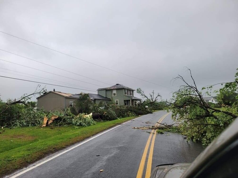
-
I like where this was going..
-
Globals are keeping it just under the 0c isotherm, but I still don't think they're picking up on the warm layer. I'd be glad to eat my words later, but this one just screams mixing all the way into western VA. We do get a good ULL pass so that may help at the end. 2014's storm was further east though. This one is way inland and we had mixing issues up to the Blue Ridge in 2014 with a storm that was further east. Perhaps trends will improve tomorrow, there's still a little time left.
-
I am just not feeling this for southern/SW VA. With such an inland track and secondary low still wanting to go up the Apps, we will mix sooner than later. I've seen it numerous times. This is why I was hesitant earlier to say 12" up here is a lock and the trends this evening have me even less confident.
-
18z ECMWF was similar to the 12z run. The low transfer to the coast took slightly longer though.
-
I'd say between 7am-10am.