Disc
-
Posts
4,052 -
Joined
-
Last visited
Content Type
Profiles
Blogs
Forums
American Weather
Media Demo
Store
Gallery
Everything posted by Disc
-
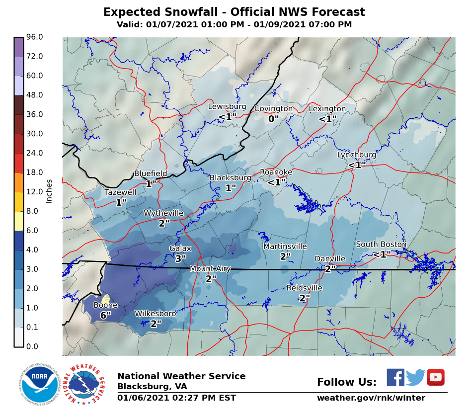
And just like that, the 18z NAM catches on for Virginia.
-
I still think the precip will be more expansive into Virginia than what the NAM/3k NAM models are showing. I've clicked thorough just about all other hi-res guidance and it does not have that sharp northern cutoff. I'll be very surprised if it indeed shuts off right at the VA/NC border.
-
I honestly haven't really looked further east into NC. I do think you all have rain first or slight mix and may change to snow as the low pulls off the coast. Snow amounts? Not sure. High end snow map from NWS Raleigh has you all pushing an inch or so. Boundary layer is quite marginal and at the moment you're more in the position for a "white rain" scenario. Full forecast package update will be 1am-4am.
-
Folks along and north of I-40 are sitting good right now. Mountains/foothills are gonna get a really good snow. VA/NC border should do really well too. Much uncertainty on the northern extend of the precip shield, but as climo suggest with such a track, areas even further north into VA will do well. I see the 18z GFS is finally playing catch up too and showing snow into VA. Models will continue to adjust and I would not be surprised to see continued slight north trends for the next 24hrs. I have a hunch our snow totals will be going up overnight, but I will leave that to the overnight shift to decide and I can't 100% speak on behalf of them.
-
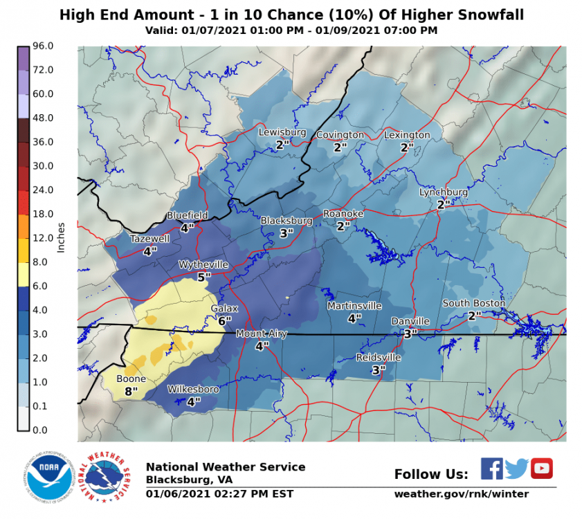
A look at higher end amounts too.
-
We'll fine tune totals. This was a significant adjustment up from what we had. There's a myriad of guidance we view that is not available publicly.
-
For our southern VA and northern NC folks.

-
Forecasting this has been a nightmare.
-
28 degrees and half mile vsby. Merry Christmas!
- 485 replies
-
- 12
-

-

-
All snow. 30.9F and still falling fast. Roads already turning white.
-
I just dropped from 50F to near freezing within 10 to 15 minutes. Wet flakes mixing in with sleet pellets..
-
Still 51 here. Things get interesting here in the next two hours or so.
-
weather.cod.edu is good as a free option. Has a 3-4" mean total snow for the northern Shenandoah Valley/81 corridor.
-
Take a look at the 21z SREF for kicks for the western folks.
-
I'm surprised there's not much talk about this front coming in on Xmas Eve. Very impressive system, albeit in and out fast. ETA: Nevermind. Few folks talking about it in the discobs thread.
-
Add me to the ripping fatties category.. Finally. Huge flakes. Road caved instantly. Sticking to everything. Hopefully a good sign for those to the north.
-
Officially all snow. Big fat flakes. No sleet or freezing rain. 31 degrees.
-
So close to finally saying "ripping fatties". Big flakes mixed with sleet.
-
My dry slot time is about over. New batch of precip moving in. It might actually be snow this time. Burkes Garden it's coming down good on the cam. https://52d9f0c4c24ee.click2stream.com/
-
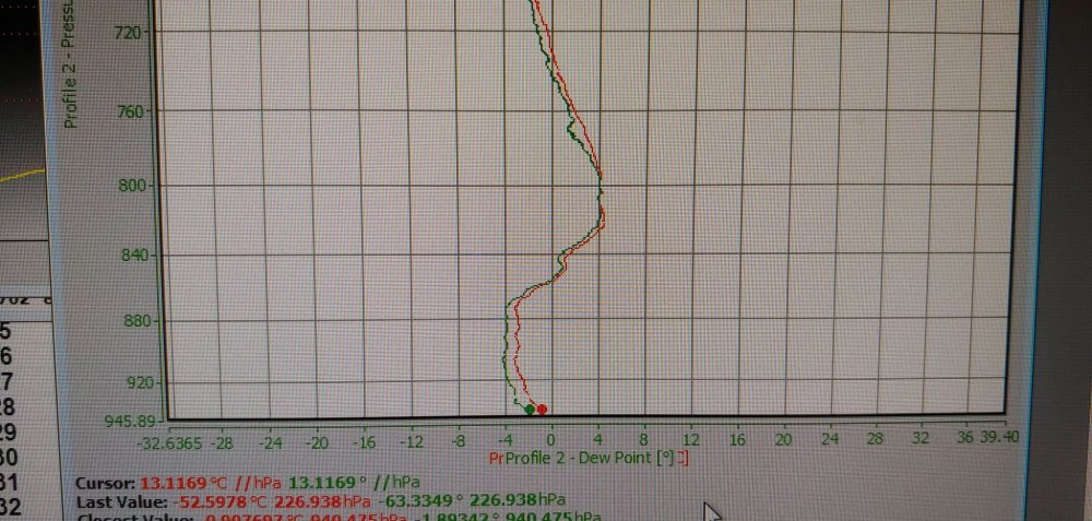
The 18z sounding at IAD looks all below freezing, but looks like this launch was sent up before the sleet/mixing line moved through judging by the radar correlation coefficient. The warmest spot was right near 0C between 930mb to 880mb.
-
I might be able to hook you all up when it appears in our system.
-
Yes. We are still 29F at the surface way down here.
-
I can only see our real time data.
-
Big warm nose on our 18z launch. I believe Sterling is also sending one up.
-
Can almost always bank on it.