Spanks45
-
Posts
4,368 -
Joined
-
Last visited
Content Type
Profiles
Blogs
Forums
American Weather
Media Demo
Store
Gallery
Everything posted by Spanks45
-
Winter 2020/21 is October 31st to November 30th...Spring begins December 1st, wouldn't surprise me with the way 2020 has treated us, Lol. 44°/44°, 0.89" of rain over the past 2 days
-
It was actually in the Newtown page, which tends to be moderated a bit better, but yeah the Southbury is laughable at times...hard to believe some of those people are neighbors!
-
I assume it had something to do with the fact that the dews rose yesterday and it wasn't evaporating the way it was days before. It was that bad that I thought I had sprung a leak somewhere....so weird
-
I noticed yesterday that my north facing walkway was soaking wet all day yesterday, despite everything else around it not being moist and not having any rain in nearly 10 days. It seems to be happening all around the area down here, as the town FB page had multiple people mentioning the same strange situation yesterday.....
-
a friend's parents just got it, from simply having an uncle stop by and help out with a few things around the house. Both parents are not doing very well at this point, amazing how 1 simple interaction could lead to dire consequences.....we need some sort of vaccine asap
-
I started putting fence posts in the ground for the garden yesterday so it is ready for planting in the spring. Might as well just plant the garden now, fresh veggies all year at this rate....
-
30.9° this morning to 79.3° this afternoon, just your normal 48.4° temp swing in a few hours.....
-
Crazy difference between elevation around here over the past week...frost almost every morning with a massive rebound by afternoon.
-
its like finally getting the EURO to latch on to the blizzard being shown by most models....GFS is Nevada at the moment, might show the blizzard after the snow starts falling
-
Just hit 70 here...29 to 70, what a day
-
A foggy 29.8⁰ this morning....everything had a frozen layer on it. The next closest weather station was 44 degrees, what a pit this area is...
-
Lol, we might know the outcome to this winter before we know who wins the election....
-
Was just thinking the same thing....furnace is a given though
-
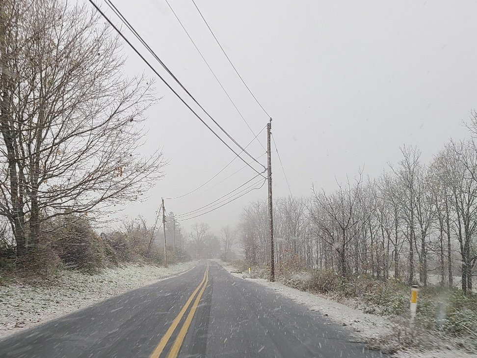
Looks like we have some sort of squall incoming...
-
It has been leaning that way since yesterday....not a good look for sure
-
Ebb and flow, 2020 style...
-
We had a slushy trace here on the western end of Southbury...
-
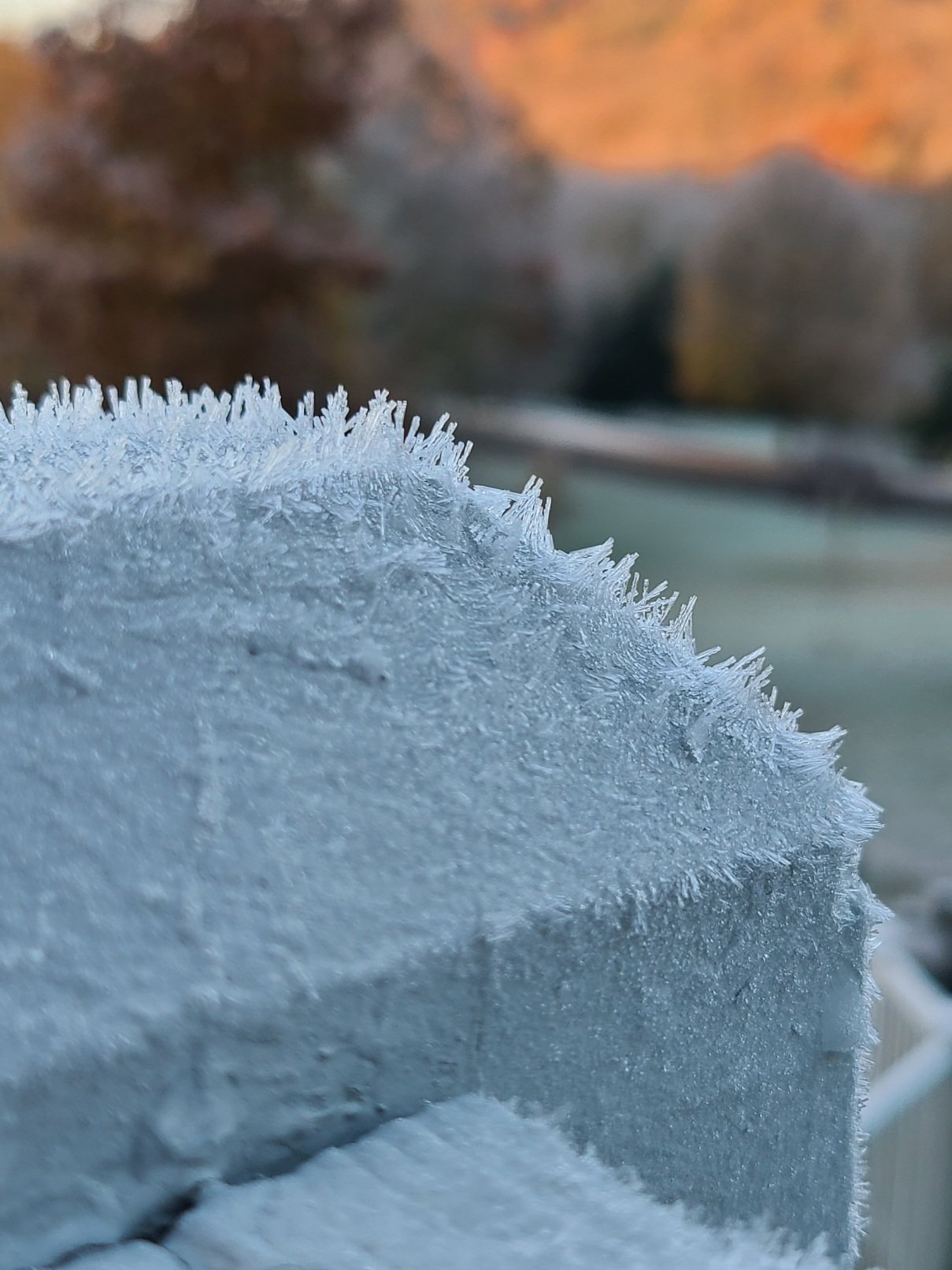
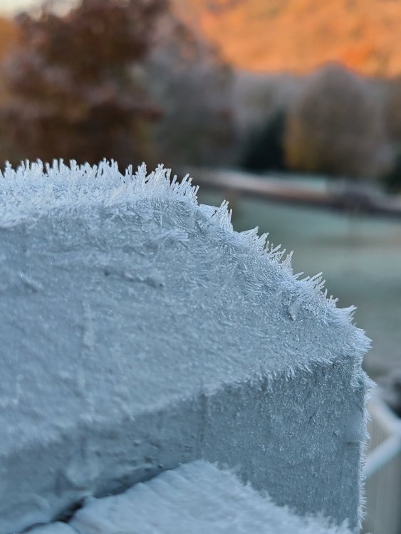
Crazy ice formations all over everything...looks like mid January
-
21.9⁰ without snow cover....way too early for this. The freezing fog is pretty impressive though
-
just some slush here....probably an inch or 2 on the hill. Temp briefly dipped to 33.3°, back up to 33.6°. Not our storm, winter saved?!?! On a side note, if the winds die down and the clouds move out it will probably be 20 degrees tomorrow morning with everything frozen solid
-
First pic is at 175', home and the second is roughly 715', 3 minutes up the hill....what a difference, temps are roughly the same.
-
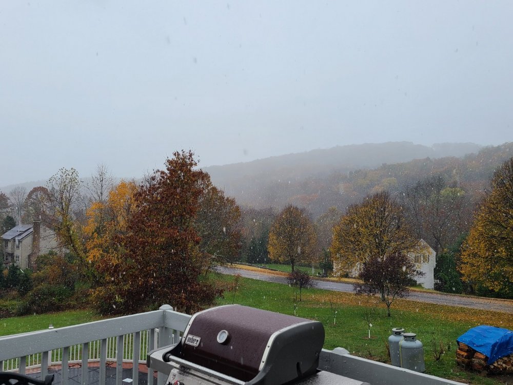
it is close here, 75 snow/25 rain....34.7°
-
mostly rain here at 175 ft, but the top of the 700 ft hills are white....
-
Thought it was just here, figured it was snowing everywhere besides here in the "valley"....finally see a few flakes mixing in as we speak though. Kids want just enough to slide down the hill, might have to stick to sledding on wet leaves and mud. Temp down to 35.4⁰
-
Long Range HRRR at 18z looks quite snowy for SNE...it is the HRRR and past 6 hours, but snow weenies will like.