Spanks45
-
Posts
4,368 -
Joined
-
Last visited
Content Type
Profiles
Blogs
Forums
American Weather
Media Demo
Store
Gallery
Everything posted by Spanks45
-
Great views from my house as it sits at the high point of the "valley". I don't think those hills will effect much, might end up staying under 32 in freezing rain events though. The breezes are great, so much better than our last place, surrounded by trees, never had any breezes, always felt stagnant.
-
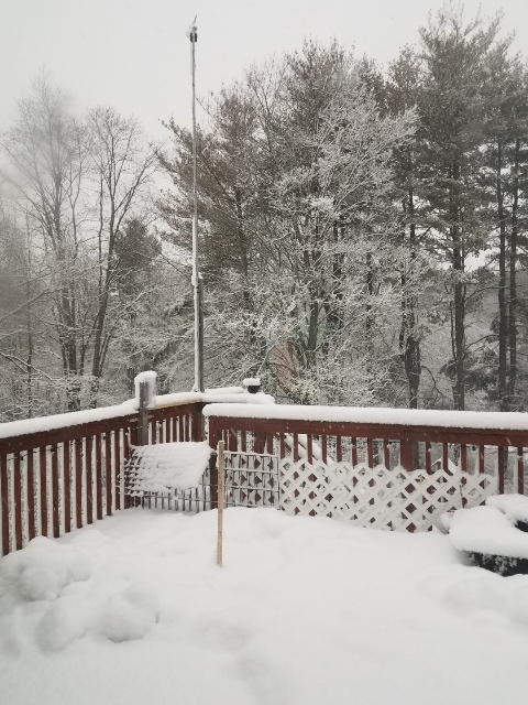
The bottom third, that the main unit is attached to is a galvanized steel pipe. The anemometer is attached to an aluminum pole that is used for a roof rake. Since it doesn't snow anymore, I figured the pole would get better use holding an anemometer...
-
Finally got the Davis setup, temporarily at least until I get the garden built and the anemometer on top of the house....
-

Significant Severe Weather Event Possible Thursday, August 27, 2020
Spanks45 replied to weatherwiz's topic in New England
In Southbury, looking toward Woodbury.... -
Significant Severe Weather Event Possible Thursday, August 27, 2020
Spanks45 replied to weatherwiz's topic in New England
North of here, right before the crazy winds and power knocked out again...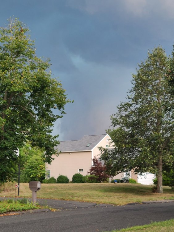
-
Significant Severe Weather Event Possible Thursday, August 27, 2020
Spanks45 replied to weatherwiz's topic in New England
Yup, I have no time to deal with anymore of that...a nice steady rainfall is fine by me -
I move in 10 days....extended power outages and tree damage is not what I need to worry about, rain would be just fine though
-
There is the region wide 3-6" storm that we need....Drought buster
-
A nice region wide 3-5" soaking would be nice. We don't need any damage thank you.....
-
May 8-9 mid-spring rain, snow, cold, wind obs
Spanks45 replied to CT Valley Snowman's topic in New England
This looks fun, hopefully it makes it here... -
May 8-9 mid-spring rain, snow, cold, wind obs
Spanks45 replied to CT Valley Snowman's topic in New England
Flakes flying here again, deck is a sheet of ice with a coating of snow...31.1 this morning. -
May 8-9 mid-spring rain, snow, cold, wind obs
Spanks45 replied to CT Valley Snowman's topic in New England
Wind is whipping, temp down to 35 and now we have some snow falling....what a May 9th! -
March 12/13/14 Blizzard/Winter Storm/WWA etc
Spanks45 replied to Bostonseminole's topic in New England
Midlevel magic ftw here in wct...snowing moderately but the heaviest seems to be over now... -
March 12/13/14 Blizzard/Winter Storm/WWA etc
Spanks45 replied to Bostonseminole's topic in New England
Just hit 7 inches here, this band in wct is starting to move, but has been great while it lasted...31.4 -
March 12/13/14 Blizzard/Winter Storm/WWA etc
Spanks45 replied to Bostonseminole's topic in New England
I have been sitting under that band for a while now, definitly fluffier in nature than last storm, but still sticking to everything. 4.75" so far, 31.8