MN Transplant
-
Posts
17,859 -
Joined
-
Last visited
Content Type
Profiles
Blogs
Forums
American Weather
Media Demo
Store
Gallery
Everything posted by MN Transplant
-
0.03”
-
Only 0.10” for the past 48 hours, but radar looks like a 66 special this morning.
-
They destroyed the mobile app years ago. I can still access via the browser option.
-
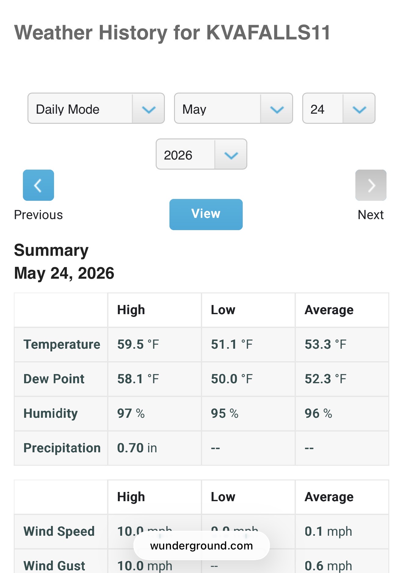
I’m not having that problem with Wunderground. I can see, for example, that today is the fourth consecutive day that we haven’t seen the sun.
-
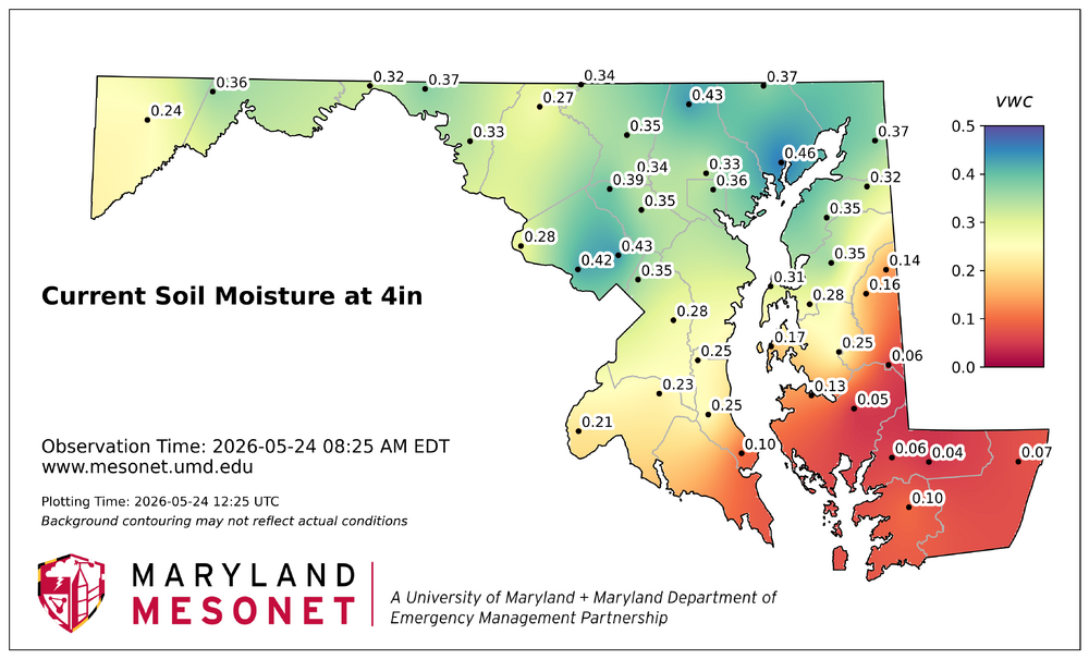
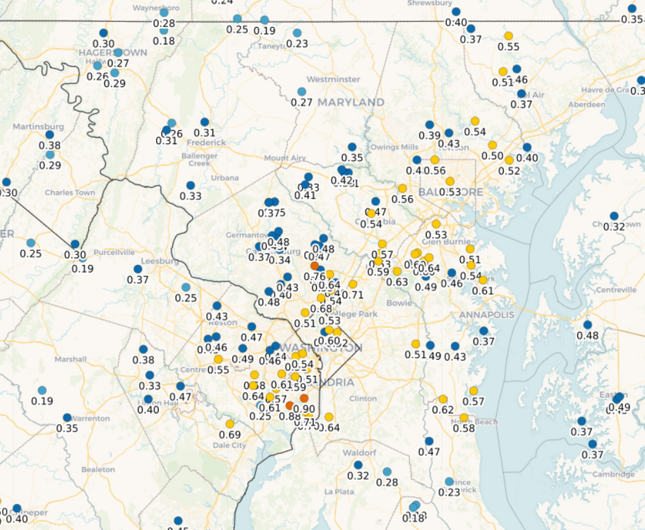
And going back to meddler's excellent post, here are the current soil moisture readings at 10cm depth.
-
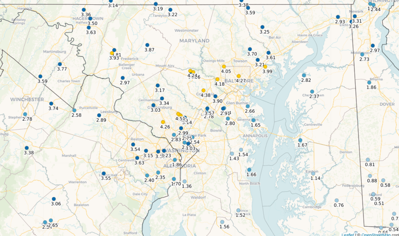
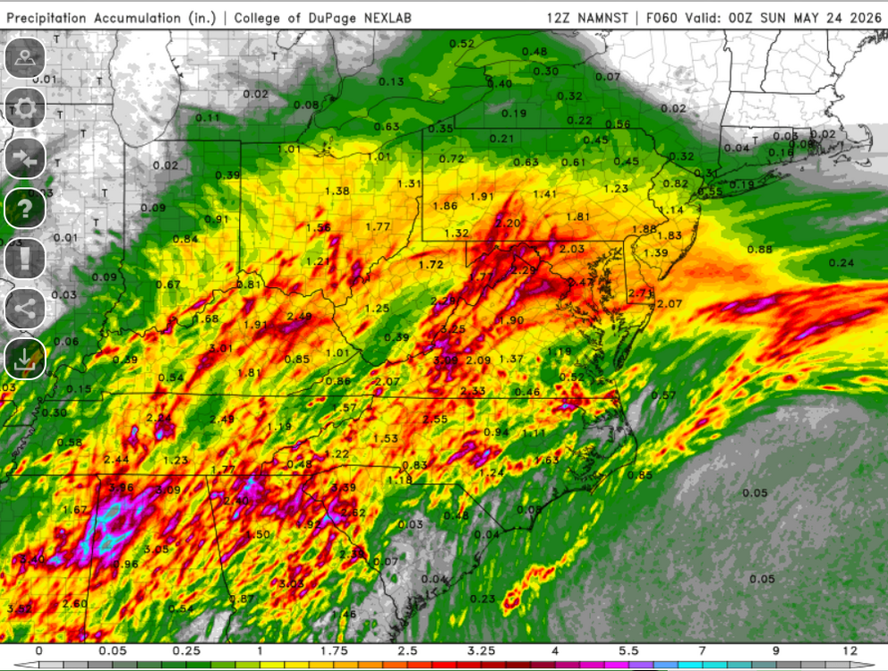
Finally got to the saturated soil phase with the rain overnight. Here are the CoCoRahs stations with a report for every day this past week. A good soak for many of us, but to the southeast is still hurting.

-
Big fan of the 3km NAM. Let's do that.
-
0.01”
-
Need to build that line south to get some breathing room.
-
DPs are still holding firm in the mid to upper 60s. That works.
-
2026 Mid-Atlantic Severe Storm General Discussion
MN Transplant replied to Kmlwx's topic in Mid Atlantic
Per usual, the HRRR is tracking too low on DPs and the NAM is too high.- 1,708 replies
-
- 1
-

-
- severe
- thunderstorms
- (and 7 more)
-
0.04” is better than nothing, but not by much
-
DCA has joined the other airports at hitting at least 96. It'll be interesting to see if any of those cells can make it east. The leading showers are dying after they get to about IAD.
-
Add one to each of those numbers for the highs thusfar. 94.6 at home.
-
Low 90s over mid 60s in most places right now. Warm.
-
It isn’t going to happen, but the Euro and HRRR have DC at 100 on Tuesday.
-
You nailed it. Crossing into the mid-60s DPs at this time of year is very noticeable.
-
The 00z Euro kept things south and the 06z GFS depends a lot on the Wed/Thus wave with light precip beyond that. It isn't what we want, but it also isn't set in stone.
-
Good hit along 95. Every bit helps.
-
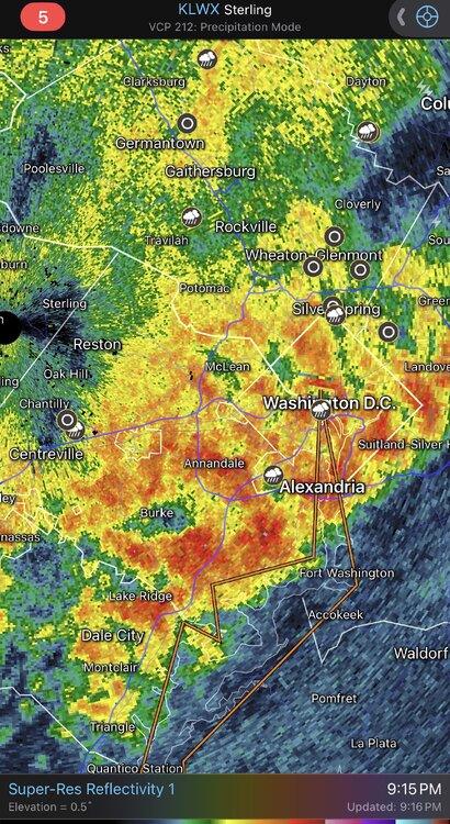
This is a good example of the polarimetric radar being important. If you look at the reflectivity over my house you’d think that it was pouring. The high differential reflectivity and low differential phase indicates that there are large, but relatively few big drops. So, despite a radar that looks like below, I’ve had 0.07” so far in this batch.
-
Pretty nice line. Hope it holds for the rest of us.
-
Almost certain that it is. But implementing it is a different beast. Various academic institutions have the run the WRF real-time, but even that is difficult to keep up without dedicated staff.
-
https://bsky.app/profile/akrherz.bsky.social/post/3mlompdfmvk2f
-
The radar QPE algorithm is having a terrible time with this event. I’m sitting at 0.23” and DCA is 0.21” and the radar estimate is ~0.7”.
-
I hear thunder. At least that’s a step in the right direction.