MN Transplant
-
Posts
17,849 -
Joined
-
Last visited
Content Type
Profiles
Blogs
Forums
American Weather
Media Demo
Store
Gallery
Everything posted by MN Transplant
-
2026 Mid-Atlantic Severe Storm General Discussion
MN Transplant replied to Kmlwx's topic in Mid Atlantic
Bit of initiation happening west of DC from the outflow from the earlier southern storms.- 1,505 replies
-
- 1
-

-
- severe
- thunderstorms
- (and 7 more)
-
Racked up 0.05”, which technically means I fell even further below normal for the year.
-
Drought rules all
-
2026 Mid-Atlantic Severe Storm General Discussion
MN Transplant replied to Kmlwx's topic in Mid Atlantic
Core of the wind went south of me, which is fine. Getting some rain which is extremely welcome. Still haven’t had a real thunder event this year. Just some rumbles in the distance. -
2026 Mid-Atlantic Severe Storm General Discussion
MN Transplant replied to Kmlwx's topic in Mid Atlantic
The gust front was solid, definitely in the 40s. We’ll see what the next surge has in store. -
97 for a high so far. They “benefitted” from getting very little rain yesterday.
-
89.0, HI approaching 100
-
0.09" added to my 0.10" this morning. Lame.
-
Dew Points 72-75 for most of us.
-
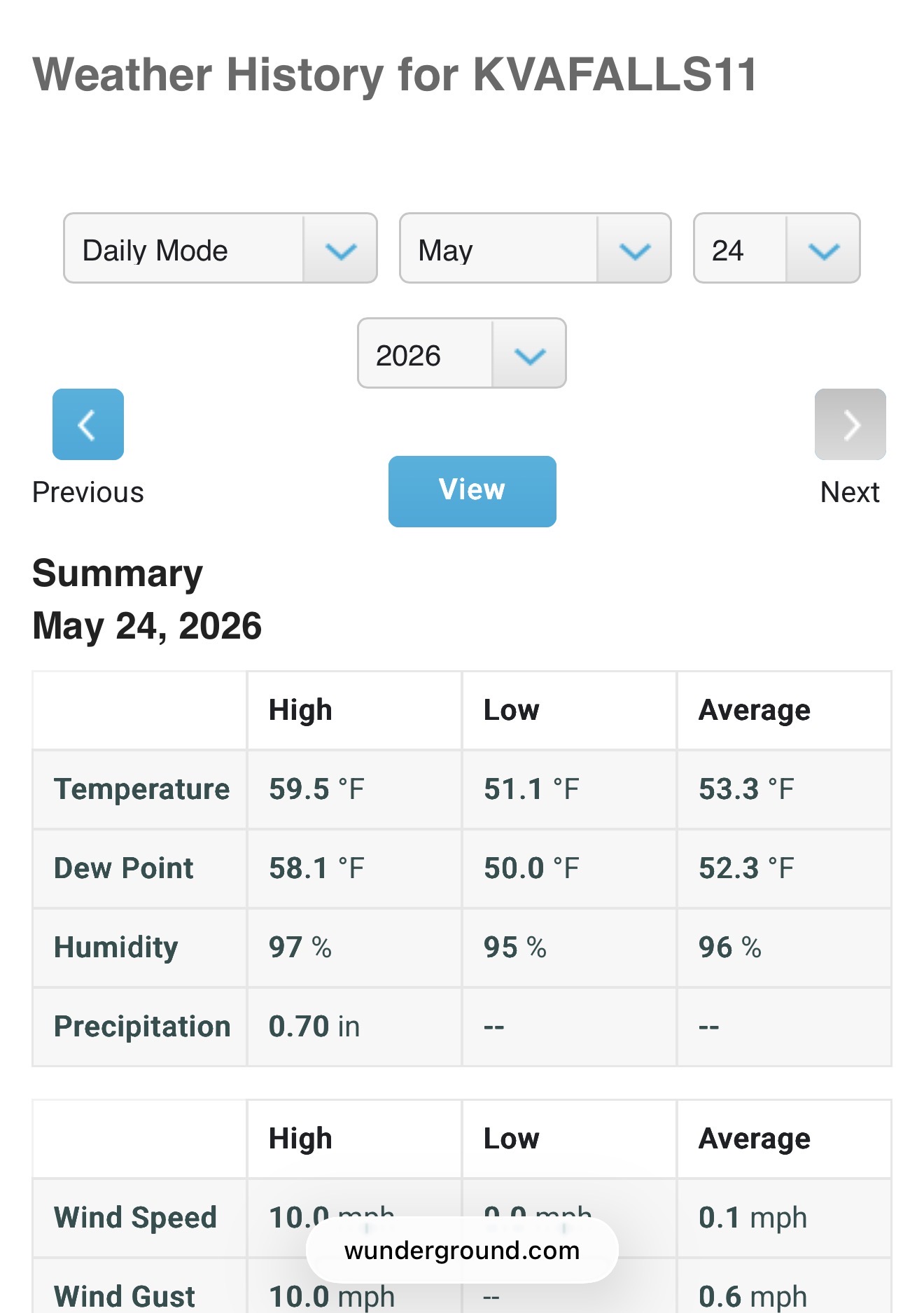
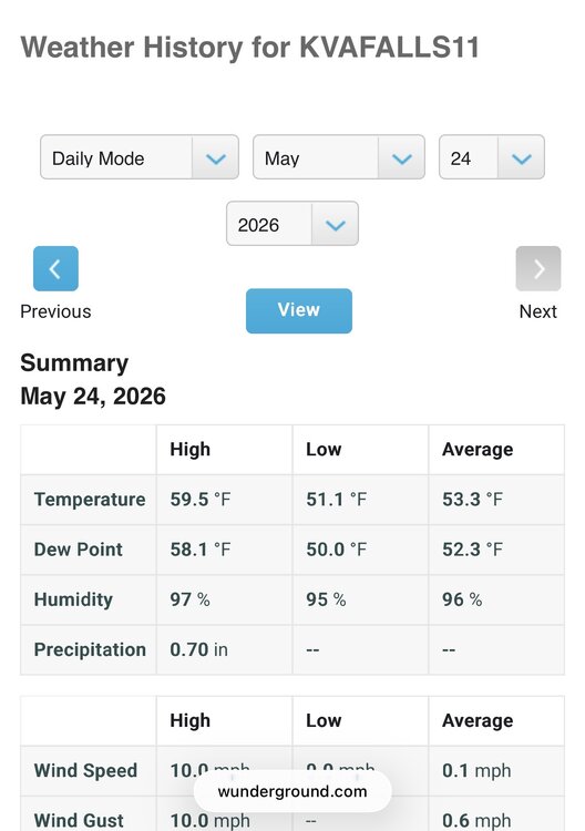
0.10”. Which brings me to 0.10” on the month.
-
At least we are sharing the drought with many https://bsky.app/profile/drjeffmasters.bsky.social/post/3mns5c3ypsc2k
-
Somewhere in MD. Doesn’t affect us.
-
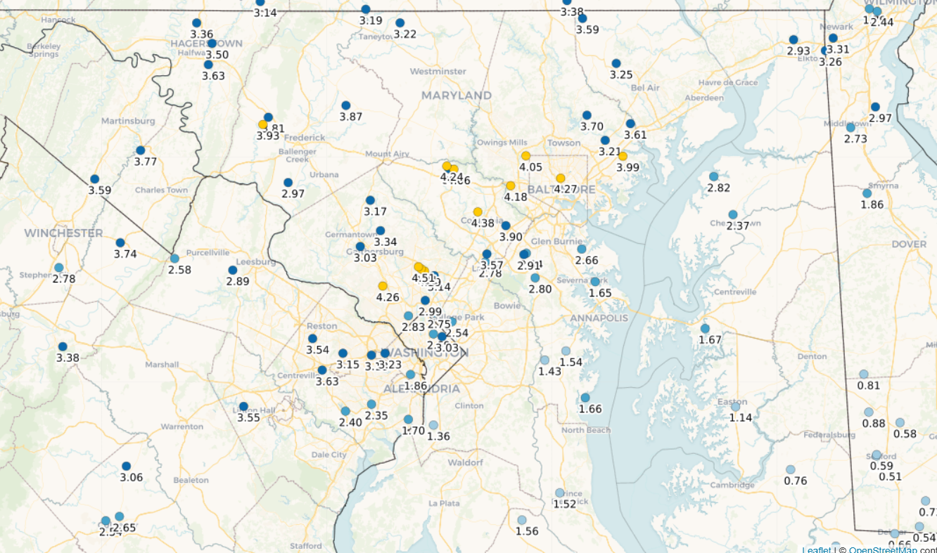
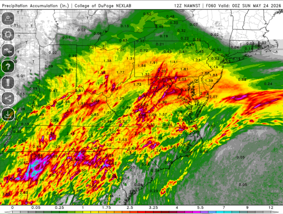
Event totals. I didn't extend over to DE, but they really got screwed with less than an inch in the southern part of the state. DCA ended up with less than 2" and will end up with a negative departure on the month.
-
82/70. I’m not ready for summer.
-
0.03”
-
Only 0.10” for the past 48 hours, but radar looks like a 66 special this morning.
-
They destroyed the mobile app years ago. I can still access via the browser option.
-
I’m not having that problem with Wunderground. I can see, for example, that today is the fourth consecutive day that we haven’t seen the sun.
-
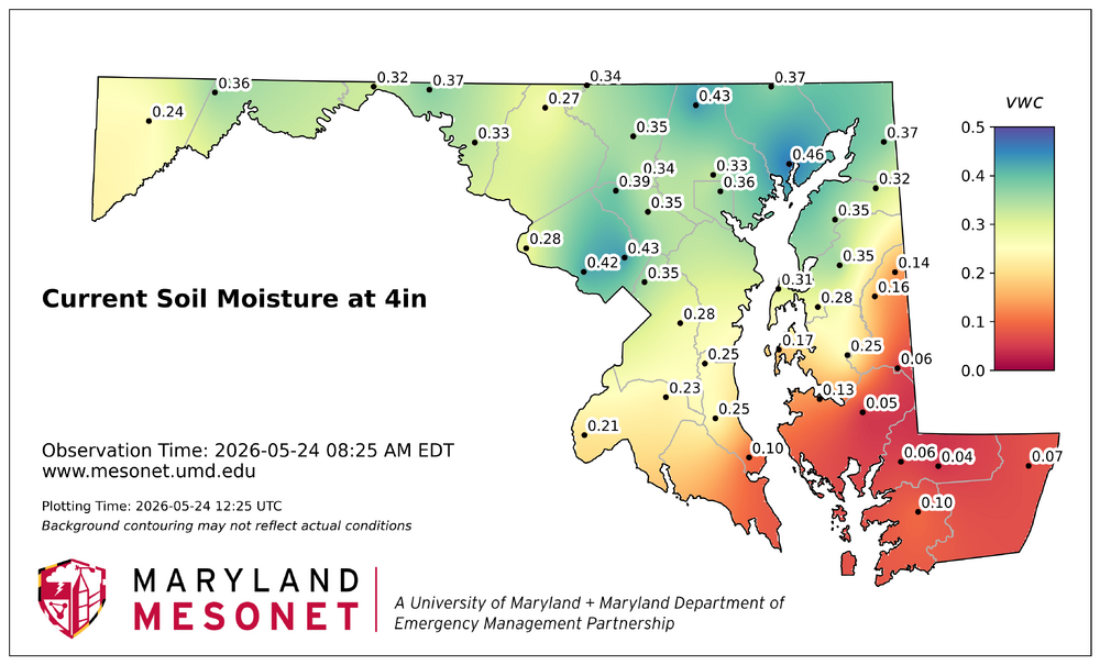
And going back to meddler's excellent post, here are the current soil moisture readings at 10cm depth.
-
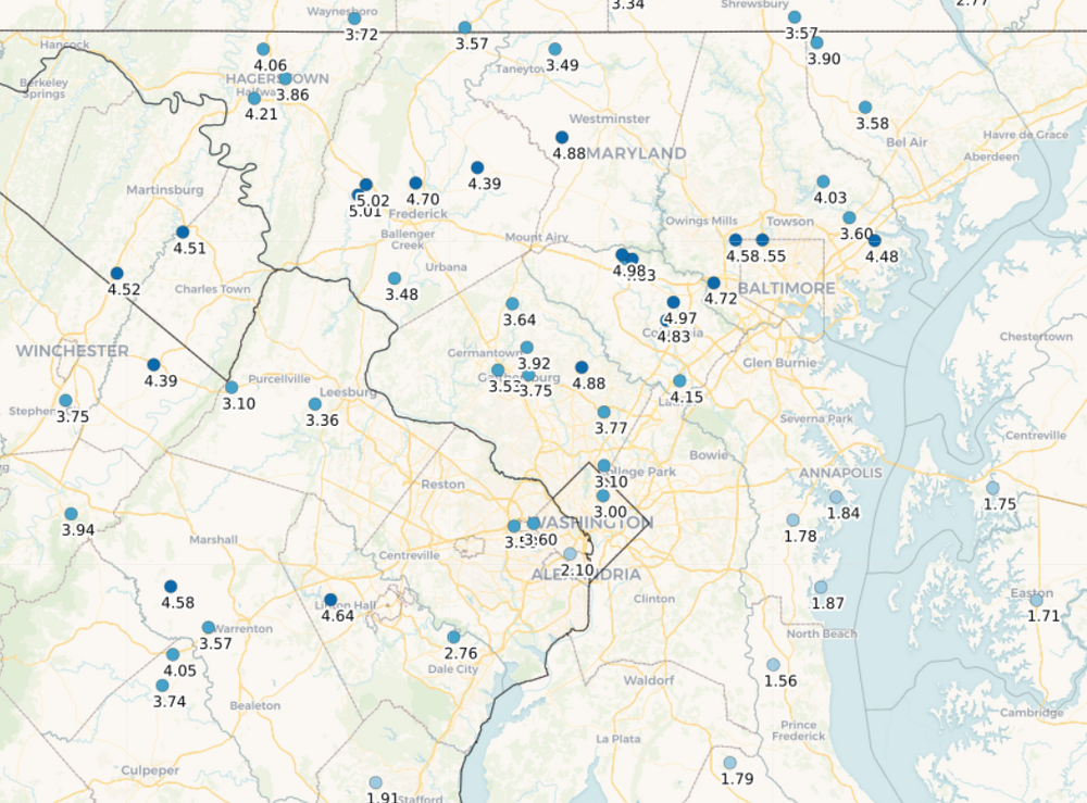
Finally got to the saturated soil phase with the rain overnight. Here are the CoCoRahs stations with a report for every day this past week. A good soak for many of us, but to the southeast is still hurting.

-
Big fan of the 3km NAM. Let's do that.
-
0.01”
-
Need to build that line south to get some breathing room.
-
DPs are still holding firm in the mid to upper 60s. That works.