binbisso
-
Posts
889 -
Joined
-
Last visited
Content Type
Profiles
Blogs
Forums
American Weather
Media Demo
Store
Gallery
Everything posted by binbisso
-
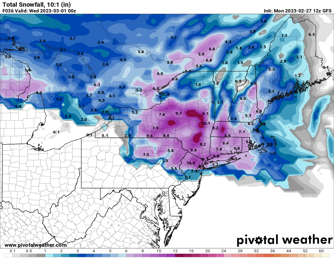
It's seems that today's 12z models have upped the initial burst. If true many areas may bust high. We shall see
-
The gfs is nuts
-
12z nam coming In colder
-
Temps busting really low today. 34* currently. My forecast high is 49*. Something to watch
-
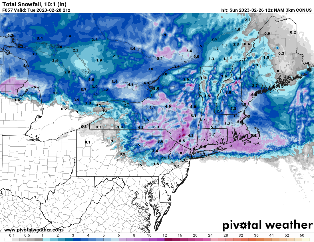
Fwiw the 3k is much colder
-
Yup. Our 3 week winter starts today. With what ensembles are showing plus mjo phase 8 I would say 15- 20" for the park when all is said and done
-
Gfs colder nice for our area
-
Mod snow big flakes solid coating so far
-
Sneaky little event. Short range models like nam hrrr and rap getting interesting. Temps will be in the 20's. Whatever falls should stick. Not expecting much but an inch would equal Biggest snowfall this Winter
-
Snowing here in White Plains
-
Yea I hear you but this time it's across all guidance and gaining traction as we get closer. It's not fantasy land. Now whether it snows is a different story
-
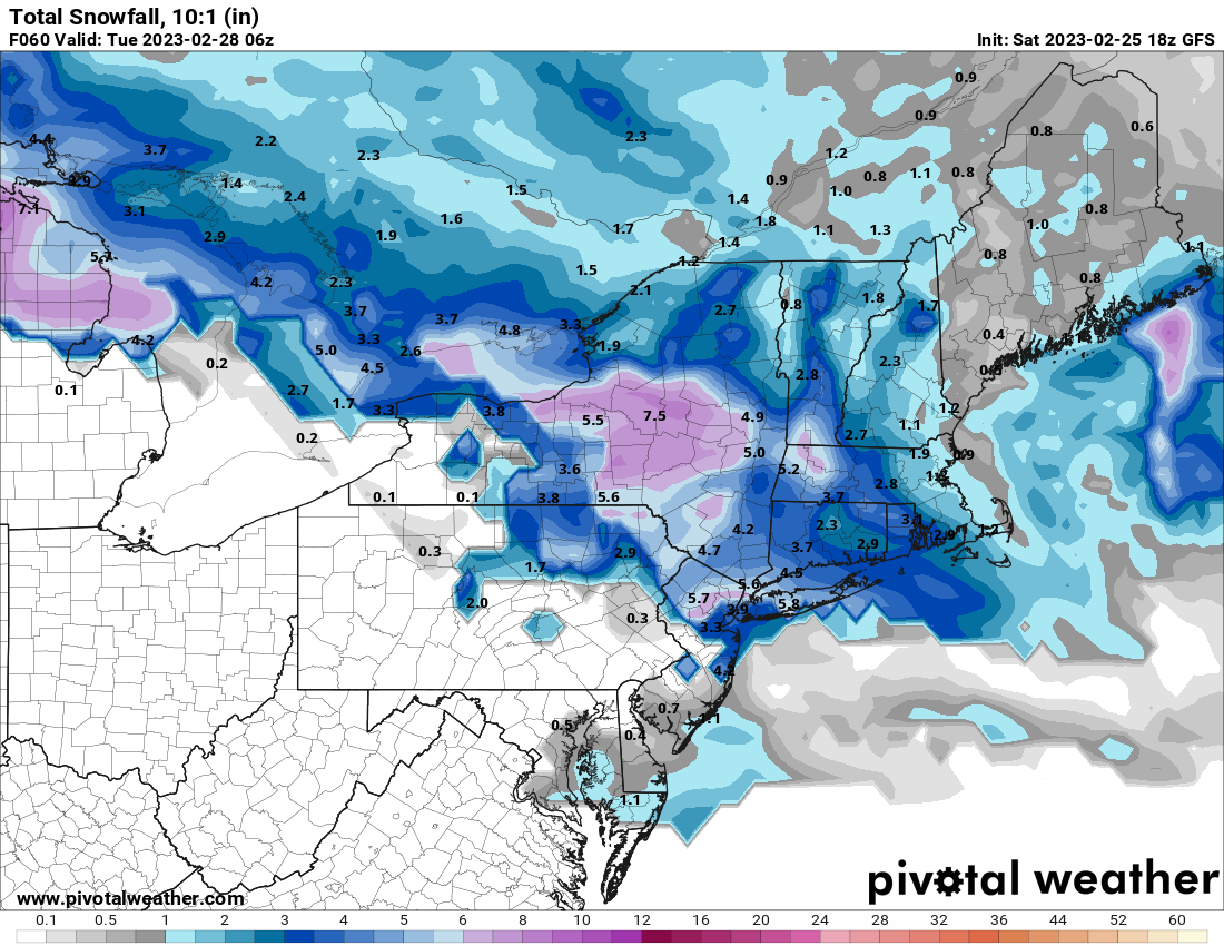
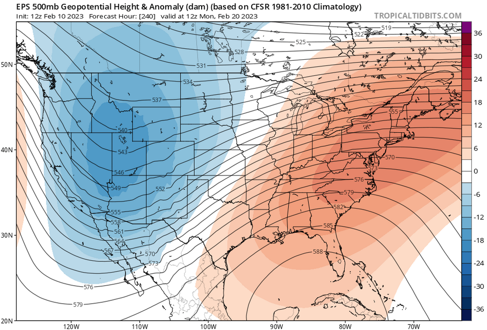
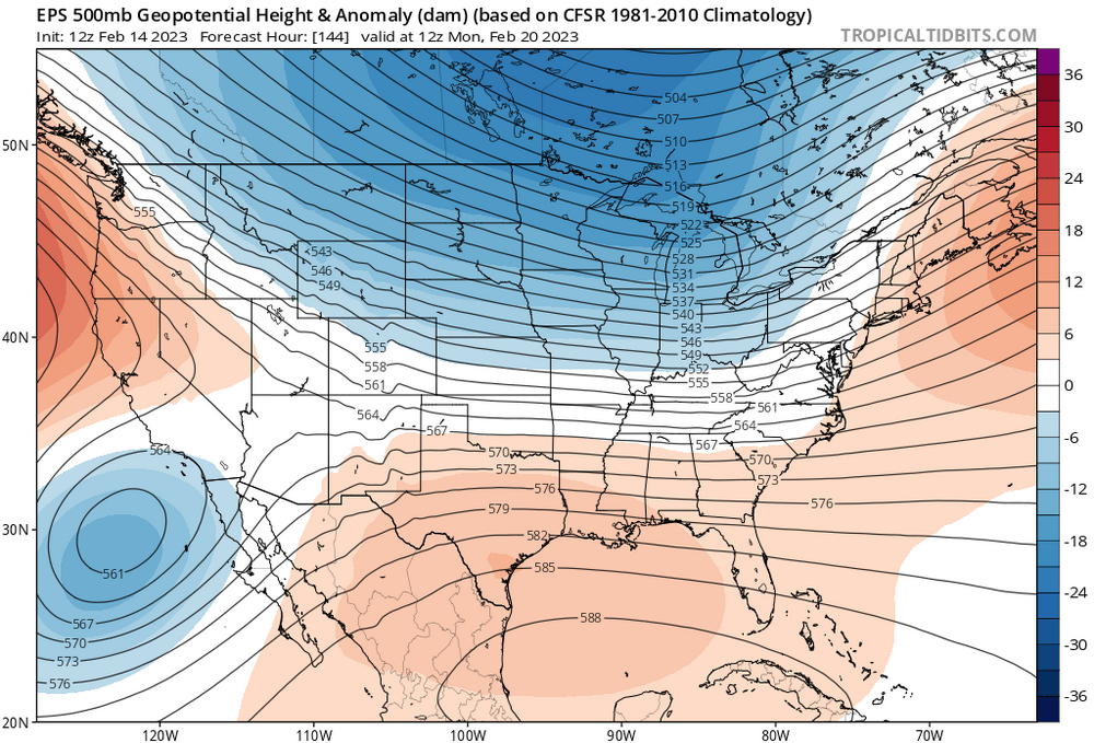
This winter has sucked and persistence has won out however this upcoming period may be different. This is the first time I've noticed the se ridge get knocked down this close. New run Old run
-
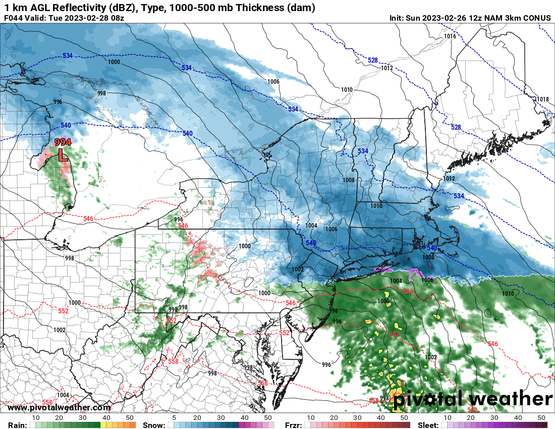
The rgem can be warm at times. Like today. It's snowing already here in Lower Westchester and the rgem up to 12z today had me as all rain. Maybe it will be right for Wednesday but it is wrong today
-
I think that clipper is the key to this system being snowier. Other models don't have it except the GFS and the 18Z nam
-
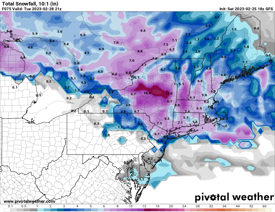
Euro went from 2"+ of rain to less than half an inch for my area lol
-
It's almost like a cf passage
-
Better trends on the op so far. Let's see what the ensembles show
-
Cmc would be good for most
-
1" here in Mt Vernon on colder surfaces. Coating on pavement