binbisso
-
Posts
889 -
Joined
-
Last visited
Content Type
Profiles
Blogs
Forums
American Weather
Media Demo
Store
Gallery
Everything posted by binbisso
-
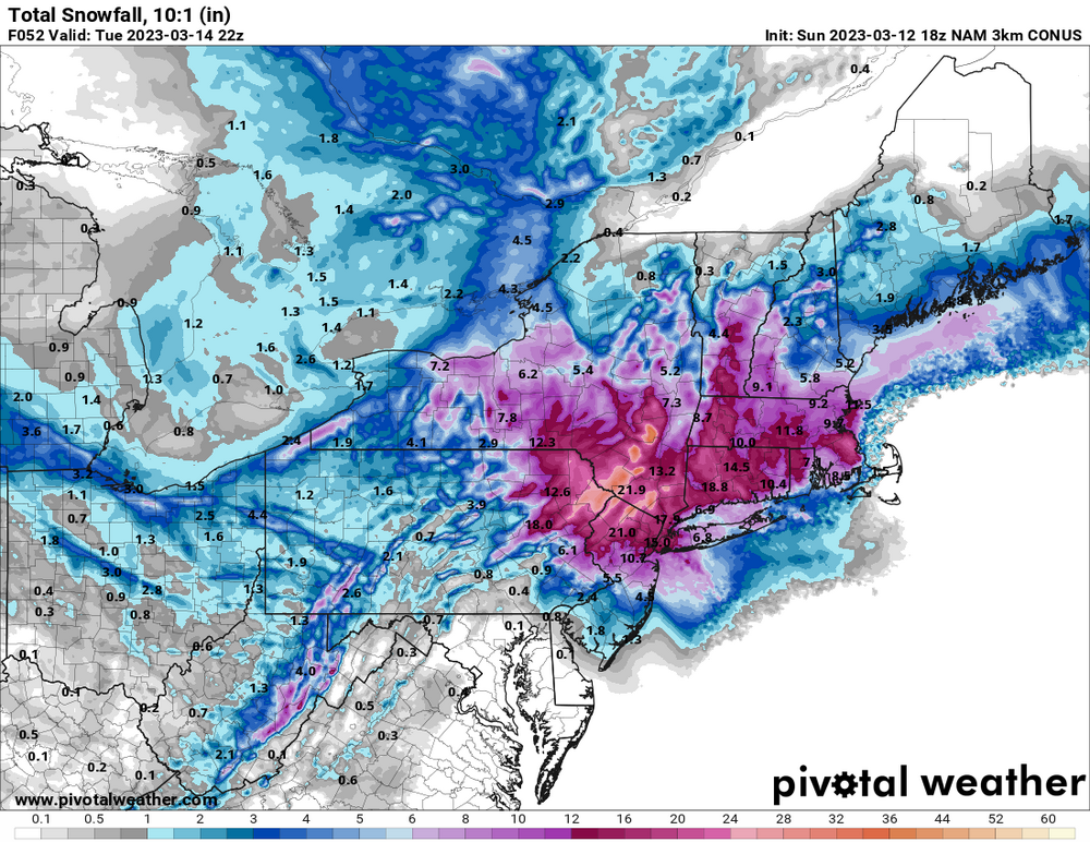
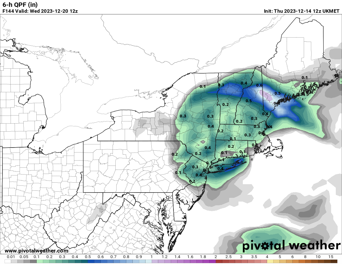
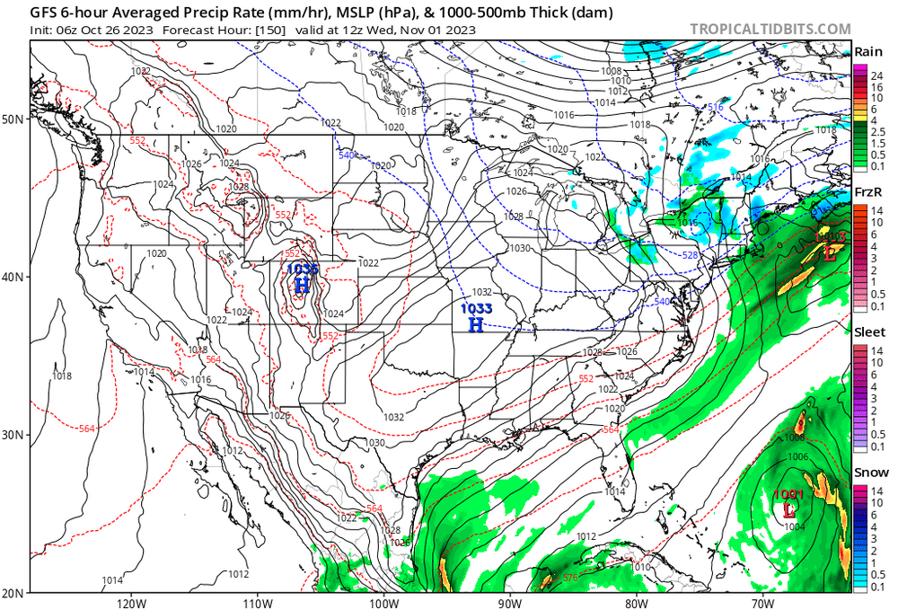
Moderate-High Impact Storm Noon Sun Dec 17, 2023 - 4PM Mon Dec 18. Flooding rain I95 corridor northwestward, coastal tidal flooding, brief periods of damaging 50 MPH+ wind gusts LI/CT Monday, ends as a little wet snow interior elevations Tue morning.
binbisso replied to wdrag's topic in New York City Metro
Ukie is also plenty cold with Temps in the upper 20's for Tuesday night/Wednesday morning
- 489 replies
-
- 1
-

-
- flooding rains
- coastal flooding
- (and 4 more)
-
Moderate-High Impact Storm Noon Sun Dec 17, 2023 - 4PM Mon Dec 18. Flooding rain I95 corridor northwestward, coastal tidal flooding, brief periods of damaging 50 MPH+ wind gusts LI/CT Monday, ends as a little wet snow interior elevations Tue morning.
binbisso replied to wdrag's topic in New York City Metro
Cmc, ukie, and icon all have the trailing n/s vort. Ukie looks the best ATM
- 489 replies
-
- 3
-
-

-
- flooding rains
- coastal flooding
- (and 4 more)
-
Yup. Maybe sooner.

-
Yes. Give me all The Pacific puke air all you want in late December and especially January just keep that trough beneath us. There's snow in the forecast just Northwest of all the big cities this weekend. Reading this forum that would seem impossible.
-
I wonder how many times the plows came through from December 96 through March of 2000.
-
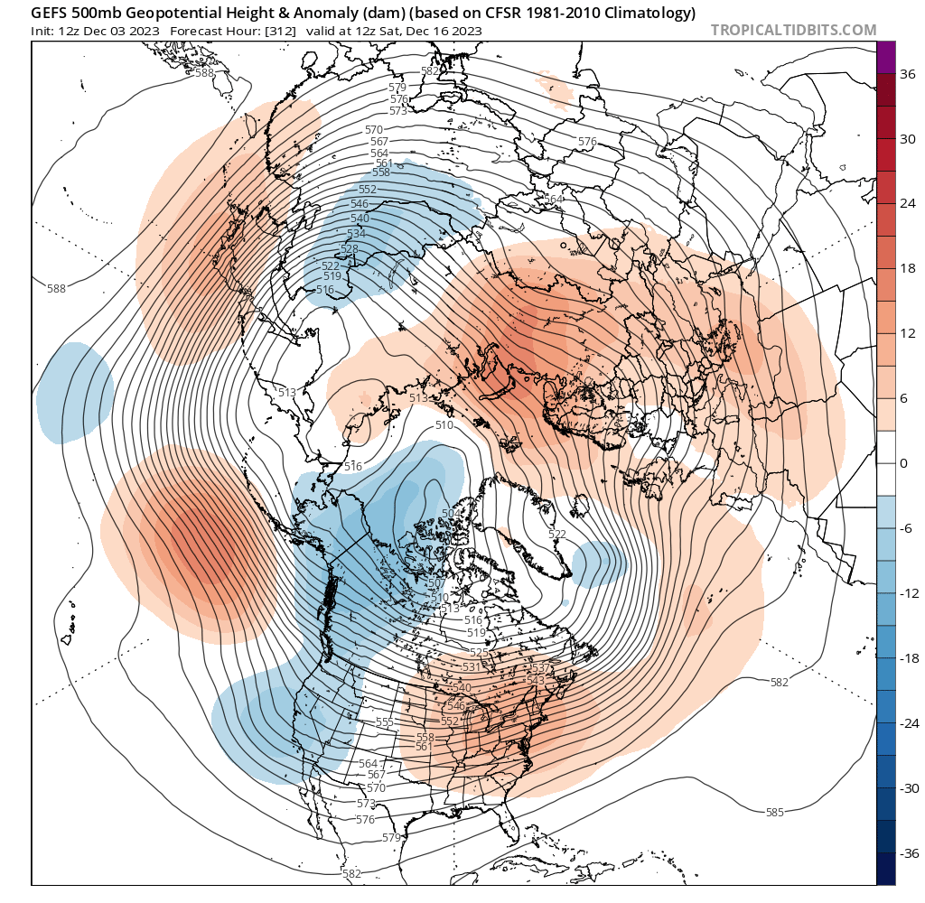
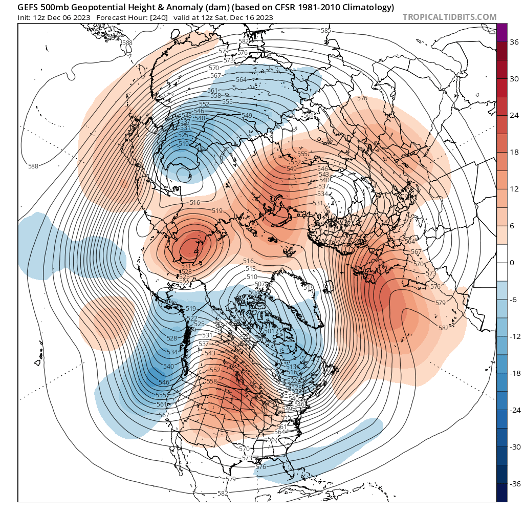
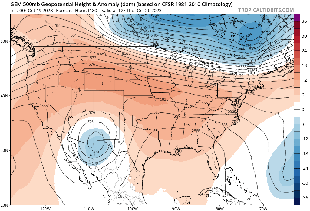
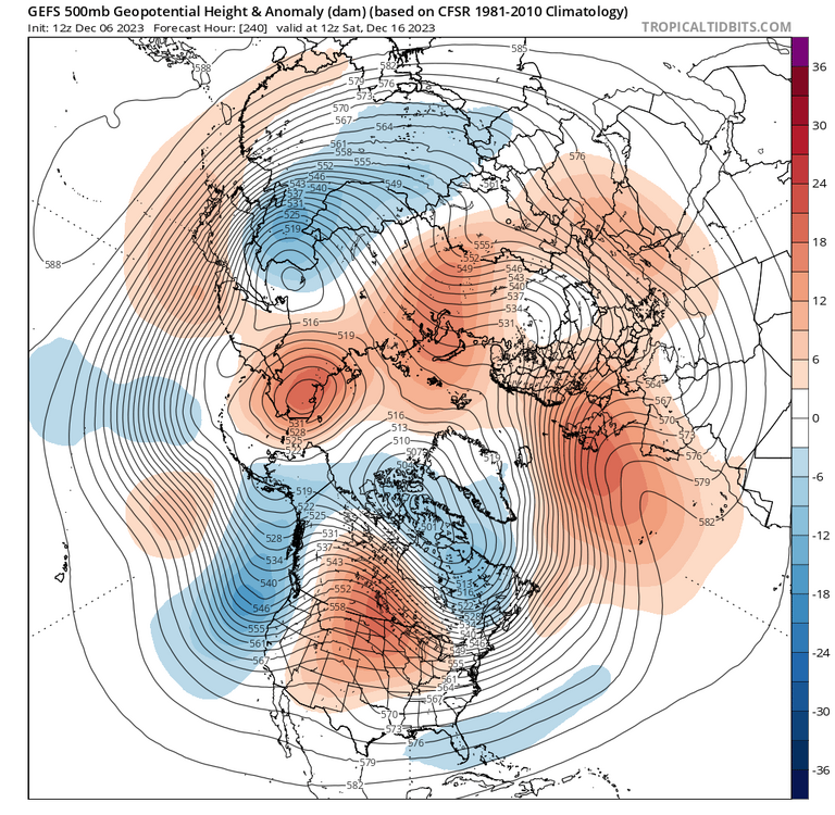
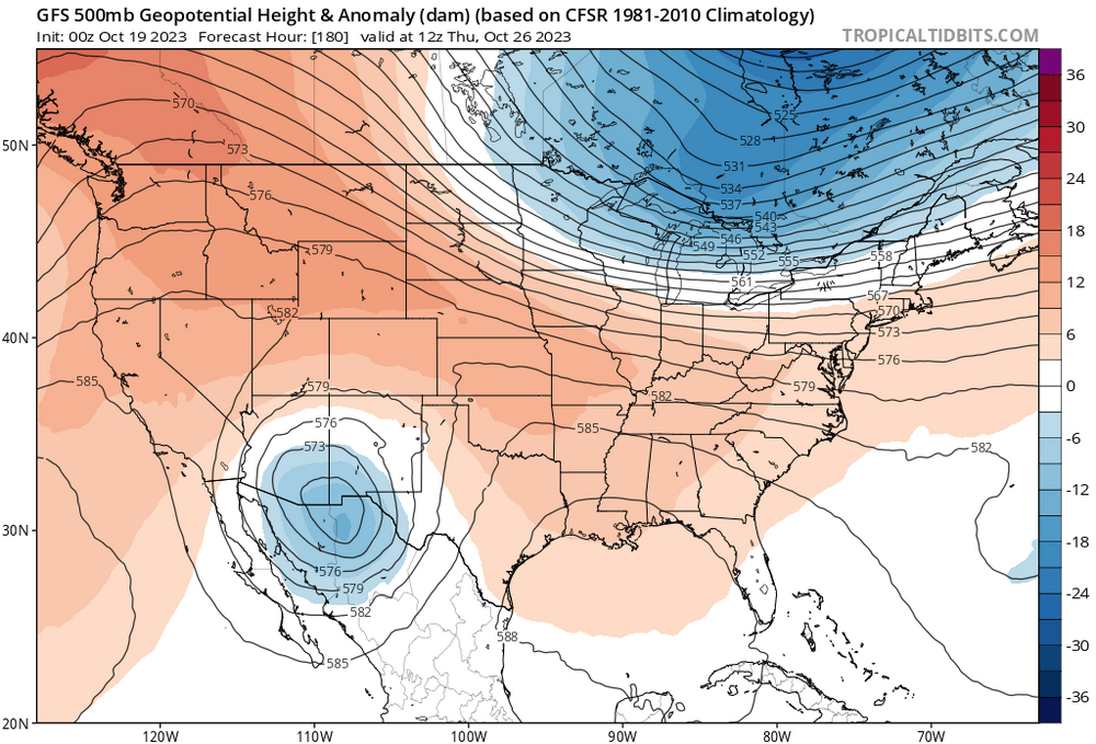
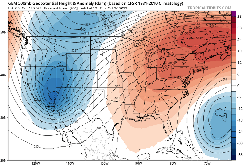
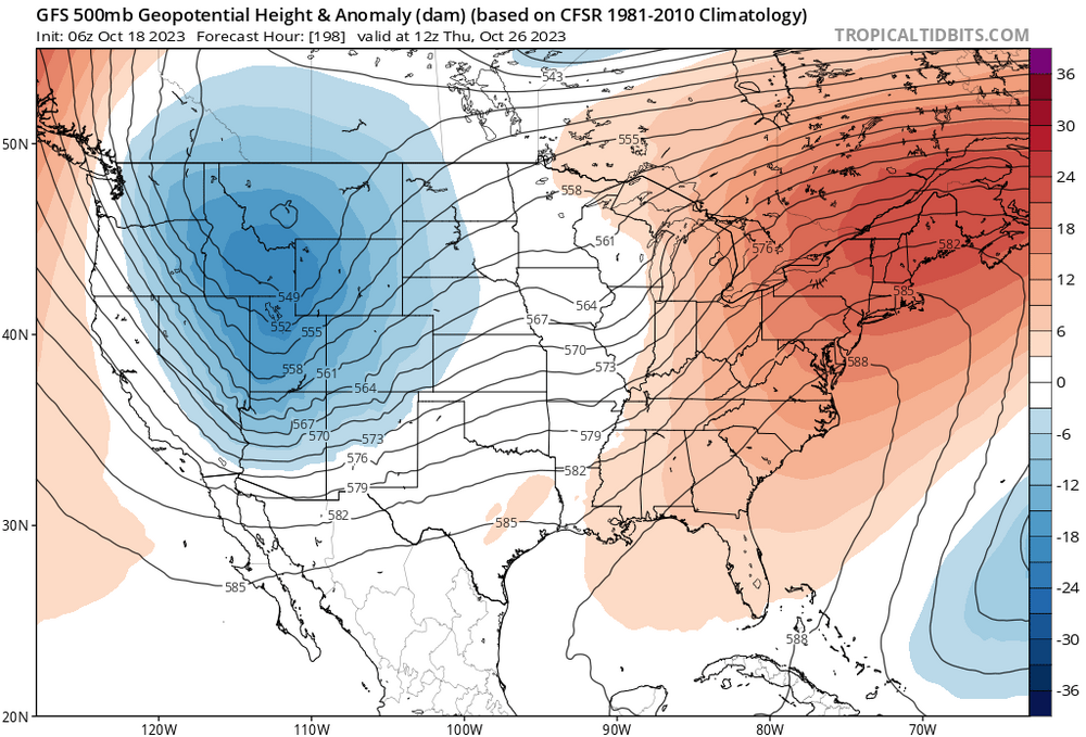
I wonder if we can sneak and event here in the 8 to 12 day period. There's a big PNA spike on the GE FS And the pretty significant change from the ensemble from several days prior. New run Old run


-
I have noticed that too. It looks like we will have our chances thru mid month. After that who knows. Climo is still against us as we need at least - 5 or better departures for snow down to the coast in early December. Most likely We will ave +1 or so thru Dec 15th with both colder and warmer periods. Plenty of S/W coming in from the pac just have to time one right.
-
I have a question. Does it even matter at this point if region 3.4 goes over 2.0 tri monthly? The earliest that could happen would be early February. Isn't there a lag. Right now oni Is high end moderate. Shouldn't seasonal forecasters look for analogs using where oni is now?
-
Octorcher or Roctober 2023 Discussion Thread
binbisso replied to Damage In Tolland's topic in New England
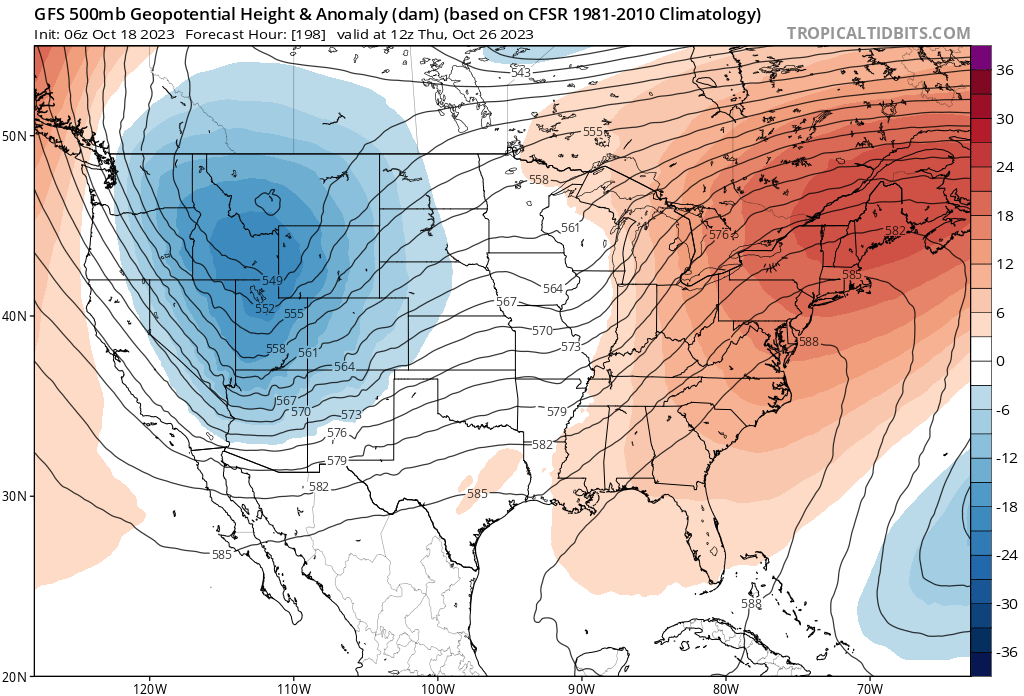
Gfs getting closer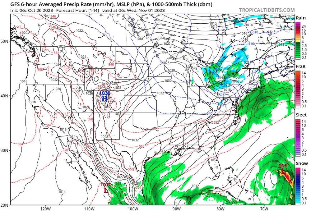
-
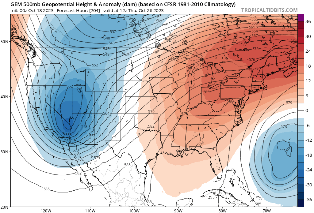
Octorcher or Roctober 2023 Discussion Thread
binbisso replied to Damage In Tolland's topic in New England

-
Octorcher or Roctober 2023 Discussion Thread
binbisso replied to Damage In Tolland's topic in New England
And icon too! -
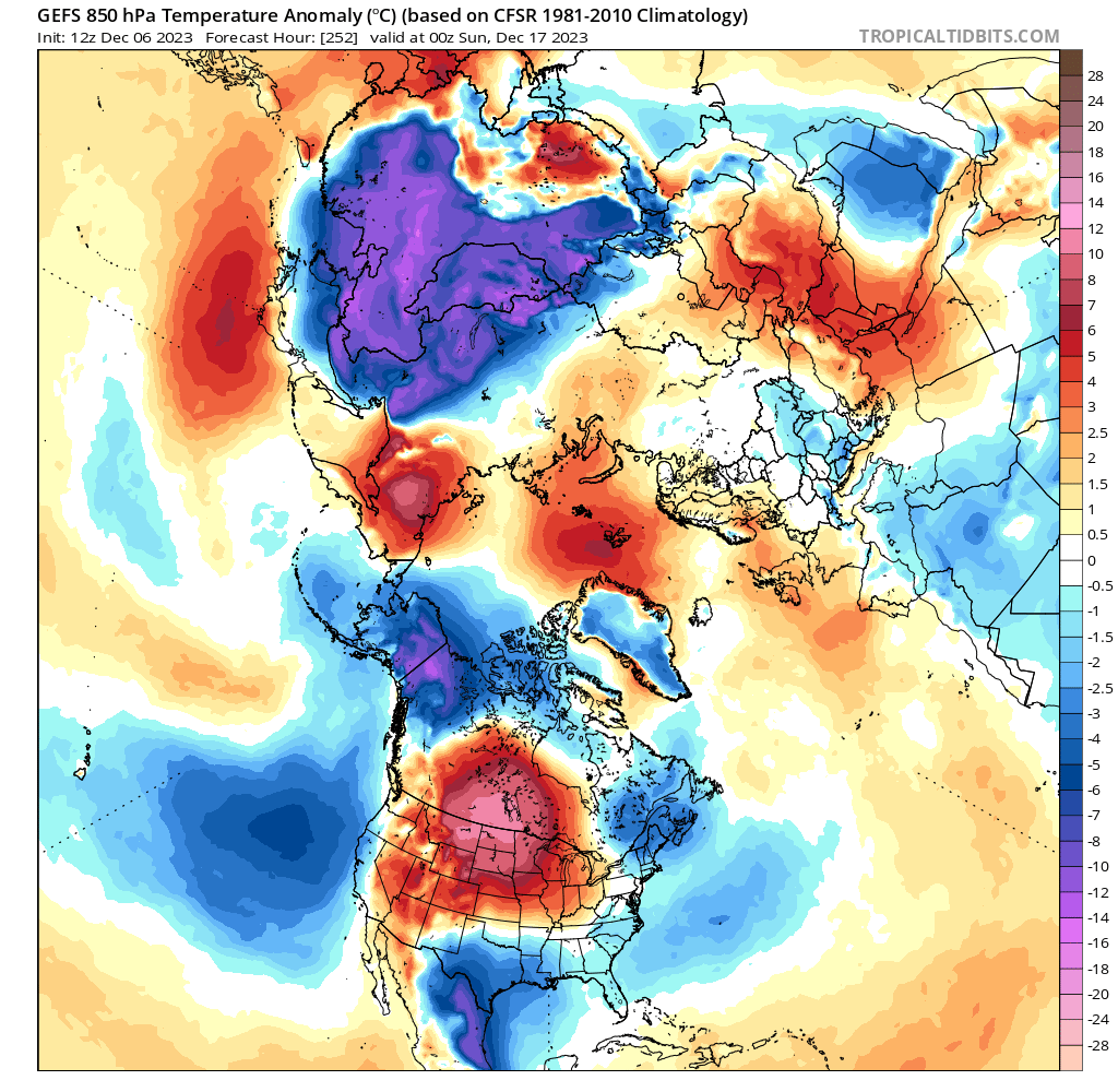
Why can't we have all three? I think what happens with the EPO will be the determining factor for our Winter with the regards to how much snow we get. There should be plenty of storm chances with the strong Nino But will there be enough cold air for it to be frozen?
-
It's also nice to have a negative EPO. Would be nice if we can get a few negative EPO periods This Winter.

-
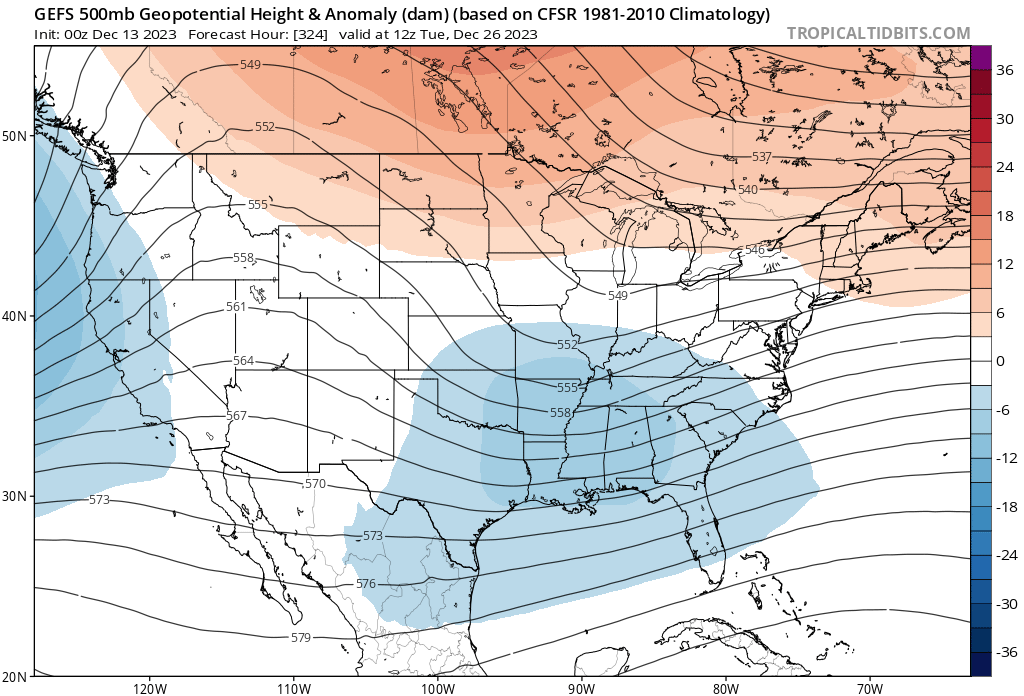
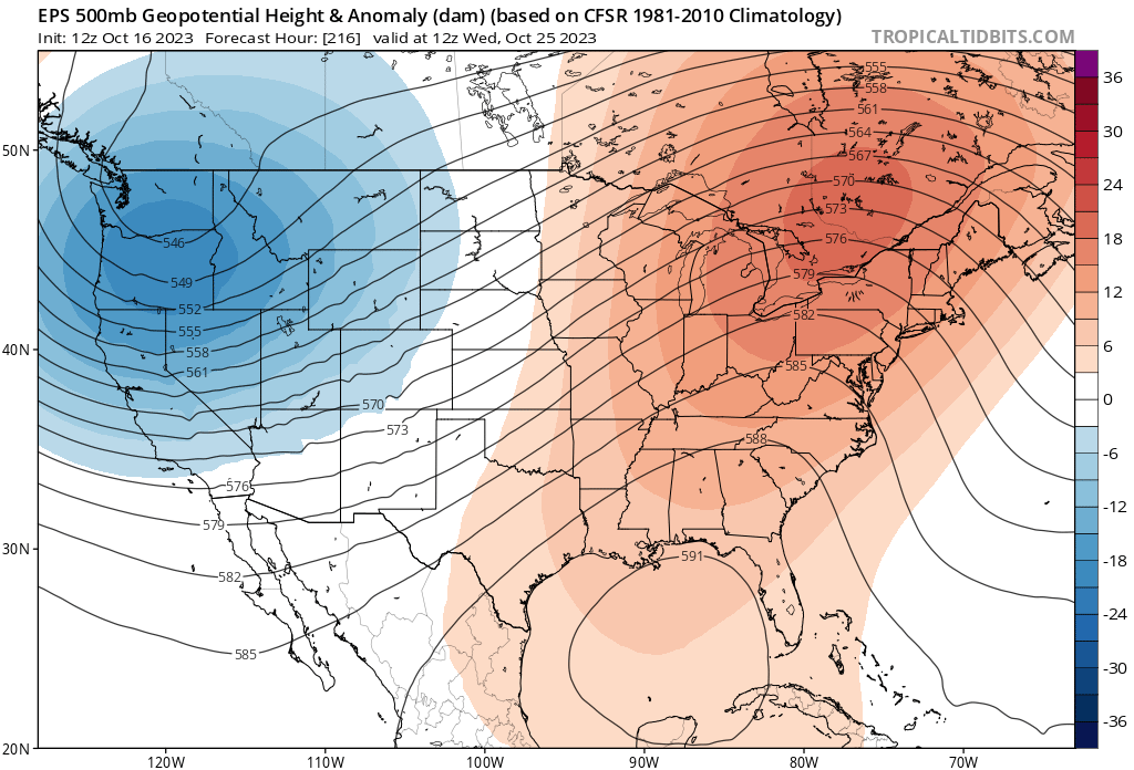
Yup. We are also losing the negative PNA next week. I wonder if it's in response to the rapidly rising PDO? Old run New run


-
Yes just saw this. The PNA is trending less negative however. we'll see what happens.
-
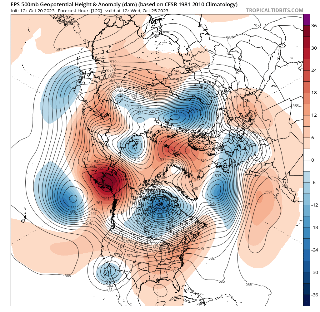
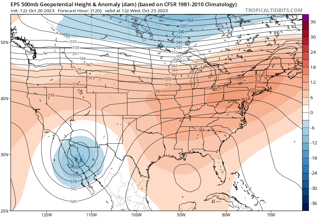
Both the operational GFS & CMC have lost the -PNA In the 7 plus day range. Older run New run

-
Octorcher or Roctober 2023 Discussion Thread
binbisso replied to Damage In Tolland's topic in New England
-
Just relentless rain not as heavy as before but still steady. Water is running down my street as the Hutchinson river which is across the street from my house has overflowed its banks.
- 886 replies
-
- 1
-
-
- heavy rain
- flooding potential
- (and 2 more)
-
Yes. I have a few inches in My basement I had 3 feet with ida.
-
You can add Westchester County into that also. right now light rain in the Bronx.
-
It looks like queens nassau into Southwest Connecticut is gonna get the worst overnight.
-
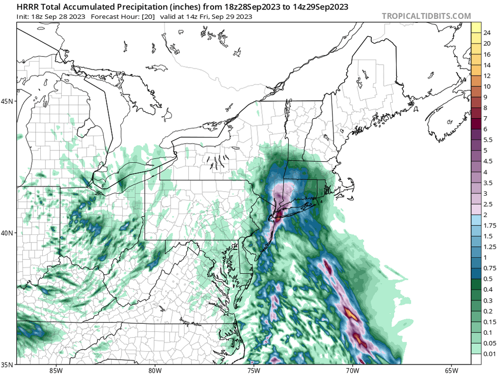
This would be awful tomorrow morning for the am commute. Latest hrrr. This is only through 9 AM tomorrow morning.
-
3k looks great