binbisso
-
Posts
889 -
Joined
-
Last visited
Content Type
Profiles
Blogs
Forums
American Weather
Media Demo
Store
Gallery
Everything posted by binbisso
-
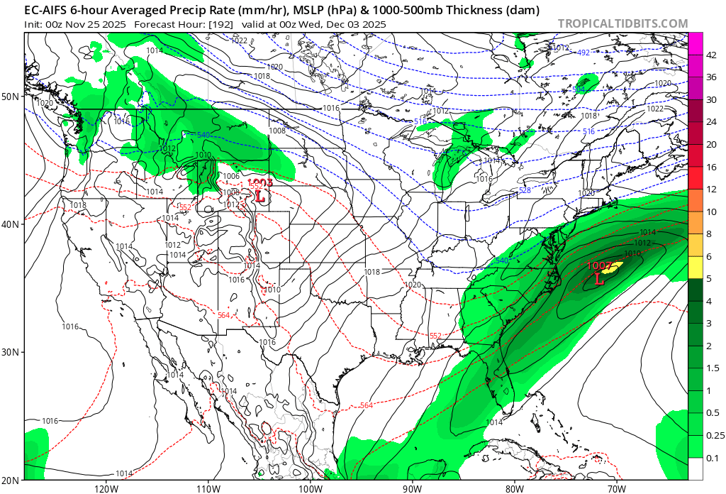
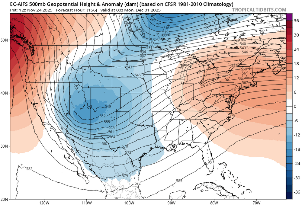
Good spot to be in 7-8 days out

-
We can add in the euro Ai

-
November 2025 general discussions and probable topic derailings ...
binbisso replied to Typhoon Tip's topic in New England
Flurries in myrtle beach s.c. broke record for the earliest snow. Old record nov 12, 2013. I would love to get a 13/14 type winter this year. Also first flakes here in the bronx atm -
Furries here in the bronx
-
Over 1" in the park and over 1.5" in white plains still coming down good. 2" seems possible
- 731 replies
-
- 1
-

-
- heavy rain
- damaging wind
- (and 2 more)
-
September 2025 OBS-Discussion centered NYC subforum
binbisso replied to wdrag's topic in New York City Metro
-
September 2025 OBS-Discussion centered NYC subforum
binbisso replied to wdrag's topic in New York City Metro
-
September 2025 OBS-Discussion centered NYC subforum
binbisso replied to wdrag's topic in New York City Metro
My point and click forecast is for 1 to 2" for Saturday. -
September 2025 OBS-Discussion centered NYC subforum
binbisso replied to wdrag's topic in New York City Metro
Yes about an inch here in westchester. 97 in white plains and 1-3" in lower Hudson Valley nw nj and ne pa -
September 2025 OBS-Discussion centered NYC subforum
binbisso replied to wdrag's topic in New York City Metro
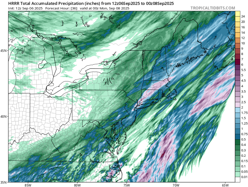
Soaking rain in the bronx over a half inch and still raining more to come Saturday -
Looking at guidance even nyc will be half way to ave by the 6th. Approaching .5" tonight more Saturday
-
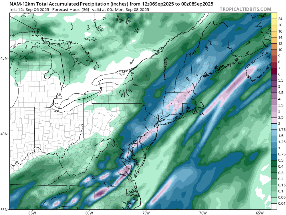
I never said nyc. Eastern pa, nw new Jersey and se ny west of Hudson. He posted north east drought conditions. many of these areas will be over September ave by Sunday morning hence he didn't look at short term guidance
-
1 to 3" of rain tonight from eastern pa thru se ny. Most of these areas will probably see a wetter than normal September. More Saturday i guess he didn't look at short term guidance
-
I agree. Especially when heat index are below 90°
-
Man this is how to run a summer month. Best August in years
-
Yeah same down here. Even ewr didn't have a HI of 90°
-
Gwdlt 87*57* HI87* top ten summer day
-
Hmm, yesterday 91* dp 54* HI 88. What a way to run a heat wave
-
To my fellow acatt crew. Summa almost done

-
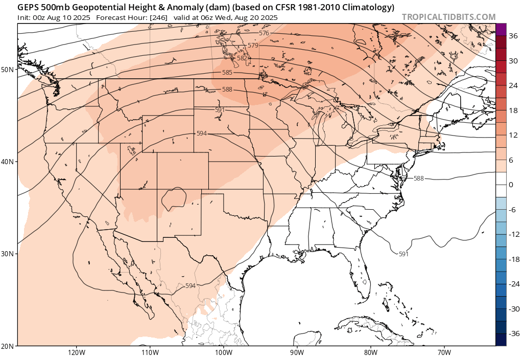
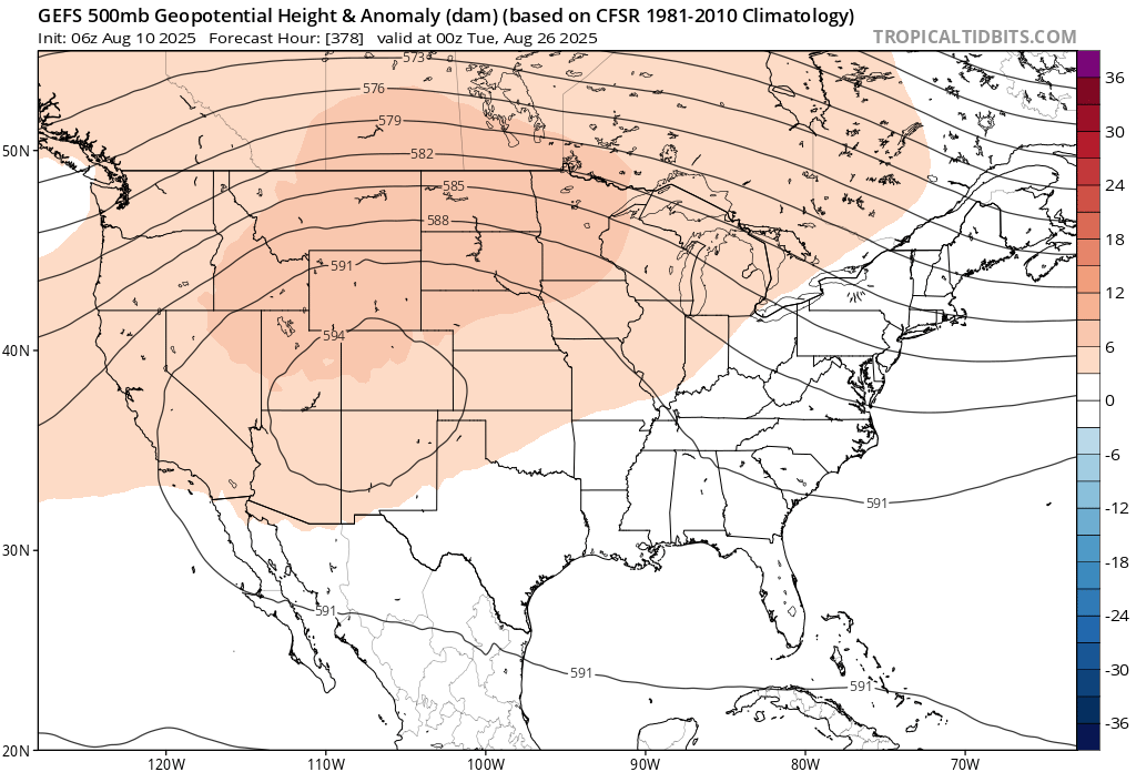
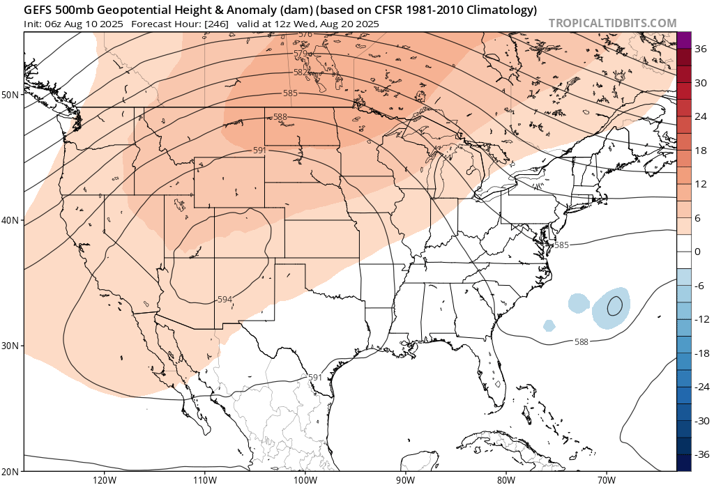
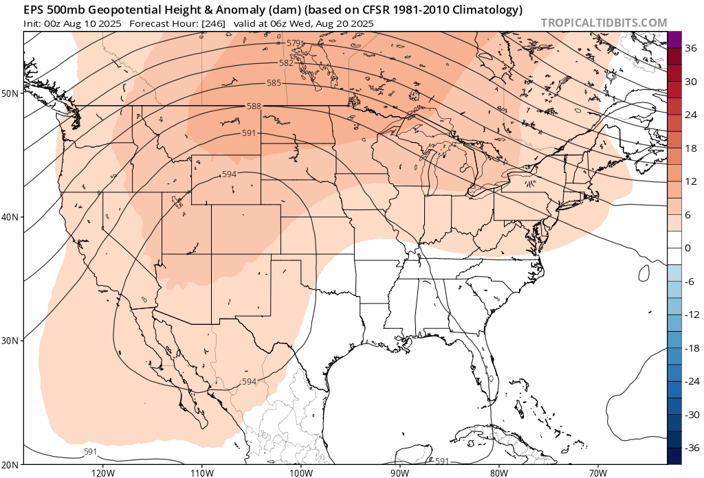
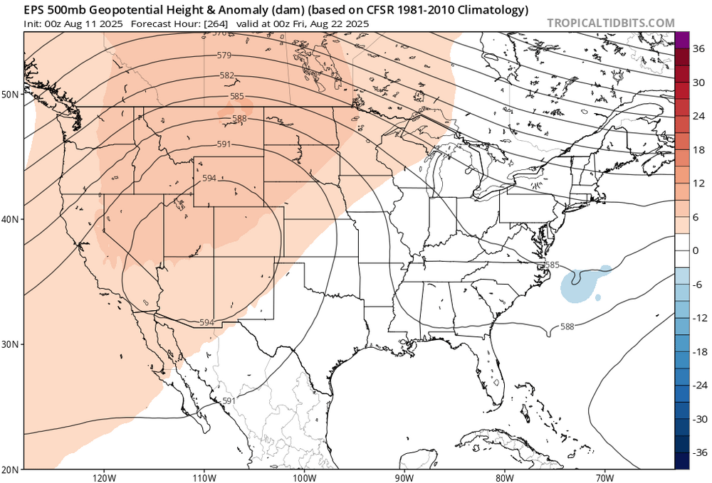
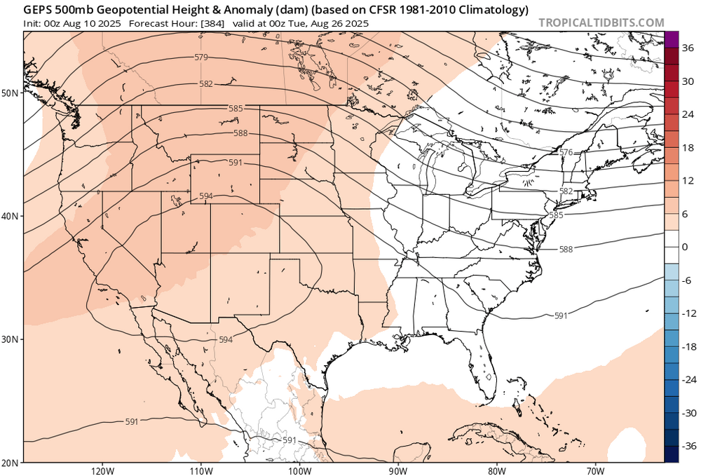
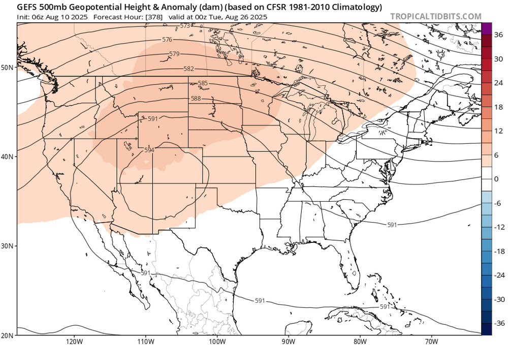
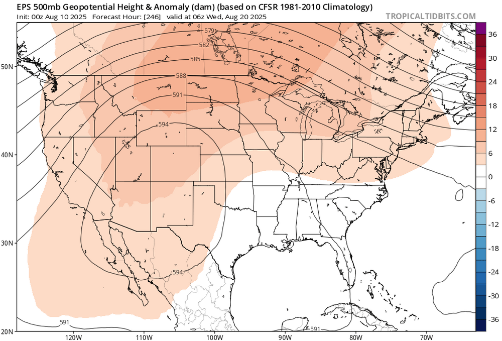
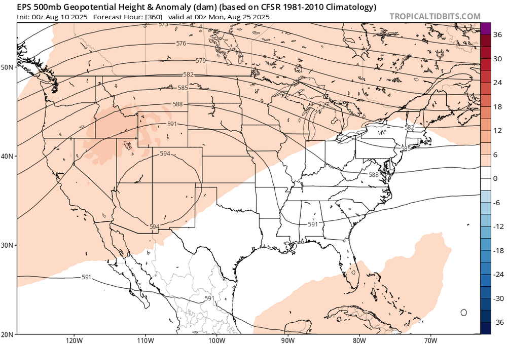
It looks like the ridge sets up out west post day 10 and continues thru the end of the month. The up coming heat could be the last of the season.


-
July 2025 Discussion-OBS - seasonable summer variability
binbisso replied to wdrag's topic in New York City Metro
Dp at newark is 63. Same at many other stations. Why is your dp so high? -
OBS-Nowcast Noon Saturday 2/15-Noon Monday 2/17
binbisso replied to wdrag's topic in New York City Metro
Snowing 29* 1/2 inch on the colder surfaces roads and sidewalks covered. Hoping to get a few inches here -
Nws snow map is very conservative. Less than an inch for nyc metro. However the 1 in 10 chance map is 6" for the city
-
Ukie looks good for next weekend
-
I know it's a day 10 op but what a block on the 12z cmc. If that verified we could be looking at a big dog sometime around the 20 to 22