binbisso
-
Posts
889 -
Joined
-
Last visited
Content Type
Profiles
Blogs
Forums
American Weather
Media Demo
Store
Gallery
Everything posted by binbisso
-
Storm potential January 17th-18th
binbisso replied to WeatherGeek2025's topic in New York City Metro
About an inch on the grass sticking everywhere heavy snow atm -
Storm potential January 17th-18th
binbisso replied to WeatherGeek2025's topic in New York City Metro
Same here in mt vernon snowing moderately 32* -
Storm potential January 17th-18th
binbisso replied to WeatherGeek2025's topic in New York City Metro
Yea hard to pinpoint where the best banding will be. Anything that falls before dawn should stick especially on colder surfaces even in the city as we were well below freezing last night and ground is frozen -
Storm potential January 17th-18th
binbisso replied to WeatherGeek2025's topic in New York City Metro
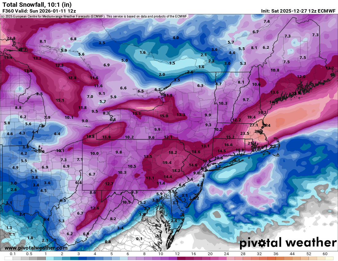
Hrrr juiced for tomorrow. Could be warning level snows for western nj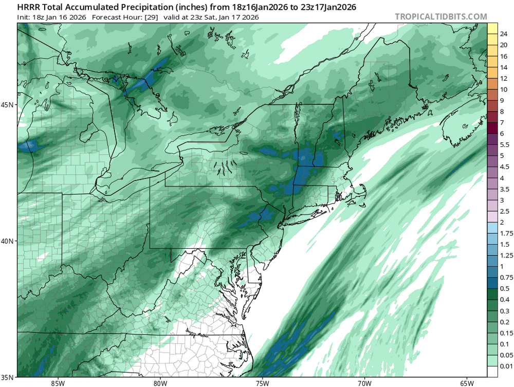
-
WWA up for orange Putnam and passaic counties for 2-4" of snow tomorrow I wonder if these will be expanded later
-
Heavy snow squall very windy everything covered
-
January 2026 regional war/obs/disco thread
binbisso replied to Baroclinic Zone's topic in New England
-
January 2026 regional war/obs/disco thread
binbisso replied to Baroclinic Zone's topic in New England
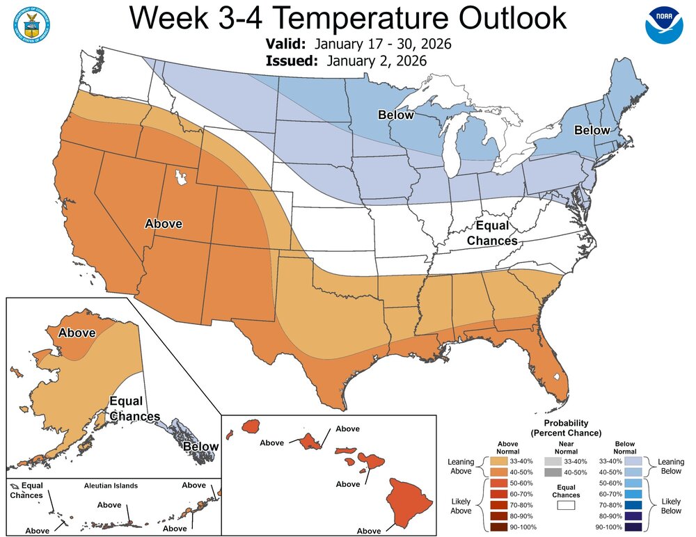
Yea we are averaging 6 degrees below normal here and continuing the next 4 days. That's approximately 38days at -6. When was the last time that happened -
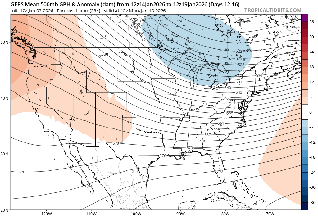
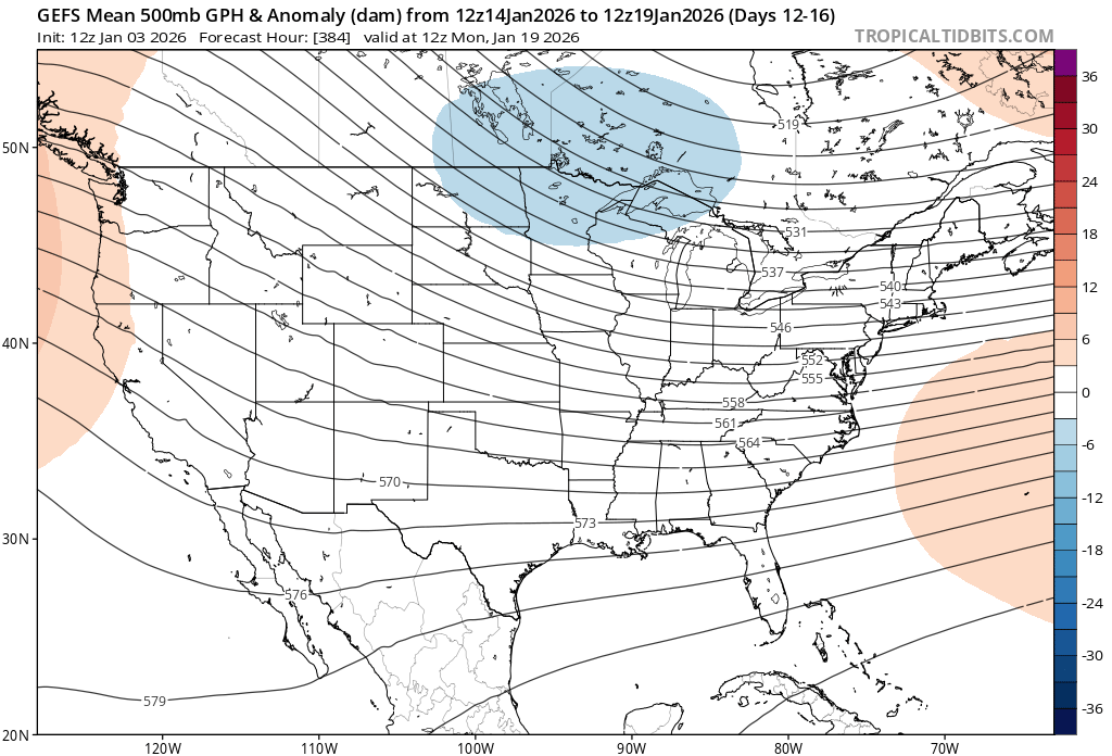
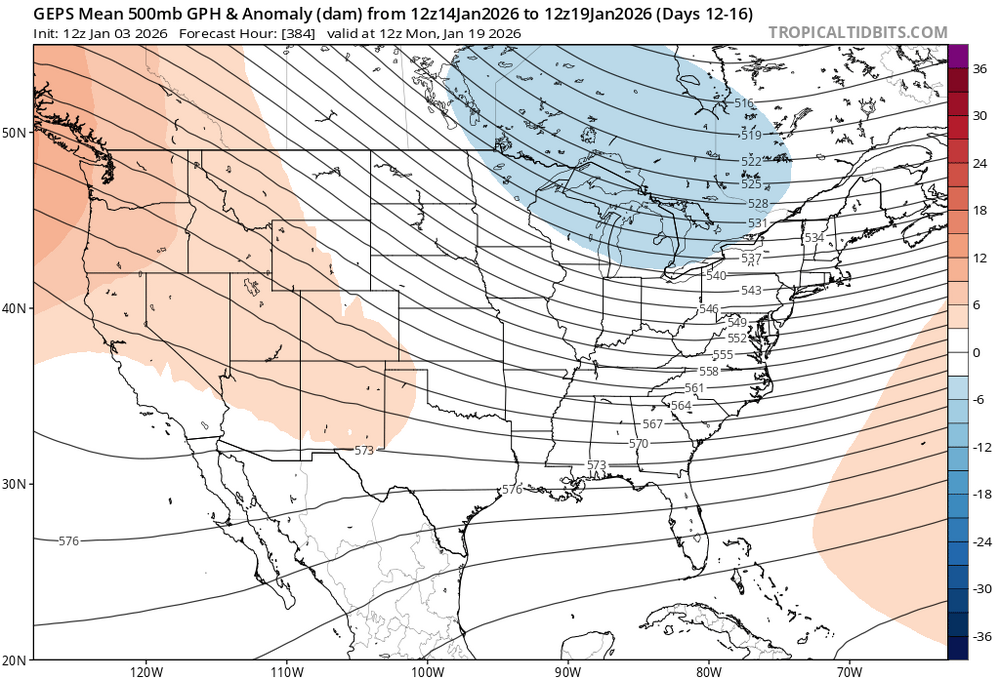
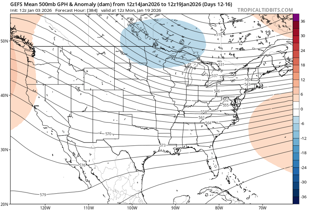
I think we can work with this look in the 10-15 day period
-
January 2026 regional war/obs/disco thread
binbisso replied to Baroclinic Zone's topic in New England
Gefs has it by the 11th. I have to agree with others that the warm ups in the extended have become muted as we get closer since late November. -
January 2026 regional war/obs/disco thread
binbisso replied to Baroclinic Zone's topic in New England

-
Lol

-
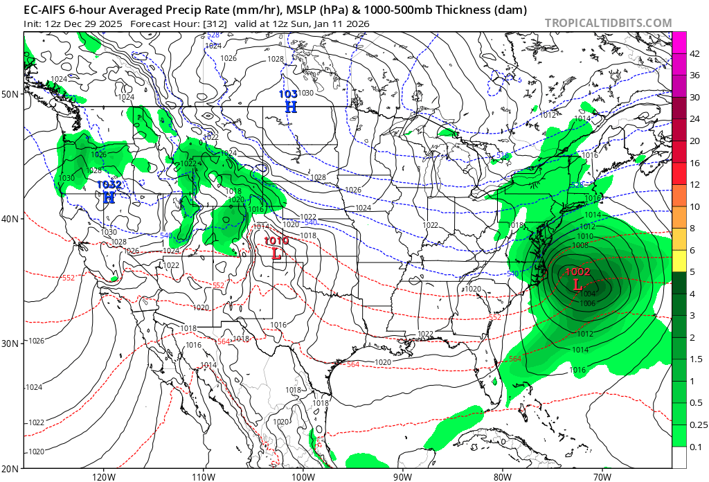
Ec-ai too and a few days later


-
January 2026 regional war/obs/disco thread
binbisso replied to Baroclinic Zone's topic in New England
We can try again few days later.
-
January 2026 regional war/obs/disco thread
binbisso replied to Baroclinic Zone's topic in New England
Ec-ai too!
-
January 2026 regional war/obs/disco thread
binbisso replied to Baroclinic Zone's topic in New England
I believe you would sign for this. Appreciate all your hard work
-
4.5" here 10.5 l" for the season
-
Wow I'm approaching 3" and snowing heavily. White plains obs has heavy snow the last hour
-
Heavy snow now heaviest so far. This is easily 2" per hour rates. I did mix with sleet for a bit but mostly snow in southern Westchester
-
Same here however back to snowing moderately
-
After a lull back to moderate snow about .5" from the first batch. No sleet yet
-
First flakes here
-
What are you talking about mt vernon is a concrete jungle. I border the bronx. What you're saying is nonsense
-
Nonsense I'm in mt vernon I border the bronx heavy snow now sticking in the daylight on all surfaces about an inch on the colder surfaces
-
Heavy snow here in mt vernon everything covered close to an inch on the holder surfaces