binbisso
-
Posts
889 -
Joined
-
Last visited
Content Type
Profiles
Blogs
Forums
American Weather
Media Demo
Store
Gallery
Everything posted by binbisso
-
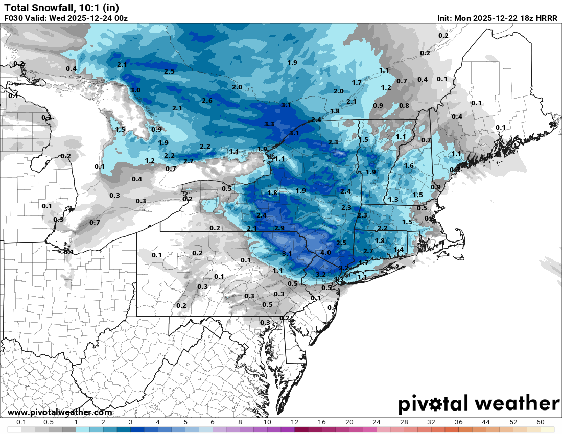
Hrrr too
-
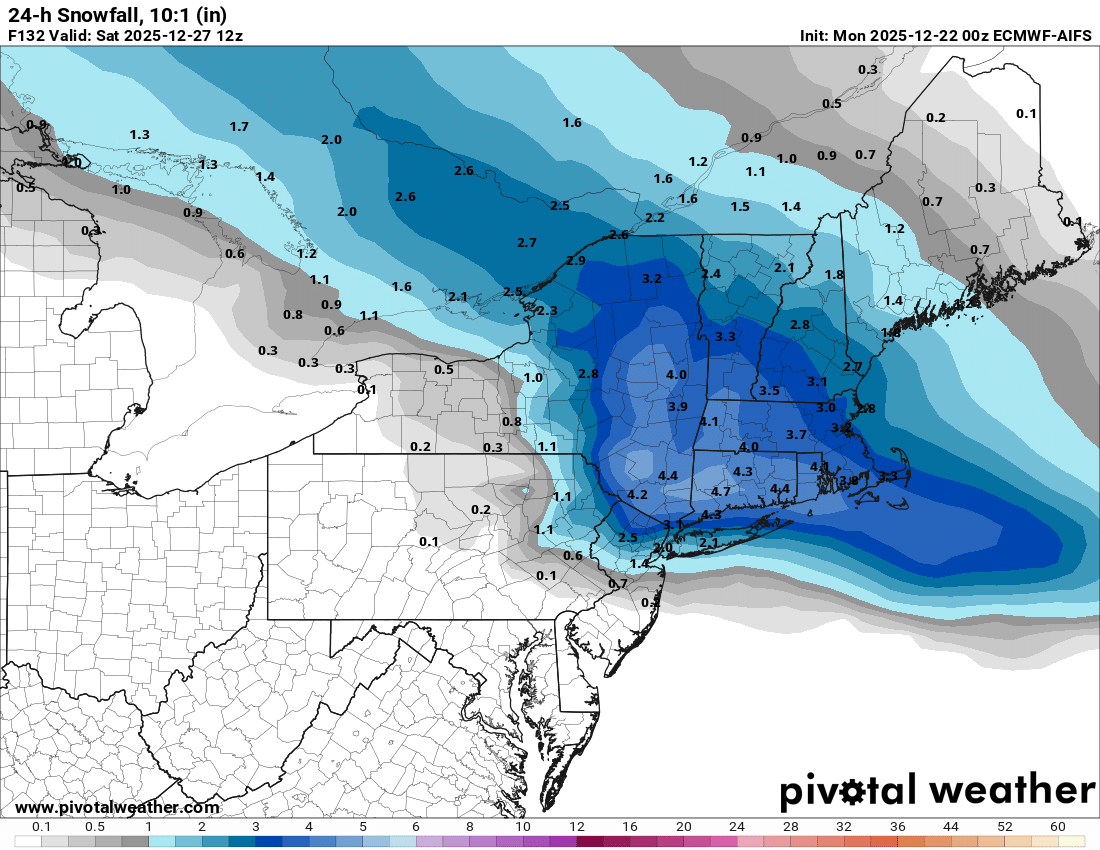
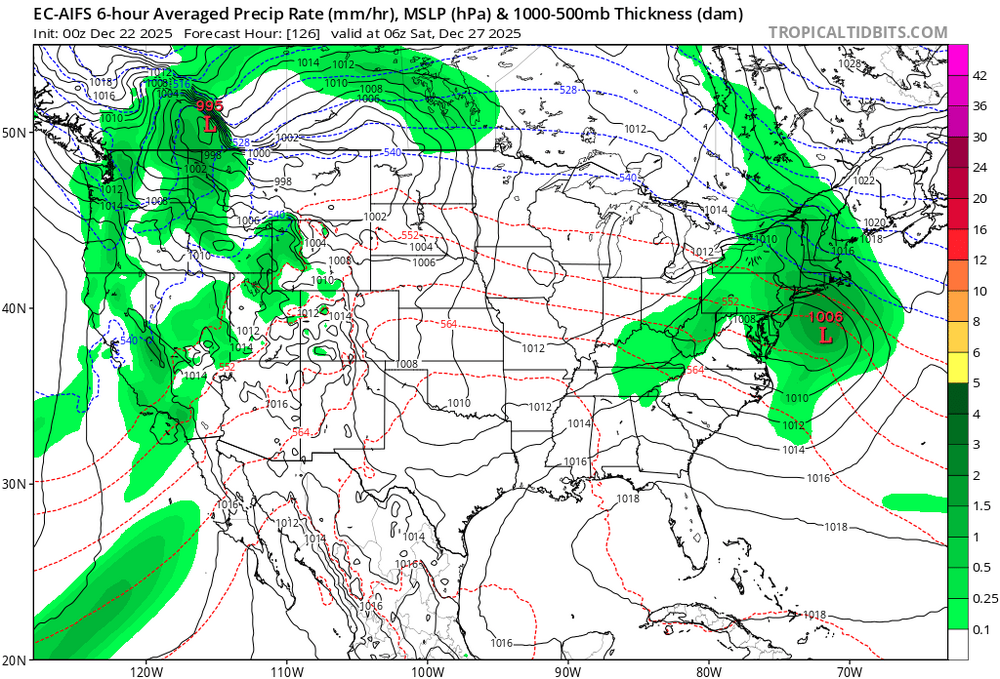
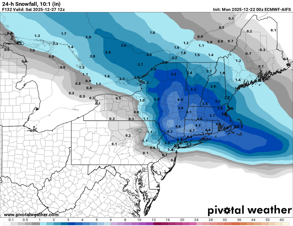
00z ecmwf ai is also south snow to rain.
-
I'm less than 3 miles north of pelham bay park and I measured 6" on colder surfaces
-
Well cpk will not reach 4" today but many places in the boroughs will. Plus the towns bordering the city will have gotten 6" or more. I'm skeptical this indicator has any value. Maybe just luck. Idk. The big question is how did the nyc metro (within 10 miles of the city) receive 6-8" with a raging pac jet, -pna, +ao and nao and mjo phase 6. From reading on here the last few years I understand nola, Tallahassee, richmond dc and nne can but not the nyc metro on dec 14th no less. Wish someone can explain this
-
Agree 100%. Above normal snowfall for most of our area and more than half a month to go. We will still have chances with all the cold bottled up in Canada and ridge axis never making it here. I wonder if the 4" snowfall in December in a nina will work out this year and don't give me the bullshit that cpk didn't get 4". Many places in the boroughs and bordering towns did
-
?? The pattern is hostile if you have been reading on here and for the last several years. -pna, +ao and nao phase 6 mjo raging pac jet. I'm confused how it snowed 6" in the nyc metro on dec 14th no less
-
Can someone please explain to me how the nyc metro area got a 6" snowstorm on dec 14 with a raging pacific jet. -pna, +ao and Nao and no phase 8 mjo mismatch. I understand from reading this forum for at least several years that nola. Tallahassee, richmond, DC, ac and northern New England can but I thought it was impossible for that to happen in the nyc metro area. I border the bronx and will likely finish with 6" + so I am not 20 or more miles away
-
5.5" on the colder surfaces and 4" on my driveway and pavers in mt. Vernon
-
4" on the colder surfaces and 2" on pavement so far still snowing moderately
-
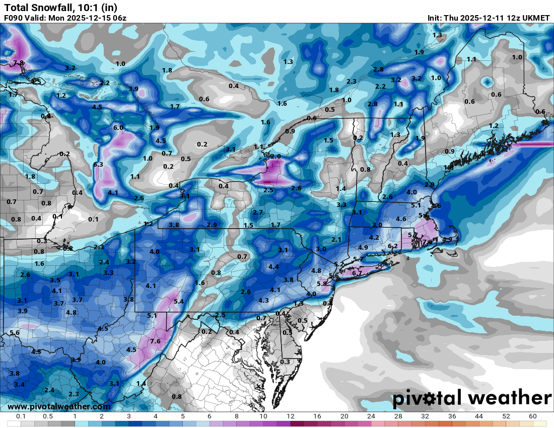
Moderate snowfall 12/14/2025 WWA up for most of the area
binbisso replied to WeatherGeek2025's topic in New York City Metro
Flurries here 35* -
Moderate snowfall 12/14/2025 WWA up for most of the area
binbisso replied to WeatherGeek2025's topic in New York City Metro
Radar really blossoming in eastern pa. Wonder if this starts earlier -
Moderate snowfall 12/14/2025 WWA up for most of the area
binbisso replied to WeatherGeek2025's topic in New York City Metro
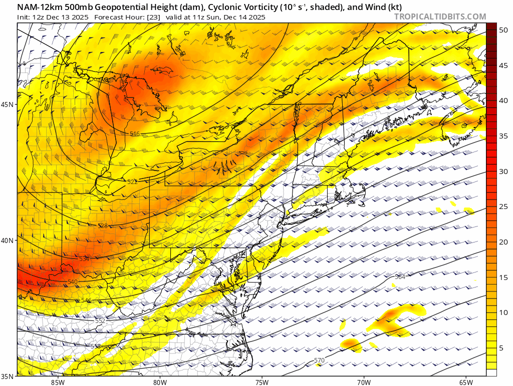
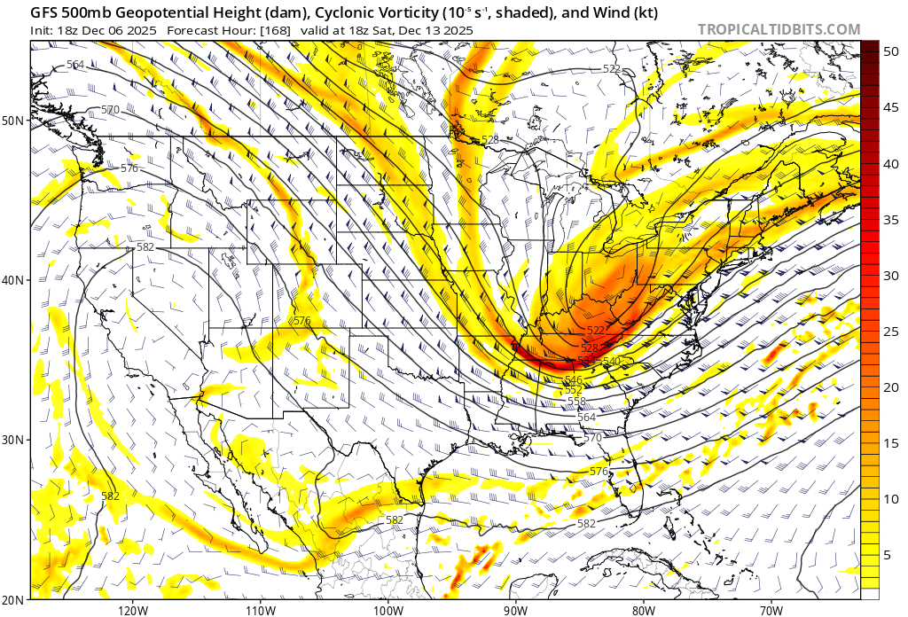
Higher heights digging sw
-
Moderate snowfall 12/14/2025 WWA up for most of the area
binbisso replied to WeatherGeek2025's topic in New York City Metro
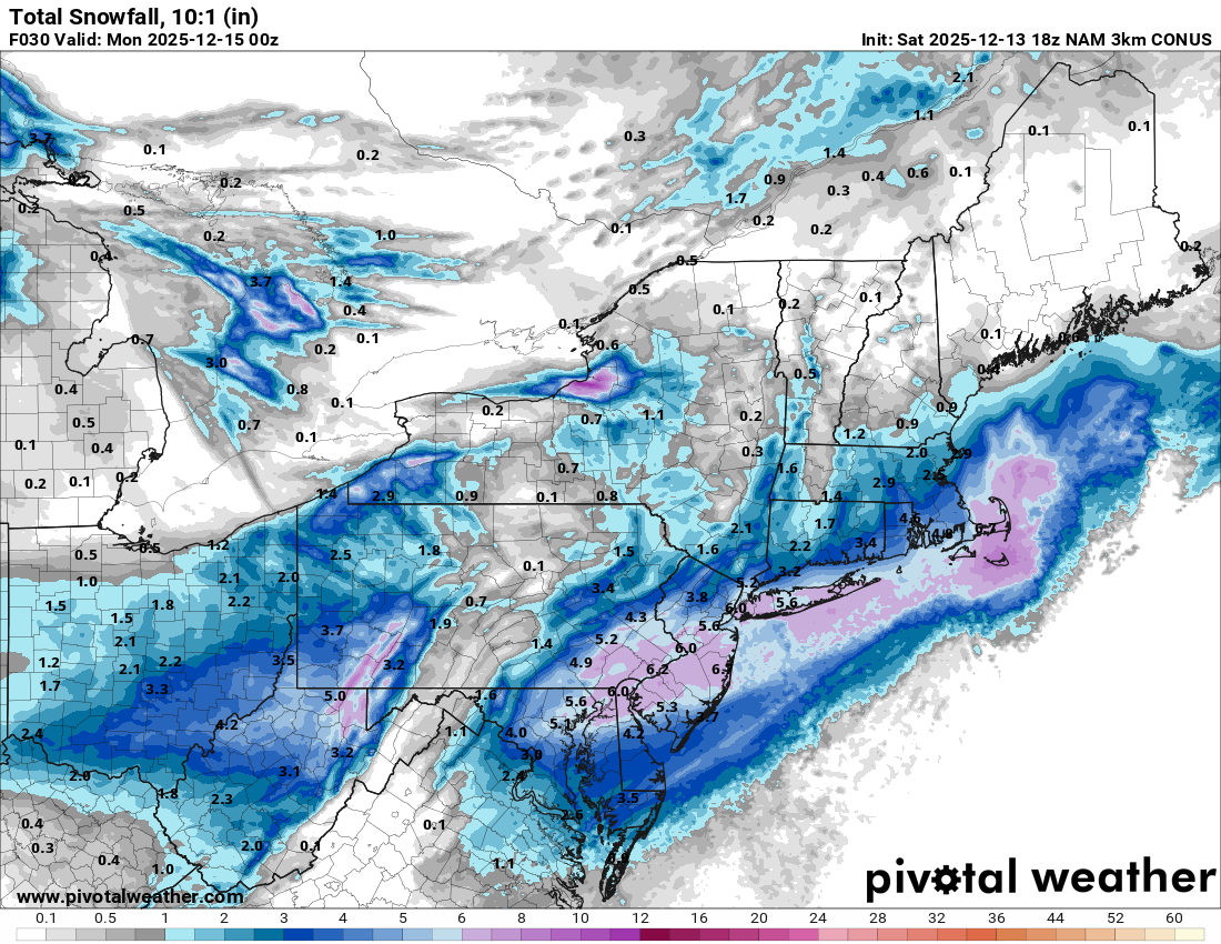
3k nam
-
Moderate snowfall 12/14/2025 WWA up for most of the area
binbisso replied to WeatherGeek2025's topic in New York City Metro
Yes ground is frozen here in lower westchester will drop to 32 once sun goes down -
Moderate snowfall 12/14/2025 WWA up for most of the area
binbisso replied to WeatherGeek2025's topic in New York City Metro
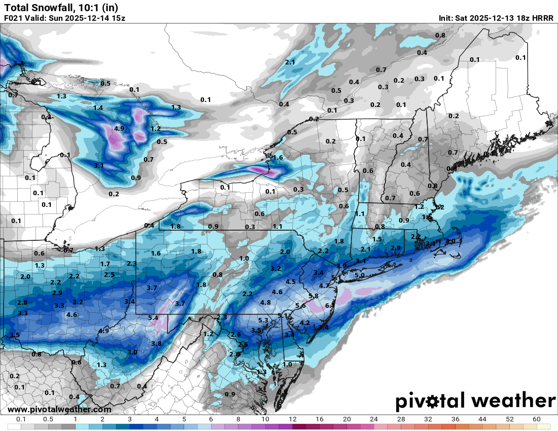
18z hrrr without ratios
-
Moderate snowfall 12/14/2025 WWA up for most of the area
binbisso replied to WeatherGeek2025's topic in New York City Metro
I know. However the .5le line is touching the southern boroughs. Move that 10 to 20 miles north with 15-1 ratios and it's not to far fetched -
Moderate snowfall 12/14/2025 WWA up for most of the area
binbisso replied to WeatherGeek2025's topic in New York City Metro
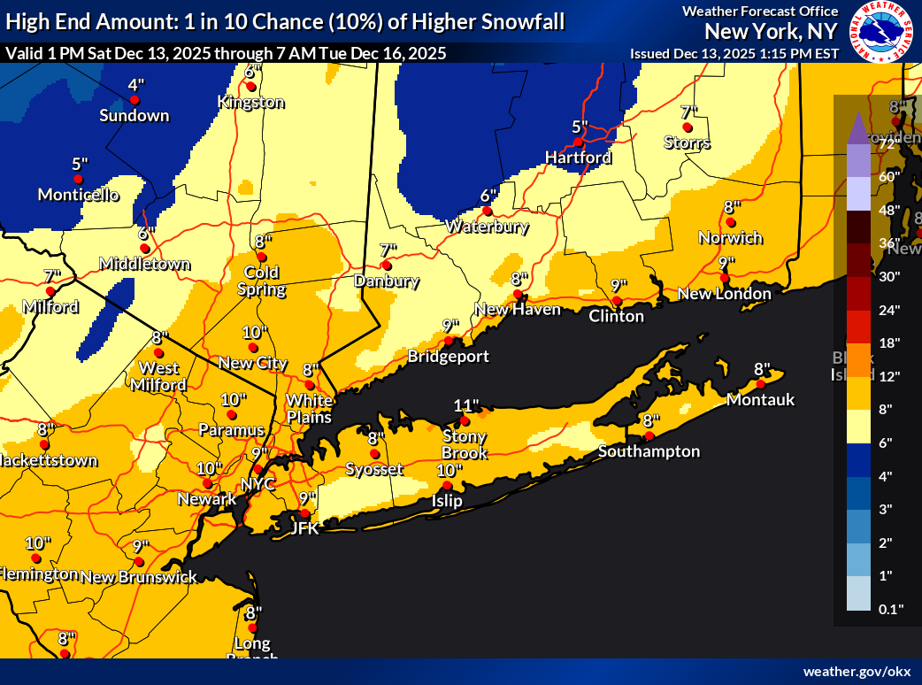
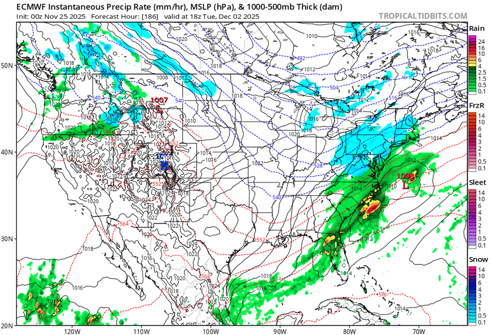
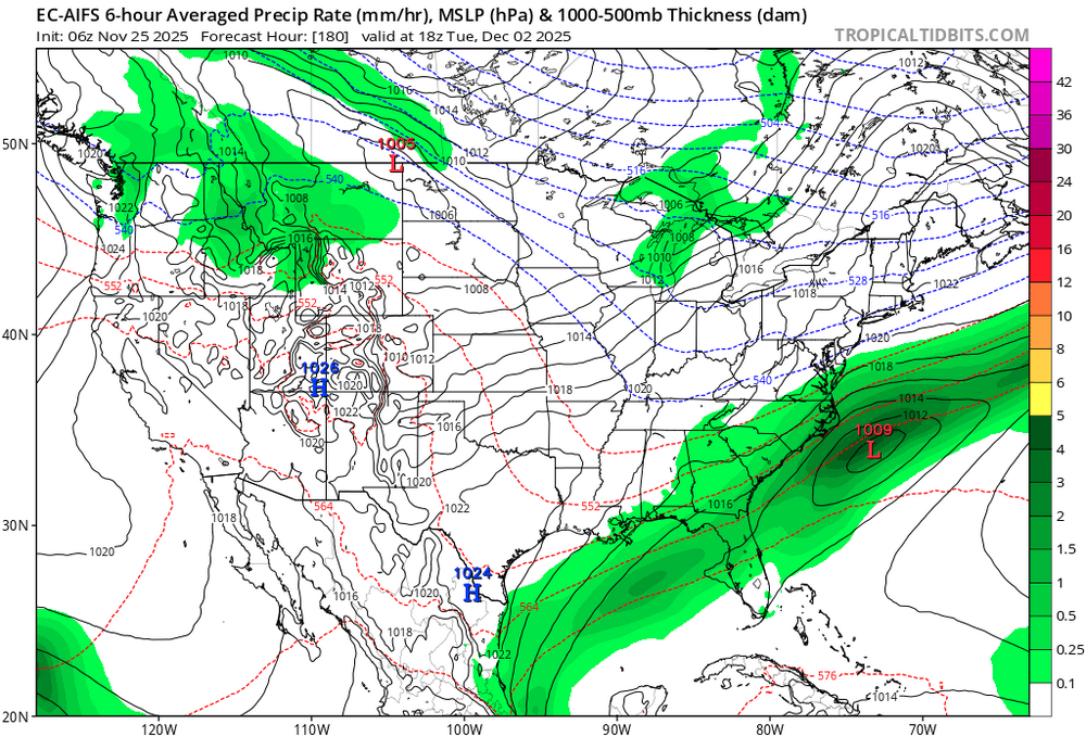
How about this map
-
Moderate snowfall 12/14/2025 WWA up for most of the area
binbisso replied to WeatherGeek2025's topic in New York City Metro
-

-
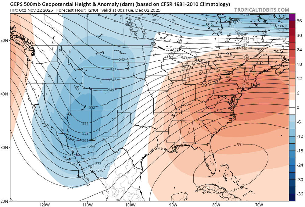
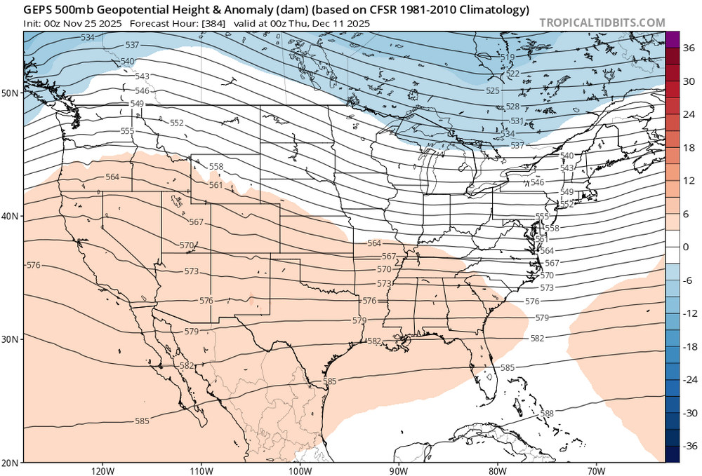
Yup. That's a piece of the pv and nice ridge out west

-
We can only go down from here.

-
Hopefully you are right with guidance showing this at day 7
-
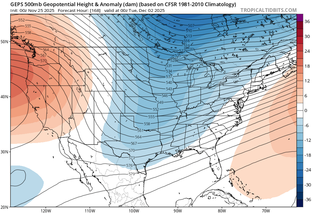
Will we go +pna mid December?
-
Pretty significant changes on the medium range guidance tonight
-
We will see if this confirms but models seem to be to strong with the se ridge in the 10+ day range geps. Older run new run