binbisso
-
Posts
889 -
Joined
-
Last visited
Content Type
Profiles
Blogs
Forums
American Weather
Media Demo
Store
Gallery
Everything posted by binbisso
-
Moderate snow here in mount Vernon, Lower Westchester coldest surfaces have a coating.
-
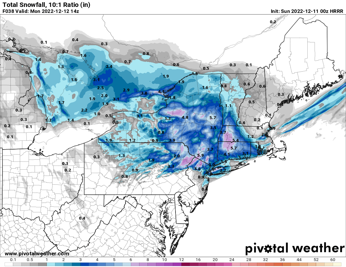
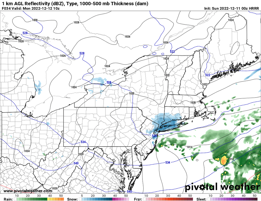
Latest hrrr
-
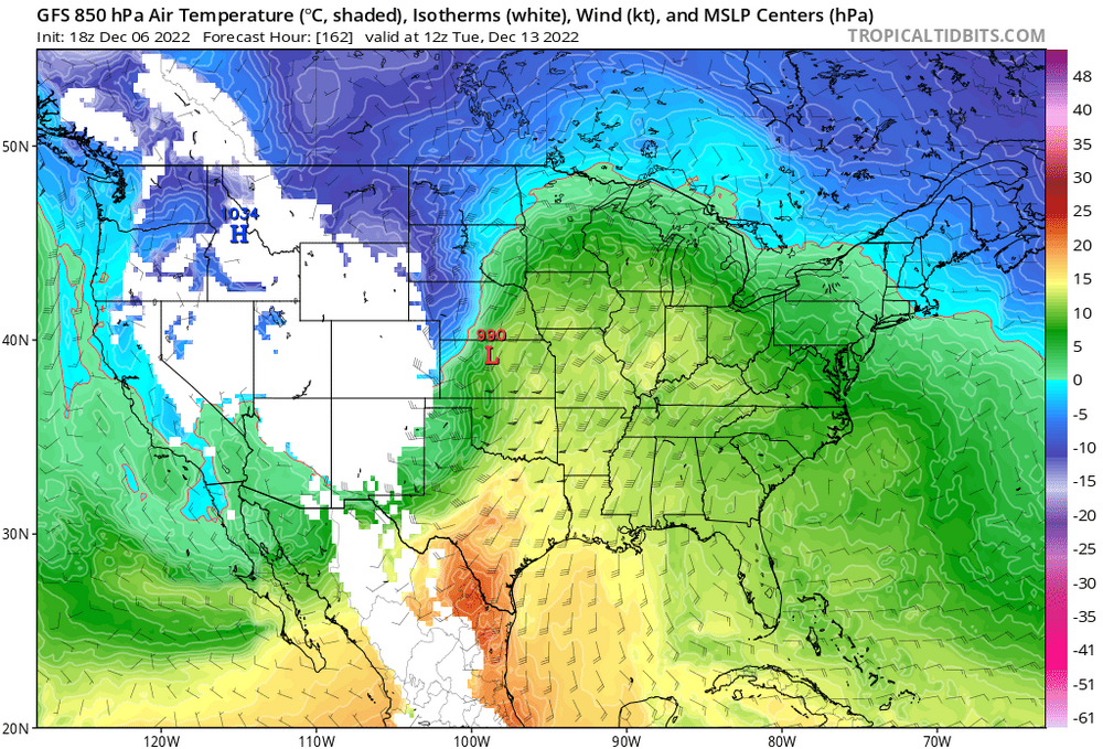
He basis his forecast on the op gfs.
-
No like this 18z gfs
-
Yes But the GFS has been a blowtorch The last week And other guidance has been waffling back-and-forth. Guidance didn't even have the system for this weekend 2 days ago. This Just popped up CMC was the 1st to see it.
-
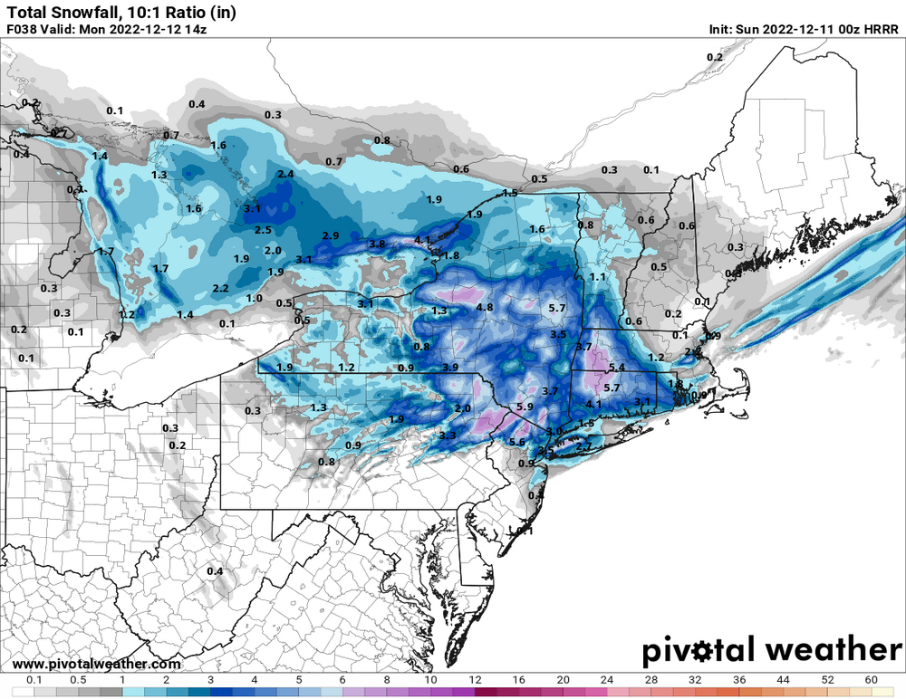
Models have been really struggling with the blocking pattern. 11th/12 now a legit chance at our first snowfall.
-
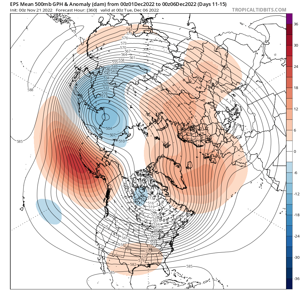
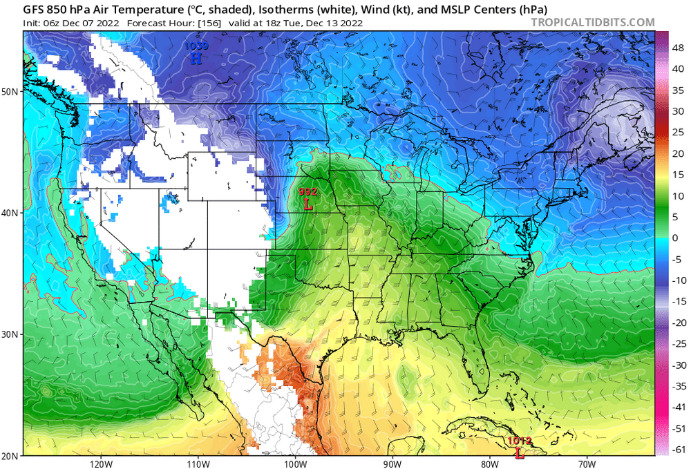
Huge changes on the 6z gfs. It Now has the low pressure on the 11th and 12th similar to the cmc. It blows that system up in the North Atlantic near the 5050 region and will probably affect the low pressure on the 14th and 15th.
-
Knyc 32" Ewr 37" Mmu 41" Isp 45" Swf 53"
-
I'd be very surprised if by December 15th those living North and West of I287 and near I 84 don't receive accumulating snow. In those areas the average high temperature is in the mid and upper thirties and lows in the mid twenties So any system tracking underneath us with this NAO block even with a crap airmass would produce for them which by the way is half of this sub forum. We may have to wait a little longer in the New York City metro Long Island in central New Jersey
-
Also I wonder if this LA Nina is now starting to die. Sub surface warmer temps Are growing esp region 4 and 3.4. Would love to get region 4 Close to neutral soon To help bring the forcing there And the better phase of the MJO So maybe we can avoid The ugly February LA Nina's
-
I think we're all a little anxious to get our 1st snowfall which is always very special. Plus we've had 9 straight days of below normal temperatures well below normal on some of those days so hate to waste the cold air. I got down to 21 here in Westchester County. Would have loved to time that with some moisture. Very early yet and a lot of good signs out there and we usually don't get our 1st snow here till after December 15th
-
Ensembles look fine. We have to watch next weekend for a wave riding along the front as it presses against the Southeast ridge And gets hung up. After that there's a signal for a coastal storm The week of December 5th As the G EFS pops a PNA ridge
-
You're out of your mind. Newark has been freezing or below for the Past 6 nights With a low of 24 and 2 days of 27゚. It has been colder than all the New York city reporting stations The last week
-
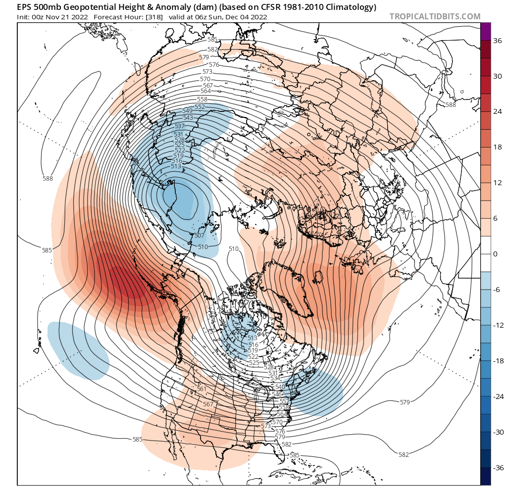
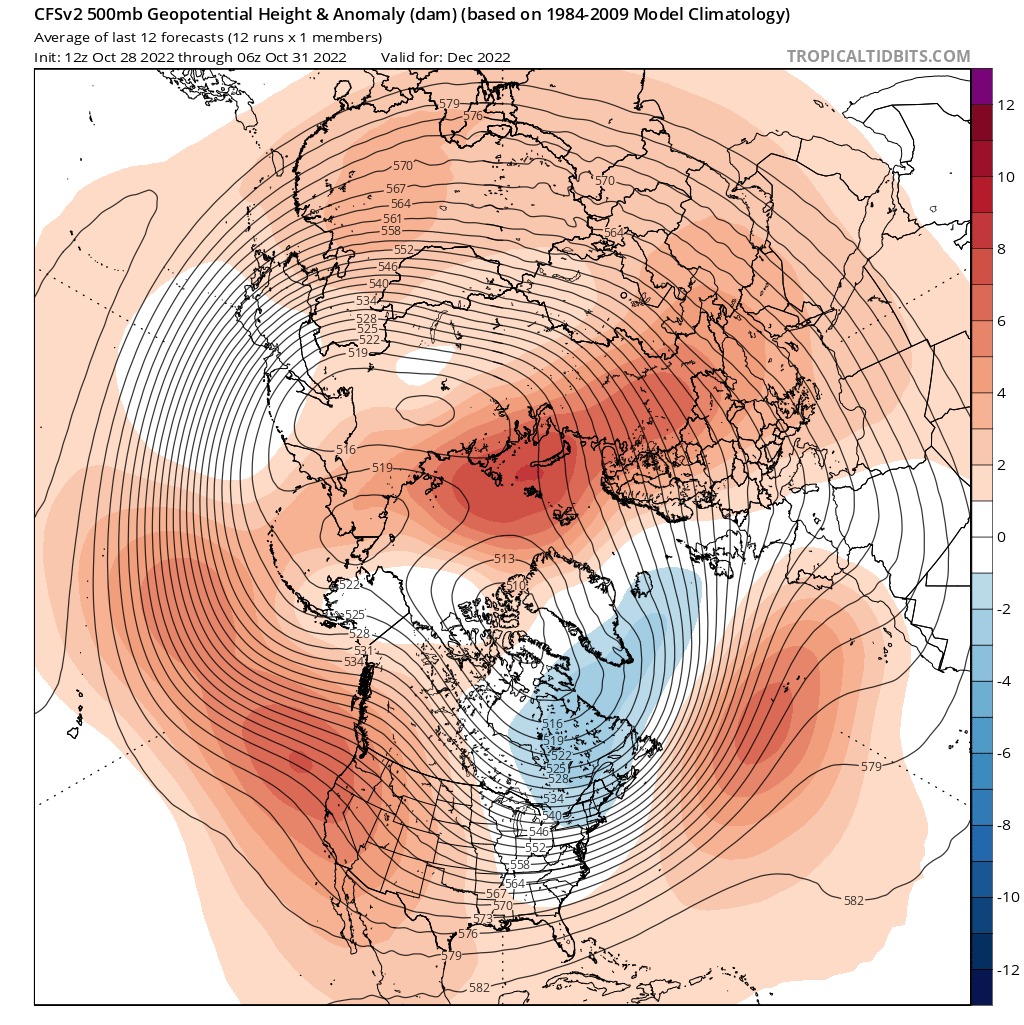
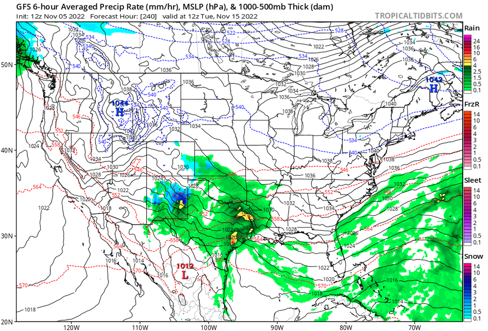
Here's the 5 day average. East based -nao and neg heights east of Hawaii could signal an active southern stream. If it holds that pattern can produce in early December. The best sign is no pig in Alaska

-
Big changes on the eps as we head into December. Looks like it tries to pop epo and pna ridge.
-
It's November. Climo is against us down here. Patience! We usually don't get our first snow until mid late December
-
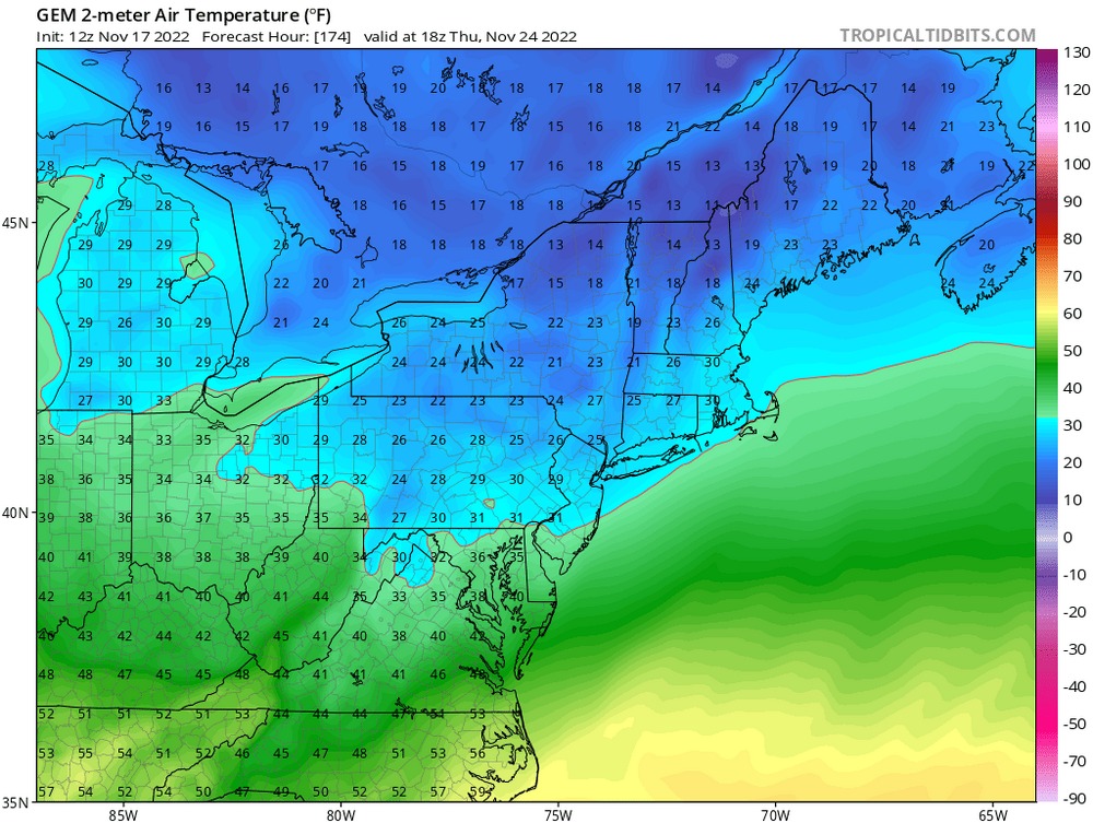
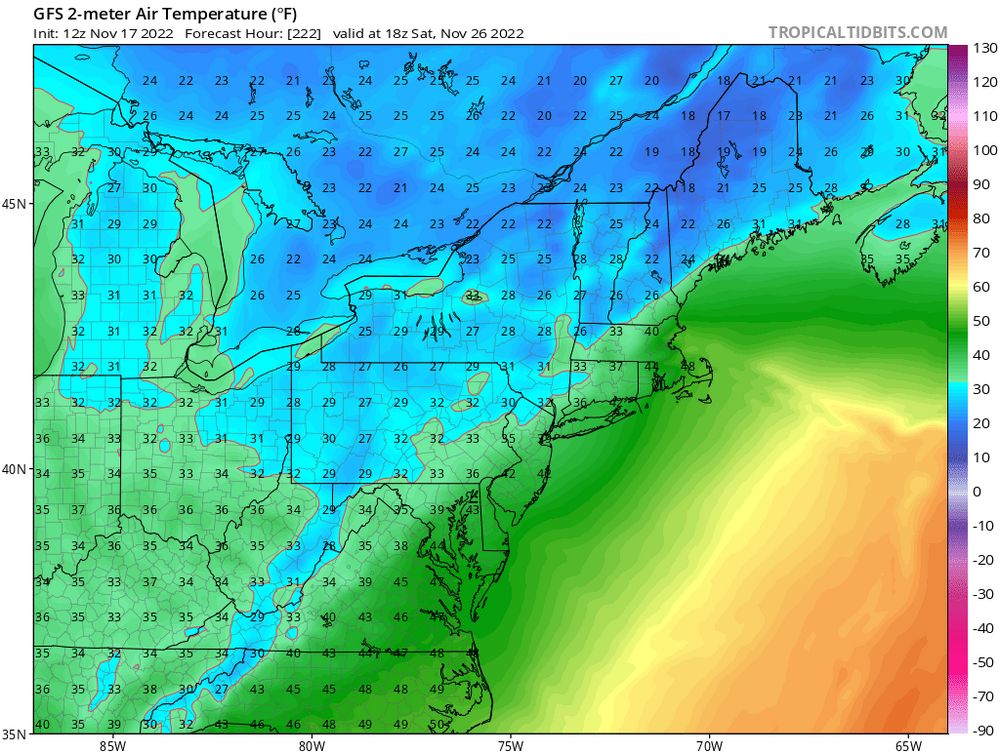
I guess we can kiss the late November moderation goodbye. Temps below freezing for highs on turkey day. Looks like we may erase the record positive departures. That would be impressive
-
Looks like the models have been underestimating the negative EPO. Models have now been trending colder for next weekend With temps well below normal. If correct We may have to watch the week of November 14th through 20th for a possible 1st snowfall especially for interior sections. love the 1040mb highs over Maine with sw in the Mississippi valley

-
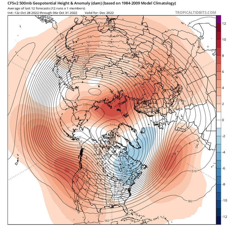
Yup. Unless there is a blend of guidance these stats are pretty useless. Cfs looks good for December. Eps heading in that direction. Not holding my breath but hopefully we can get a decent December this year. We are due
-
Euro 3 to 4" of rain for the city
-
Approaching an inch and a 1/2 since yesterday afternoon At all major reporting stations. Car thermometer at 44゚ Wind swept heavy rain right now
-
Gfs, cmc and rgem With an additional inch plus through Tuesday. Nam is dry
-
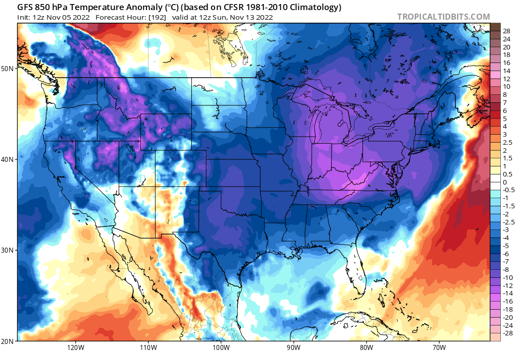
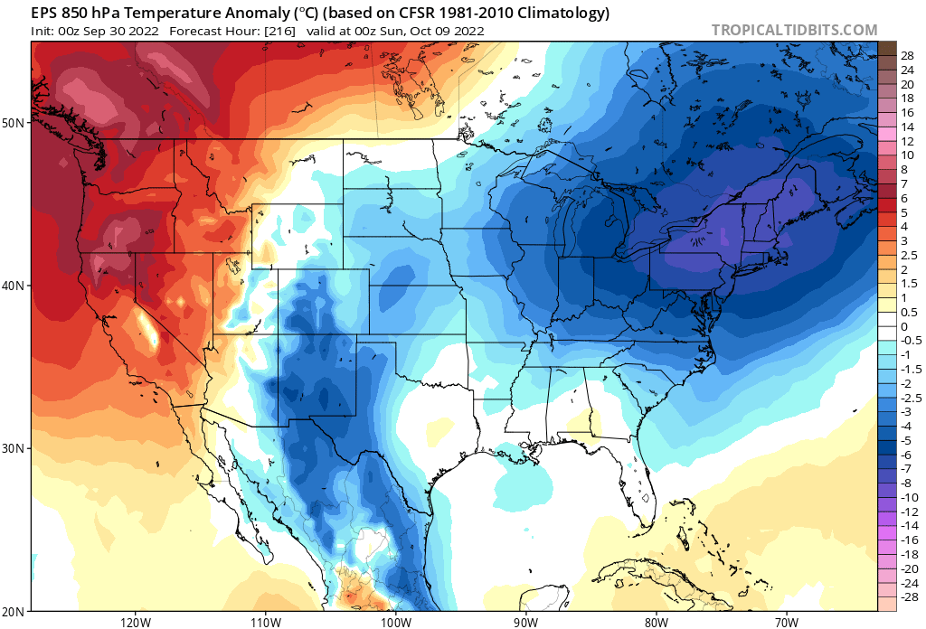
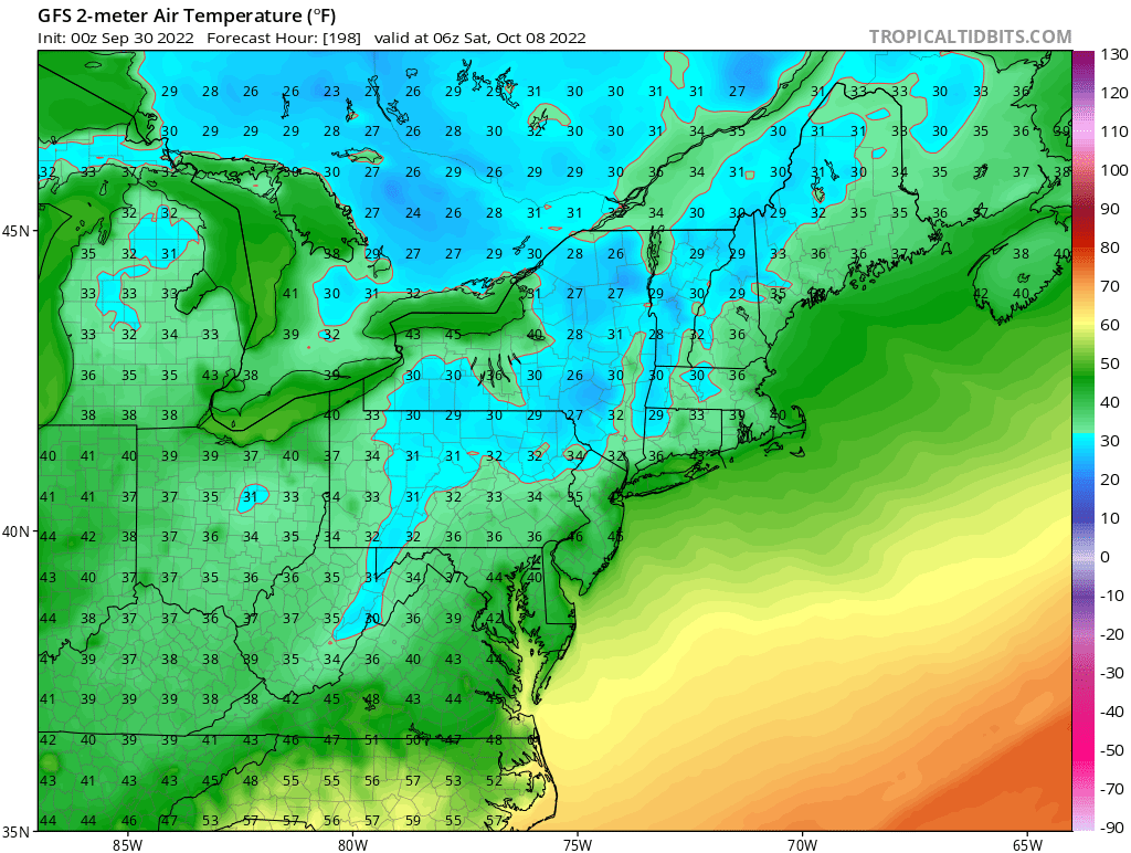
8 straight days without a positive departure. The next 10 days are all below normal on current guidance With coldest air mass of the season possibly next weekend. 1st frost/freeze for some of our northern burbs. Haven't had a stretch like this in quite a long time

- 1,529 replies
-
- 8
-

-
- hurricane
- tropical storm
- (and 1 more)
-
Flash for my warning for just about the entire 5 boroughs
-
We'll be over 2" in The Bronx with this new batch moving up from Staten Island