

Kmlwx
-
Posts
13,431 -
Joined
-
Last visited
Content Type
Profiles
Blogs
Forums
American Weather
Media Demo
Store
Gallery
Everything posted by Kmlwx
-
TDWRs have something interesting near Bowie. I'm in Annapolis tonight.
-

2021 Mid-Atlantic Severe Weather - General Discussion
Kmlwx replied to Kmlwx's topic in Mid Atlantic
We always seem to manage some sneaky gusty shower event in November or December. I just want something other than grey, boring skies to track. -
A few flurries here in Colesville, MD.
-
December 2021 Medium/Long Range Discussion Thread
Kmlwx replied to North Balti Zen's topic in Mid Atlantic
That's also only out to D10. There are indications that the warmer pattern may be in place until late month. Would not expect anything prior to the end of that chart - and more likely even a bit longer. -
Welcome to the watch list
-
Doesn't really look like the bird/insect stuff we are used to. Is there a fire/explosion out that way? That was weird.
-
Get out.
-
2021 Mid-Atlantic Severe Weather - General Discussion
Kmlwx replied to Kmlwx's topic in Mid Atlantic
Door is open for some gusty showers this weekend. If it can't snow - let's go for severe! -
Weather weenies sure know how to beat a dead horse
-
Let's perhaps get through the Torchember period and then we can look at setting something up if psu is back to not being as busy. There's no rush.
-
Family comes first. Doubt this will be enough to get a Zoom call going, anyway - especially since we haven't had our "get to know each other" call for the group. I'm guessing less folks would have been available on a weeknight as well. Hope the kid has a speedy recovery!
-
"When will they hoist warnings?" "I'm one county away from a warning...weather knows county boundaries"
-
We should have a contest for best virtual Zoom background
-
More likely is that we'll all have thrown our computers into the streets and the subforum will be a raging dumpster fire with Yoda wandering aimlessly around vacant streets and Ji rocking back and forth in the fetal position in a dark alley.
-
psu has been busy I believe. I was on the initial list of folks who sent emails to him - as long as you sent to the right address all should be well.
-
December 2021 Medium/Long Range Discussion Thread
Kmlwx replied to North Balti Zen's topic in Mid Atlantic
I mostly figured as much - my main point being is that you're not on here posting about how we are F'd because of La Nina and omg no snow - omg it can't snow anymore. You're just quietly resigned to it. Every last one of us is still peeking at the models every day even if we don't admit it -
This is true on literally every internet website. It's the web - there's going to be more abrasive people and less abrasive people. Don't let things get to you so much and it will get way more tolerable. If you feel like you need to reply to everything - you're doing something wrong. Gotta take a breath and just let the world unfold. It'll be okay for all of us.
-
December 2021 Medium/Long Range Discussion Thread
Kmlwx replied to North Balti Zen's topic in Mid Atlantic
Let's just be honest - it could be July and it could be like this with the right combination of users and posts. -
December 2021 Medium/Long Range Discussion Thread
Kmlwx replied to North Balti Zen's topic in Mid Atlantic
OT - but just a few friendly tips. I generally enjoy you as a poster - but you've gotta just chill a bit. There's a big difference between being in the crowd of "assuming it'll be a lower end winter - and being happily surprised if anything nice happens" and being an absolute deb at every opportunity. @mappy - just quietly sort of makes one comment and it's more of a "let's see what happens and it is what it is" Your posts tend to come across as much more of a "omg it really won't snow ever - we just need to throw in the towel because it's over and won't ever snow this winter" I know those aren't your exact words - and I know you're trying to learn about meteorology (as we all are from the pros on here) - but I'd lean towards the mappy approach. You can definitely absorb what the pros are teaching us without needing to necessarily have a response. I've seen you post questions like "well there has to be an explanation as to why it doesn't snow anymore" and similar. There's rarely a single, catch-all answer to things in this field and it sometimes feels like you're assuming it's all down to one thing. Post counts aren't everything. I think we all have been through phases of panic over no snow and angst. I get it. Moderation is the key. I was really, really similar to you back in the EasternUSWX days. Just remember that the weather is going to do whatever the weather is going to do. As much as we joke about things like the snow blower curse, or cursing things with radio shows - there's so much in this field that is still unknown. It is what it is. -
No. An email list is being built for now.
-
I think @psuhoffman's idea to have a prelim style meeting. If we get a sense of who will be joining future meetings, we can weed out trolls if needed (putting faces to names). Bumping the thread again for visibility in case users missed it.
-
I'm waiting for instructions. I can setup if needed at any time.
-
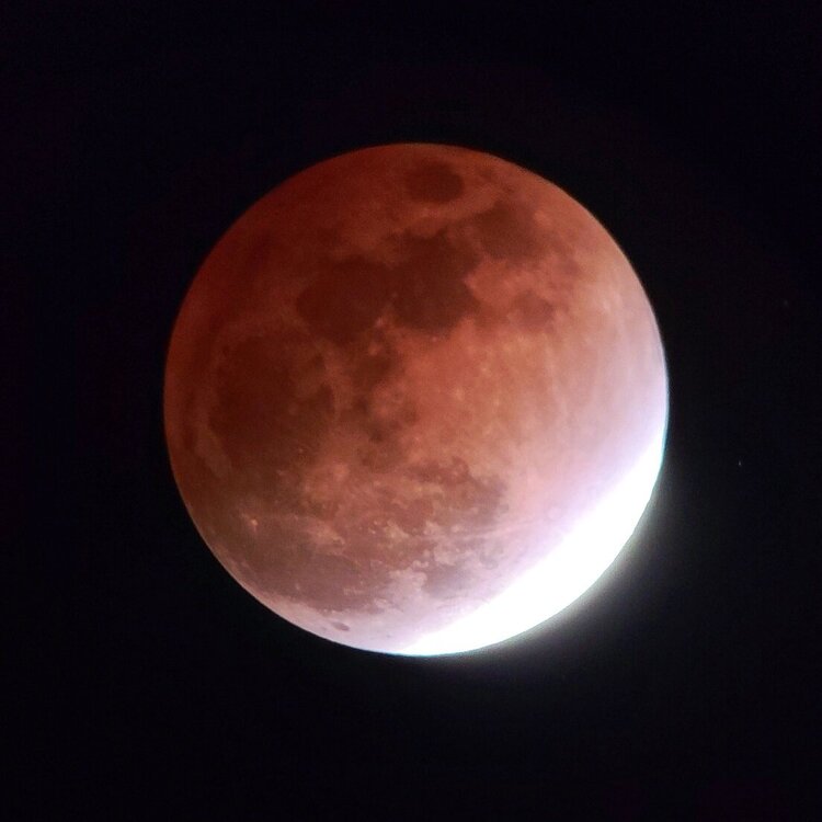
Was yours via a telescope? That may have been a factor. Also mine was just my phone held up to eyepiece…so I may have been holding it at an improper angle
-
Didn't have time to setup anything fancy - and my telescope was poorly collimated. But here's mine!
- 454 replies
-
- 16
-

-
A snow squally event could be fun - even with no accumulation locally.


