

Kmlwx
-
Posts
13,549 -
Joined
-
Last visited
Content Type
Profiles
Blogs
Forums
American Weather
Media Demo
Store
Gallery
Everything posted by Kmlwx
-
No "official" records - but Washington, Jefferson and apparently some other people or orgs in the area wrote about it in detail. Have to hope that they weren't slant sticking. I've always thought that storm (if authentic) is probably the theoretical max for a single storm in this area. Based on how Washington wrote about it - it's even possible it was two storms back-to-back (similar to 2010)
-
Washington/Jefferson Storm Redux. We'll all be partying like it's 1772.
-

Thursday 1/20/22 Stat Padder Discussion and Observations
Kmlwx replied to stormtracker's topic in Mid Atlantic
Hanging tough around 36-38 here in Colesville, MD. Temp has been oscillating around those points for a couple hours now. -
Thursday 1/20/22 Stat Padder Discussion and Observations
Kmlwx replied to stormtracker's topic in Mid Atlantic
Friendly reminder the models are on zulu time. -
What if the models beyond 48 hours only showed H5 panels. Would sure cut down on the snow map weenies.
-
Thursday 1/20/22 Stat Padder Discussion and Observations
Kmlwx replied to stormtracker's topic in Mid Atlantic
It's Ian's famous corn fumes. -
Yeah isn't it the unpertubed (same initial conditions as the OP) but run at the resolution the pertubed ensemble members are run at?
-
Outage numbers for PEPCO are pretty low so far. Though it could just be a slow refresh of the map.
-
30.7 now in Colesville. Appears to be raining lightly out there. Definitely getting slick on surfaces I shoveled earlier.
-
29 degrees now. The temp rise has been quite impressive.
-
Temp is really rising now - up to 26.1 it looks like.
-
Looks like 2.25" as the pingers started here. Compaction will really start now.
-
Was out shoveling the driveway and heard pingers here in Colesville.
-
Around 1.25" so far here in Colesville, MD. VERY pretty outside with cold fluff. 24.4 degrees for the temp and 17.4 for the dewpoint. So they are closing in on each other now. Expecting pingers in the next while here.
-
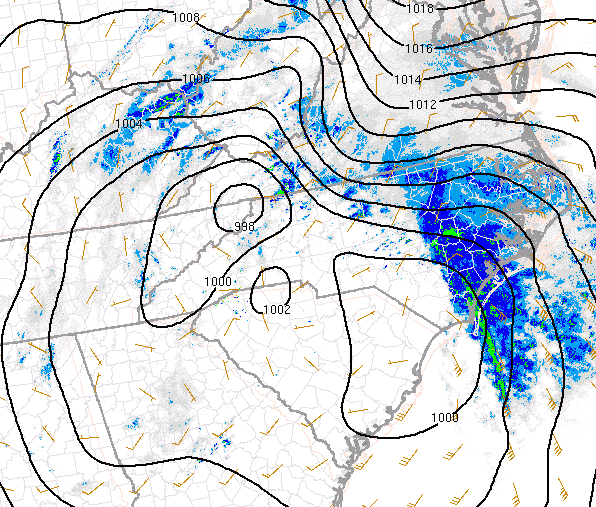
H5 low is showing in North Central GA per mesoanalysis - we'll see where it goes.
-
-
Mesoanalysis has the lowest pressure in extreme NE Tennessee.
-
Venturing a guess - but once the surface winds shift and change from being what they currently are (NE or NNE) - the temps may start to respond fairly soon after that.
-
Many stations still have winds out of the NE or NNE - temps should be good for now.
-
Another thing to consider is folks can be using different color tables depending on what radar or program you are using and the source. I have a special "snow" color table that Ian sent me a while back - so where I see obvious returns may not show the same as other folks. Regardless - my original point to he/she stands - the precip does start pretty soon after returns pick up in intensity.
-
You are also farther from the radar. So the beam is showing you a slice that's higher up in the air versus folks closer to the radar.
-
Give it a few mins. It starts almost as soon as a couple shades of returns are overhead.
-
Snowing very lightly here in Colesville, MD. 24.3 air temp and 8.4 dewpt
-
Has done this as long as I can remember in winter events.
-
Given what this storm did from it's trek from the long range to the medium range - I'd rather have that for now.

