midatlanticweather
-
Posts
4,941 -
Joined
-
Last visited
Content Type
Profiles
Blogs
Forums
American Weather
Media Demo
Store
Gallery
Everything posted by midatlanticweather
-

Outta gas and Outta Time: Early March Winter Storm finale
midatlanticweather replied to Ji's topic in Mid Atlantic
The deck was icey for sure! Had to clean it for the dog and family not to slip. Roads are fine, but the trees, combined with the wet snow from yesterday, are weighted down quite a bit. 31.7 degrees! Just a little bit longer for winter's last gasp and then the warm up begins. -
Outta gas and Outta Time: Early March Winter Storm finale
midatlanticweather replied to Ji's topic in Mid Atlantic
Had a chance to get to the shaded spots of the deck. Over 2 inches of snow still this evening. Pretty good snow today here in Purcellville. Currently 29 degrees. -
Outta gas and Outta Time: Early March Winter Storm finale
midatlanticweather replied to Ji's topic in Mid Atlantic
Almost 2 inches for a very short period of time when my temps were beat down to 28 degrees.. As soon as it got light it has been steady melt. Sitting at 31 and light snow. -
Outta gas and Outta Time: Early March Winter Storm finale
midatlanticweather replied to Ji's topic in Mid Atlantic
Snowing well out here in Purcellville! White ground. Roads are fine. 29.2 degrees -
2/26 - Follow-up Hopium Battlezone Storm
midatlanticweather replied to DDweatherman's topic in Mid Atlantic
Rain/snow mix in northern Loudoun. -
People in Northern Loudoun have sent me video of rain/snow mix in that heavy band.
-
2/26 - Follow-up Hopium Battlezone Storm
midatlanticweather replied to DDweatherman's topic in Mid Atlantic
-
2/26 - Follow-up Hopium Battlezone Storm
midatlanticweather replied to DDweatherman's topic in Mid Atlantic
We can't either!!!
-
Feb 22nd/23rd "There's no way..." Obs Thread
midatlanticweather replied to Maestrobjwa's topic in Mid Atlantic
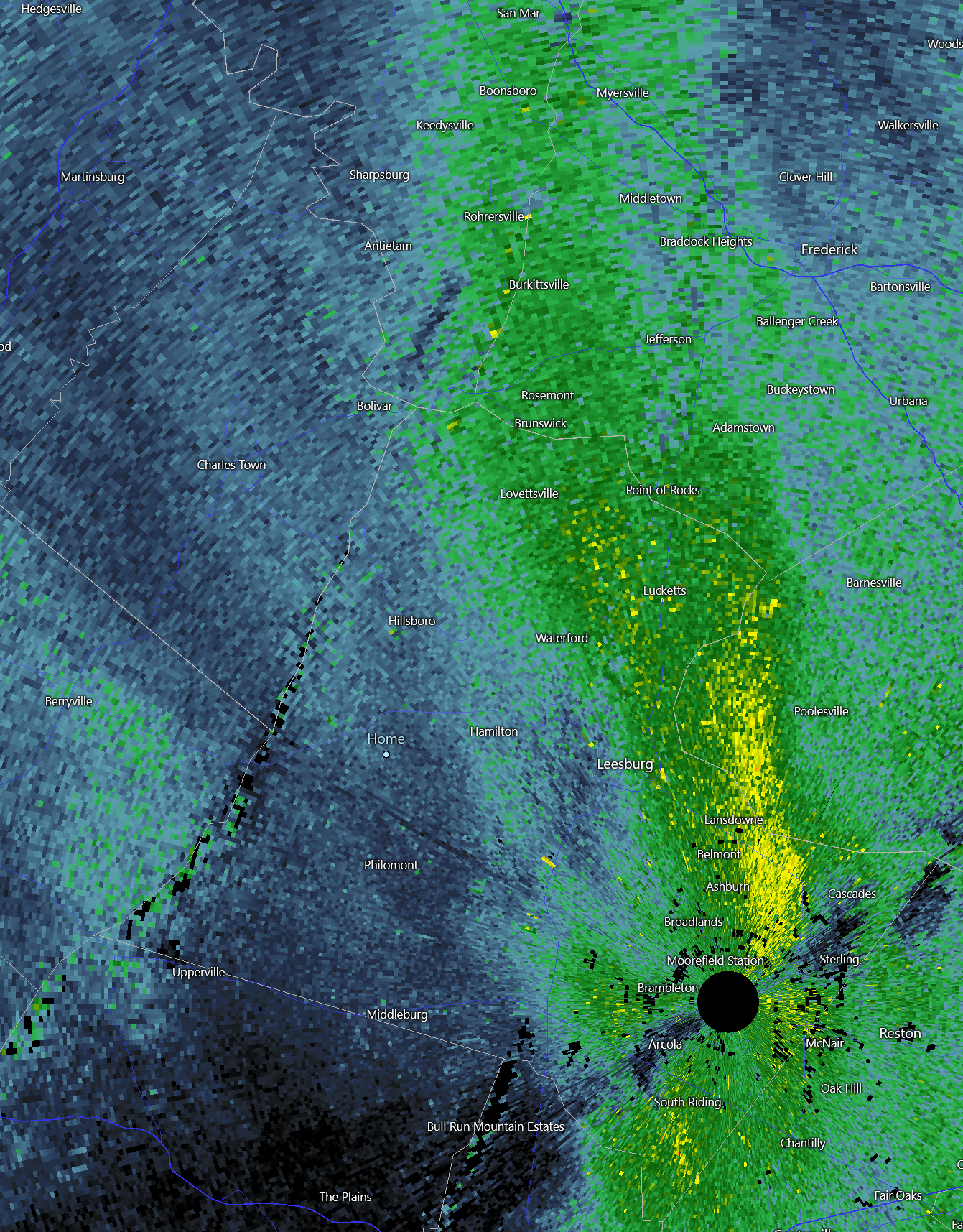
Wow! BOOM just east of Ashburn in Loudoun County near Georgetown Loudoun Campus, and just west of Cascades down near Dulles Town Center! Wow!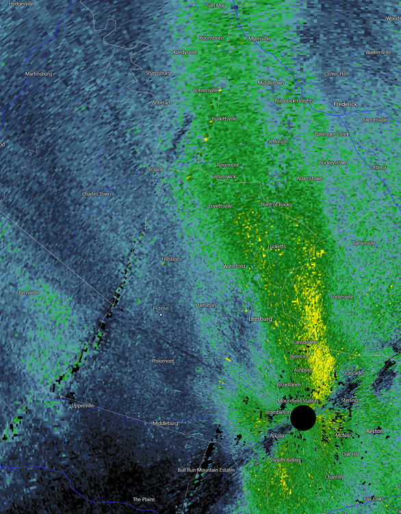
-
Feb 22nd/23rd "There's no way..." Obs Thread
midatlanticweather replied to Maestrobjwa's topic in Mid Atlantic
Great seeing you capitalize.. The norlun is close so maybe you get back in it. Light snow at least started back up out this way. We are at about 0.2 of an inch. Just outside the goods. -
Feb 22nd/23rd "There's no way..." Obs Thread
midatlanticweather replied to Maestrobjwa's topic in Mid Atlantic
Crazy seeing the snow back west but miss me by a few miles. @MillvilleWxsaid there would be winners and losers very close to each other. Yep.. That is the way it looks. It may build more west but it is struggling. -
Feb 22nd/23rd "There's no way..." Obs Thread
midatlanticweather replied to Maestrobjwa's topic in Mid Atlantic
Well - went driving about an hour ago. I got less than 0.15 of an inch, but eastern Purcellville had picked up close to an inch. Snow almost wrapped up here as we get the subsidence from the norlun and also as the energy and moisture gets sucked east. I did drive over the Blue Ridge with snow-covered roads! Was wild and very low visibility in fog. So, I was whiffed but eastern Loudoun is looking good for now! I am about 1.5 miles from downtown Purcellville. -
Feb 22nd/23rd "There's no way..." Obs Thread
midatlanticweather replied to Maestrobjwa's topic in Mid Atlantic
Been snowing nicely for about an hour. Mulch is starting to cave.. Grass is getting lighter with slush. Cars covering slowly. 33.3 degrees -
Feb 22nd/23rd "There's no way..." Obs Thread
midatlanticweather replied to Maestrobjwa's topic in Mid Atlantic
Snowflakes bigger but not all snow. Temps dropping! Down to 34.8 in Purcellville -
Feb 22nd/23rd "There's no way..." Obs Thread
midatlanticweather replied to Maestrobjwa's topic in Mid Atlantic
Traffic Cam at Bears Den on Rt 7 - Along the BR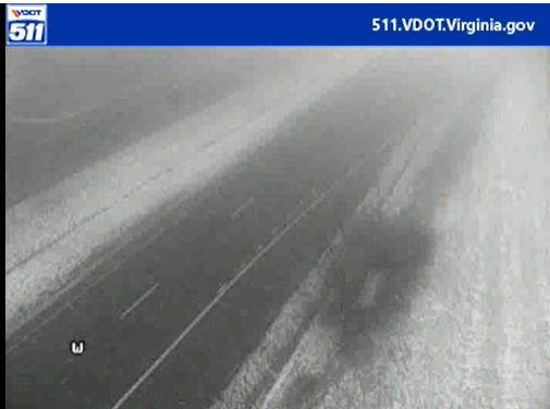
-
Feb 22nd/23rd "There's no way..." Obs Thread
midatlanticweather replied to Maestrobjwa's topic in Mid Atlantic
Cameras on 511de.org are fun to look at! Huge flakes and coated everywhere on most! -
Feb 22nd/23rd "There's no way..." Obs Thread
midatlanticweather replied to Maestrobjwa's topic in Mid Atlantic
I think k that is a bit early to be making ten conclusion. I suspect the band gets set up once the low gets cranking -
Feb 22nd/23rd "There's no way..." Obs Thread
midatlanticweather replied to Maestrobjwa's topic in Mid Atlantic
Mixed back with snow now. But temperatures have torched to 37 degrees out here in Purcellville -
Feb 22nd/23rd "There's no way..." Obs Thread
midatlanticweather replied to Maestrobjwa's topic in Mid Atlantic
Just rain here in Purcellville. It is probably just too light. Temp is up to 36.4 as well. -
Feb 22nd/23rd "There's no way..." Obs Thread
midatlanticweather replied to Maestrobjwa's topic in Mid Atlantic
Earlier that hill had rain/snow mixed. I am about to head home back in Purcellville but it looks like it is all rain out there now. Looking at security cameras -
Feb 22nd/23rd "There's no way..." Obs Thread
midatlanticweather replied to Maestrobjwa's topic in Mid Atlantic
In Leesburg. Rain has some bouncy elements to it now. Trying to mix in -
Feb 22nd/23rd "There's no way..." Obs Thread
midatlanticweather replied to Maestrobjwa's topic in Mid Atlantic
In Purcellville it was like 70%. 40% up to about rt9. -
Feb 22nd/23rd "There's no way..." Obs Thread
midatlanticweather replied to Maestrobjwa's topic in Mid Atlantic
In Leesburg now. Light rain. Was rain/snow mix until I went over the hill by rt9 -
Feb 22nd/23rd "There's no way..." Obs Thread
midatlanticweather replied to Maestrobjwa's topic in Mid Atlantic
0:1 -
Feb 22nd/23rd "There's no way..." Obs Thread
midatlanticweather replied to Maestrobjwa's topic in Mid Atlantic
rain and snow mixed. 35.5 degrees. Lowest we had was 34.9 degrees a few hours ago.