BlunderStorm
-
Posts
1,235 -
Joined
-
Last visited
Content Type
Profiles
Blogs
Forums
American Weather
Media Demo
Store
Gallery
Everything posted by BlunderStorm
-
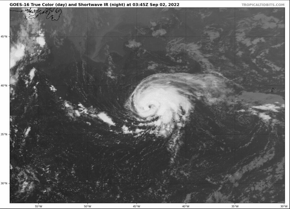
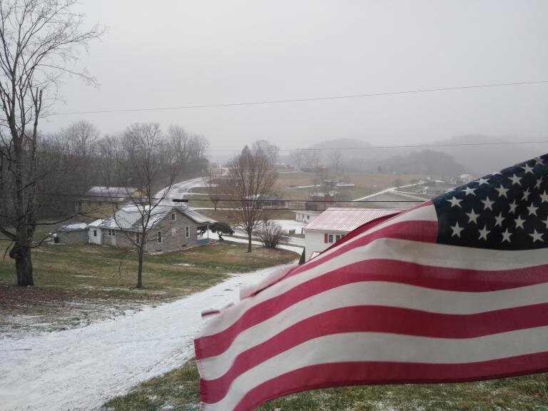
She's looking snazzy tonight.
-
It got to a point up my way I gave up on the mower and pulled out the old weed-eater. Of course mid-way through knocking things back down to something resembling a yard a thunderstorm put an end to that and likely will today. I must say though I have been appreciating the moderated temperatures.
-

Spring/Summer 2022 Medium/Long Range Forecast Discussion.
BlunderStorm replied to John1122's topic in Tennessee Valley
Good disco by MRX this morning. X000 FXUS64 KMRX 280744 AFDMRX AREA FORECAST DISCUSSION National Weather Service Morristown TN 344 AM EDT Thu Jul 28 2022 .SHORT TERM...(Today and Tonight)... Key Messages: 1. Flash Flooding threat for our southwest VA counties through late morning/early afternoon, Flood Watch in place through 18Z. 2. Conditional Flash Flood threat this afternoon, once again, mainly along and north of I-40. 3. Isolated damaging wind gusts possible with any stronger storm this afternoon. Discussion: Now through sunrise: Periods of showers and storms will move across southwest VA through at least late morning according to the last few runs of the HRRR. Periods of moderate to heavy rain are expected. Current 1 hr FFG values across our SWVA counties ranges from 0.75 to 1.25" with 3 hr FFG values from 1 to 2". The ongoing and additional rainfall that is expected will likely cause localized flash flooding, depending on where the heaviest rainfall occurs. For this reason, went ahead and issued a Flood Watch for Flash flooding through 18Z for our SWVA counties. The HRRR has also shown additional showers and storms developing along the KY/TN border, also through late morning. Radar returns are beginning to increase across these areas, confirming what the HRRR has been showing. This will also be an area to watch for potential isolated flash flooding but not confident enough to include these areas within a Flood Watch at this time. Will continue to monitor things closely. The rest of the day: The forecast over the past few days has been very frustrating to say the least. As mentioned in previous discussions, it`s very difficult to pinpoint where convection will be focused in a weakly forced environment. The good news, we`ve missed out on the heaviest rainfall over the past few days as it has largely remained to our north. The bad news, FFG values still remain very low for areas north of I-40, especially across southwest VA. The environment for today remains unchanged with a frontal boundary to our north and high PWs still in place, so moderate to heavy rainfall is still expected with any convection that develops. As of now, the CAMs seem to show a little better coverage of showers and storms across our area through the day compared to previous days but we will see how that goes. As with the past few days, an isolated flash flooding threat still exists for today but is conditional on the amount of shower/storm coverage we see. In addition to the flood threat, we will also see a threat of isolated damaging wind gusts with any stronger storms if they develop, mainly during the afternoon hours. POPs will continue into the overnight hours as a weak shortwave impulse moves through the upper trough, keeping isolated to scattered showers and storms going through the night. Highest POPs will be across far northern areas. Patchy fog likely overnight across areas that see rainfall through the day today. .LONG TERM...(Friday through Wednesday)... Key Messages: 1. Unsettled pattern through the extended period with high rain chances through about Monday. 2. Locally heavy rainfall and flooding possible through the weekend. 3. Ridging aloft begins to build back over the region Tuesday with more diurnally driven convection. Discussion: On Friday, a frontal boundary will be lying across central Kentucky and western Tennessee early in the day and then shift south to the southern areas of east Tennessee by evening. High precipitable water values and CAPE values up to around 2000 J/KG during the afternoon could cause some strong winds with the storms Friday and possibly Saturday and Sunday if there is enough heating. Showers and thunderstorms will continue to develop and move across the northern parts of the CWA early in the day Friday. Highest rainfall totals for the forecast area for the first day of the extended forecast look to be over the same area as Thursday and a second area over the southern Valley. The front is forecast to shift farther south during the day Friday with heavy rainfall shifting southward out of the northern area. Then Saturday more shortwaves will move from west to east along the front and affect much of east Tennessee with heavy rainfall.Sunday the front seems to lift north again with heavier rainfall across the northern sections. The broad troughing over the eastern states deepens Monday night and Tuesday with Ridging aloft building in from the central states back into the Tennessee Valley. Convection will then become more diurnally driven Tuesday and especially Wednesday and fast moving shortwaves will only bring light amounts of rainfall to the region. The showers and storms will be more typical afternoon and evening convection triggered by heating. High temperatures will stay mostly below normal...in the 80s through the period. TD .AVIATION... 06Z TAF DISCUSSION. CHA and TYS will be VFR through the period, other PROB30 MVFR for afternoon storms. Showers and storms are currently just north of TRI across southwest VA. A few showers may move across TRI through sunrise, resulting in MVFR conditions. Then, VFR conditions through the rest of period except for PROB30 MVFR for late morning/early afternoon storms. Winds will generally be 10 kts or less from the southwest at all sites. .PRELIMINARY POINT TEMPS/POPS... Chattanooga Airport, TN 92 74 90 73 88 / 50 40 80 50 70 Knoxville McGhee Tyson Airport, TN 90 73 86 71 85 / 70 40 80 60 70 Oak Ridge, TN 89 72 85 71 84 / 70 50 80 60 60 Tri Cities Airport, TN 86 70 83 68 82 / 60 40 80 50 60 .MRX WATCHES/WARNINGS/ADVISORIES... NC...NONE. TN...NONE. VA...Flood Watch until 2 PM EDT this afternoon for Lee-Russell-Scott VA-Washington VA-Wise. -
The snow showers are making it into the valley from the plateau up this way. Making for a pretty morning all considered. Yesterday while in Abingdon I experienced a first. In the late afternoon some dime size hail was followed by some bursting snow say 20 minutes later. Temps were in the upper 40s and dropped to the mid 40s. My only guess is a strong downdraft associated with the storm allowed the flakes to reach ground altitude as much of a stretch as it was. Really ties in with the crazy wind we've been getting.
-
Fall/Winter Banter - Football, Basketball, Snowball?
BlunderStorm replied to John1122's topic in Tennessee Valley
Thought this was worth sharing. Pretty neat.
-
March 11th-13th Winter Weather Event. Winter's last gasp?
BlunderStorm replied to Windspeed's topic in Tennessee Valley
With the exception of Clintwood I would argue all of swva is off broadly speaking. Especially for the 2nd depiction. The storm reports are a testament to that much. https://www.spc.noaa.gov/exper/reports/?&all&date=20220312 -
March 11th-13th Winter Weather Event. Winter's last gasp?
BlunderStorm replied to Windspeed's topic in Tennessee Valley
Got a low of approximately 6.8 here. Second coldest night of the year unless december has something to say about it. -
March 11th-13th Winter Weather Event. Winter's last gasp?
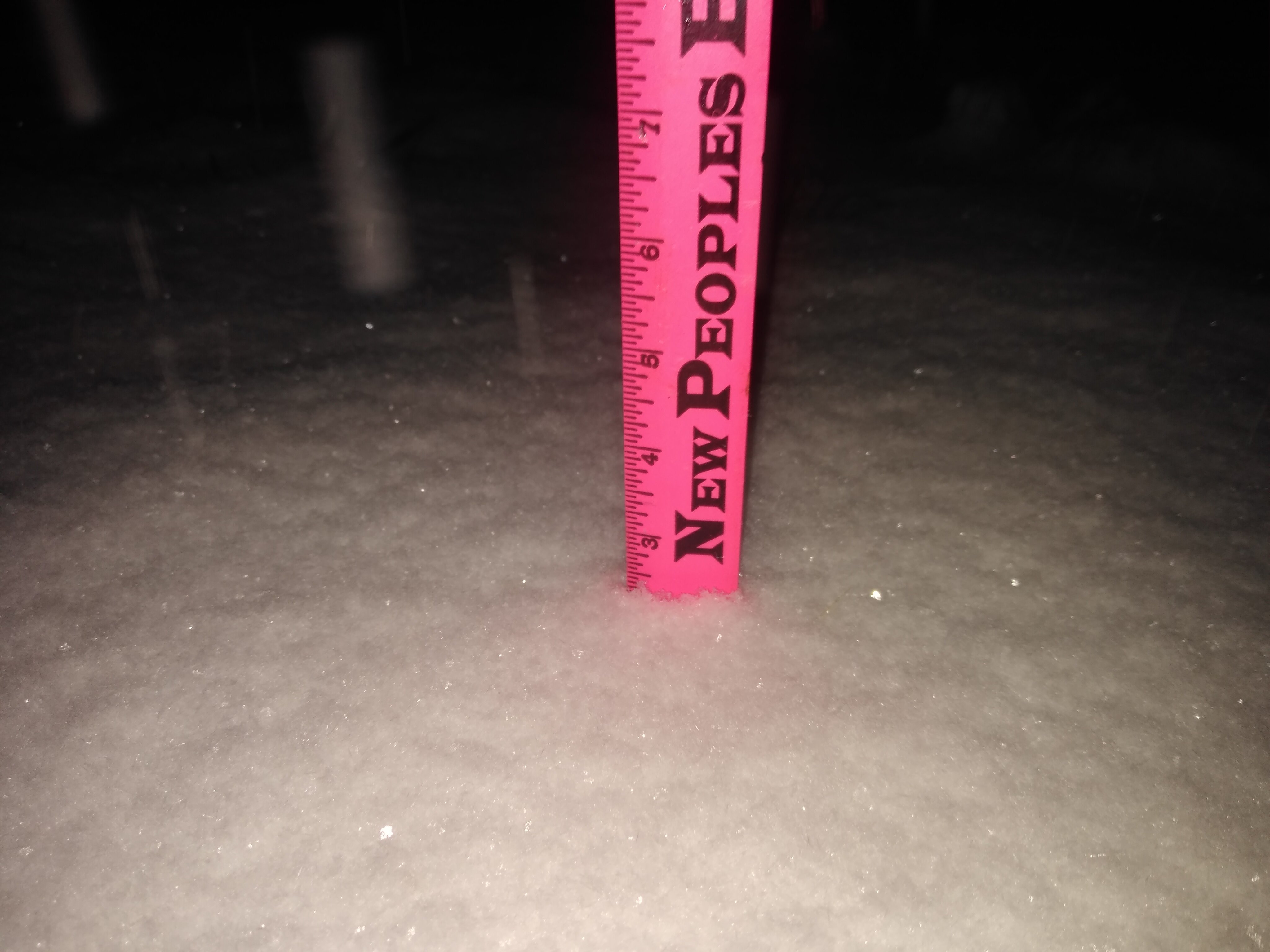
BlunderStorm replied to Windspeed's topic in Tennessee Valley
Weighing in at an average of 6 inches in the yard maybe 6.5 on the tile I measure on. Wow! And still more to go! -
March 11th-13th Winter Weather Event. Winter's last gasp?
BlunderStorm replied to Windspeed's topic in Tennessee Valley
It's a rare but welcome sight for a weather weenies tired eyes. At last in the dead of night, it has arrived. You had about written the season off but a week or two prior. You looked under a skeptical lense as a potential storm presented itself mere days prior. Surely the models had one too many... Now at last you look out your window to what appears a winter wonderland in the 11th hour. You then look to the radar only to see a solid ocean of deep blue and can't help but grin. "Finally!"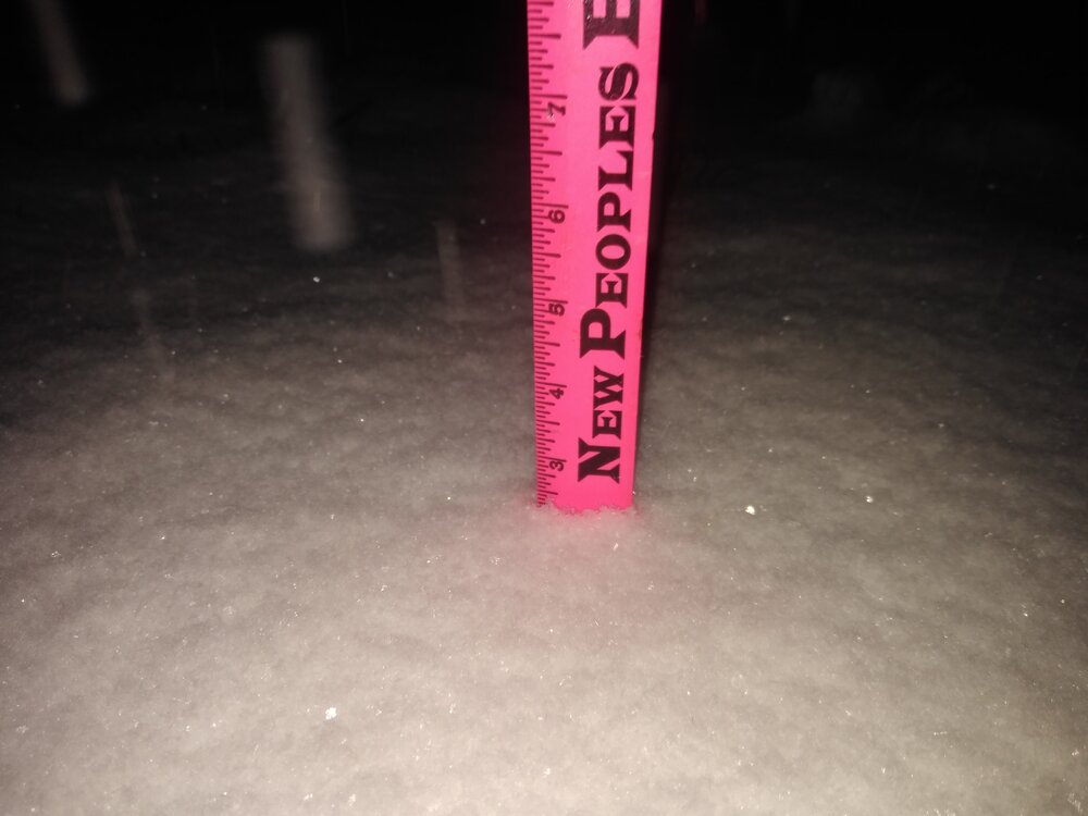
-
March 11th-13th Winter Weather Event. Winter's last gasp?
BlunderStorm replied to Windspeed's topic in Tennessee Valley
Getting into the meat and potatoes of the winter storm now. With 2" on the ground the fat flakes have been replaced with a steady stream of fine flakes like those stovepipe mentioned earlier. The main road has cleared though I don't suspect it will remain that way with some of the heavier bands coming up the valley. Currently on track for the biggest snowfall of the season barring a dry slot. -
March 11th-13th Winter Weather Event. Winter's last gasp?
BlunderStorm replied to Windspeed's topic in Tennessee Valley
Getting huge puddles of silver dollar sized crystalline water. -
March 11th-13th Winter Weather Event. Winter's last gasp?
BlunderStorm replied to Windspeed's topic in Tennessee Valley
Now 35 and mixing. No sleet in the mix from what I can see. Clean transition. Here we go. -
March 11th-13th Winter Weather Event. Winter's last gasp?
BlunderStorm replied to Windspeed's topic in Tennessee Valley
The rain is now falling in the far east and the temps are about to collapse. Winds getting into the teens and currently 43. -
March 11th-13th Winter Weather Event. Winter's last gasp?
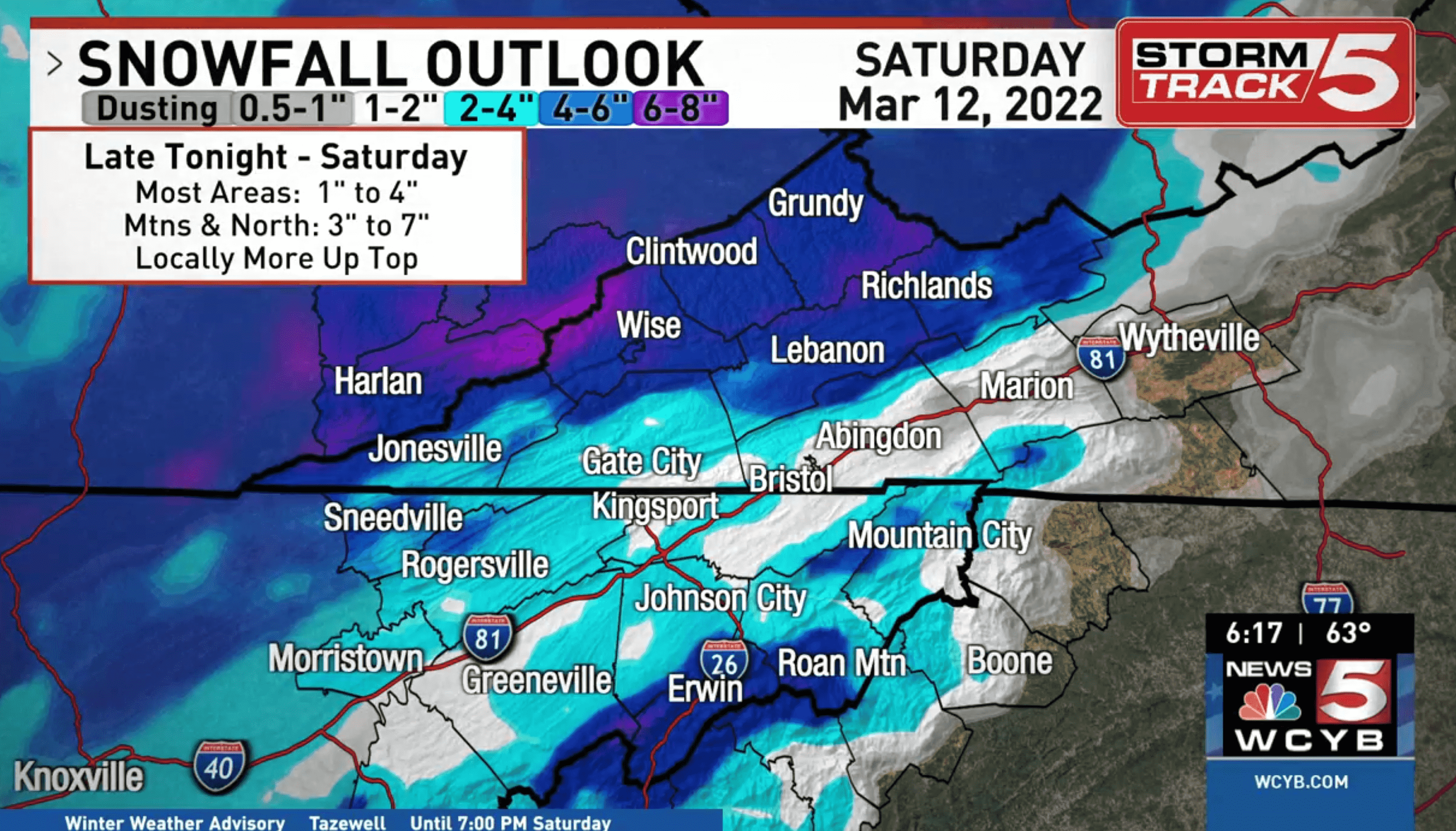
BlunderStorm replied to Windspeed's topic in Tennessee Valley
For reference, here's the prediction from WCYB.
-
March 11th-13th Winter Weather Event. Winter's last gasp?
BlunderStorm replied to Windspeed's topic in Tennessee Valley
Definitely a step up for far eastern and western TN. Plateau loses some but is still smacked. Not bad at all. -
March 11th-13th Winter Weather Event. Winter's last gasp?
BlunderStorm replied to Windspeed's topic in Tennessee Valley
Bit of a late response but... Well let's see how 0z holds up. I'm hoping the 3km fills the ETN "snowhole" but really even that much would be a nice close to the season. Dear God...mp4 -
Relative elevation as well as the orientation of the mountains also plays a major role. While I may be roughly 350' higher and at the 37th parallel, living in a river valley puts my annual snowfall totals beneath yours consistently.
-
January 28th-29th Clippers/NW Flow Obs/Last Minute Forecasts.
BlunderStorm replied to John1122's topic in Tennessee Valley
I know I was forecast for more than a dusting up this way but I was too cynical and underestimated it. After the initial virga and marginal temps things have really materialized in the past 2 hours with an inch of snow already accumulating and the median of the road whitening. Radar in general has improved leaps and bounds from 6 hours ago for the backend of this system. -
Fall/Winter Banter - Football, Basketball, Snowball?
BlunderStorm replied to John1122's topic in Tennessee Valley
No comment.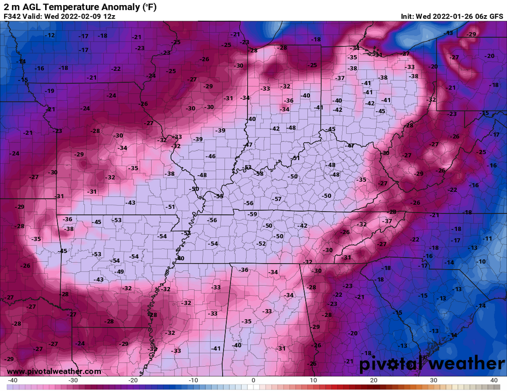
-
06z GFS Has possibly the coldest air of the entire winter following a vicious App cutter next weekend could be a good deal plateau and west. The associated trough is a lot less positive. Canadian seems to be on board as well but will see if it continues the trend later this morning. 0z Euro was too west for everyone. (9/10 days out take with a grain of salt) 24hr Kuchera https://www.pivotalweather.com/model.php?m=gfs&p=snku_024h&rh=2022012606&fh=210&r=us_ov&dpdt=&mc= 2m Temps https://www.pivotalweather.com/model.php?m=gfs&p=sfct&rh=2022012606&fh=246&r=us_ov&dpdt=&mc= Edit: Holy #### Check out the GFS clown in the 300 range. Practically forms a "Tenntucky" Ice Sheet.
-
"I didn't hear no bell!"
-
You're not alone. When the dry slot hit temps went from 26 to 38 and have only been dropping in the past couple hours. Only the back end can save us from a complete bust. As of now the pivot is in full gear. Here's hoping...
-
25 and heavy snow and sleet. Maybe the coldest I remember sleet falling. The main road is white. About 1/3 an inch of frozen stuff on the ground.
-
About 1/10th an inch of sleet has accumulated. Temperatures as of 8:30 stand at 27 and remain stable. Up until now winds were steadily increasing but I think this trend may be thankfully ending. I think I'll take the dry slot over an ice skating rink.
-
Precip rate has lowered and the sleet is beginning to more closely resemble graupel (sorta). Overall it looks like Clinch mountain is up to its old downslope tricks for my microclimate. The 850 level must be a mess. Lol, I'll never forget how much of a bust I got from a nearly identical setup on radar back in December 2018. I was so pissed I screenshot an Intellicast radar frame and made this little piece of "art" in MS paint. In retrospect not my finest moment. This time it was to be expected. Anyway, how are things goin on the plateau and west is the snow holding?