MattPetrulli
-
Posts
1,736 -
Joined
-
Last visited
Content Type
Profiles
Blogs
Forums
American Weather
Media Demo
Store
Gallery
Everything posted by MattPetrulli
-
 I like Monday the most right now in terms of discrete supercells producing tornadoes. Tuesday looks messy storm mode wise and we've seen time and time again setups that didn't reach their full potential due to that, that being said we've also seen significant outbreaks from that same mixed mode. Just in terms of discrete potential I like Monday more. Going for Tuesday, I have seen a 4/13/19 comparison being thrown around and gotta say that's what I think about when I see this setup. Mixed mode tornado outbreak from East Texas to AL. Suffered some things like mixed storm mode that limited its full potential too given the parameter space. Just my unprofessional opinion though. POTENTIAL is definitely there for something high end either of those 2 days or both, though.
 -
Starting to fear we won't end up with a dusting, extremely disappointing as there isn't even a single flake on the ground here yet.
-
Besides a few mixed in flakes, no consistent snow here at all. Has been a light drizzle all day.
-
Ah yes the random Sevier County snowhole At least there's a solid sleet/mixing band heading up towards the area
-
Sunshine here in Pigeon Forge Hoping for an inch or 2 at this point as HRRR suggests with backside snow later on, then move on to Thursday/Friday
-
Given downslopping, am just hopping for 2 inches in Pigeon Forge at this point. Pretty disappointing but we got 5-7" in the system a few weeks ago so it buffs out I guess.
-
I am curious about the HRRR part because if I recall correctly, the HRRR did not do great at all last event and it ended up drier than expected in southern mid state and East TN.
-
MRX seems to have upped snow accumulation a little
-
No longer a Sevier County exclusive snowhole, I would accept 4-6 inches.
-
Sevier County snowhole happens and I am quitting this hobby.
-
Sevier County snowhole occurs and I am moving
-
Light dusting in PF Hopefully we can get some backside snow showers later
-
Little bit of an issue, seems like 18z HRRR isn't initializing the snow shield correctly in Middle TN. Quite drier than depicted by HRRR.
-
All rain Pigeon Forge
-
00z Euro
-
Seems pretty reasonable to expect 2-5" for Sevier Co on Thursday. I would love if models keep uptrending but 2-5" certainly suffices after the trash winters for the past few years. A lot of the county still without power/having a lot of power issues so have to get it resolved by then. Would be really nice to have another snow that's actually during the day and not at 5 AM though
-
Appreciate this, ground temperatures and snow has always been confusing to me, am really hoping for at least a few inches.
-
Is snow depth product on NAM being lower because of it factoring in soil temperatures or snowfall ratio?
-
Feel free to correct if I don't have a good idea, but am curious to see how much of 5-6 inches of snow as modeled by NAM/HRRR would actually stick and accumulate. I'm expecting at most a dusting here in Sevier County. I don't have a great idea of how fast soil temperature falls with snow, etc. Overall, am hoping for a nice little event here and hopefully an appetizer for later this week.
-
This is absolutely wild
-
Yeahhhhh may have to eat those words
-
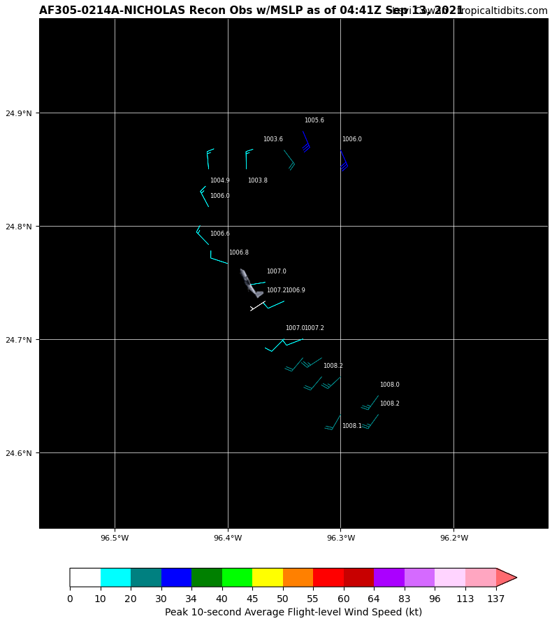
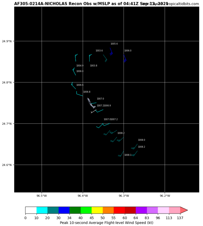
I thought so earlier today, but recon and satellite show a rather very disorganized system and most intensity guidance has stayed in TS territory this evening. Could make it to a hurricane maybe, but I think it's rather unlikely at this time. Small size could help it spin up and intensify quickly, but it only has about 24-36 more hours over water at most so we'll see.
-
...NICHOLAS EXPECTED TO STRENGTHEN AS IT MOVES TOWARD THE NORTHWEST GULF COAST... ...STORM SURGE WARNING AND HURRICANE WATCH ISSUED FOR A PORTION OF THE TEXAS COAST... SUMMARY OF 400 PM CDT...2100 UTC...INFORMATION ---------------------------------------------- LOCATION...22.8N 95.5W ABOUT 160 MI...260 KM ESE OF LA PESCA MEXICO ABOUT 240 MI...385 KM SSE OF MOUTH OF THE RIO GRANDE MAXIMUM SUSTAINED WINDS...40 MPH...65 KM/H PRESENT MOVEMENT...NNW OR 340 DEGREES AT 14 MPH...22 KM/H MINIMUM CENTRAL PRESSURE...1008 MB...29.77 INCHES
-
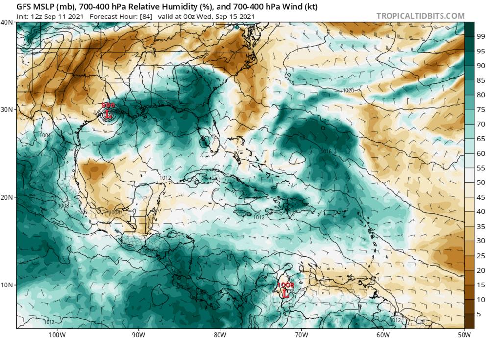
Euro coming in with a landfall in mid TX coast Tuesday morning. Models seem to be zeroing in on a US landfall but nothing for sure yet.
-
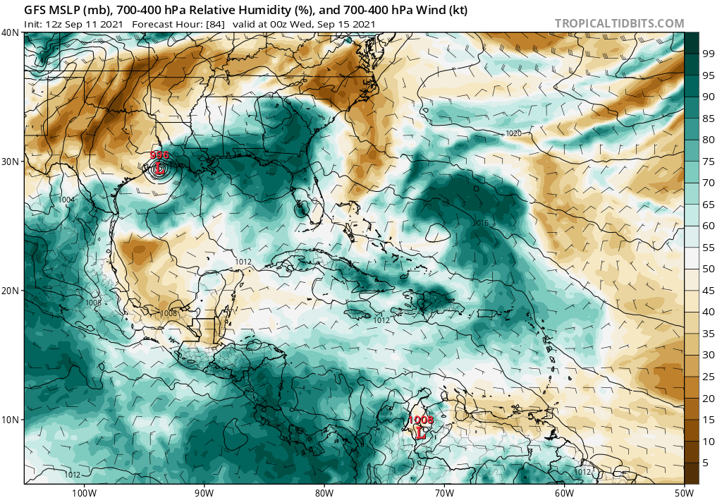
While 12z GFS and ensembles are stronger with 94L, something that may hold it back besides land interaction would be dry air as multiple GFS runs have been hinting at