

MattPetrulli
-
Posts
1,734 -
Joined
-
Last visited
Content Type
Profiles
Blogs
Forums
American Weather
Media Demo
Store
Gallery
Everything posted by MattPetrulli
-
-
Something of note, a big bend landfall would probably be best case scenario here. Small storm may limit surge into major west coast cities, and big bend is pretty unpopulated. Also, may be a weakening hurricane rather than a strengthening one. Atm I would favor a landfall just north of Tampa however
-
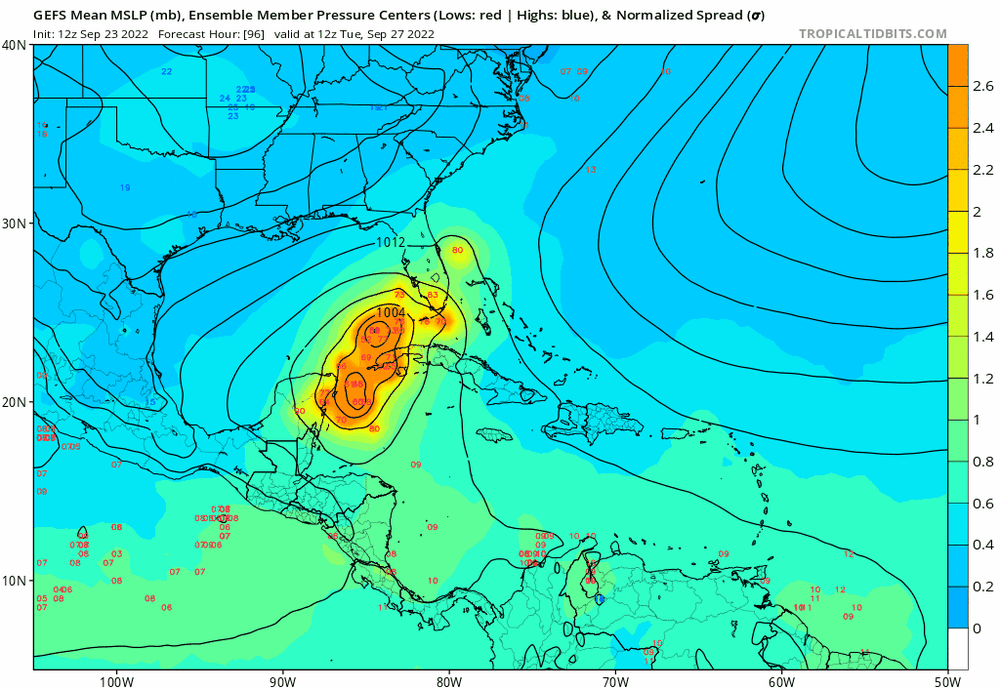
Shift west on 00z GEFS, but quite a wide spread
-
00z GFS further east and weaker
-
Frictional convergence increasing on landfalling eyewall leading to intense DBZs. Definitely still got a Cat 2-3 level storm.
-
Curious if new flare up is indicative of a LLC reformation to the SW
-
Now have Tropical Storm Ian according to best track or whatever that thingy is called 35 knt 1005 MB
-
Thread for banter of future tropical storm/hurricane/major hurricane Ian
-
Nice sting jet bro
-
Almost like if you don't take the bait the bait disappears!
-
East shift on 18z GEFS
-
New cone is slightly west
-
TD10 has been given the name Hermine. TD 9 will be Ian.
-
Intense burst of convection too
-
18z Spaghettis go west
-
Important observation is almost all of those are significant hits, different from the decaying tropical storm the 12z GFS provided
-
Something not talked about much, Havana and the Keys have a decent shot at sustaining a significant hurricane hit before moving towards main SW Florida, assuming a path further to the east is realized.
-
Andrew
-
That's gonna be a fairly significant Carolinas hit
-
Slight adjustment west would be worse. Would push more surge into Ft Myers area which is extremely surge prone
-
12z Euro basically follows the exact NHC cone
-
FWIW HMON and HWRF which are on the left side of the guidance absolutely explodes TD9
-
00z Euro is gonna be fun on social media tomorrow. I don't know if you can tell but that is not OTS btw
-
Strangely quiet, gotta think the Canadian benchmark hurricane would be challenged here. Somewhat ignorant to it, but may be at or surpass the damage of Hurricane Juan.


