
Chinook
-
Posts
10,674 -
Joined
-
Last visited
Content Type
Profiles
Blogs
Forums
American Weather
Media Demo
Store
Gallery
Everything posted by Chinook
-

Winter 2022/23 Lake Effect Snow Thread
Chinook replied to Chicago Storm's topic in Lakes/Ohio Valley
It reminds me of a hurricane, although possibly only 10 kt to 30 kt winds within the circulation(s). One other mesolow was over by Alpena earlier. -
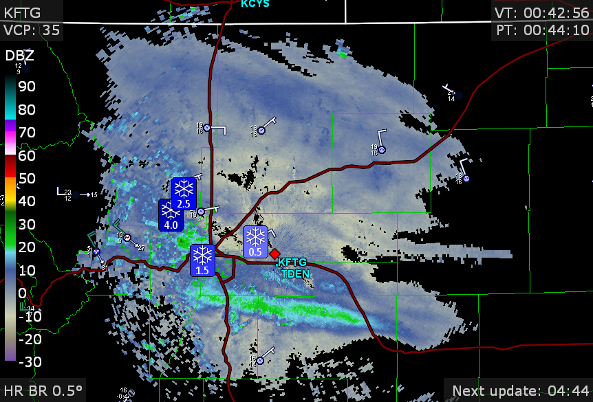
There have been snow reports of 1.5" to 4". The temperature is 16 degrees in Denver. There are light snowfall rates, with a few bits of heavier snow rates around Boulder and south Denver.
-
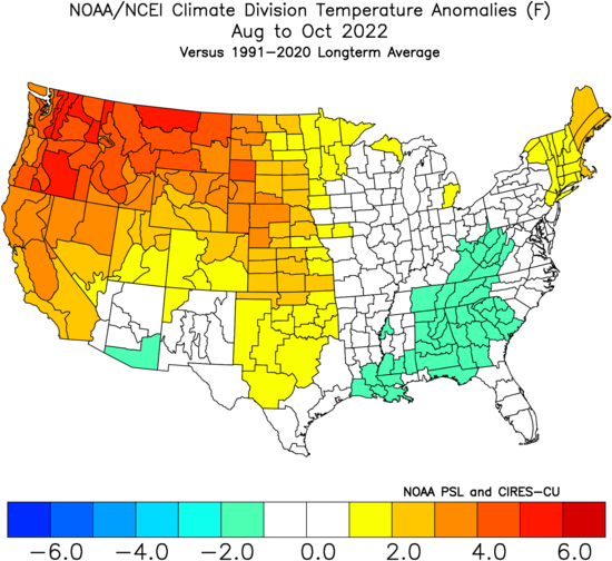
This shows the temperature ranking on the late summer to fall heat wave: #1 warmest Aug to Oct, basically for Washington, Oregon, Idaho, Montana.
-
There is a winter weather advisory for the Front Range
-
Historic Lake Effect Event?! 11/17-11/21
Chinook replied to BuffaloWeather's topic in Upstate New York/Pennsylvania
NWS-WPC has 2"-3" of total QPF (120 hours) just offshore from Jamestown NY/Erie PA with 1.9"-2.1" for Erie and the Southtowns of Buffalo. -
Here are the local storm reports for the last 48 hours.
-
December-type weather is happening now, with continuing lake effect snow in the area. There were many pleasant sunny days recently, even multiple days over 70 degrees. The last 30 days have been roughly 4 degrees F above normal over most of us on the sub-forum. I saw some decent sized snowflakes yesterday, with what could have been a snow rate at least 1/2" per hour. It wasn't really cold enough to get 1/2" accumulation for more than a half hour or an hour. I saw some large aggregate snowflakes of 1/2" width or better, so that's pretty rare. At the end of the day, the ground was really too warm for accumulation
-
tornado warning for downtown Durham.
-
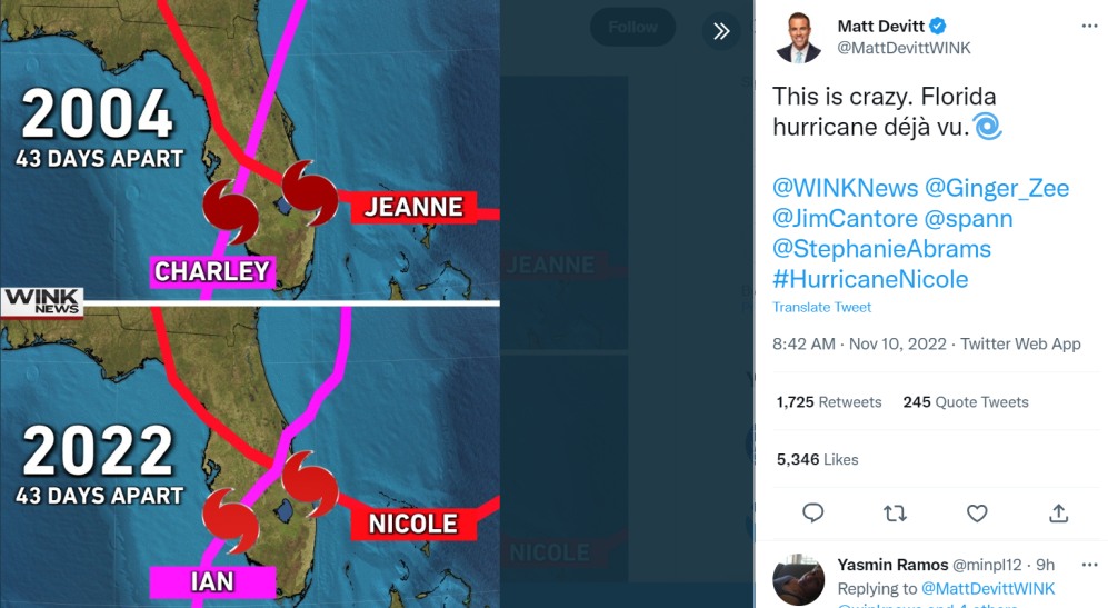
interesting tweet that I saw retweeted by Jim Cantore
-
hand-picked observations from 0650z to 1050z
-
Here is a cross section across the Midwest. The cold front is on the left, the warm sector is in the middle, and the warm front is on the right. The black lines represent potential temperatures and you can see a little higher slope of the frontal surfaces with the cold front. Colors are frontogenesis. You can see the 0 degrees C isotherms (purple dotted lines) near the ground on both sides.
-
It's a pretty good weather day in Ohio, with completely sunny skies in the state. There are only easterly winds in Ohio at this time. In the late fall, easterly winds typically go with clouds, below normal temperatures, or rain.
-
Major November Outbreak Possible
Chinook replied to Tallis Rockwell's topic in Central/Western States
second EF-3 tornado, which includes the preliminary storm survey information that I saw -
Major November Outbreak Possible
Chinook replied to Tallis Rockwell's topic in Central/Western States
tornado track of the earliest EF-3 on Friday -
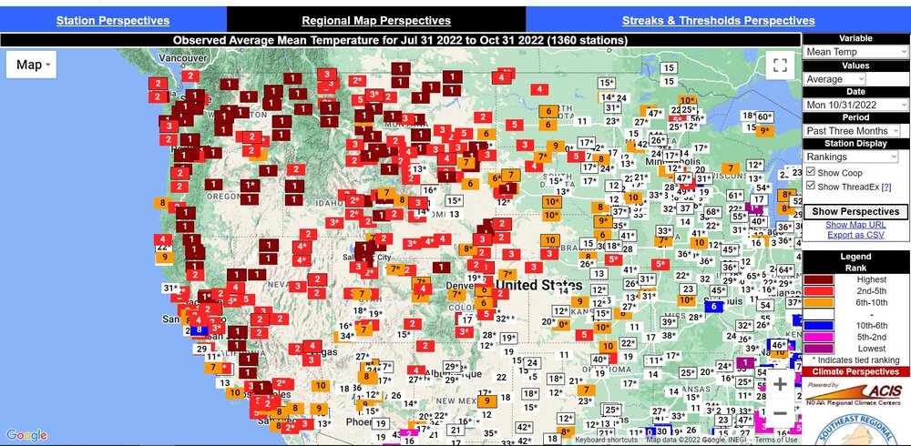
So, I guess 3 ft of snow fell since September 30th in WA, OR, ID, MT, WY, and CO, with more coming.
-
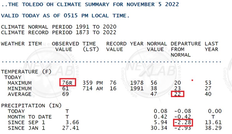
Toledo tied a record high of 76 degrees from, surprisingly, 1978. There has been quite a low percentage of normal rainfall since September 1st.
-
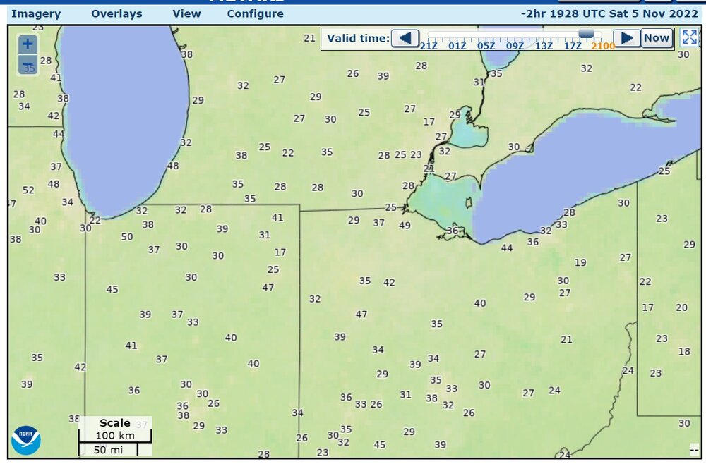
Max wind gusts measured by METARs (standard gust, not "pk wnd") a couple of hours ago (knots)
-
My area has been slow to get into the wind gusts. I just went jogging with a temperature of 70 degrees, fading sunshine, and wind gusts only up to about 15 to 20mph occasionally. There were groups of leaves blowing down the street. I wouldn't go jogging with 35-40 gusts, it's to much.
-
There was a 76mph wind report in NW Illinois
-
Major November Outbreak Possible
Chinook replied to Tallis Rockwell's topic in Central/Western States
heavy damage reported at Idabel, Oklahoma from a couple of hours ago. -
Major November Outbreak Possible
Chinook replied to Tallis Rockwell's topic in Central/Western States
continuation of Boston TX tornado -
Major November Outbreak Possible
Chinook replied to Tallis Rockwell's topic in Central/Western States
large tornado debris signature at Bagwell, TX -
Major November Outbreak Possible
Chinook replied to Tallis Rockwell's topic in Central/Western States
damage to homes at Powderly, Texas -
Major November Outbreak Possible
Chinook replied to Tallis Rockwell's topic in Central/Western States
Tornado debris possible at Honobia/Pickens Oklahoma (this storm) -
Major November Outbreak Possible
Chinook replied to Tallis Rockwell's topic in Central/Western States
Very rural eastern Oklahoma (Fort Smith AR radar)


