Chinook
-
Posts
11,160 -
Joined
-
Last visited
Content Type
Profiles
Blogs
Forums
American Weather
Media Demo
Store
Gallery
Everything posted by Chinook
-

Texas/Oklahoma 2023 Obs and Discussion
Chinook replied to Ed, snow and hurricane fan's topic in Central/Western States
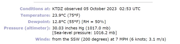
The northeast side of Dallas may have gotten 2.5"-3" at this point in time. I have not seen a report of a tornado. -
wow, it's 11:00PM in October
-
Texas/Oklahoma 2023 Obs and Discussion
Chinook replied to Ed, snow and hurricane fan's topic in Central/Western States
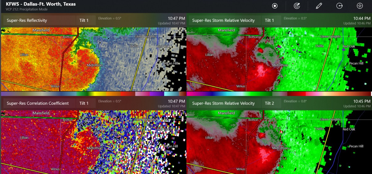
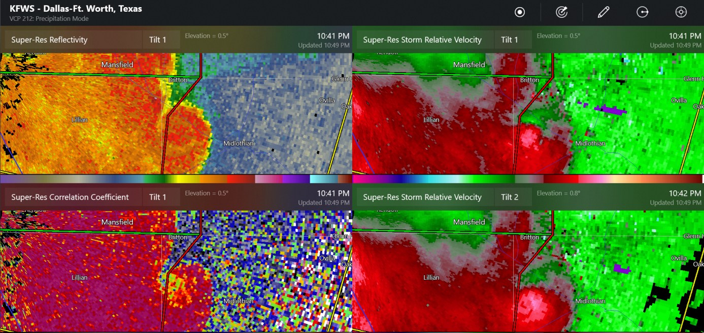
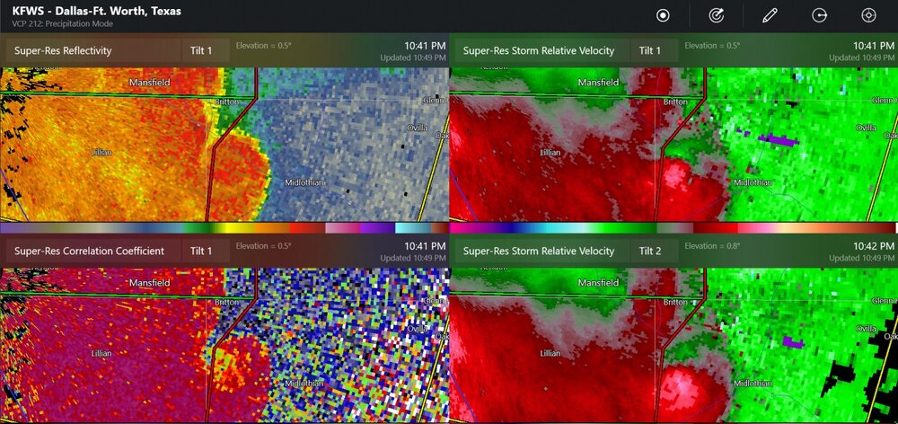
Wow! That might be a TDS confirmed tornado at Britton Texas, near Midlothian. I thought this severe event might be over.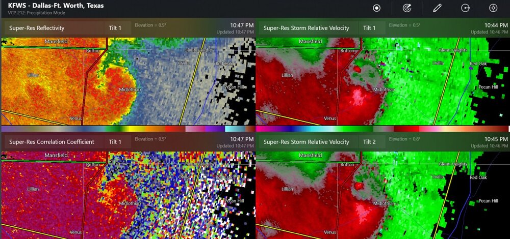
-
I sort of wish we had a few days of 70 rather than 85. Actually, 89 yesterday was, as mentioned, only 3 degrees lower than the all-time maximum temperature for the month for Toledo.
-
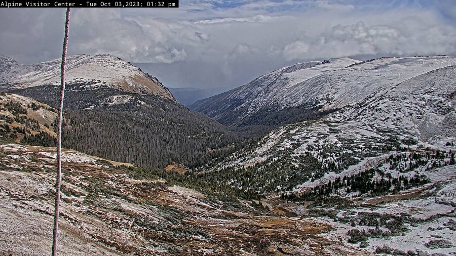
I think this is about 1"-2"
-
I overstated that. Toledo's monthly record is 92 on Oct 4 and Oct 8.
-
I am thinking that Toledo may be breaking a monthly temperature record for October.
-
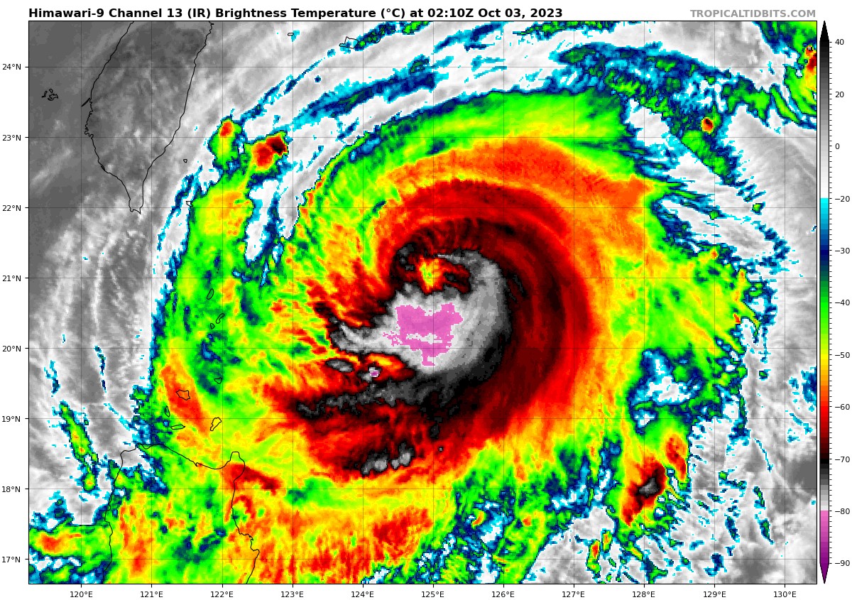
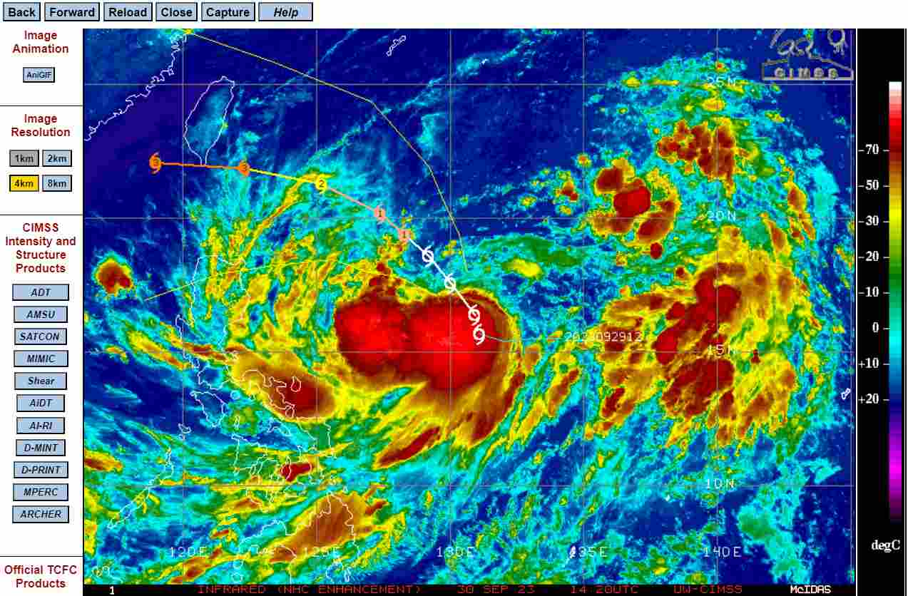
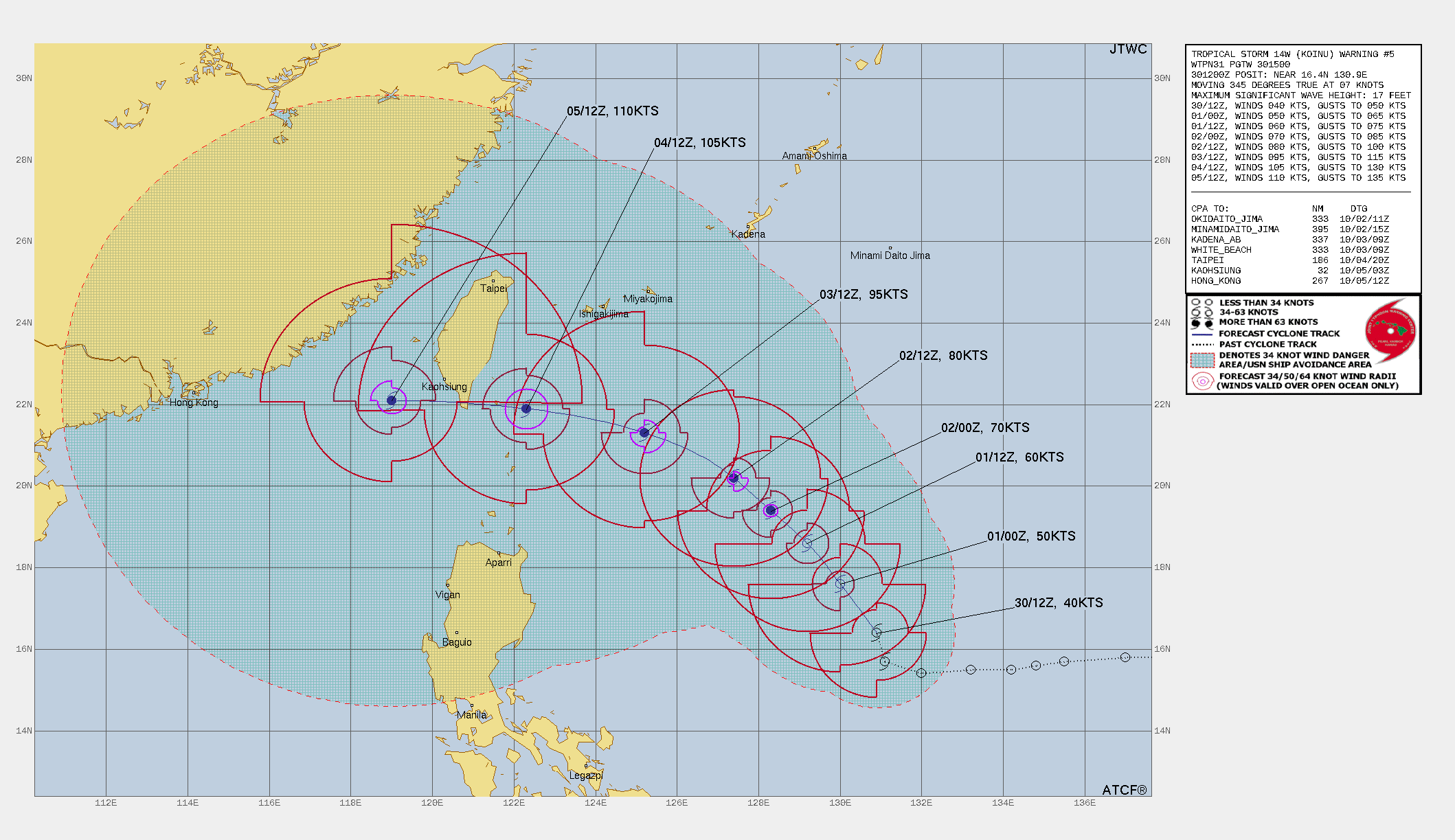
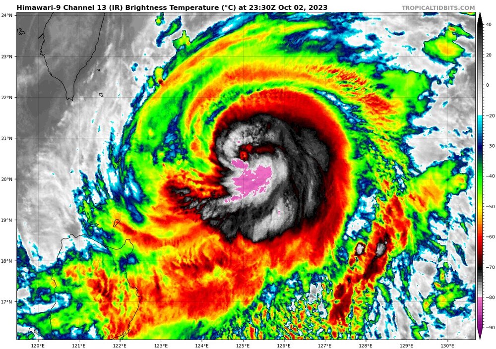
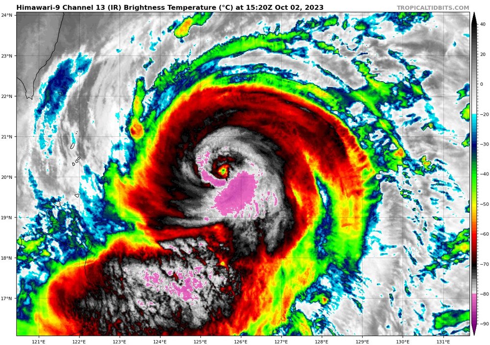
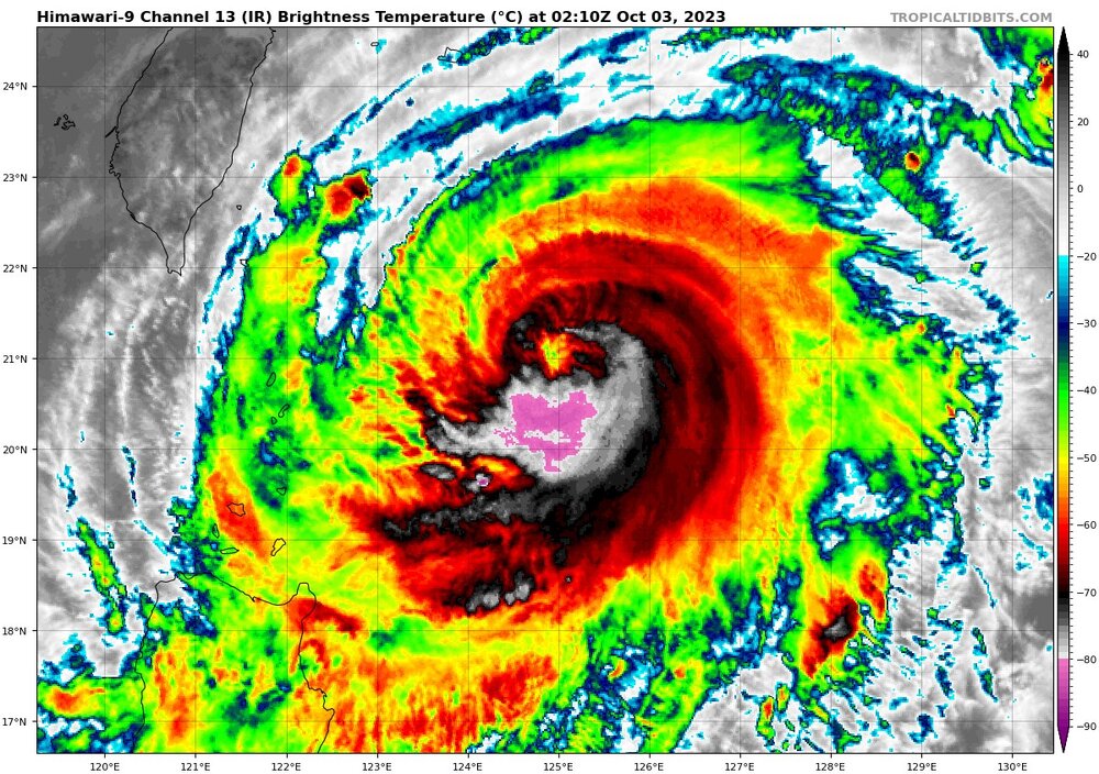
Koinu looking absolutely nuts. It is maxing out at 105 knots now, but will weaken to 85 knots while it is east of Taiwan, and approach southern Taiwan. The landfall forecast has not changed much, except for a few miles. If you check the most recent HWRF, the model might not have been initialized correctly, and then the forecast is completely wrong for some awful reason.
-
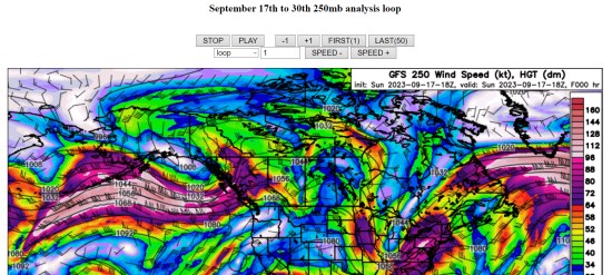
my loops of September 2023, 250mb, covering all of last month. I am going to try to keep up with these, monthly (maybe) but no promises. https://great-lakes-salsite.web.app/Sep_1_18_2023_250mb_loop.html https://great-lakes-salsite.web.app/Sep_17_30_2023_250mb_loop.html sample:
-
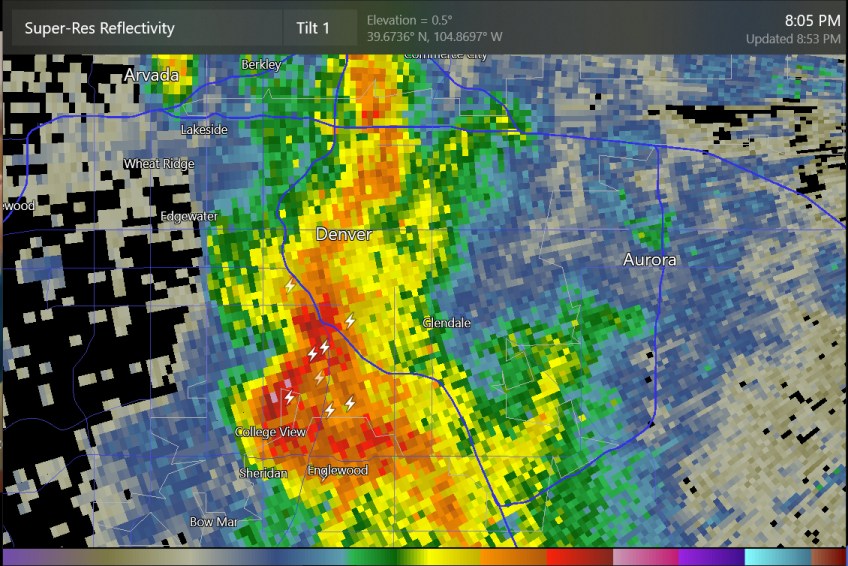
some thunder at south Denver and south of Loveland tonight
-
I was thinking of posting a loop of 250mb analysis, North America view. I am saving them just to study the jet stream over the El Nino winter. It's kind of because I almost always look at the 500mb map for the USA but ignore what's happening at 250mb in the Pacific. Does anybody want me to post a 14-day loop of this?
-
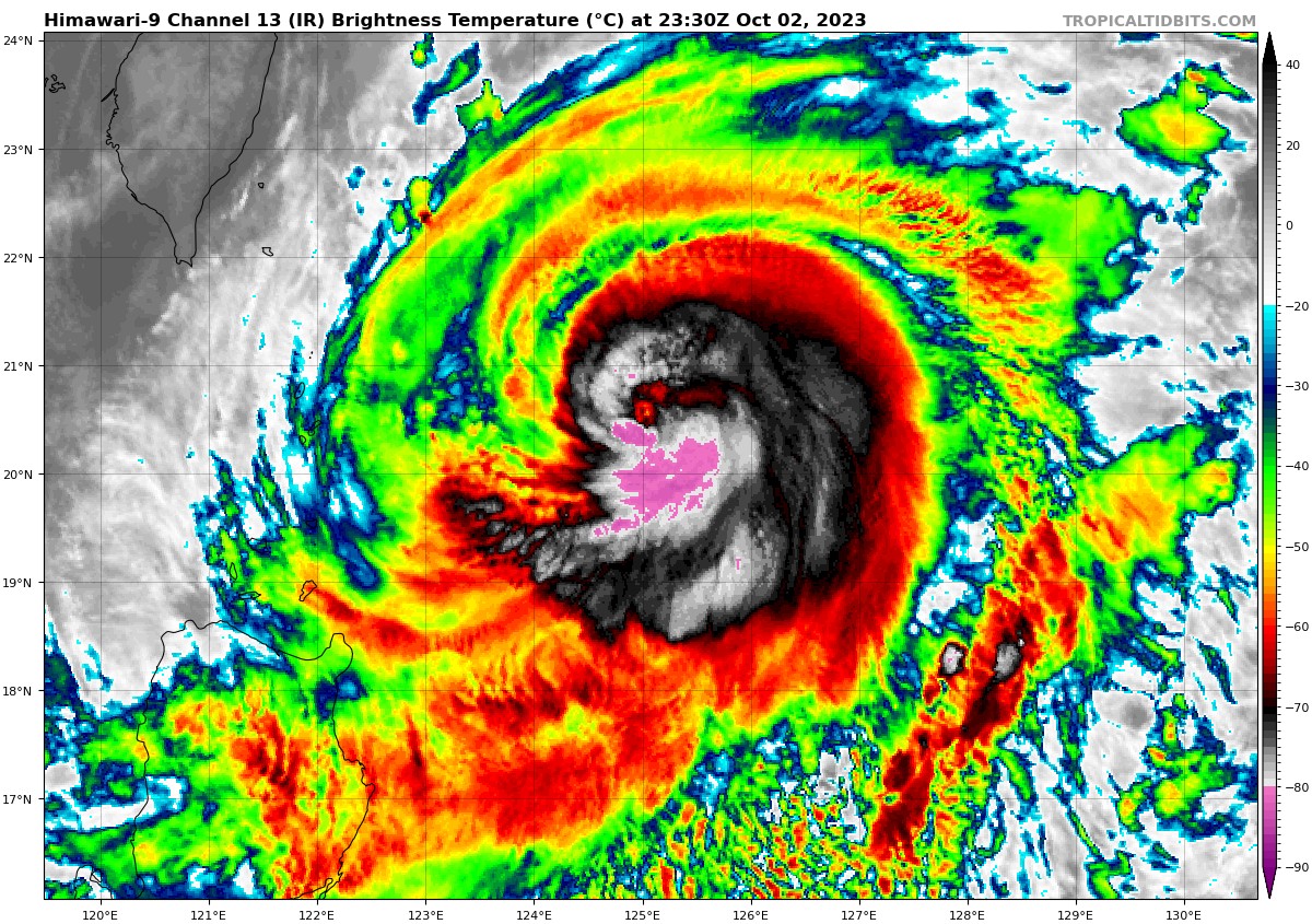
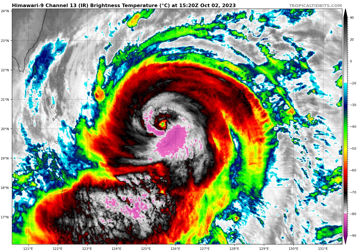
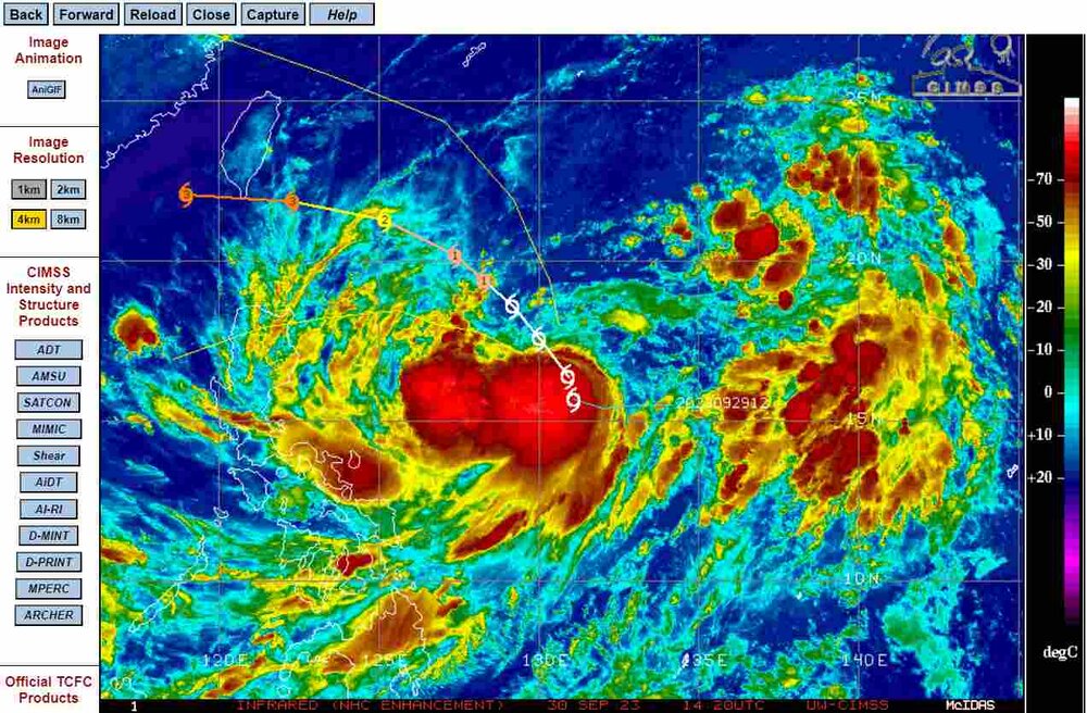
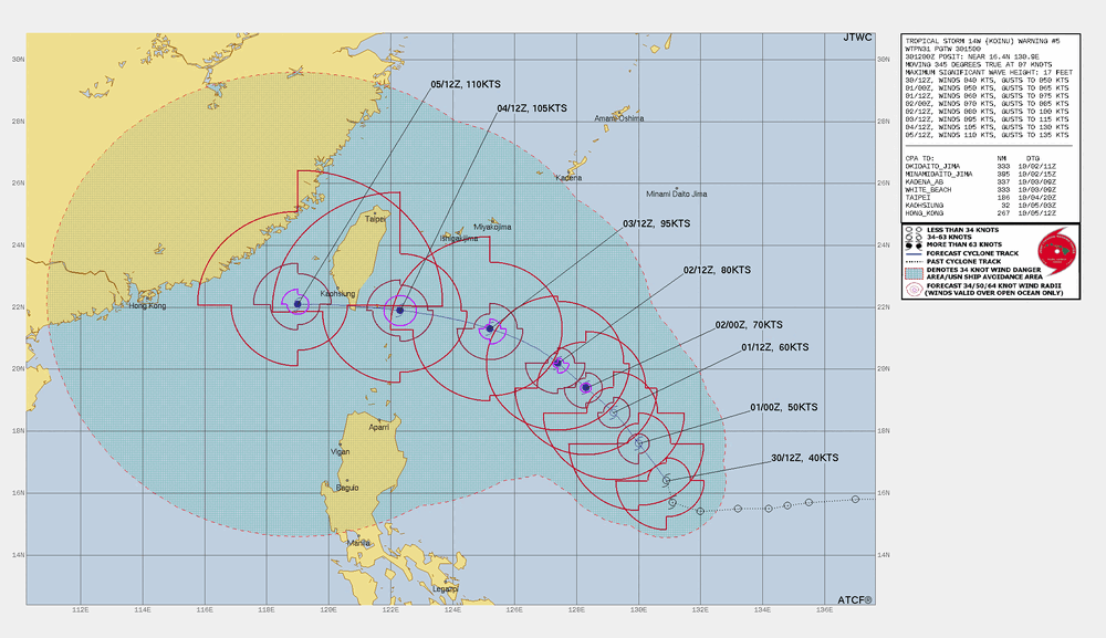
Typhoon Koinu now is an 80kts typhoon as per JTWC advisory, so it getting up there into Cat-2 type strength. Most of the rest of the JTWC forecast is similar to what I posted yesterday. JTWC now has 105 knots before a likely landfall at southern Taiwan. It is always interesting to see the -90 C cloud tops for the West Pacific tropical storms/typhoons due to the high tropopause or just simply the high topped convection over those warm waters.
-
Tropical Storm Koinu could intensify to 110 knots as it approaches Taiwan, as per JTWC
-
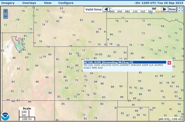
Summertime temps of 81-82 at Denver, 85 at Salt Lake City, Wyoming, and even Montana, with the mountains getting also summertime values with no clouds.
-
Texas/Oklahoma 2023 Obs and Discussion
Chinook replied to Ed, snow and hurricane fan's topic in Central/Western States
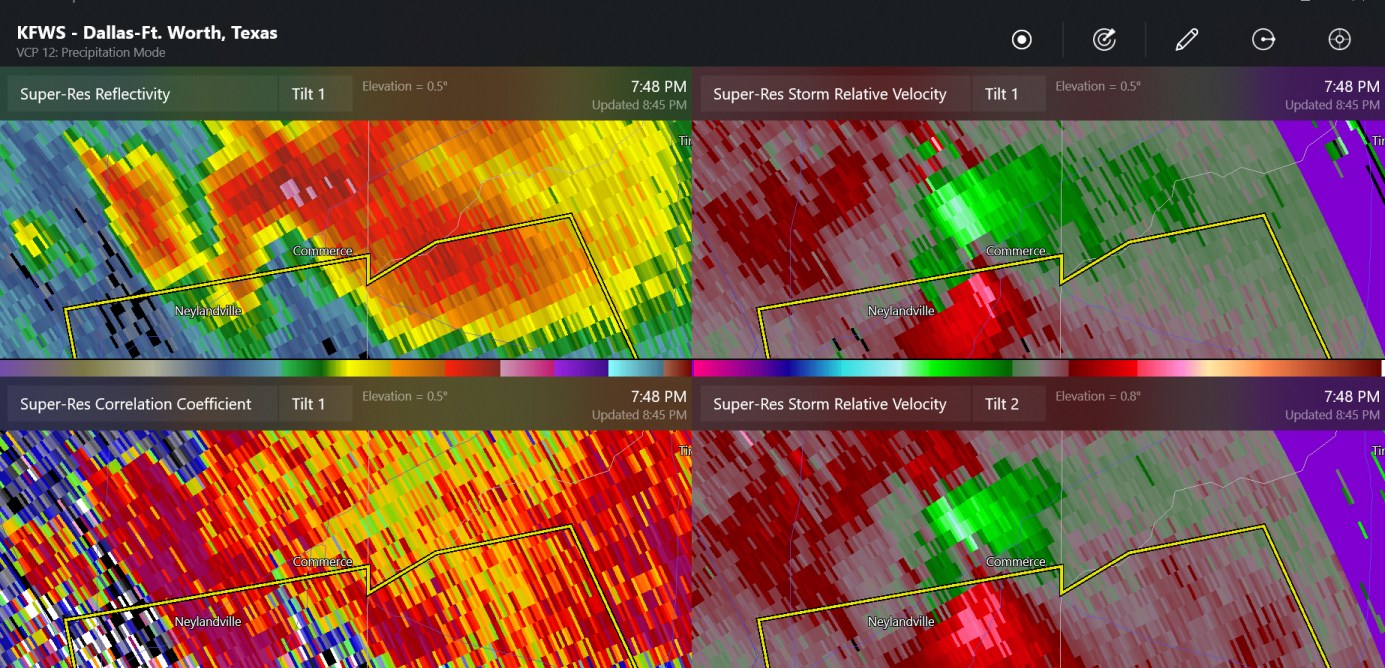
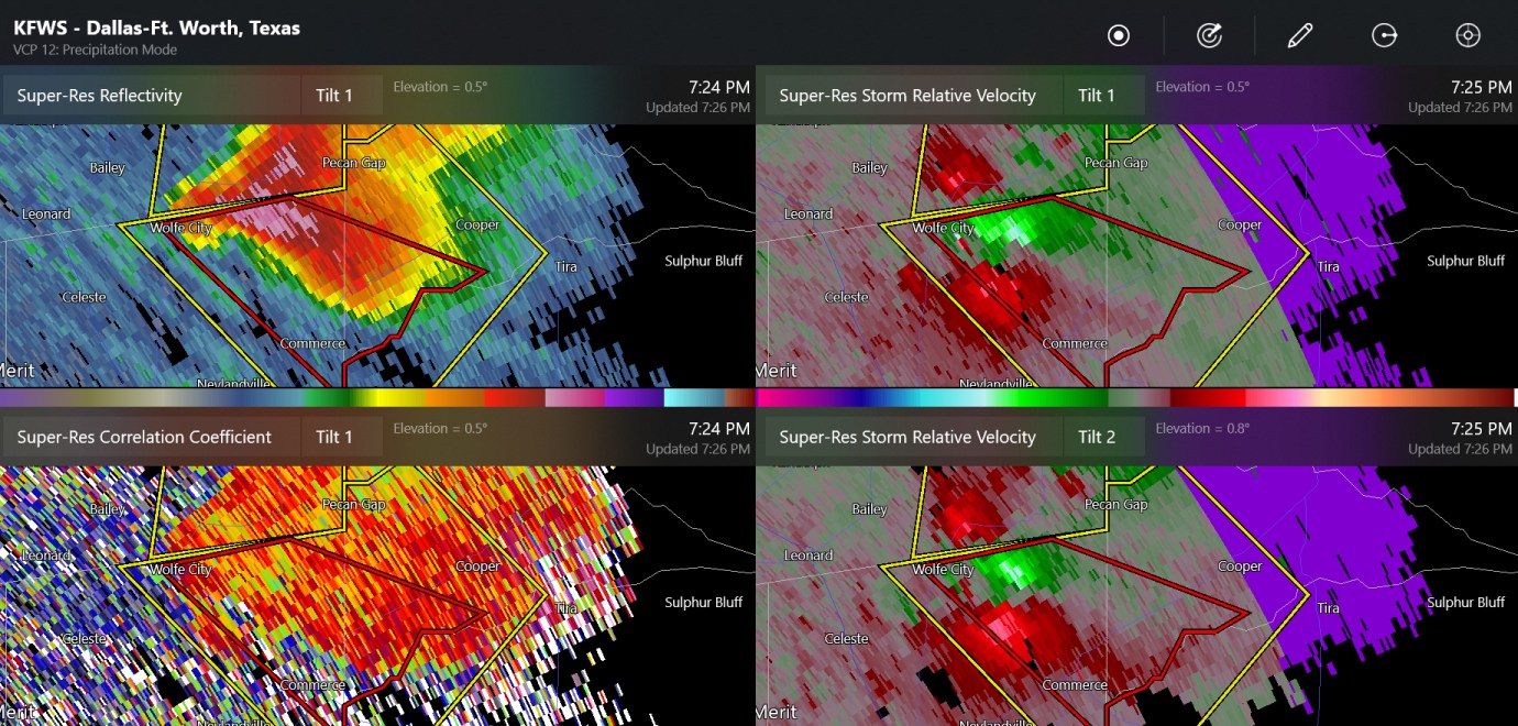
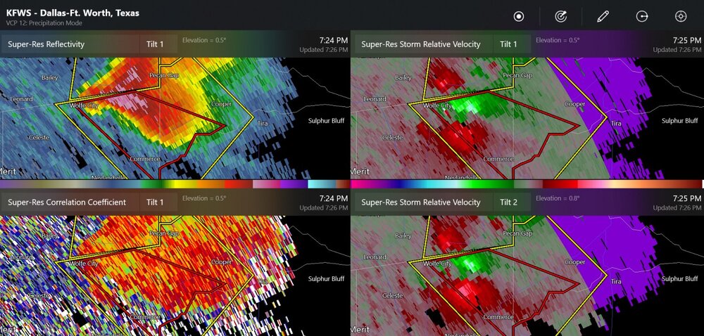
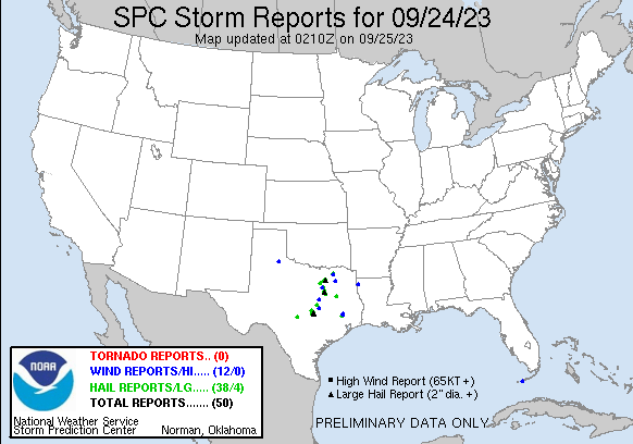
There have been several large hail reports of 1.5" + today in northern Texas. As for this, I do not know if there was a confirmed tornado at Commerce, TX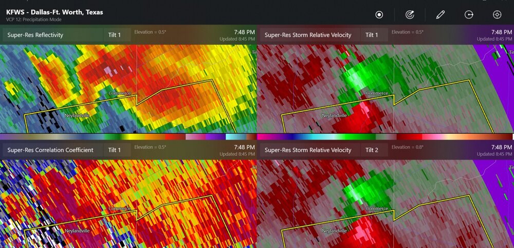
-
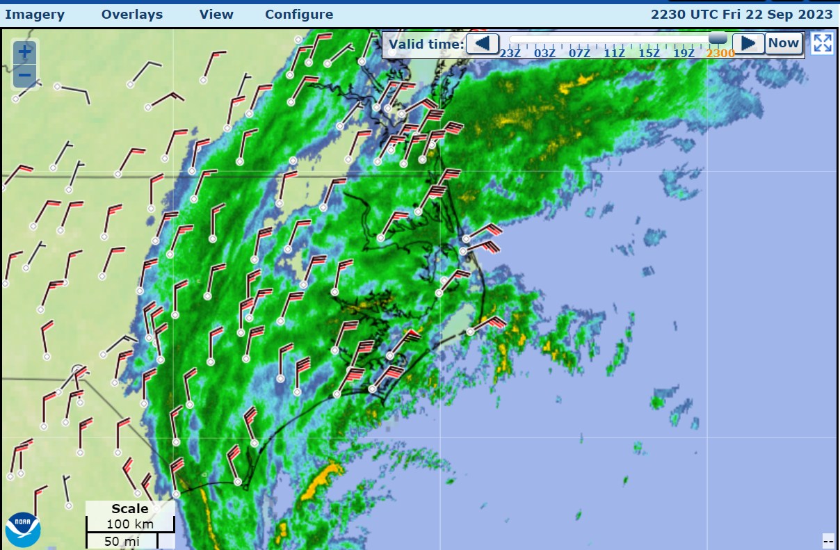
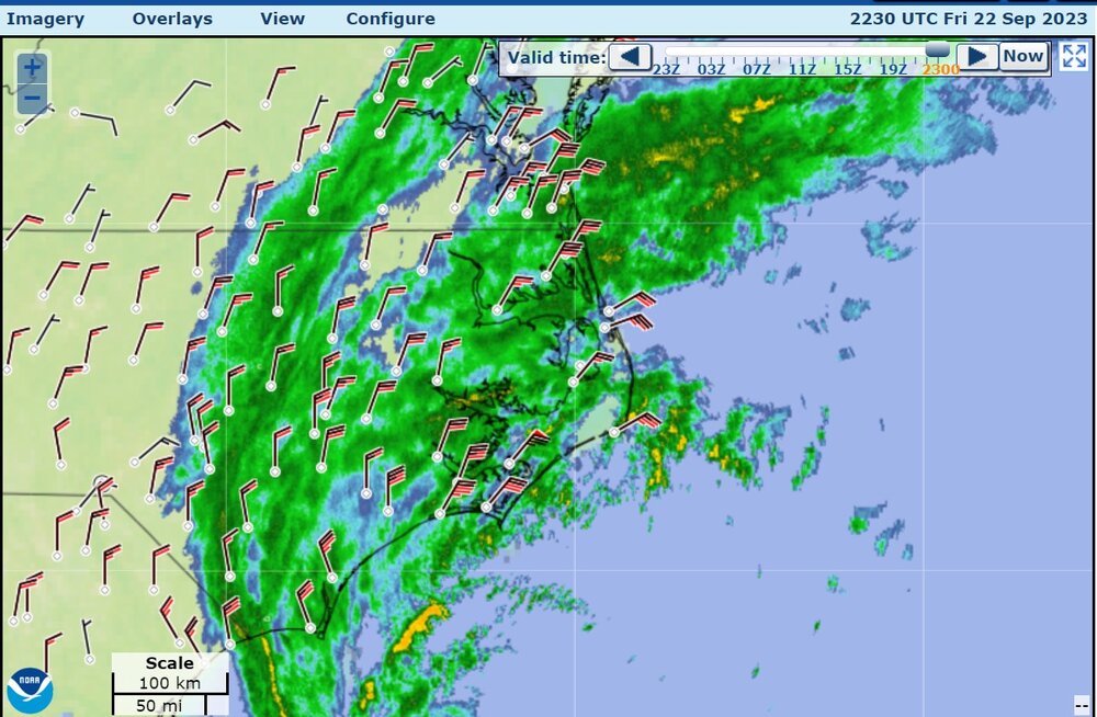
Mid-Atlantic winds are picking up a lot. Virginia Beach has 26 knots gusting to 41 knots now
-
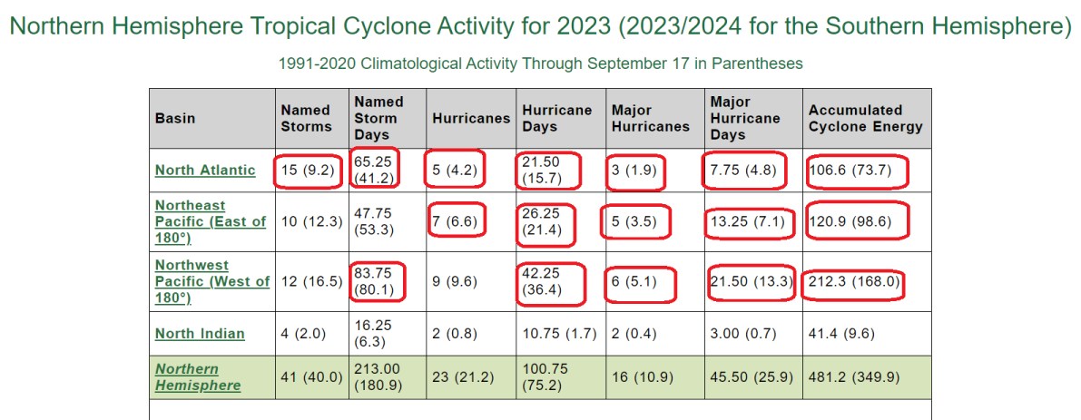
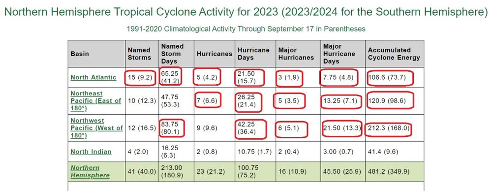
Values above average for the main three areas are circled in red
-
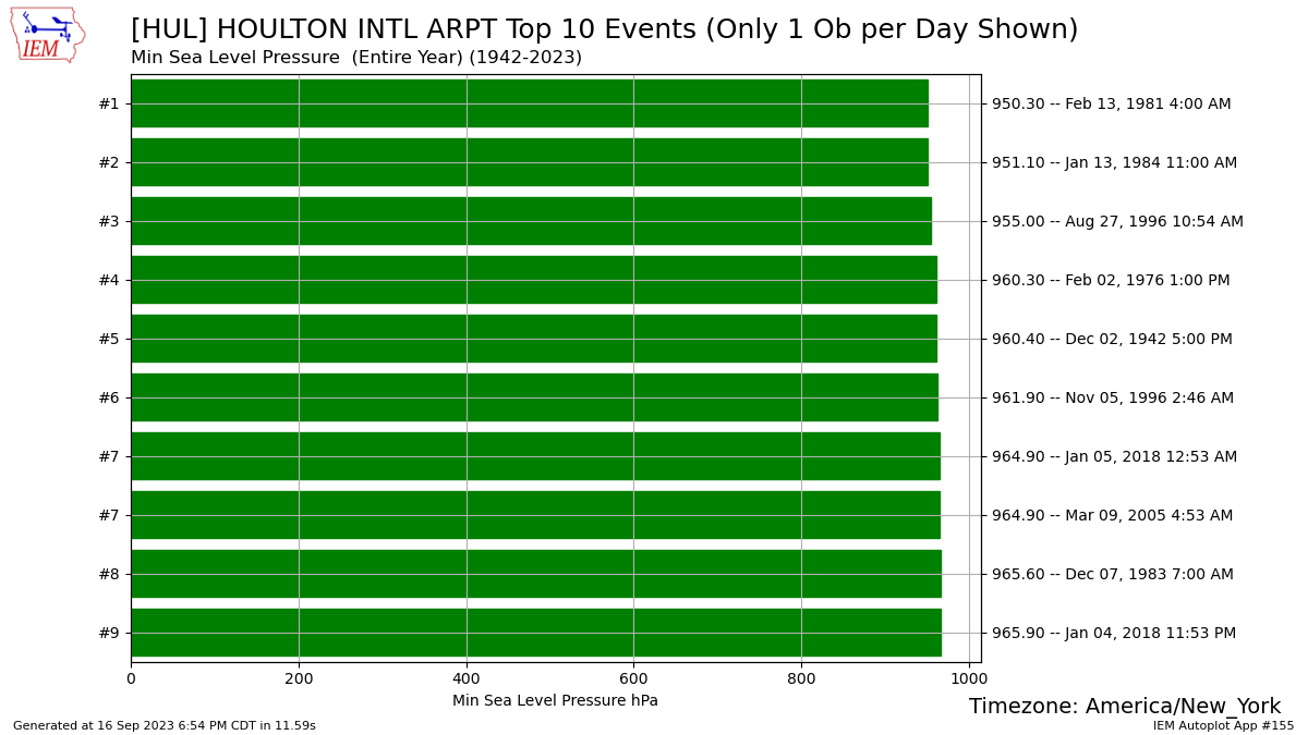
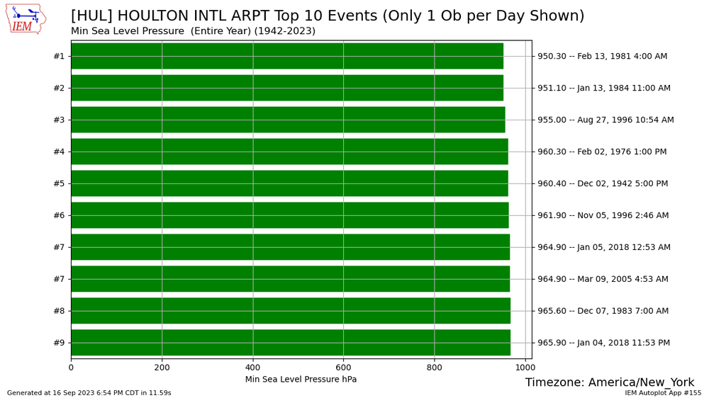
Houlton all time pressure records (not sure if any of these are in error)
-
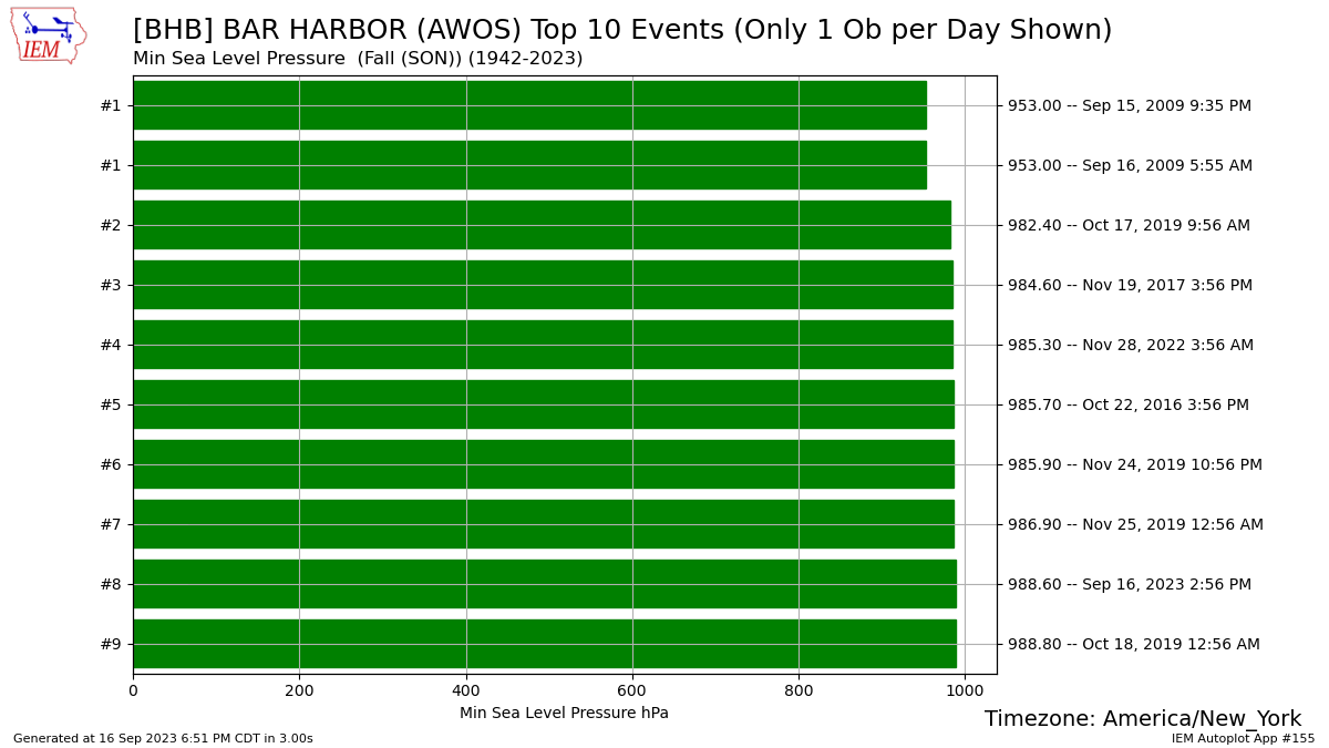
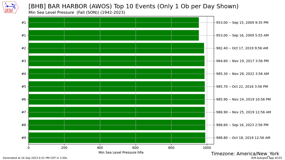
lowest pressures in the fall season, Bar Harbor. Sep 15-16 2009 is not correct data, as the pressure was about 1010mb.
-
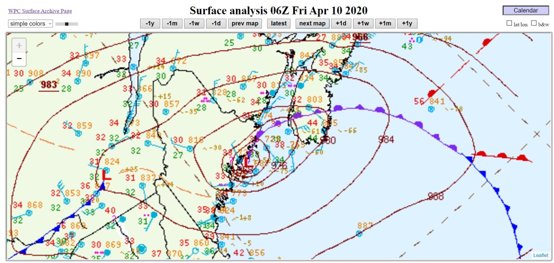
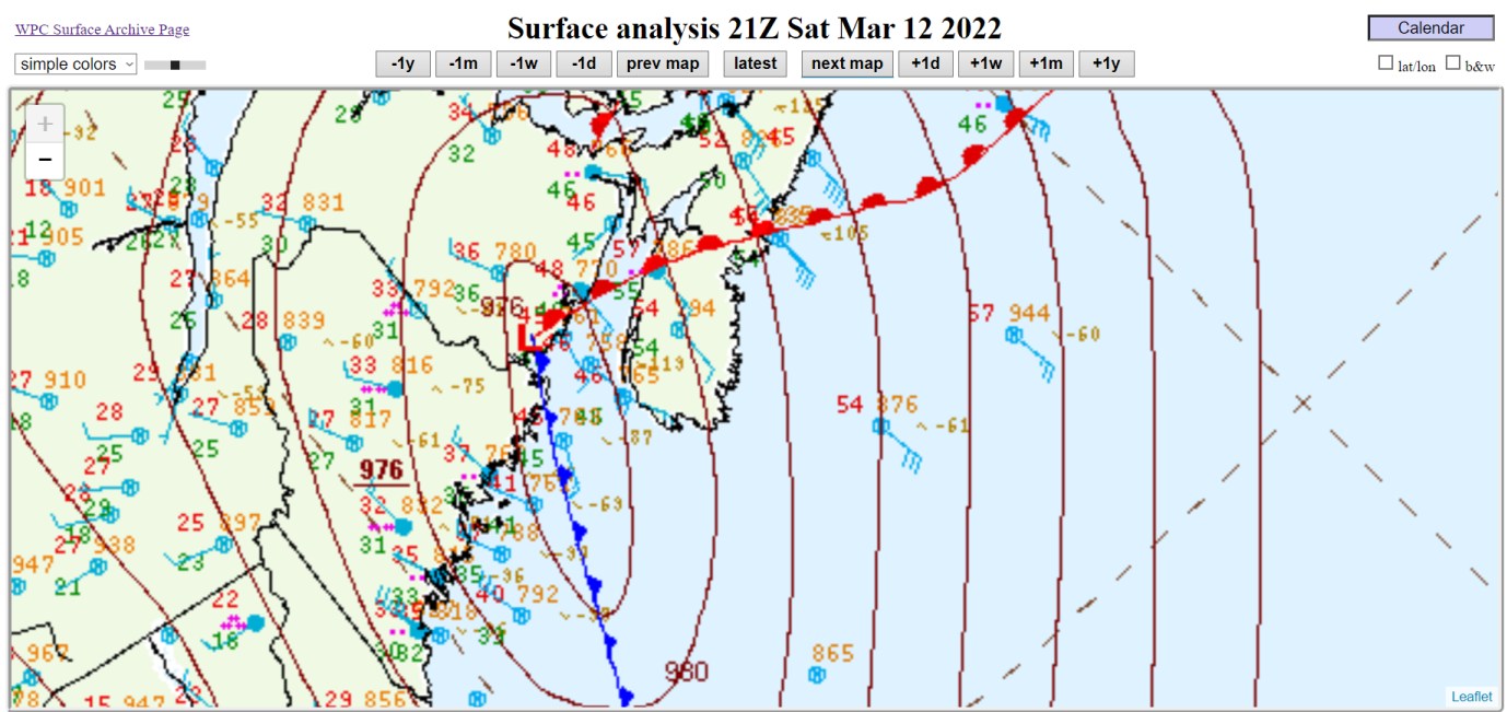
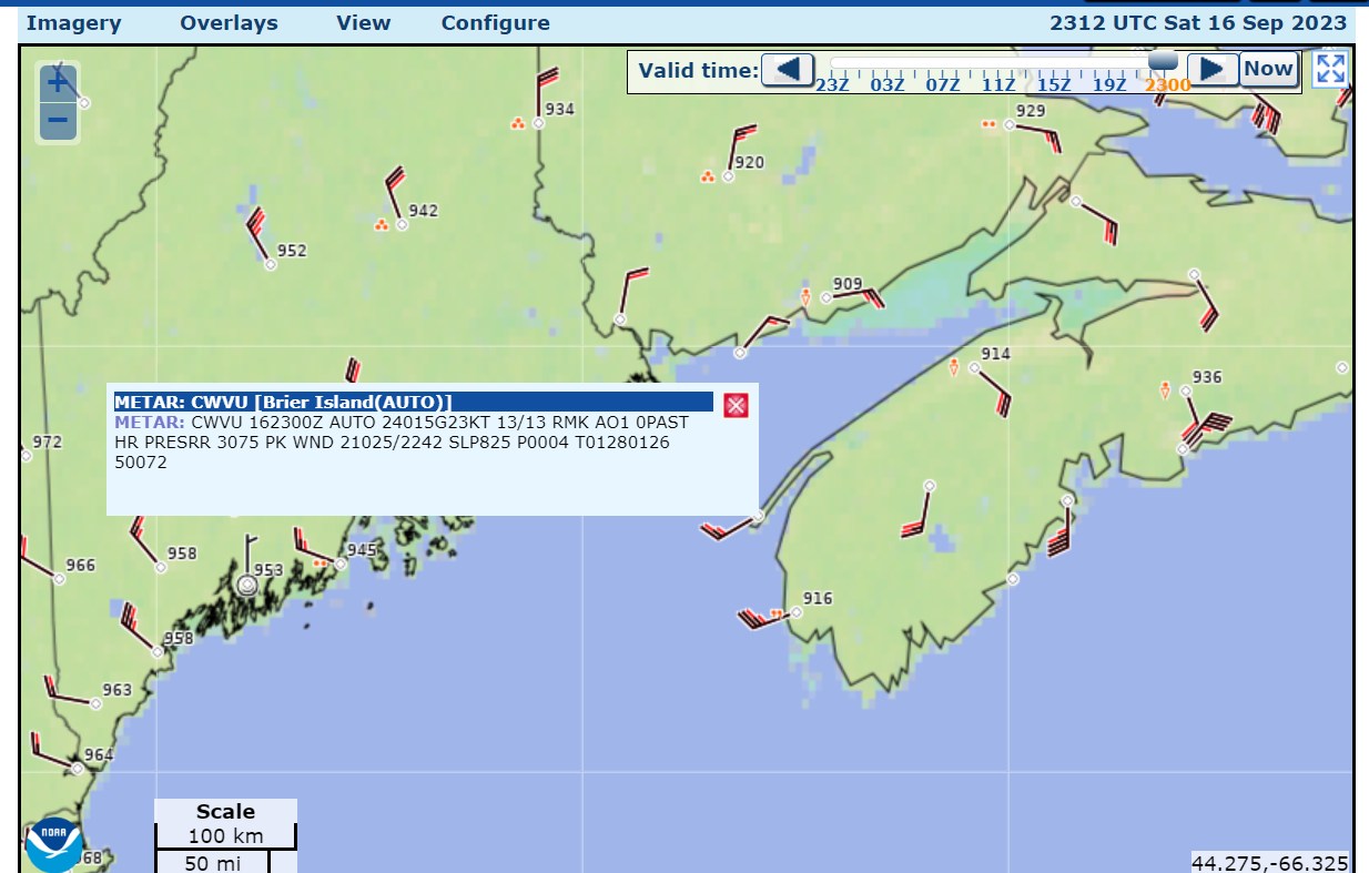
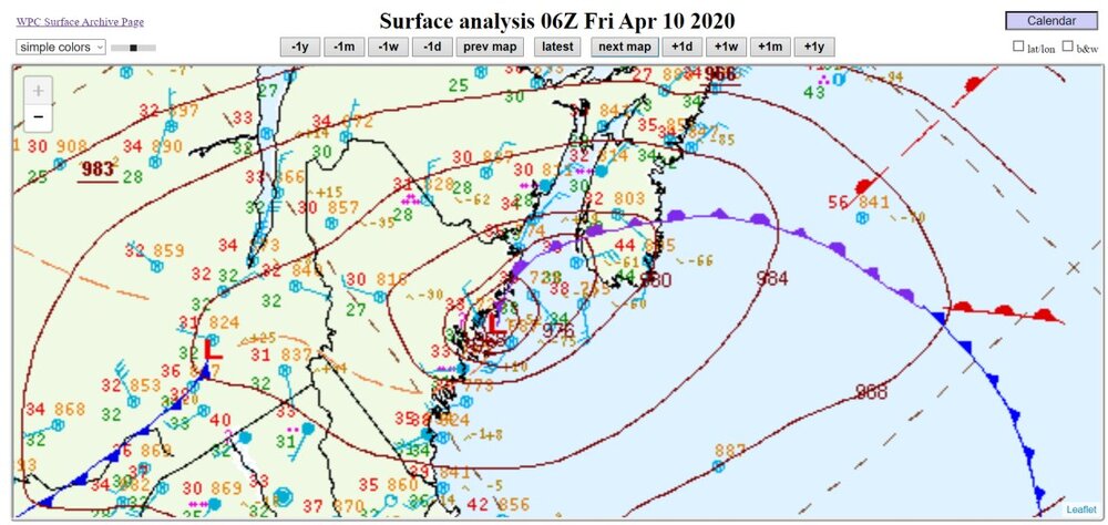
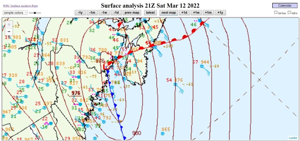
Did you know? January 5, 2018 had a lower pressure at the same spot at TS Lee right now. It was a blizzard with 949mb at the mouth of the Bay of Fundy, January 5, 2018, 03z. Also, February 8, 2020, 00z had 966mb with rain/snow. how about 968mb with rain/snow in April? non-occluded low at 976mb last year, March
-
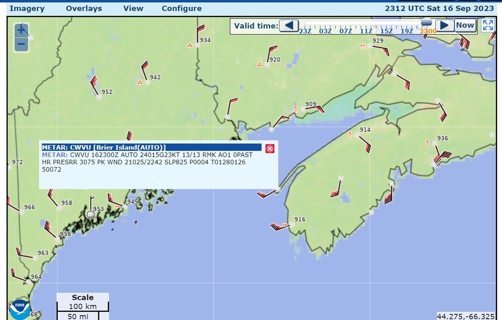
It would appear that the low is at the mouth of the Bay of Fundy
-
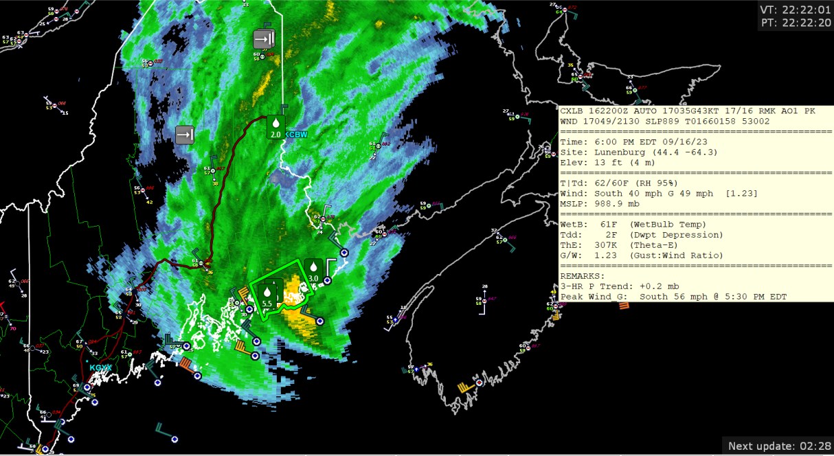
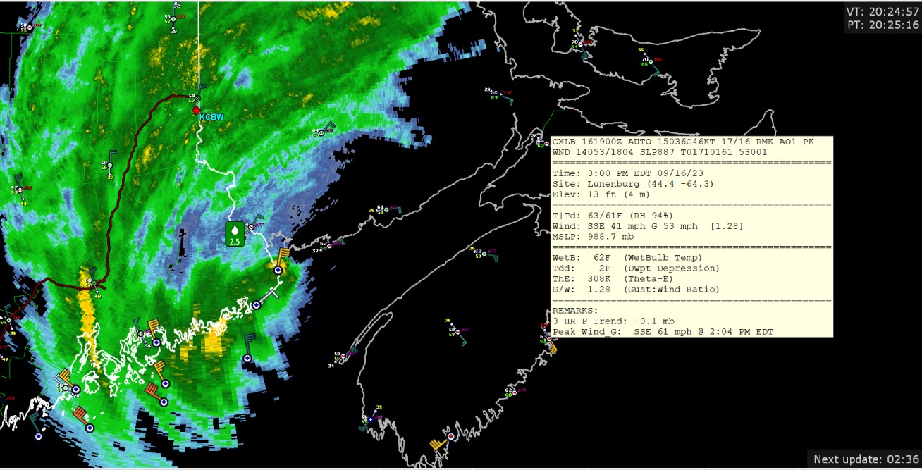
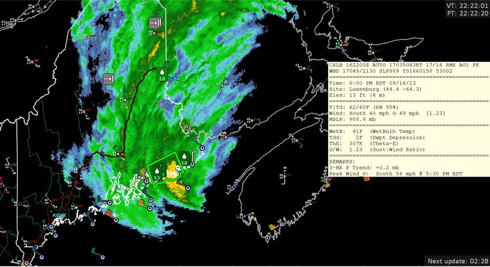
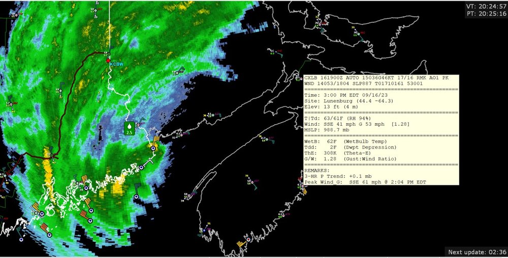
wind gusts to 61mph (53 kt)
-
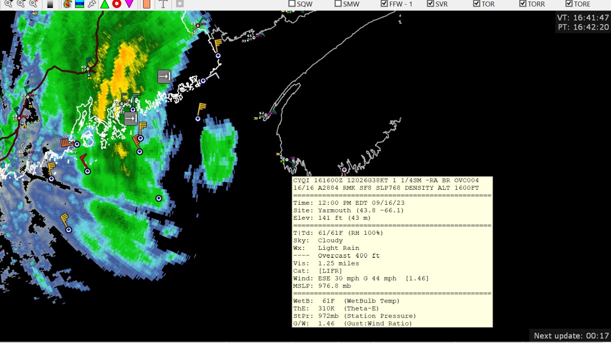
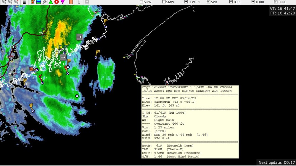
974.2 mb at Yarmouth Nova Scotia, so probably bottoming out what that airport will measure.
-
976 mb
-
gusting to 49 knot at Mitinicus Island Maine (part of the buoy system, CMAN observation)