das
-
Posts
2,299 -
Joined
-
Last visited
Content Type
Profiles
Blogs
Forums
American Weather
Media Demo
Store
Gallery
Everything posted by das
-
21.9ºF / 19ºF here in Charlotte, VT High of 23.1ºF Light snow continues.
-
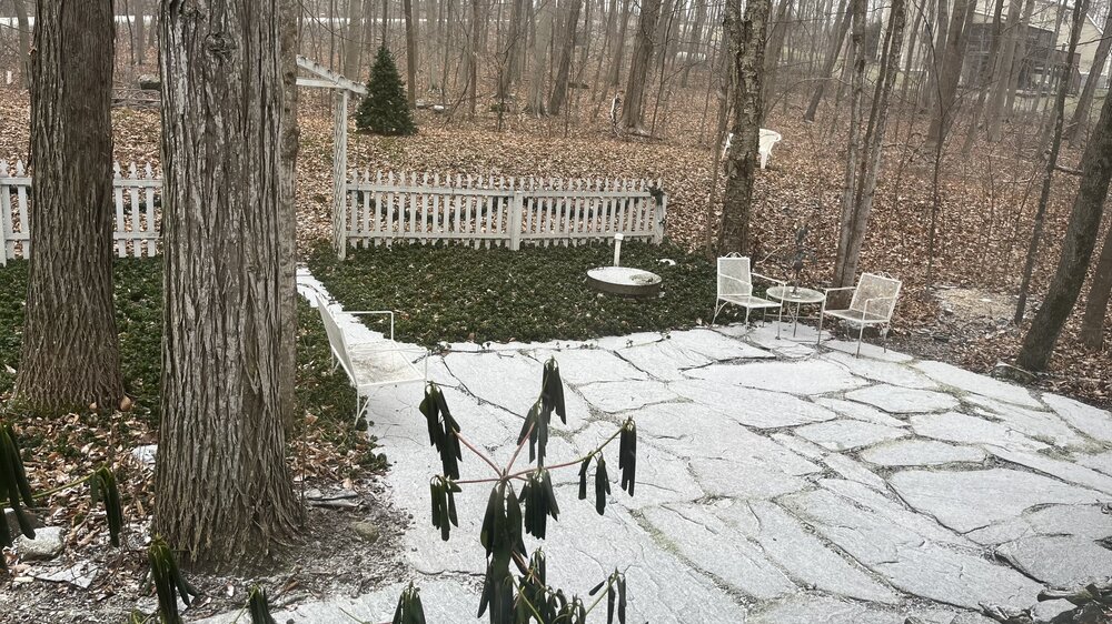
Obs from the house in Clarksburg: 34.8ºF and a RN/IP mix. Mostly rain. Precip started out as SN and maxed out at 0.2" before rain started mixing in. Glad I am up in VT for this storm....
-
I totally get this. Going to school and living in Fresno, CA was miserable. I could not wait to move/work back east.
-
Overrunning Precip has started already way up here in NW VT. Ground is already white.
-
Typically, when you see ops guidance cranking out all-time SLP records at these timeframes, you toss it. But, the ensembles and atmospheric dynamics at play support it.
-
Here comes the reinforcing cold for y’all, moving thru NW VT right now. IMG_8374.mov
-
I’d guess our 1” of 18:1 fluff will be fully sublimated by the time the deluge on the 10th starts.
-
At least it’s on the right side of the globe this time.
-
Not really. Those on the NW cold side of the cutter on the 10th are fretting and overanalyzing every run of every model, just like this subforum is for this weekend's storm. There's just a whole lot less of them because it's the midwest.
-
I was talking with some friends at BTV earlier in the season, "laughing" that we'd be on the outside looking in in Jan/Feb watching storm after storm run thru the benchmark and leaving us with 1" of cold smoke or, worse, staring at high cirrus. Here we go, I guess.........
-
This is indeed the type of setup where Parrs Ridge typically does well. Edited to add: Those low level ESE and E winds advecting moisture in combined with the upglide can really wring things out on a front end thump like that at Parrs Ridge. Take a look at PSU’s post here. Good rationale there as well.
-
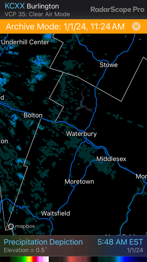
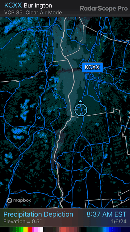
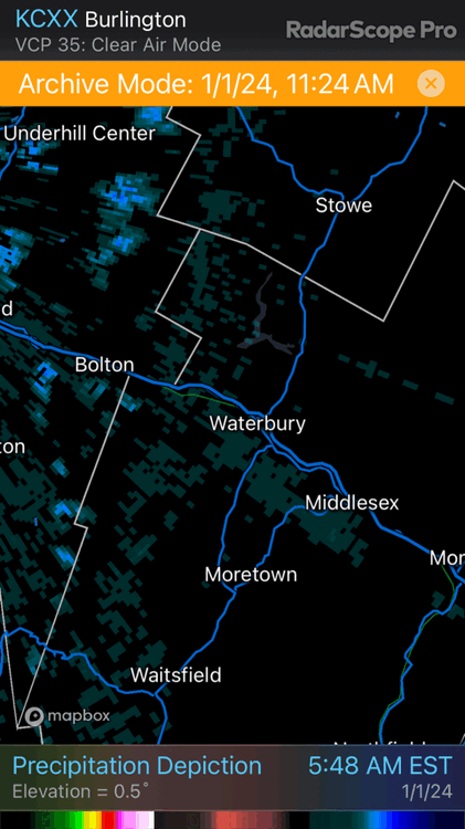
I love microclimate stuff like that. The radar coverage from KCXX is poor there, but it did capture some of the action where it was able to look up the Winooski River Valley. The band had to be less than 10 miles wide and persistent for hours. The highest report I saw was 8 inches. Did you see any higher than that?
-
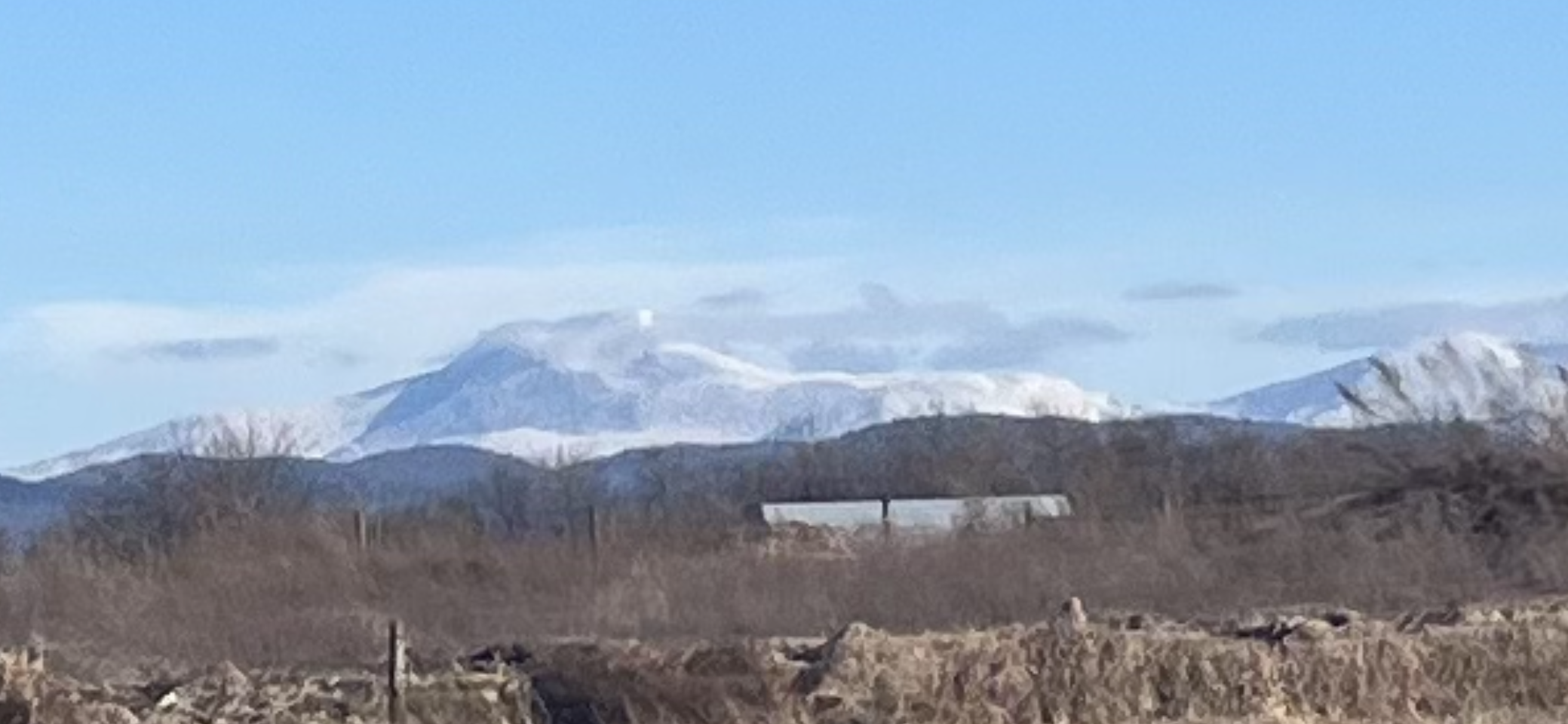
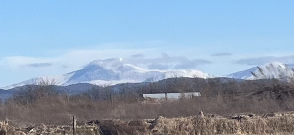
I saw it waaaay off in the distance today from the other side:
-
How are things up your way? Did you lose 100%? Just some parking lot piles left around here in the valley. We got skunked last storm here at 284’ with a paltry 0.9”.
-
It’s been a busy time. Now that I am going back and forth between VT and DC/MD regularly again, I should be mucking around in here again. If y’all will have me.
-
The common understanding has been that short-term volcanic impacts on sensible weather were largely limited to equatorward significant eruptions (like Pinatubo) cooling worldwide weather for a year or two but recent research points to greater duration and impact for significant poleward eruptions. (The current Icelandic eruption is not significant in either ash or sulfur emissions at a global climatological scale). This is an interesting read on the subject if you are so inclined: https://www.pnas.org/doi/10.1073/pnas.2221810120
-
Terpeast's 2023-24 Winter Outlook - Overall Grade: C
das replied to Terpeast's topic in Mid Atlantic
Nice writeup. I am prepared to watch storm after storm cruise by just to my east from my warm(ish), dry perch up here in Vermont. It'll be maddening. -
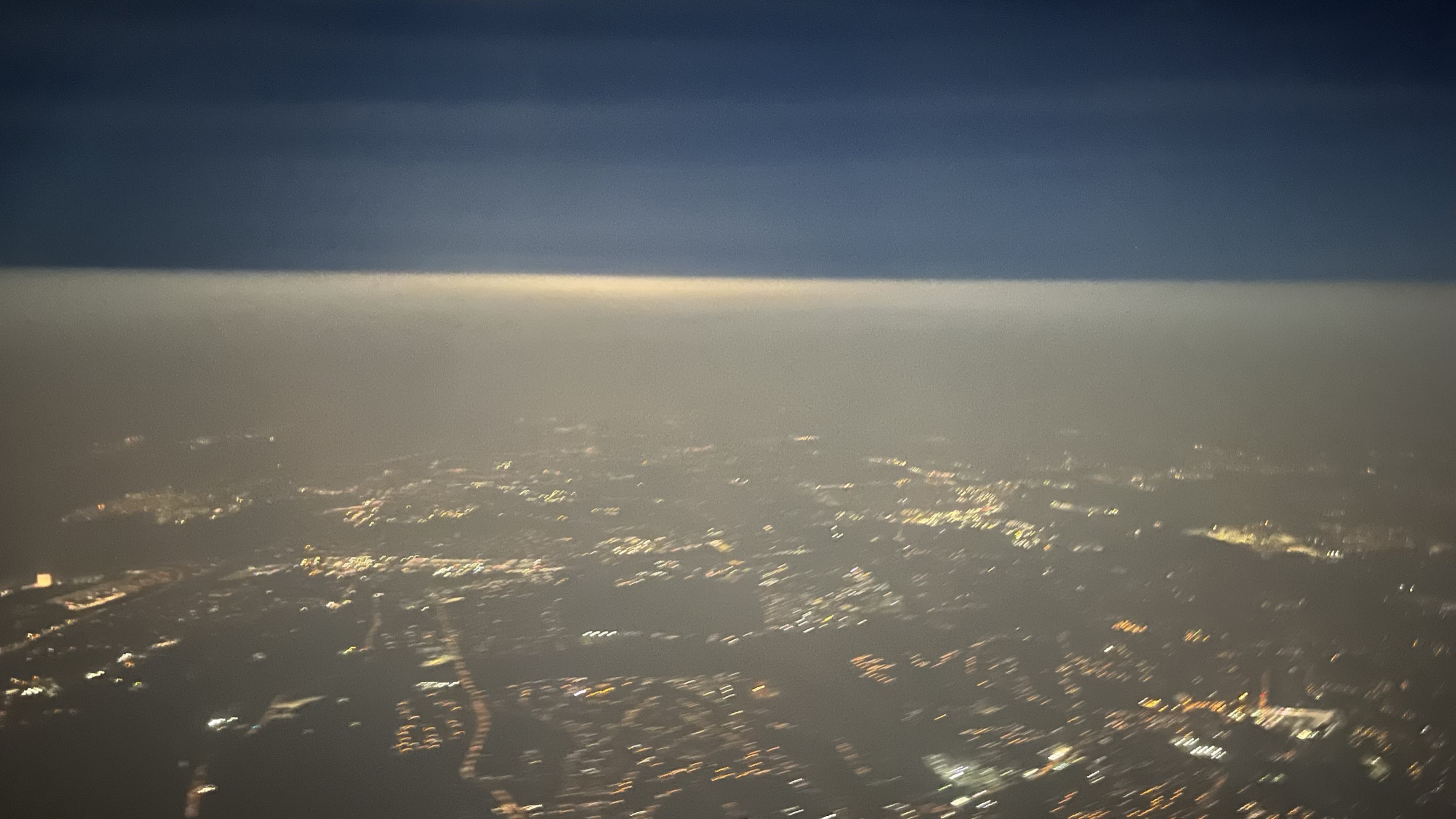
Hi there, mid-Atlantic gang! Flew out of DCA last night at 11pm and took this pic passing thru 10K ft. just north of the Beltway. Pretty cool to see the smoke inversion from above.

-
I called the head of the Mission Assurance division at my agency a modelologist a few weeks ago in a meeting. He sat back in his chair with a pleased/satisfied look on his face and then five minutes later said, “Hey!!!”
-
Wow, that's an epic snowdevil. Perfectly placed with the sun behind it.
-
14.6ºF for the low here in Charlotte. Nice. I'll run in the afternoon, thankyouverymuch...
-
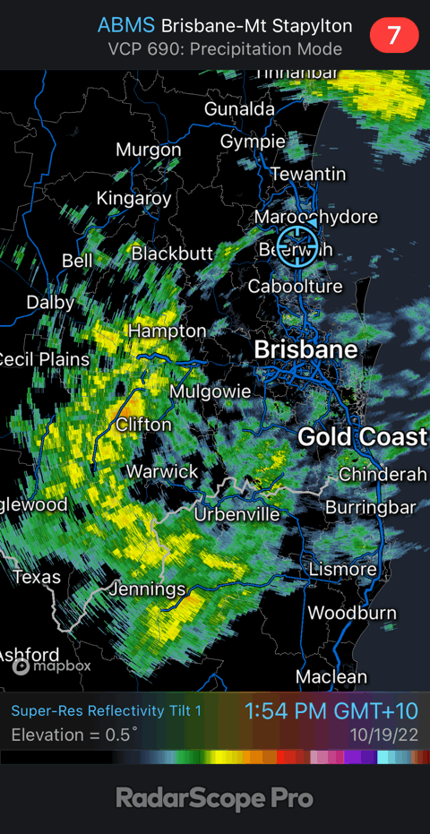
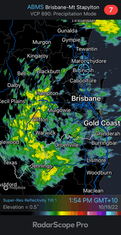
Greetings from the Gold Coast in Australia! I’m missing all the glorious Vermont Fall weather since I am down here for 3 weeks. Popped in to say that even after a wee being here, my mind still struggles to orient on cyclone and airmass movement here in the southern hemisphere. I have to think (hard) when I am looking at maps and radar. It’s reminded me how hard the basic parcel physics can be for people new to the study/hobby.
-
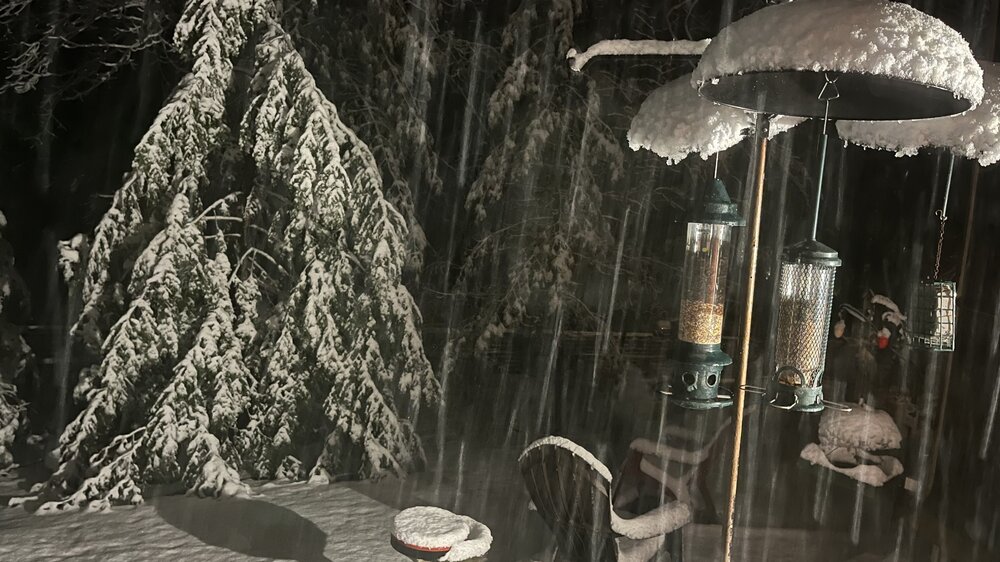
4.1" here in the Valley. Very picturesque.
-
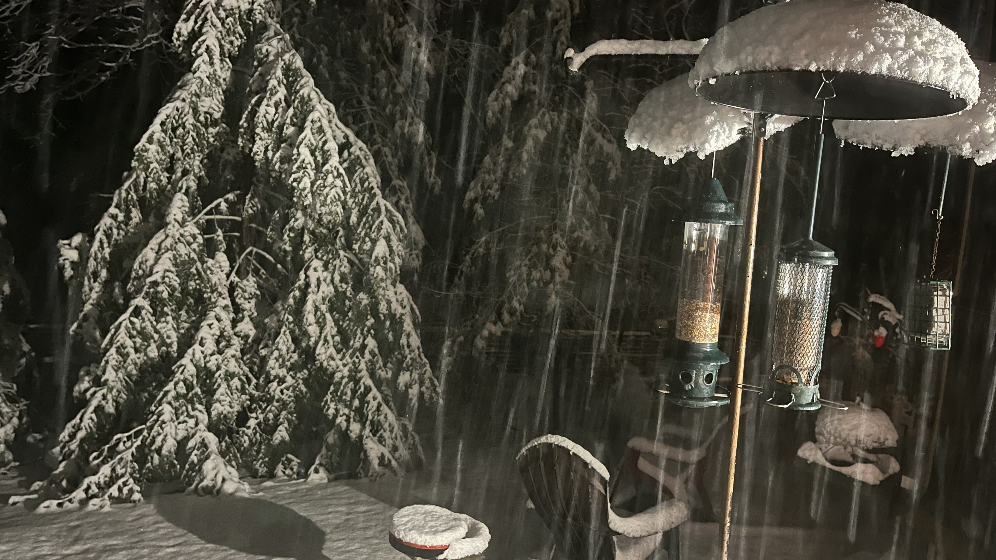
No slush. First hour was massive aggregate dendrites that took 15 minutes to accumulate. 2nd hour is individual dendrites even here at the valley floor at 32-38dBZ volumes. Temp down to 33°F.
-
Flipped to snow at 3:16am here in Charlotte. 1.3” in the first hour. It was 54°F at 10pm on gusty south winds and now it’s 34°F on light SSE winds.