das
-
Posts
2,299 -
Joined
-
Last visited
Content Type
Profiles
Blogs
Forums
American Weather
Media Demo
Store
Gallery
Everything posted by das
-
It's going great! Great to hear from you! It looks like there was a 7" report in Damascus when all was said and done. Not a bad storm. I am heading down on Sunday for a couple of weeks. It'll be nice to come to a place that has some real snow. Ha.
-
I prefer the IEM Mesonet numbers typically vs. those reported into NWS. For example, they reported 7" 4mi to the NE and 7.5" 4mi to the SW of my place and my kid measured 6.5" OTG at the end in Clarksburg but with no "clearing the board".

-
Always a reporting desert in upper MoCo. C'mon, people.....
-
Any reliable measurements from Clarksburg? Either my 36” snow stake is buried (ha) or it fell down.
-
This is true. I have never had a snow day or weather-related day off in my 11 years as a Fed.
-
Whenever my wife calls me a weather nerd, which happens surprisingly often, I remind her of your story from 2016 as a way to center her perspective. Yeah, it doesn’t work that well. She just comes back with some snippy comment like, “safety in numbers is a fallacy…”. Ha. You are semi-famous in casa de das.
-
I am NOT putting myself in the same category as many here but this is one of the truer things ever said on this board. The talent that shows up here is off the charts good. Glad some of you recognize that.
-
Scored 1.2” over 3.5 hours with this. Open water of the lake gave the shortwave quite a boost. At times, there were 25dBZ returns occurring and you could still faintly see the moon through the clouds/snow. At least the ground is white again for the cold week.
-
Looks solid. Although, the max in MoCo being mid-County vs. Parrs Ridge rarely verifies. 1 in 10 times, maybe. The upglide on any low level flow with any easterly component is real.
-
I am driving down that Sunday. Maybe I should put a plow on the front of the car. And, apparently, I have to drive 500 miles south to get any snow in this pattern.
-
January: Medium/ Long Range: May the Force be with Us....
das replied to Weather Will's topic in Mid Atlantic
Starting to travel to DC (and stay in the Clarksburg place) more often again. It'll be nice to check in on you hooligans when I am in town. Especially since you all may be stealing all the New England snow in this pattern... -
January: Medium/ Long Range: May the Force be with Us....
das replied to Weather Will's topic in Mid Atlantic
This confluence is fer realz. Will be interesting to see if it is overdone (as usual) and relaxes a bit leading up. -
No, but you did hear what models are calling for.

-
This made me LOL.
-
And, just to be clear on why I am cluttering up this perfectly fine thread with this drivel above with legit threats on the horizon, I ascribe to the same practice as when a pitcher is throwing a no-hitter.
-
I am pretty sure my wife would rather I get euthanized vs. her beloved flock. It would be a bad, bad day in Casa de DAS if avian flu was discovered here.
-
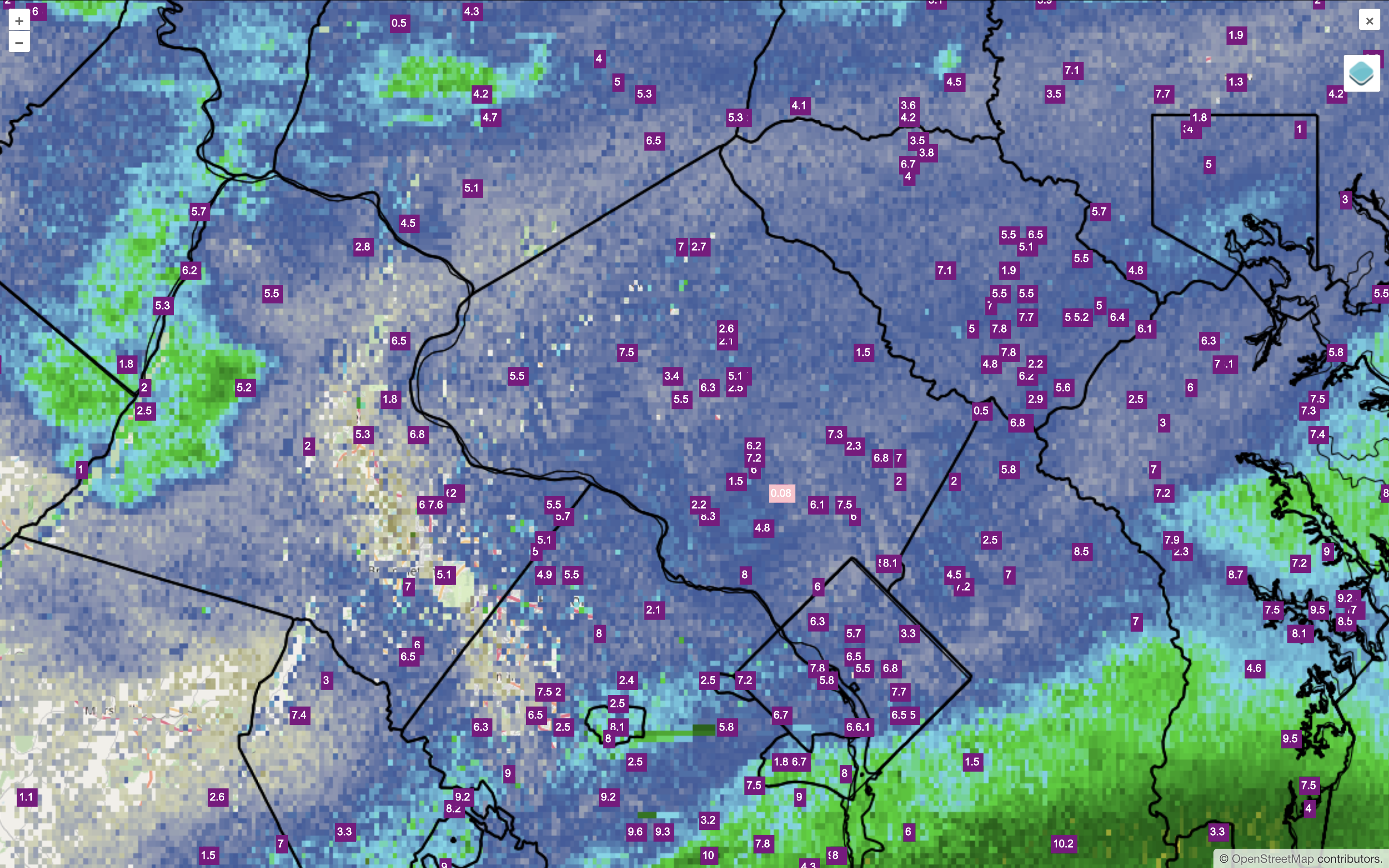
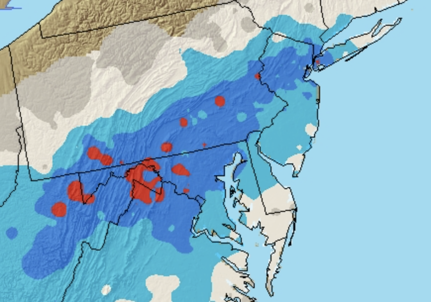
The most I've ever experienced is 33.6" in Clarksburg, MD 22-23 Jan 2016. Besting the highest total in Burlington, VT by 0.5" in 2010. I am the red dot in Montgomery County, MD in this NESDIS map:
-
December 2024 - Best look to an early December pattern in many a year!
das replied to FXWX's topic in New England
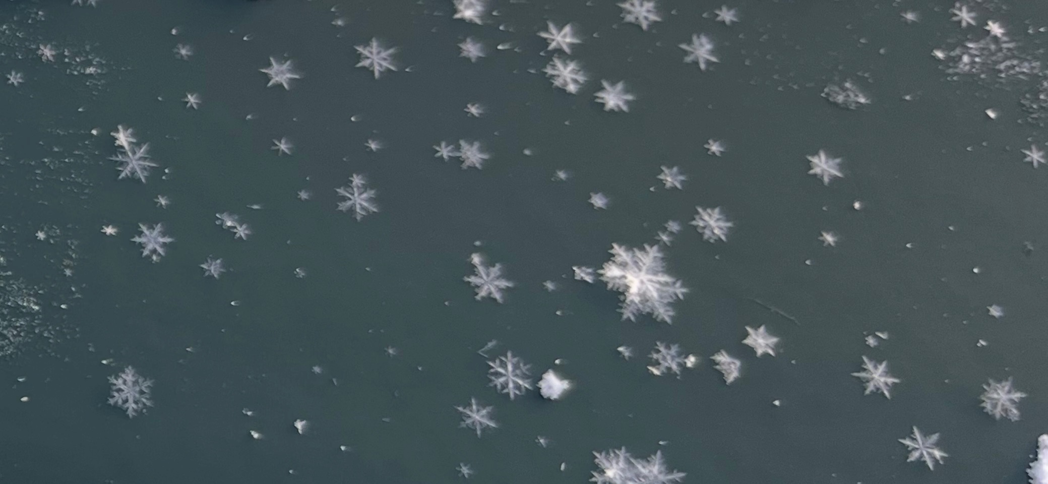
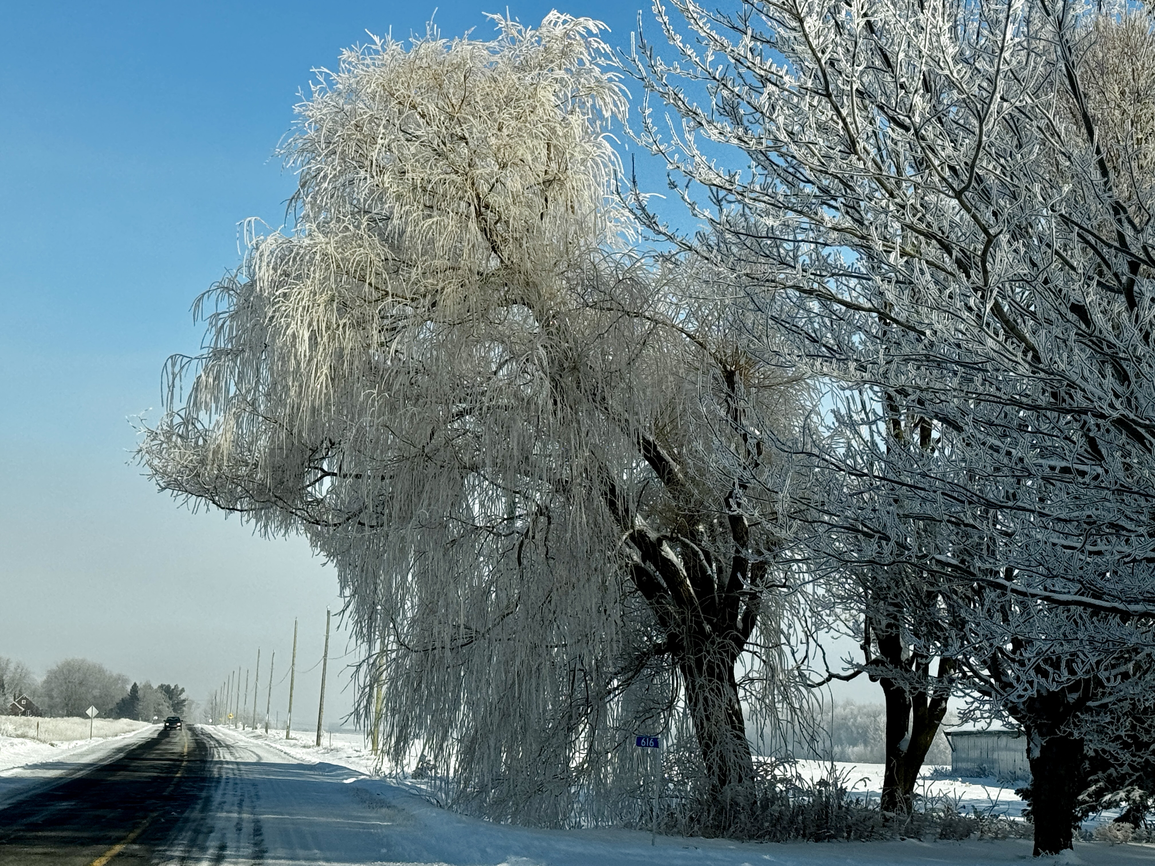
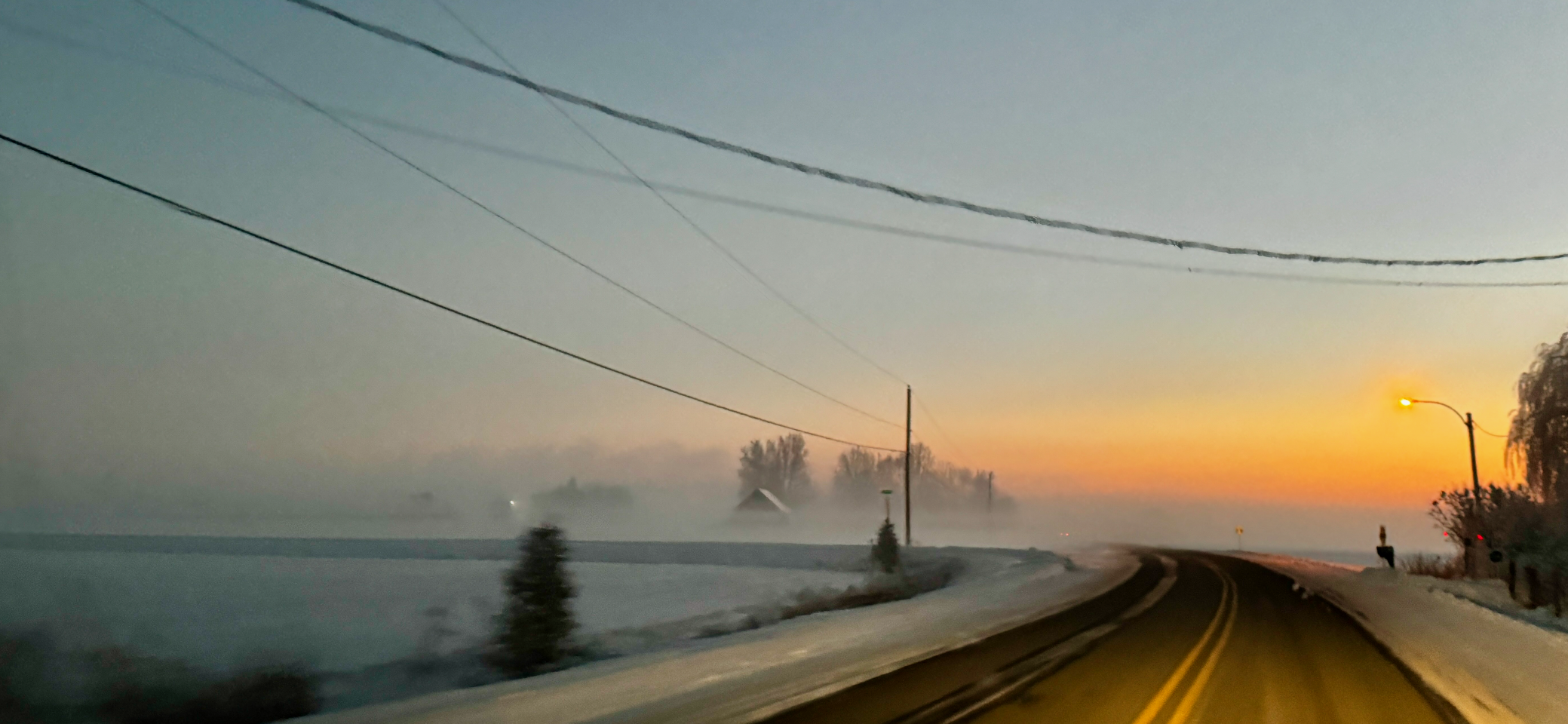
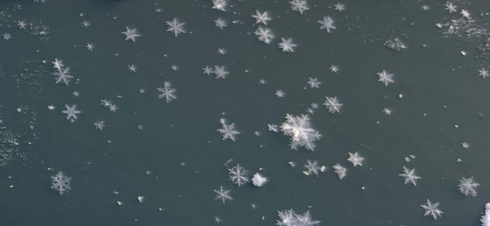
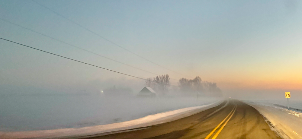
Here in Charlotte, just south of BTV, the inversion has been pretty cool. The high yesterday and Christmas day was 21ºF with a low of 3ºF and 7ºF, respectively with freezing fog each evening and the development of hoar frost. The inversion was only at around 900' and each time the DGZ would dip down below the inversion or the inversion would waver up, perfectly formed dendrites would start falling. Here's a couple of pics my daughter took with a crappy cell phone: I spent those two days up in Old Quebec City driving up on the 25th and back yesterday and took some pics of the inversion and freezing fog on my way back to VT yesterday evening. The temp alternated between 3ºF and -9ºF at sunset depending on the elevation of the St. Lawrence lowlands just to the north of the VT hills with those elevation differences only being ~20-30'. The hoar frost was fer realz where the fog was heaviest: ...and the fog pics at sunset were awesome: Sitting at 22ºF right now here in Charlotte with the deck lifted maybe 100' off of the ground. I am at 238'.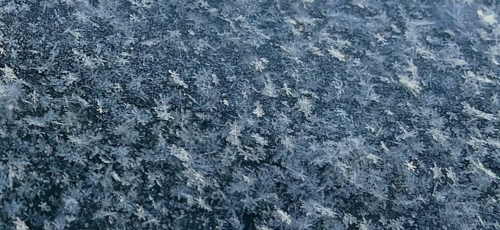


-
This conversation got me curious and looking around. There is a ton of peer-reviewed research on the cloud physics of snowflake generation, on decent transformations like riming and even the metamorphosis of snow ice crystals in snowpack on the ground but very, very little about wind-affected transformations as it falls. I only found one hit in the intro of one paper but it was a minimal reference: "Snowflakes falling on the Earth's surface have a mono-crystalline, idiomorphic form (dendrite, for example) or polycrystalline elements with crystals ranging in sizes from 0.1-0.4 mm [1] at very low air temperatures (-50°C - -70°C) to several millimetres at air temperature around 0°C. Depending on the weather conditions (air temperature, moisture, wind velocity) the snowpack is formed under windless conditions from lamellar snowflakes with an initial snow density of 10-80 kgm -3 and idiomorphic contours, or from snowflake 0.2-0.3mm sized fragments formed under windy conditions with a density of about 200- 300 kgm -3." Guseva-Lozinski, E. (1999). Transformation of the snow crystal to a particle of ice. In: Hutter, K., Wang, Y., Beer, H. (eds) Advances in Cold-Region Thermal Engineering and Sciences. Lecture Notes in Physics, vol 533. Springer, Berlin, Heidelberg. https://doi.org/10.1007/BFb0104196 Seems like an interesting topic for an enterprising doctoral candidate.
-
Funny you say that. I've only ever heard it up here from this specific crew. But, I've heard it from them a few times now. Here's the specific text. Judge it as you will: "...As such, snowfall amounts were increased pretty much everywhere leading to more widespread cover of 3 to 6 inches of accumulating snow. One foil, which moderated my forecast a bit, is that the dendritic growth zone is rather high for many locations and coincident with 35+kt winds. These winds will likely fracture a good portion of dendrites resulting in more of a mixed snow-crystal structure reaching the ground favoring a dry, but relatively more dense snowpack that could limit snow depth."
-
The BTV AFD captures the risk here well. The snow growth level is high with some mid-level winds so it's likely that the dendrites will break up on the way down. Leading to denser and lower snow totals than would typically be expected with this air mass.
-
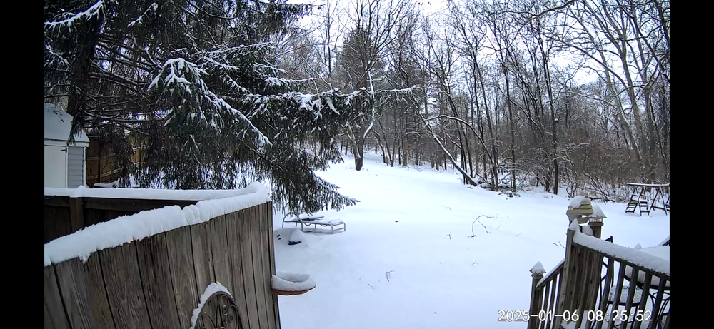
This. My 4.1 inches of fluff is now 2 inches even though it has been cloudy all day with diamond dust falling for hours. Hopefully the clipper produces up here a little bit.
-
Blocking in full swing down here. IMG_2832.mov
-
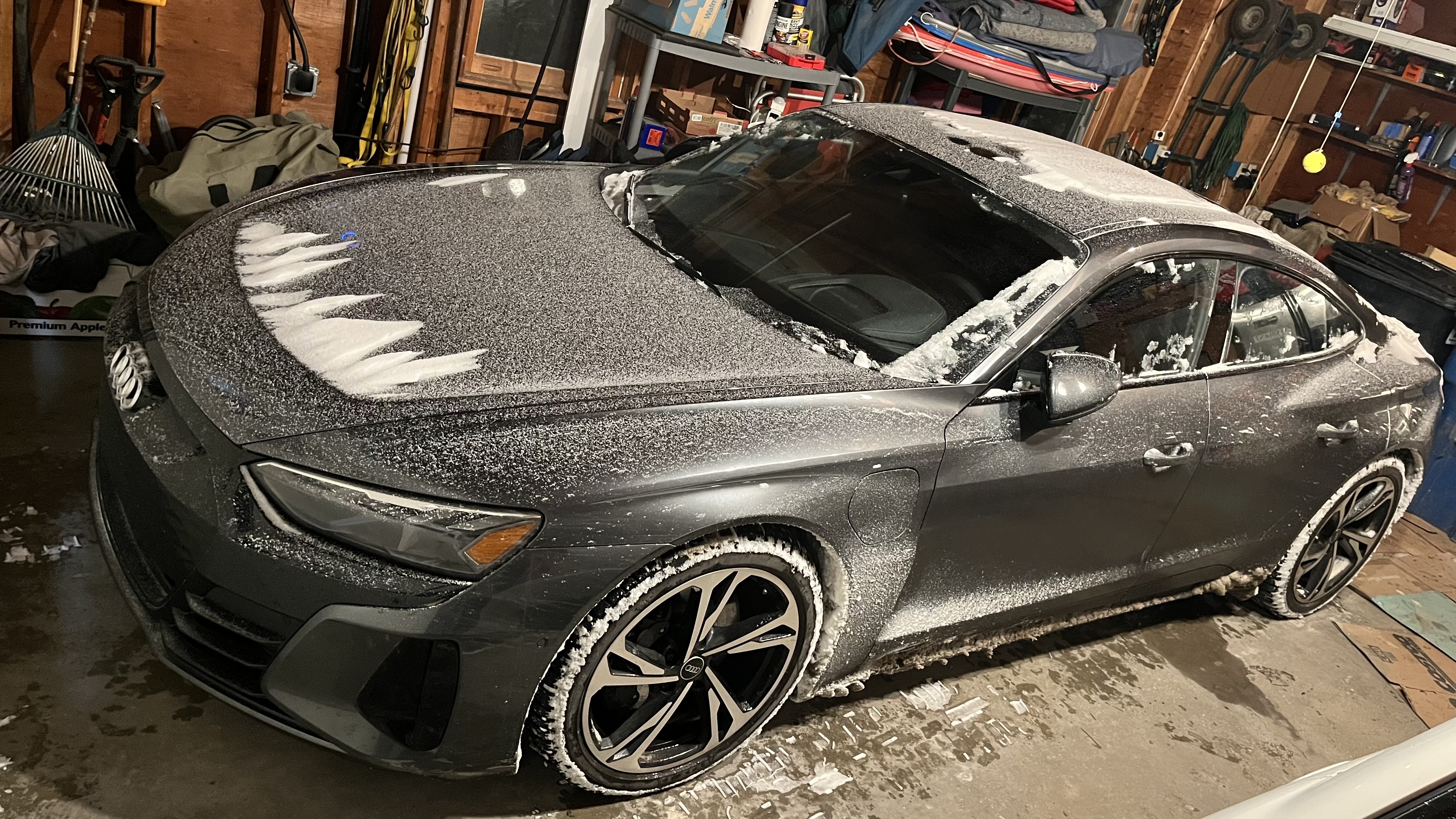
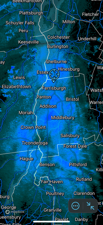
Started snowing just after noon way up here in the Champlain Valley. Just passed 2 inches. Subcritical flow is trapping some moisture in the lowest levels for us (sorry for you all east of the Greens, all ur vape belongs to us) and flake quality is increasing. Next few hours should be nice. 4” by noon tomorrow would be a nice overbust up here. I'm too lazy to put my boots back on to take a nice Christmas lights pic so I’ll just post a pic of the car after banzai’ing around in the snow running errands. Fun!

-
December 2024 - Best look to an early December pattern in many a year!
das replied to FXWX's topic in New England
An op run 300 hours out in a volatile longwave pattern. What could possibly go wrong?