das
-
Posts
2,299 -
Joined
-
Last visited
Content Type
Profiles
Blogs
Forums
American Weather
Media Demo
Store
Gallery
Everything posted by das
-
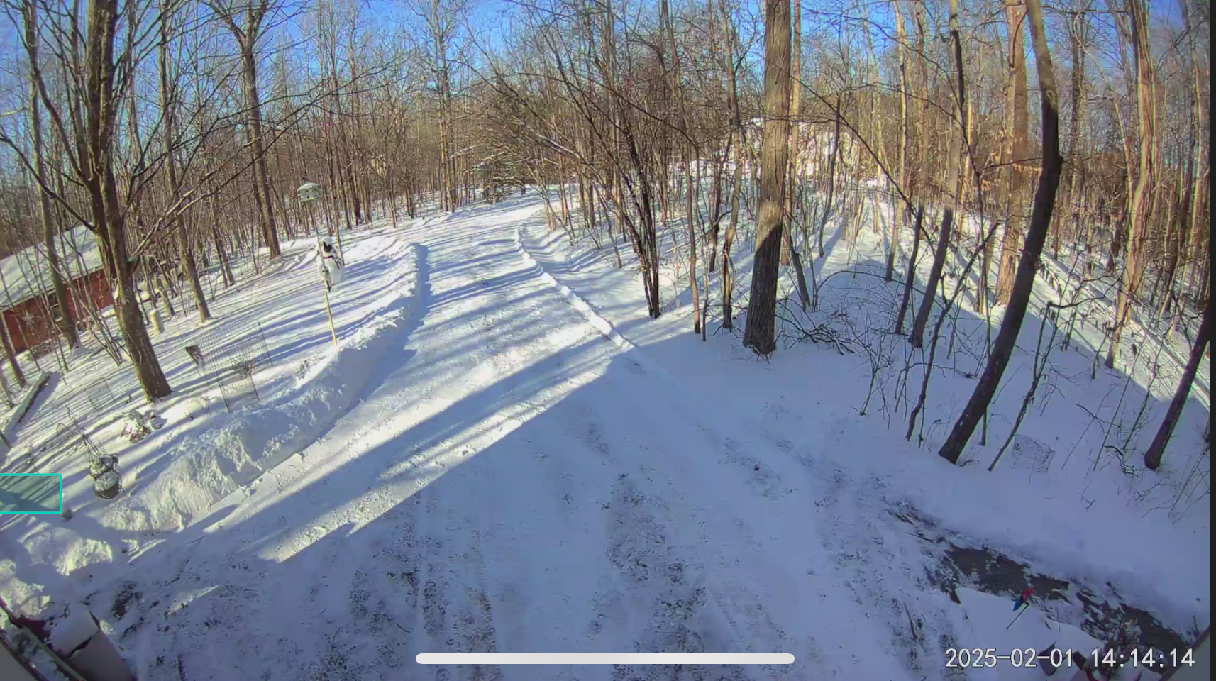
I'll be in DC / Clarksburg for the week. Oiling up my snow shovel and making ridiculously tall snow piles that'll last until June.
-
Feb 9: Iggles flying, weenies high-fivin’: the kickoff to a great stretch
das replied to mahk_webstah's topic in New England
5.7” in Charlotte, VT. -
I am happy to report that 100% of the precip from this storm up here in Clarksburg has been snow. That said, it was for around 10 minutes hours ago... Edited to add: Oops, spoke too soon. Now we are getting some sprinkles. 35ºF / 21ºF
-
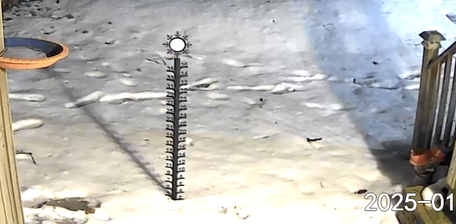
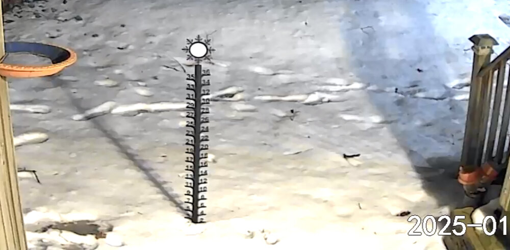
2.5” was the total up here. We were right on the north edge. Another 20 miles up the valley just got a dusting. Too lazy to get a good pic so a floodlight cam pic it is. 9°F at 2pm with a forecast low of -7°F for tonight. Perfect post storm weather in my book.

-
The low level wind from the (dry) north has been so very persistent for the last 30+ days. You have to go up to the mid levels to get any appreciable moisture coming from any of the westerly directions. Even the moisture coming off of the Great Lakes when the wind is westerly is scrubbed out by upslope on the west side of the Adirondacks (and subsequent downsloping here in the Valley) with the only real moisture making it to y'all at the mids... Again and again...
-
1.1" in Charlotte, VT. For the umpteenth time this year, synoptic moisture comes in less than modeled/forecasted here in NNE. When in drought, predict drought...
-
Up here in NNE, the battle on the front lines will be fun to watch. These are the forecasted high temps, starting with today's high temp and thru to next Tuesday: 13ºF, 28ºF, 21ºF, 36ºF, 14ºF, 28ºF, 37ºF, 18ºF
-
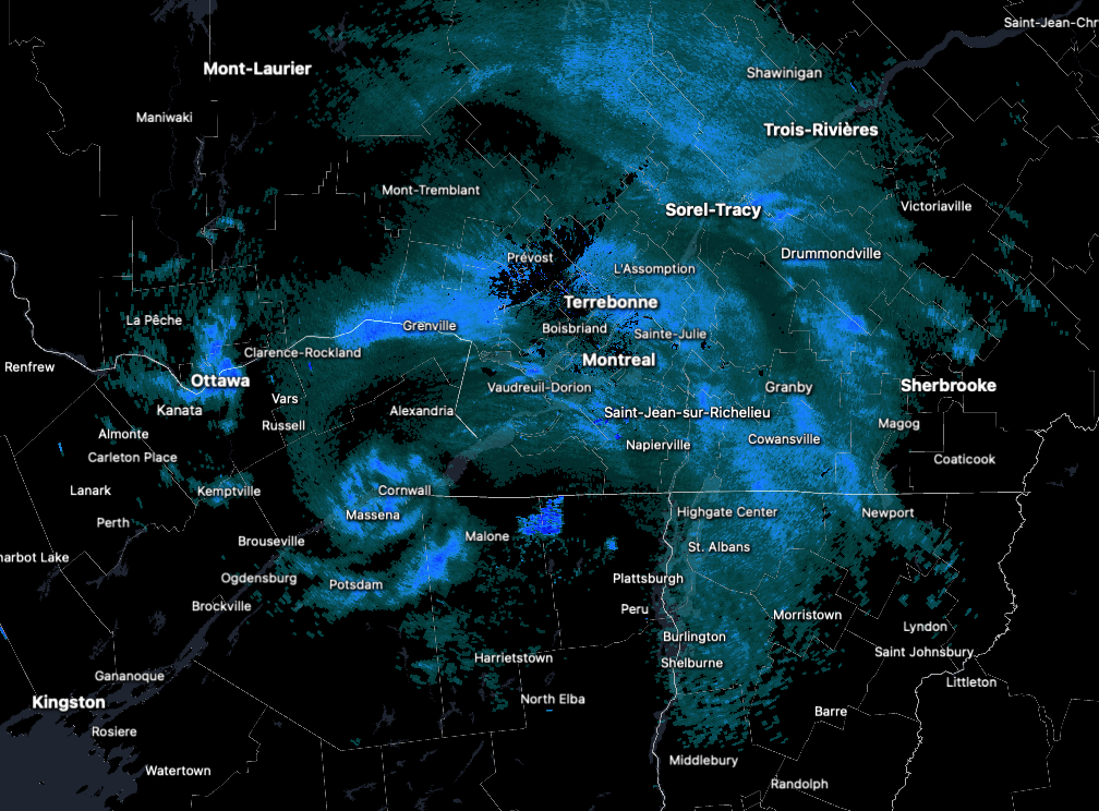
@ineedsnow @dendrite Indeed it was. 2.1" in 4 hours as the band wavered over a couple of times. ea8f8912b0876f0a269062e89ecee312.mp4
-
1.1" so far here in Clarksburg. Meh. Two, maybe three bands of wraparound about to start moving through. Don't think I'll pull off 0.9" to get to 66% of the low end of the forecast. Yes, I am being pedantic.
-
574'. I am in a little NE-facing hollow at the top of Parr's Ridge that peaks at 700' around 1,000m to the NNE and rises to 650' in all other directions. So, my "climatology" is more like 630' for this area. Probably more info than you wanted but the microclimate dynamics here are interesting and I've had a long time here to see them in action.
-
First flakes mixing in here in Clarksburg. Temp down to 33ºF.
-
Nope. Working here at the house (PTT for the loss? Win?) with windows on three sides. Not one flake.
-
Still rain and 35ºF here in Clarksburg. Nary a flake.
-
Rain started around an hour ago here in Clarksburg with the temp of 34°. Rain picking up in intensity and it is now 37°F.
-
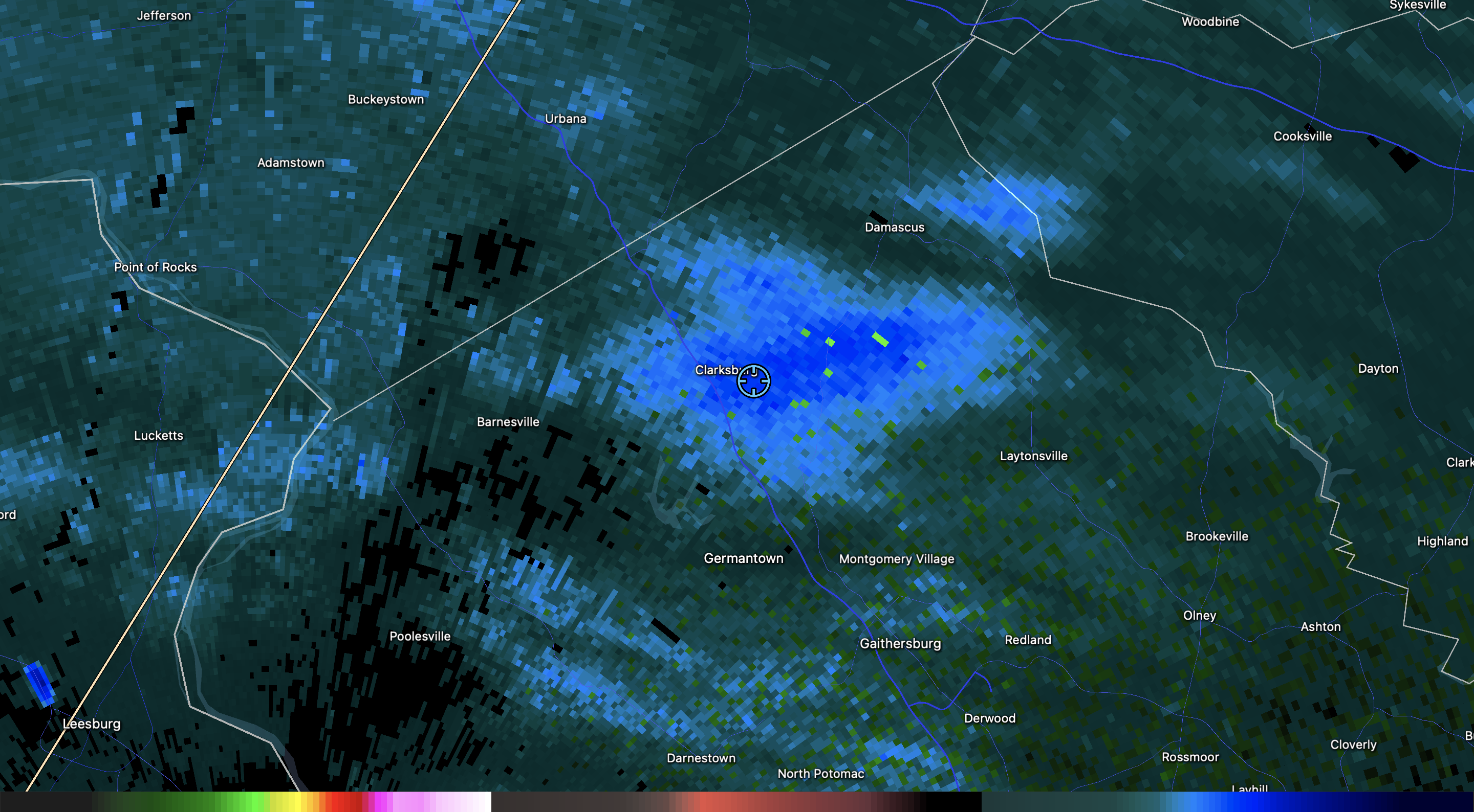
Aaaaaaand, my backyard weather sensors crapped the bed so I am flying blind for the storm. I guess I could find a thermometer to stick outside and check manually but, um, no. It says it's 62.9ºF / 43ºF with a wind of 0mph from the NULL. No amount of fiddling with it / changing batteries / shaking it is helping. Grrrrr..... At lease I can count on the good, old analog stuff:
-
It's funny to hear this over and over again. We have 8.5" in Clarksburg, less than the 33rd percentile for the area yet everyone thinks it's been a cold, snowy winter because of the days and days of snowcover. This is my favorite. I like big snows but I like deep winter cold with extended snowcover even more.
-
These are nice when they pop thru. Third one in the last two hours. IMG_3216.mov 0.2” on the day in Clarksburg. We’ll see where we end up.

-
0.4" from the Snowicane passing to the NW of Charlotte, VT.

-
It happened here in the Valley last week. 3" of subcritical flow fluff with the inversion below the ridgetops to the east. First time in a *VERY* long time. Just missed out yesterday as well. I got 0.5" but when I went to the gym 12 miles away, it was 4" of surprise fluff that just never shut off all day. The BTV snow machine is interesting in these NW flow regimes when there is a cutoff to the NE.
-
It's 25ºF here in Charlotte but the super bright/strong/blistering early January sun is melting my snow. I was surprised to hear the infernal drip-drip-dripping when I went on the porch a few minutes ago. When there is less than 0.1" water content in a 4" snowpack, what the sublimation does not kill, a 25º sunny day will.....
-
New England Winter 2024-25 Bantering, Whining, and Sobbing Thread
das replied to klw's topic in New England
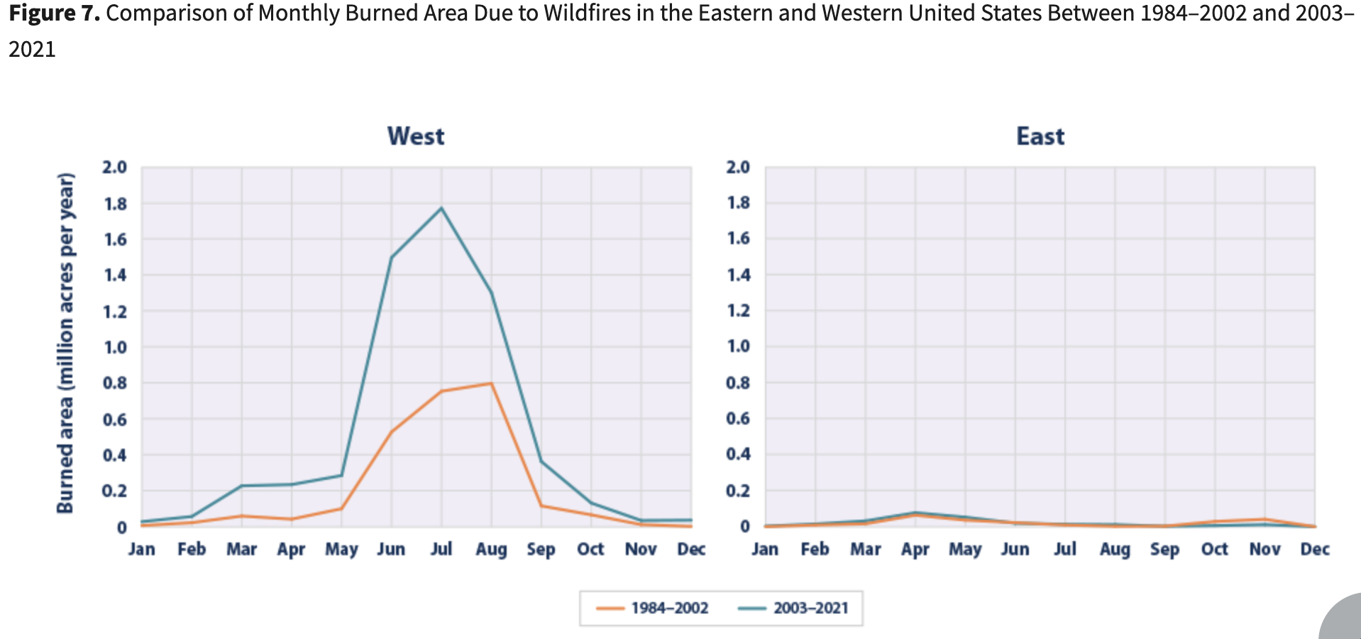
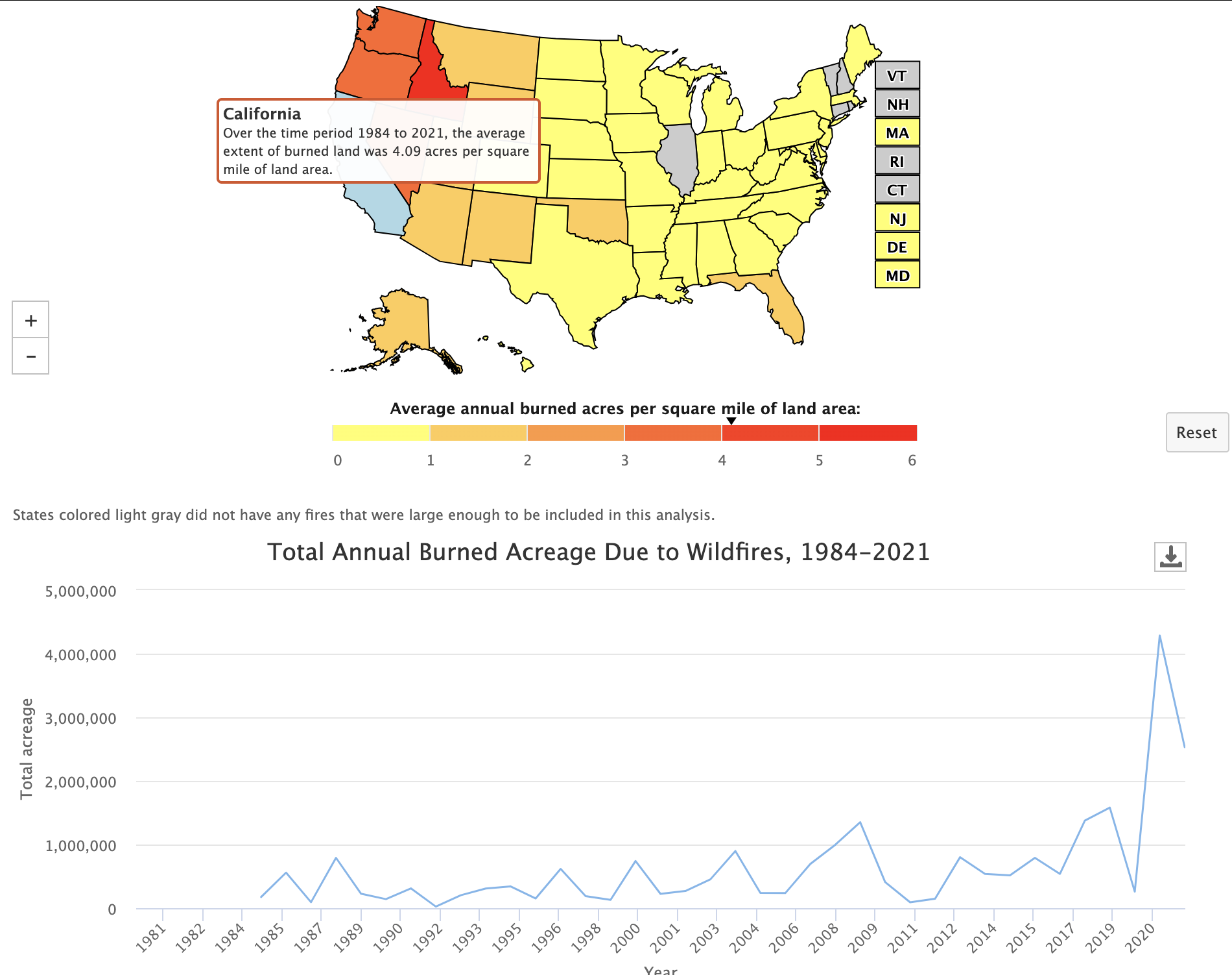
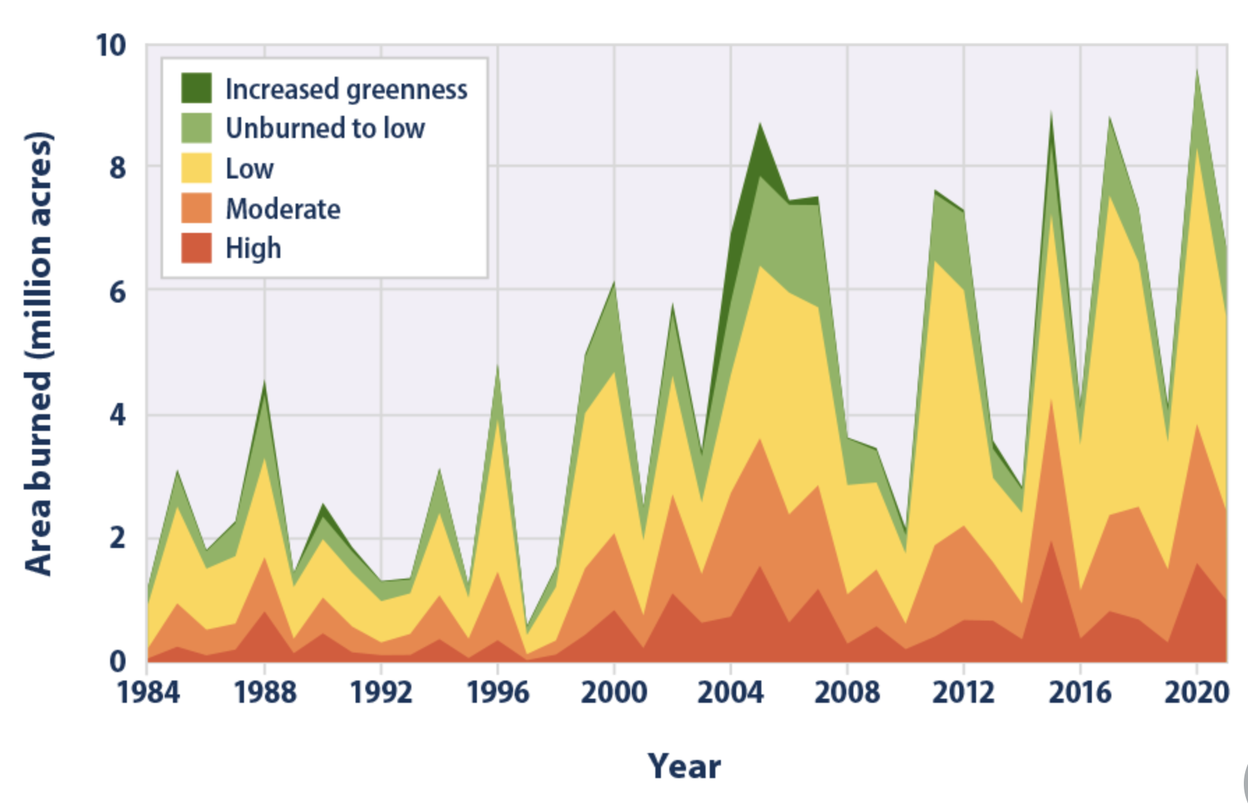
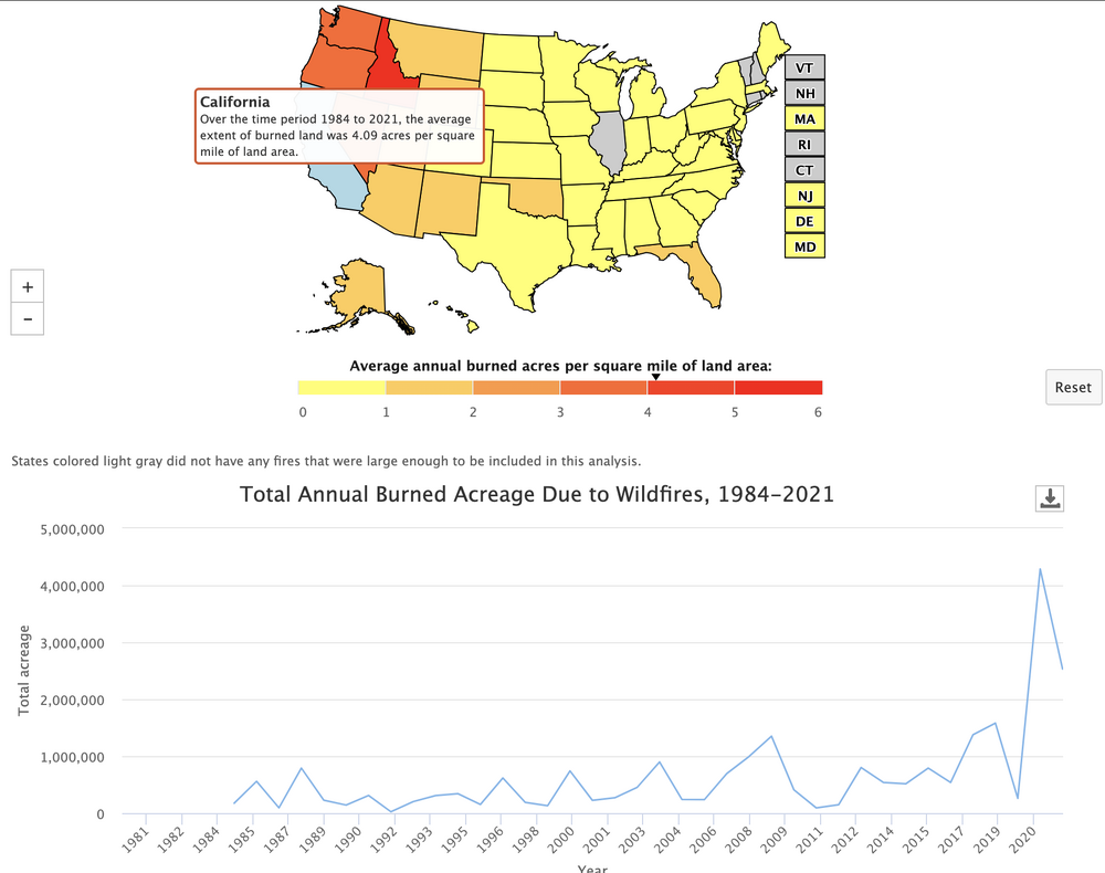
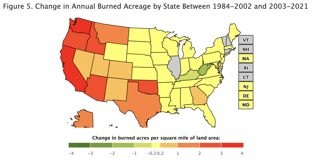
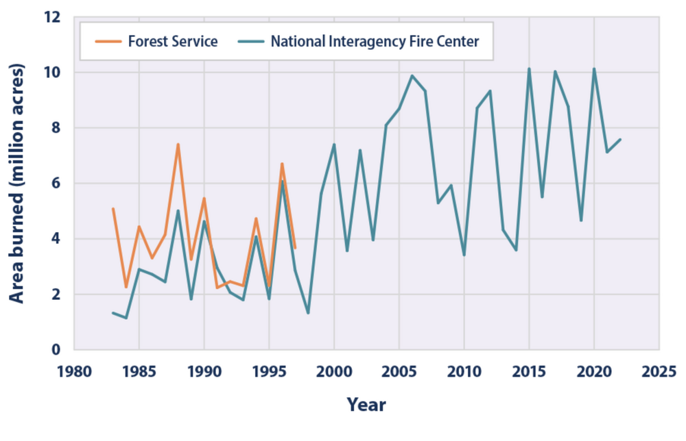
This is a real thing. The fire weather and mitigation process in CA, as flawed as it is, is on a periodic cycle meant to extend their limited resources. This tragedy hit at a down time meant for preparation and mitigations for the upcoming fire season. (The negative impacts of climate change, poor fire fuel management, etc... are very clear over the represented timescale but the yearly fire weather low period is very clear regardless). There is always risk, of course, but the risk is historically much lower this time of year so it is the natural time to plan and prepare. The perfect storm of increased hydroclimate volatility (perfectly at play in SoCal with two years of well above rainfall enhancing the growth of underbrush followed by anomalous dry in the 5 weeks leading up to this event): ...was a recipe for disaster. Here's a recently published paper by Swain et. al., from UCLA on the subject. SoCal is one of the study focus areas: hydroclimate volatility Swain et al.pdf California was second only to Idaho in total acres per square mile burned each year over the last 4 decades with a sharp increase in the last few years. Clearly, what they are doing is not working. ...and, that ignores the human-centered impacts with their propensity to build in places that they should not and fight fire fuel mitigation activities. Which is a whole 'nother discussion. This trend is only getting worse as time goes on: And, finally, having nothing to do with sharp increases in human population and encroachment into fire-prone areas, actual wildfire extents are increasing: ...but, as well, the intensities are increasing: Unfortunately, unless humans drastically change their short and long term behaviors, their desire to live in places that are fire prone, exacerbated by a upwards trends in the periodic cycles of climate and downstream effect on fire behavior, this will continue to be a volatile cycle of poor human and ecological outcomes.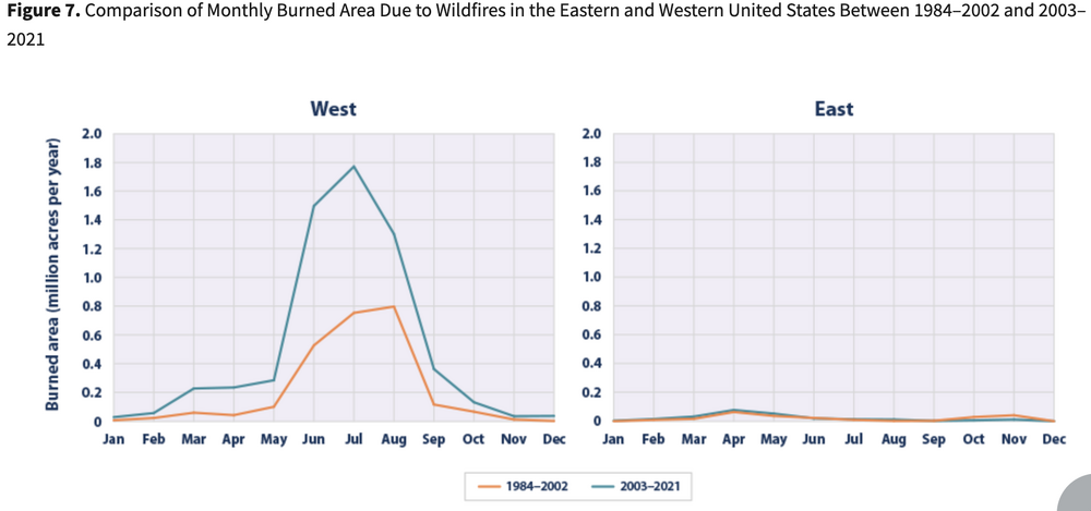


-
New England Winter 2024-25 Bantering, Whining, and Sobbing Thread
das replied to klw's topic in New England
Why wouldn’t you just use a modified version of the NESIS scale? It’s already firmly established and rooted in a codified and rigorous methodology. It would give whatever you are trying to do some credibility since it’s based on existing best practice.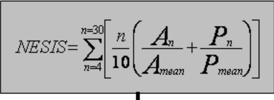
-
What a great graphic.
-
No guarantees, of course but you are supposed to be an actual trained spotter to submit.
-
Thanks! I'll go with the 6.5" that was measured by my kid even though it would have likely been 7" using proper measuring methods...