das
-
Posts
2,299 -
Joined
-
Last visited
Content Type
Profiles
Blogs
Forums
American Weather
Media Demo
Store
Gallery
Everything posted by das
-
December 2024 - Best look to an early December pattern in many a year!
das replied to FXWX's topic in New England
I thought that when I left the Mid-Atlantic forum and came up here, I was coming to the land of Ivy League scholarship and New England courteous civility where even the banter contained references to sailing regattas, latent heat release, lobstah recipes and subcritical flow. -
December 2024 - Best look to an early December pattern in many a year!
das replied to FXWX's topic in New England
1.3" SN up here. Low level cold hung on longer than expected so no FZRA or FZDZ. It's been dry (and melty) since precip shut off and temps finally surged 8ºF between 11pm and midnight. -
December 2024 - Best look to an early December pattern in many a year!
das replied to FXWX's topic in New England
My own personal snowstorm this morning. Subcritical flow FTW. 3” so far.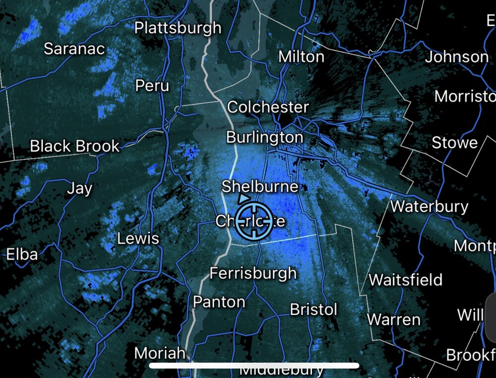
-
0.8" on the year here in Charlotte, 19 miles south of town. Woo?
-
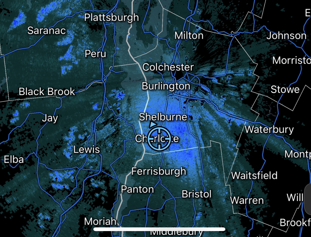
The line approaching western MA had some juice as it passed over KTYX

-
And, keeping with the thread topic, snowfall total here in the Champlain Valley was a whopping 0.3". The dry slot moved in pre-dawn and now the sun is out and burning off the <1" we had OTG. And, it's a blazing 36ºF. Yuck.
-
This paper hits on one of the challenges of disruptive (read, not modernized or transformative) technology. Successfully managing the organizational change management aspect of that disruption is often as valuable as the disruption itself. https://journals.ametsoc.org/configurable/content/journals$002fbams$002f105$002f11$002fBAMS-D-24-0044.1.xml Machine Learning-based AI has been deeply embedded into numerical weather prediction for 20 years. Generative AI is a whole different thing. And, you see the acceptance biases of NWS forecasters quite easily in this paper. And, interestingly, you see those biases morphing over the duration of the study. A side benefit of the study is the fantastic reference list of NWP and forecasting AI research papers. Enjoy!
-
It was pretty cool to see this standing wave sitting over you for a couple of hours this evening.

-
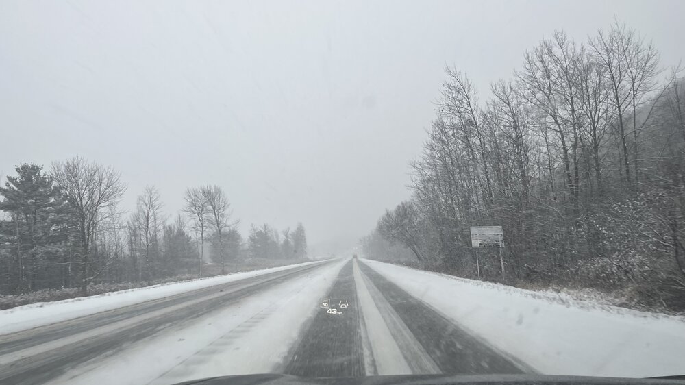
Nothing from the storm on Thursday. A dusting from today that survived in shady spots. Maybe 1/2” will fall tomorrow as a shortwave moves thru. It’ll stay since it won’t breach freezing and will be cloudier tomorrow. Wednesday nite and Thursday will be plenty cold but we’ll be shadowed pretty badly here in the valley so we’ll be lucky to get an inch for our 36 hours of SN wed-thurs.
-
That’s the greatest thing ever. I’m going to show everyone at work tomorrow.
-
Turkey Day Birch Bender Snow Storm/Observation Thread 11/28/-11/29
das replied to dryslot's topic in New England
Yep. Heck, one week from then. With my 0.1" from this morning, I am off the schneid. Looking forward to the Thursday clipper to get my total (barely) over an inch. -
Turkey Day Birch Bender Snow Storm/Observation Thread 11/28/-11/29
das replied to dryslot's topic in New England
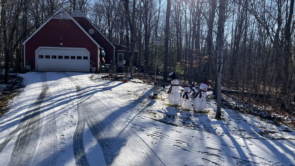
I had the easiest cleanup. 0.00" of snow here at 284'. For the 12+ hours of precip, we had 20 minutes of SN, 6 hours of RN/SN and a low temp of 35ºF. If I drove in any direction for more than 15 minutes, there was accumulating snow.
-
Shush. The weather gods are listening and will be displeased.
-
Living in Clarksburg MD on Parr's Ridge for 20+ years, it was enjoyable being in the sweet spot for the DC area 90% of the time. Coming to Charlotte VT and being in the anti-sweet spot feels, um, not good, even though I average over double the annual snowfall of Clarksburg. It's an odd emotional juxtaposition. Could not pass up the house or location attributes (minus elevation) though.
-
Who moves to Vermont then picks a place at 285'? This guy. This guy right here.
-
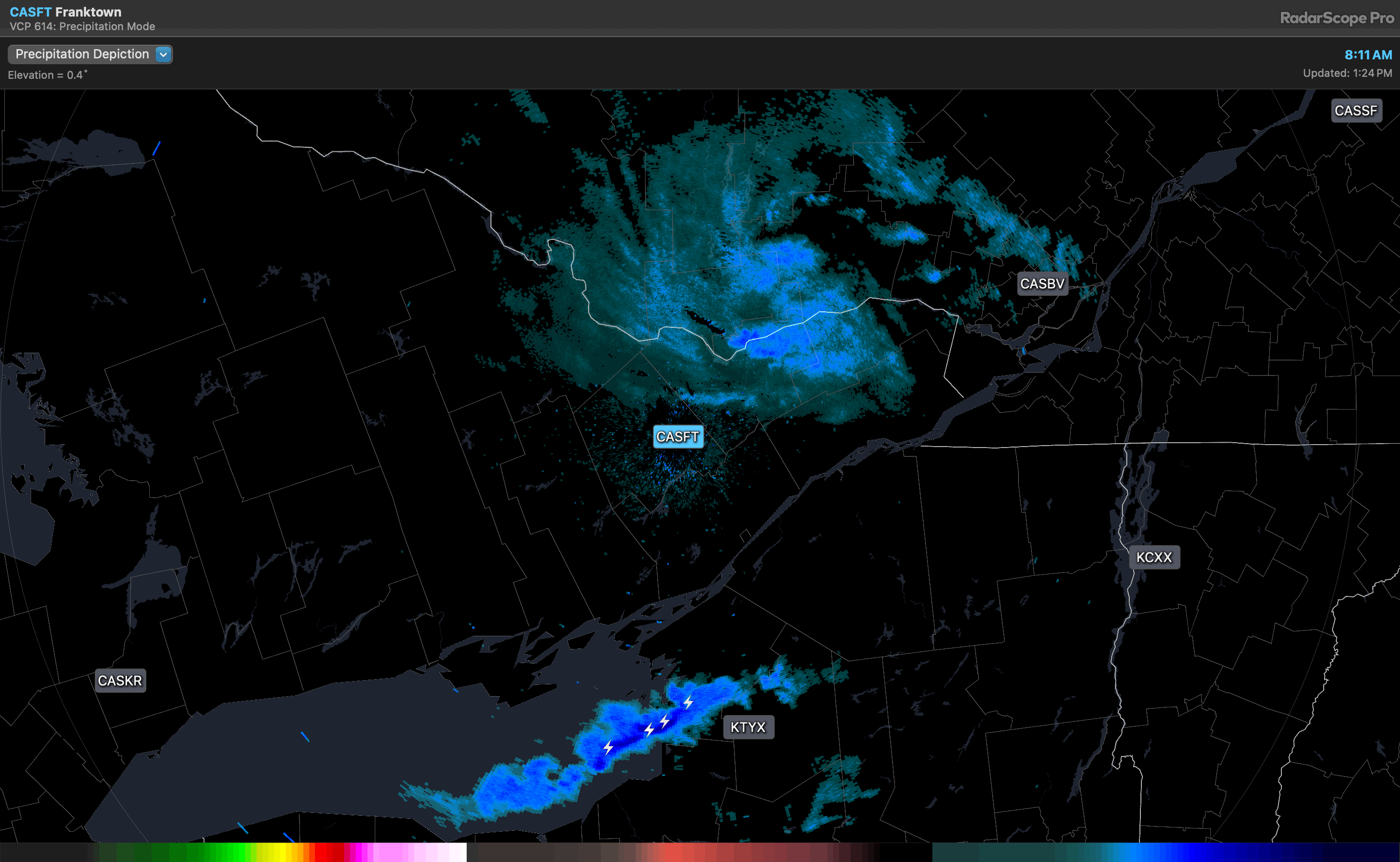
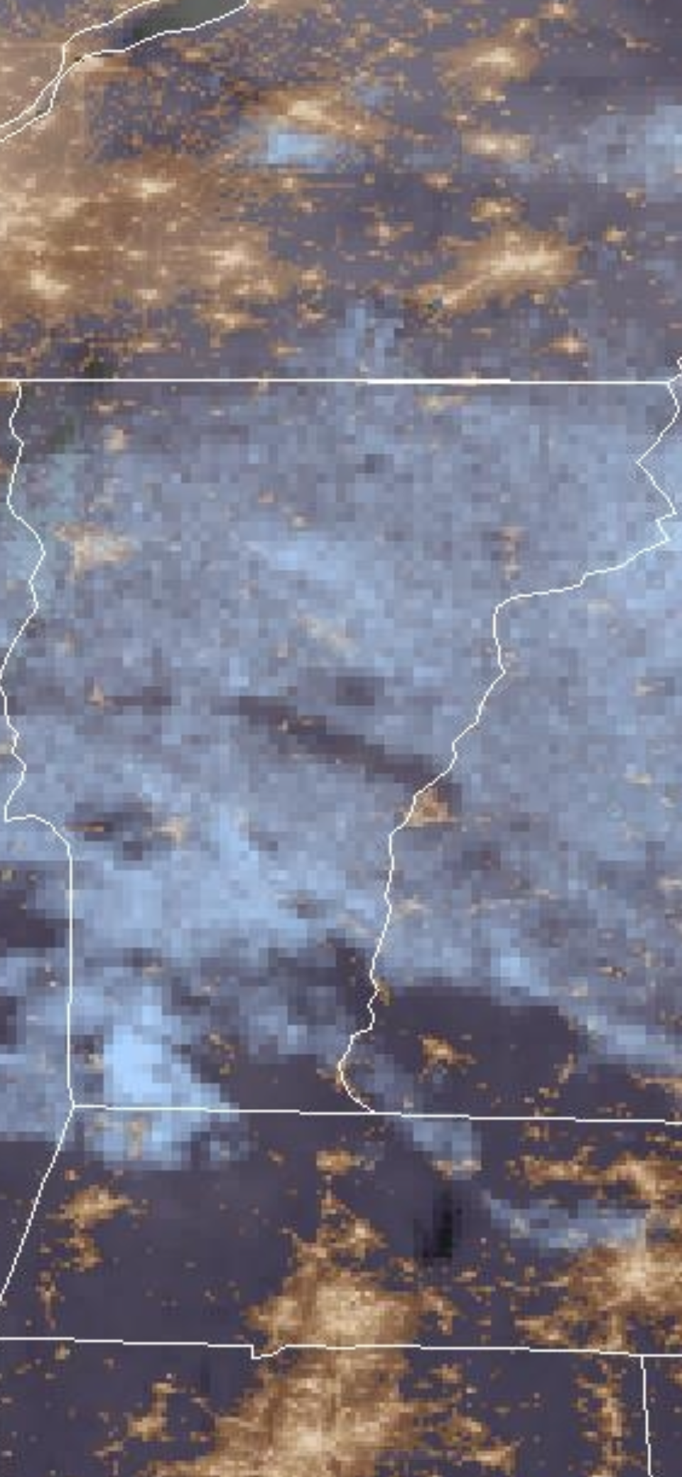
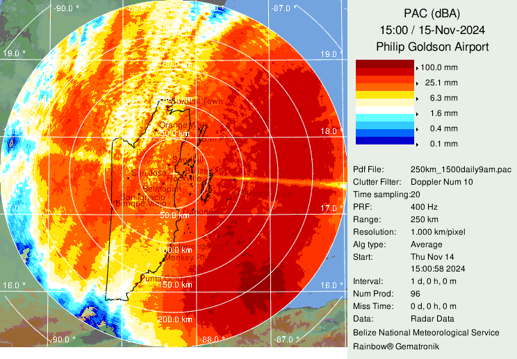
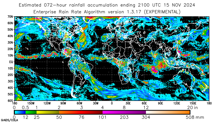
Not much radar-based data in the area. From Belize, capturing the far northwest Honduras coast: Maps pretty well to the satellite estimates:
-
Good find! Here is the non-smoothed image. Very cool.

-
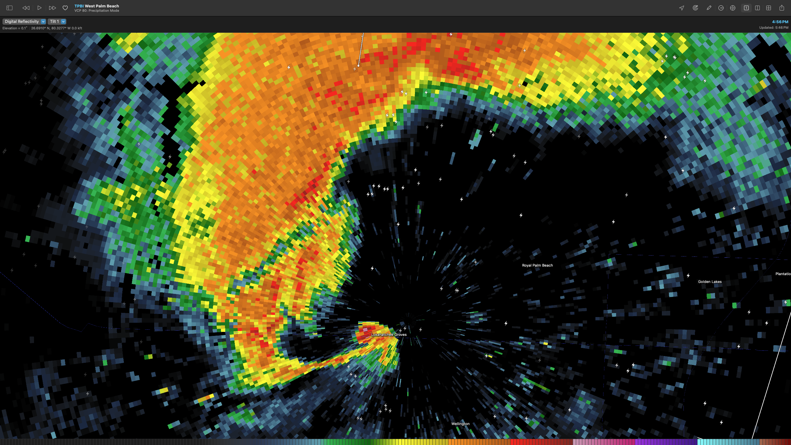
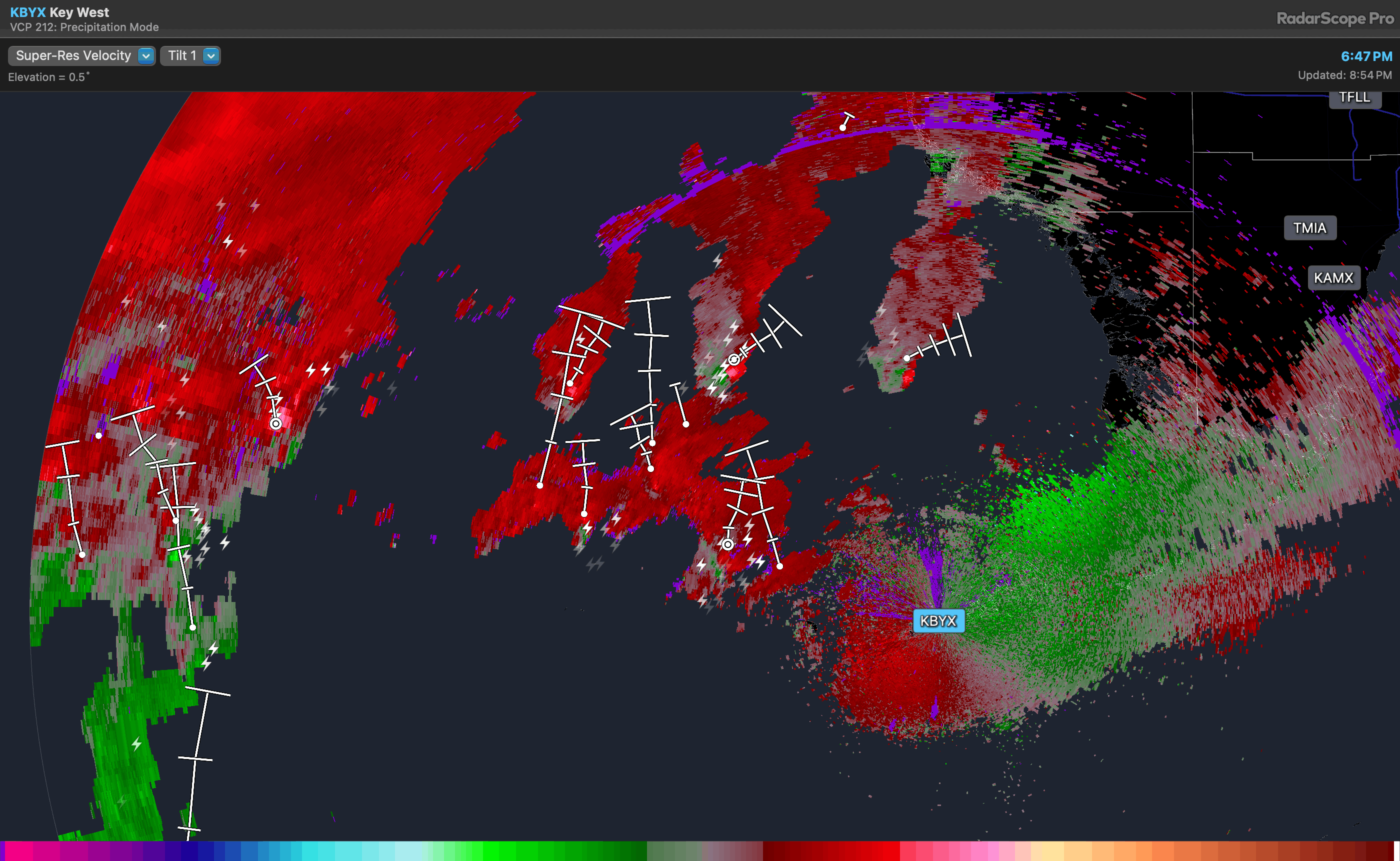
Good catch. That's a lot of supercells out front of the storm.

-
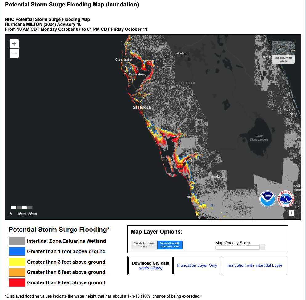
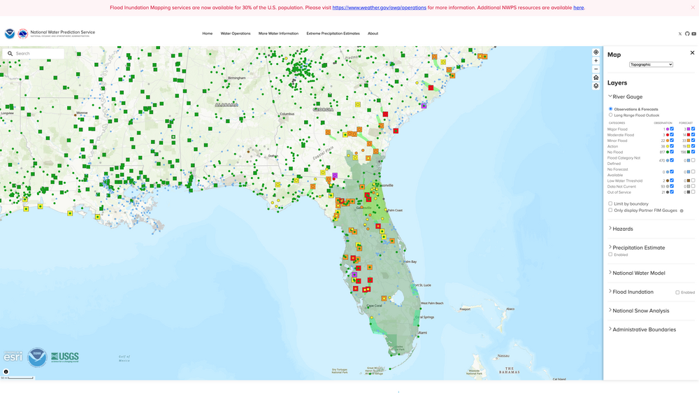
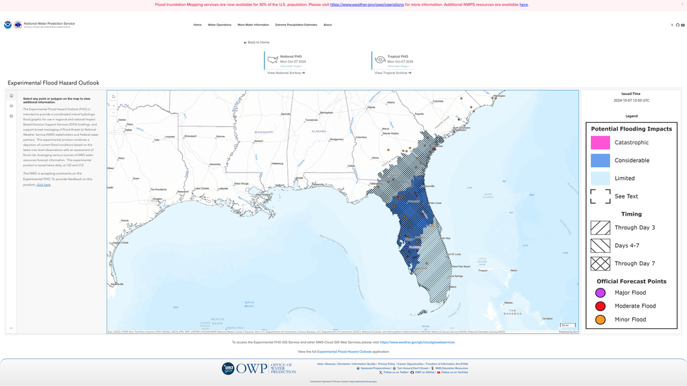
From a water (areal flooding and storm surge inundation) standpoint, this is a deeply concerning situation. The current state of existing flooding: … coupled with the (experimental)flooding projections: …with the base and tidal inundation forecasts …lead to a pretty dire projection. People living in the areas represented in these maps need to heat the caution, warning and direction of emergency preparedness personnel in their region.

-
Posting this here for posterity. 500 image vis loop at 1(ish)m intervals at 1km from sun up to now. You can save it as a .gif with the button there on the page. Back to storm preps for me.... https://rammb.cira.colostate.edu/ramsdis/online/loop.asp?data_folder=goes-16/mesoscale_02_band_02_sector_05&width=1000&height=1000&number_of_images_to_display=500&loop_speed_ms=80
-
The Congrats Dendrite Deck Destroyer 3/23-3/25 obs discussion
das replied to Ginx snewx's topic in New England
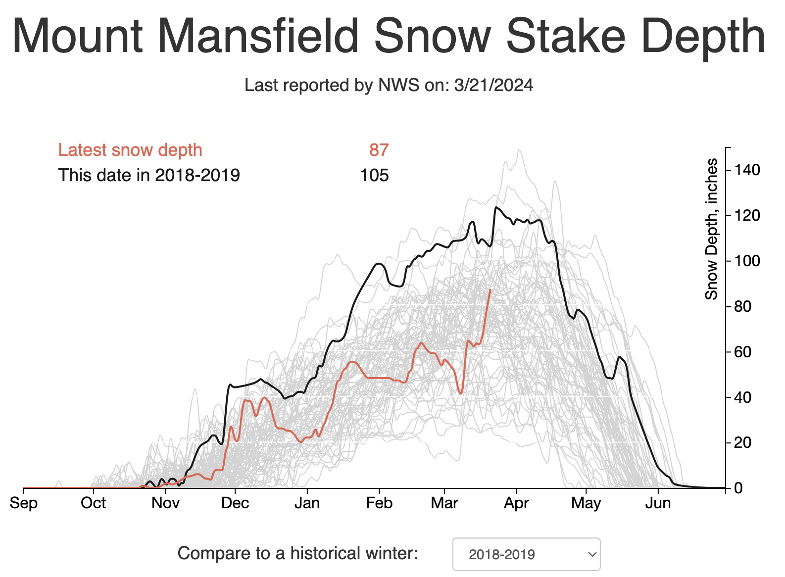
I know, right? What an incredible 2 weeks up there. From 40" to possibly 100"+ in 14 days. And, it is / will be super high water content pack too so it'll have real staying power. This storm is like a day or two late for them to catch the 2018-19 season...ch the incredible
-
The Congrats Dendrite Deck Destroyer 3/23-3/25 obs discussion
das replied to Ginx snewx's topic in New England
If I get the 14" shown on the map here in Charlotte, it will put me at... 47.9" on the year. Still a stinker. -
Yep. Second squall of the day. First one late morning dropped 0.6". This one is at 0.4" so far.
-
It’s been 21 days since Charlotte, VT has recorded measurable snow.
-
It was a Flop... February 2024 Disco. Thread
das replied to Prismshine Productions's topic in New England
100% of stations are reporting below average in mid-Feb. not sure I’ve seen that before.