das
-
Posts
2,299 -
Joined
-
Last visited
Content Type
Profiles
Blogs
Forums
American Weather
Media Demo
Store
Gallery
Everything posted by das
-
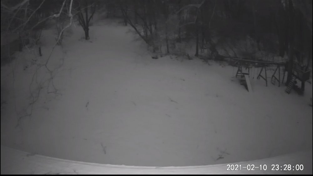
Just passed 6" here in the valley with the ULL starting to channel some convergence. Looks like the flow continues to waiver just east and west of south which is really helping to mitigate any shadowing. 29ºF and steady for the last 4 hours here at 300' with visibilities ranging between 1/2mi and 3/4mi as the waves move on through. Just have to make it to ~4pm after which any risk of mixing goes away.
-
Monitoring a potential important TV to East Coastal storm: Jan 17
das replied to Typhoon Tip's topic in New England
Hush, you. Remember, guidance picks up the big ones early. -
2.8” was the final all the way out here on the west coast of New England. Was sitting at a paltry (and expected) 1.4” when the wraparound picked up some moisture off of the lakes and dropped another 1.4” over 2.5 hours late afternoon.
-
I’ll just have piles after the rain down here in the valley. It’s been a miserable year so far, for sure.
-
And, something more weather related: look at these mesovorticies in the eye wall, two hours after “landfall”. Incredible.
-
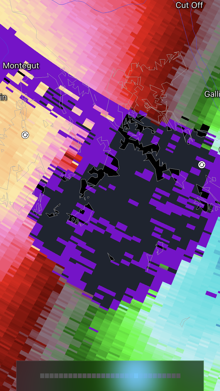
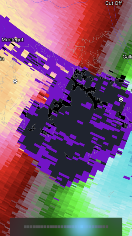
Now that the storm is ashore, a slightly banter-ish comment: that WebCam in Grand Isle deserves the storm chaser of the year award. It’s getting sandblasted from the backside now that the water has receded.
-
It's snowing all the way down to 300' here in the Champlain Valley. Woo!
-
Like my old mentor used to say: “never ever ever predict a record and you’ll have a fine career”.
-
omg. OMG. O. M. G. The black flies are horrific. Never have I ever been in a place where I can't outrun a freakin' fly. They draft behind your head, ala NASCAR, and then make you go yelping down the path at top speed flailing your arms about like an absolute lunatic when they bore a hole in your neck. OMG. And the bite itches and hurts for hours. The idyllic Vermont scenes on the Hallmark Channel never prepared me for this BS.
-
31F / 21F here in the Champlain Valley. Snow started 30 minutes ago. 1/2mi visibility. Mostly individual dendrites with some conglomerated groups.
-
This has nothing to do with model performance. It’s not called modelology. If your forecast is based on model read outs rather than an understanding of cloud physics, fluid dynamics and numerical weather prediction comprehension, it’s not a forecast at all.
-
Nice post. And great link to the Reeves paper. For those of you interested in helping numerical weather prediction to iterate to better outcomes by aligning this this math and code with observed data, do your citizen science part and use mPING to submit your real-time obs. These next couple of dynamic storms will be a great opportunity to gather good data on the morphology of precipitation types.
-
Maybe the NWP scoring analysts all live in Bolivia.
-
I always just call it styrofoam.
-
40-44dBZ SN radar returns are legit.
-
I forgot to have the roommate turn on the back yard lights so I’ll have to live vicariously thru your reports. <>edited to add: 31.8°F/32°F there at the house in Clarksburg>>
-
33°F/32°F in Clarksburg with SN. Dirty snow is white again, new snow on all elevated surfaces. Man, the radar sure looks juiced to the WSW entering WV along the low level jet. It will be interesting to see where the heaviest snow sets up running west-east in MD.
-
Oops, posted obs in the other (wrong) thread. Just passed 2" here in NW VT. Looks like the 1-3" will be more like 2-4" up here. 16F/15F, calm wind.
-
Looking like good guidance for here in NW VT. Just passed 2" at 11am here. 16F/15F, calm wind.
-
It was pretty vigorous. I just passed 7" here in Charlotte and 3.5" of it came in 1h45m from 3:45pm to 5:30pm. The convergence was definitely greater 20mi to the north in Milton so it's likely a legit measurement as they were under it for like 3 hours and they started with 4 or or so already while I only had a measly 2.5" when it started. Steady snow still going here. It's going to be a nice 24 hours upcoming as waves of moisture continue to wrap around the GOM low.
-
The valley convergence has pushed far enough south down the valley to just now reach me. 1/8mi. visibility, it looks like. I'd guess this is 2"/hr rates. We'll see in a bit.... 24ºF/19ºF, N23G31, it's howling out there.

-
If ever you think about it seriously, talk to the NWS Burlington team. They do serious work in this area on nearly a daily basis during the winter. For example, here’s their AFD from this evening: 000 FXUS61 KBTV 020336 AFDBTV Area Forecast Discussion National Weather Service Burlington VT 1036 PM EST Mon Feb 1 2021 .SYNOPSIS... Accumulating snow will make for difficult travel conditions across the area, especially during the Tuesday morning commute. Southern areas will only see light snow Tuesday night, but northern areas will have the best chance for accumulating snow and continued difficult travel conditions through Wednesday. Overall looking at six to twelve inches of snow tonight through Tuesday night with slightly less amounts for portions of the Saint Lawrence Valley and parts of northeast Vermont. && .NEAR TERM /THROUGH TUESDAY NIGHT/... As of 1003 PM EST Monday...Overall, no significant changes were made to the forecast. Only small tweaks were needed to speed up arrival of precipitation by an hour so as snow is already being reported at Rutland and Lebanon, NH. This precipitation shield will continue to move into northern NY and VT overnight. Interesting to note that east of the Greens temps and dewpoints are in the 20s while the northern Champlain Valley and northern New York remain firmly in the single digits/low teens. Have adjusted the temp forecast accordingly based on these latest observations. Still thinking that as the warm front continues to move northward these locations will warm into the 20s by morning. Previous Discussion...Forecast remains on track for widespread snow event across the North Country tonight through Tuesday night. Only change to headlines will be to include eastern Clinton County in the Winter Storm Warning. All other warnings and advisories remain in place. Bottom line much of the area will see six to twelve inches of snow with slightly less amounts over parts of the Saint Lawrence Valley and northeast Vermont. Snow spreads from south to north tonight and especially after midnight and continuing through the morning commute on Tuesday. Looking at a period of difficult travel conditions during this time period. Main mechanism for the snow during this period will be pronounced 700 mb frontogenesis lifting northward across the area. In addition, favorable alignment of omega and snow growth support the idea of a burst of steadier snow...around an inch per hour. The snow will taper off from south to north during the late morning and afternoon hours with best forcing lifting to the north. However, flow will become more northerly Tuesday night and moisture wrapping around the upper low will support the idea of snow becoming more widespread across far northern New York and northern Vermont. Northerly flow and very low Froude numbers support the idea that snow should also be in the Champlain Valley and not just confined to the higher terrain. &&
-
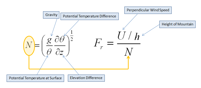
Continuum fluid dynamics defined as the ratio of the flow inertia (at the boundary layer) to the external field (at the crest level) that calculates blocking. BTV has experimental output they use to determine if snows will fall on the lee side of the crest, the windward side or, under extreme blocking conditions (ie., <0.50), back up into the valley. It's found here: https://www.weather.gov/btv/froudeALL I posted this earlier, I think, but here's the primer on it: https://www.weather.gov/btv/froude More scholarly reading: https://web.stanford.edu/~fringer/publications/mayer-jfm-2017.pdf
-
Watching closely .. February 1-3rd for moderate to major coastal event
das replied to Typhoon Tip's topic in New England
Does not compute. -
First indirect influences of the storm here in Charlotte: LES band has popped on the increasing N low level winds. Fluffy dendrites FTW! Temp is up to 4F.