das
-
Posts
2,299 -
Joined
-
Last visited
Content Type
Profiles
Blogs
Forums
American Weather
Media Demo
Store
Gallery
Everything posted by das
-
Even more shocking is the same can be said for central Maryland, just north of DC. 14 days and the highest high modeled is 27°F. With at least three nights below zero.
-
Yep. Like I said in the post just above, I like the ingredients at play here. You look at the model output on those runs that show nothing and the somewhat obvious question is; where is the storm that should be right there? I like your phrase, “restoring system”. I am going to steal that.
-
Yep, I get it. I am actually excited about the ingredients for a significant storm rolling up the coast late next week.
-
CPC is not buying it. They are going dry, dry, dry eastern half after this storm and have nothing in their experimental heavy snow risk probability map for 30 Jan thru 05 Feb.
-
IMG_7191.mov This was at the office in Burlington an hour ago.
-
Here in Burlington too. IMG_7191.mov
-
It's like bb's falling from the sky. And walking/driving in it is more like walking in sand than anything else. It's pretty fascinating. Also, it is a lightening-fast sledding surface.
-
Surrounded by 70+% open water, albeit running cooler than normal. Incredible. I wonder if the industrial chicken houses there even have insulation.
-
The highest 2m temp at Gaithersburg once the cold rushes in Friday thru Thursday 05 Feb 2026 is 25ºF
-
Yep. I'll tell the pilots and DCA management that I have some serious snow to measure IMBY in Clarksburg. Slantsticking is serious government business.
-
Flying down to DC Monday morning. I asked the Vermont cold to head down a few days ahead of me. You're welcome.
-
Ooo, ooo, do me!
-
This is me this winter. 32" on the year with >1" snowcover for 42 of the last 45 days and yet the high water mark for OTG is 5.5". The 1.5" that is OTG now is a block of ice. You can stand on it and it does not give. I went to core it yesterday before I headed to DC for the week and it broke the plastic gauge I use to assess water content.
-
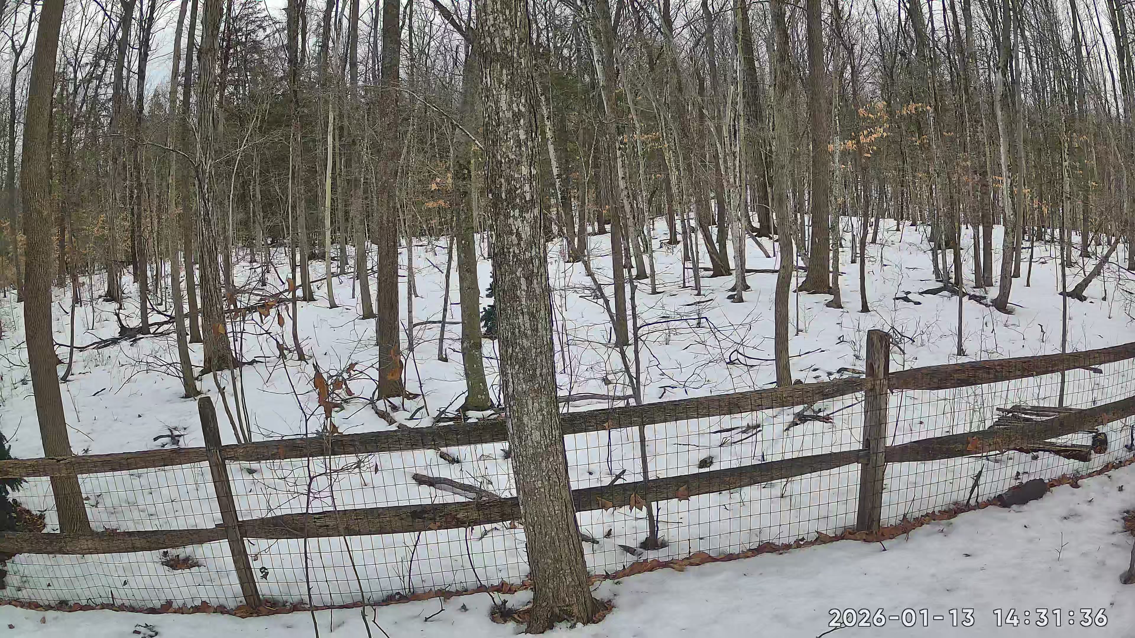
3.1" Monday night here in Charlotte and 3.2" last night. On an off flurries and light snow today. Nice winter day.
-
I got just a dusting from the clipper last night here in the valley. But, did score 0.5” on 16 straight hours of -SN obs from the blocking all day yesterday. Nice midwinter day.
-
My advisor in school way back when did his dissertation on the 2m temp impacts of the moon. +0.3°F on a full moon at orbital perigee on a cloudless night was the average.
-
Here’s the data dump. I don’t record Traces. The couple of years before, I was splitting time between here and DC so there were big gaps in obs. I’m doing that again now but have deputized (and trained) my daughter. Weather obs are serious business in casa de das. Ha. 2024/25 Season12/2 0.1”12/3 0.4”12/4 0.3”12/7 3.8”12/8 2.3”12/9 1.3”12/12 0.1”12/16 0.1”12/19 0.3”12/21 4.1”12/22 0.1” diamond dust 12/24 2.2”1/4 1.2”1/5 2.1”1/7 0.2” 1/8 0.1”1/9 0.5”1/11 1.1”1/19 2.01/24 0.3”1/27 0.1”1/28 0.3”1/29 1.1”2/1 2.5”2/2 1.12/6 3.4”2/7 0.2”2/9 5.72/13 3.1”2/16 11.0”2/24 ~1”2/27 ~1.5”3/7 0.1”3/9 0.1”3/10 1.5”3/27 0.1”3/29 6.3”4/8 0.7”Total: 62.4”2023/24 Season11/1 0.1”11/9 2.1”11/19 0.2”11/21 3.1”11/26 0.6”12/4 0.4”12/11 0.9”12/13 0.1”1/8 8.4”1/9 3.4”1/11 0.7”1/14 0.3”1/16 6.1”1/19 0.5”1/24 2.1”2/13 1.1”2/14 0.7”3/10 1.0”3/11 1.1”3/20 0.6” + 0.4”3/23 8.1”Total: 42.0”2022/23 Season11/17 3.1”12/12 1.2”12/13 0.1”12/17 3.1”12/18 0.2”12/23 2.1”1/12 0.3”1/13 1.4”1/20 5.8”1/23 3.5”1/26 4.0”1/30 0.6”1/31 1.0”2/2 0.3”2/17 0.1”2/24 6.2”3/1 2.3”3/4 7.0”3/15 12.8”3/25 0.4”3/31 1.2”Total: 56.7”2021/22 Season11/3 1.5”11/25 0.5”12/8 0.6”12/9 2.9”12/17 3.5”12/20 0.7”1/2 3.8”1/3 0.7”1/5 0.2”1/16 3.1”1/18 1.5”1/20 0.8”1/27 1.1”2/2 7.5”2/3 0.7”2/5 1.1”2/7 0.4”2/9 2.7”2/16 4.3”2/19 1.2”2/22 0.6”2/25 0.5”3/1 0.2”3/3 0.2”3/13 0.2”04/01 0.2”Total: 40.7”2020/21 Season11/26 0.5”11/28 0.4”12/1 0.4”12/4 0.3”12/8 1.1”12/09 0.2”12/19 5.6”12/25 0.2”12/26 0.2”1/2 2.1”1/7 2.8”1/9 0.2”1/10 0.2”1/11 0.1”1/14 0.3”1/17 7.4”1/23 0.2”1/28 0.2”2/4 17.8”2/14 0.6”2/18 2.0”2/25 9.2”2/27 0.5”3/2 0.1”3/3 0.2”3/9 0.1”3/12 5.1”4/19 4.1”Total: 62.1”
-
Nothing of note here in the valley. 0.3” with most of that coming in a burst as the cold front moved through around 5:30 AM. December ended up largely average for my location with 17.5” although I have yet to hit average for an entire season in my seven years here so far. Maybe this will be the first year… Charlotte, VT 44.29°N 73.24°W 2025/26 Season 11/10 5.0 11/11 1.1 11/21 0.2 11/23 0.3 11/28 0.1 11/30 0.2 12/2 4.2 12/4 1.7 12/6 0.5 12/7 2.2 12/10 1.6 12/14 0.1 12/22 0.3 12/23 4.2 12/24 0.7 12/25 0.9 12/26 1.1” Total: 24.4”
-
Wounded Duck Strikes Back: Dec 26 & 27th Winter Storm Obs
das replied to WxWatcher007's topic in New England
1.1” here in Charlotte, VT. 1” would not be enough to cover the monstrous mounds of turkey crap my wife’s turkeys plop all over the yard whenever they drop a load. The anatomical physics are hard to explain there. -
Wounded Duck Strikes Back: Dec 26 & 27th Winter Storm Obs
das replied to WxWatcher007's topic in New England
First flakes in Charlotte, VT. 8.1°F/1°F 4.5” OTG at the start. -
I’ve had snow falling in 13 reporting hours so far today with periods of legit high-ratio wind-driven moderate fluff this afternoon and evening from the lake enhancement. 1.1” on 0.07” liquid equivalent. With three more reporting hours to go. Real Currier & Ives hallmark type of winter day. 5” OTG. A legit white Christmas from any vantage. I even went for a run during the heaviest squalls in the 5”. Winds were NNW 23G34. 6.2 miles felt like 10. And, I had the pleasure of running through two big snow devils. Ha.
-
Another 0.5” since 2:30am with a nice batch rolling thru at 10am. Christmas Day snow is the best. HL_PAN4_80482C982400_cacheVideo.mp4
-
4.9” here in Charlotte.
-
7 years. Moved up "permanently" just before the pandemic. I still work in DC so I am down there half the time. The other half up here I thoroughly enjoy.............
-
Nice midwinter day here in Burlington. Light snow for the last 3+ hours with at least a couple more hours upcoming. Highs in the low 20's. Will be a nice "commute" home to Charlotte at 5pm. Edited to add: IMG_6849.mov